Photo Credits (5)
Difficulty
Moderate
Trail Length
2.4 miles
Trail Type
Out And Back
Elevation Gain
350 ft
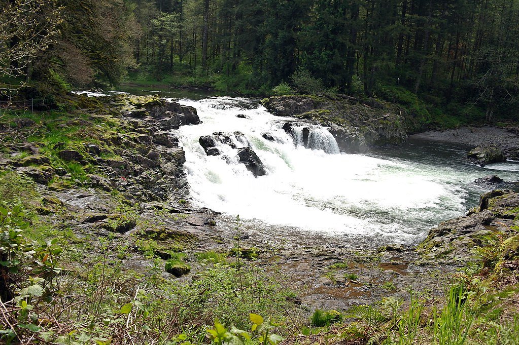
About Lucia Falls
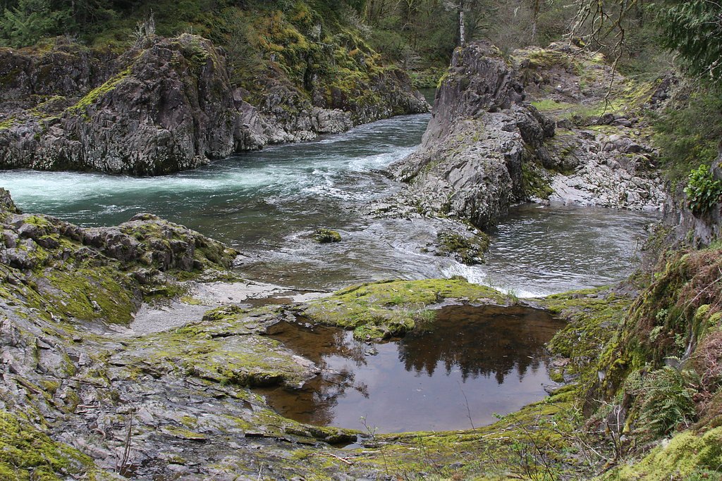
Lucia Falls tumbles along the East Fork of the Lewis River in Washington, framed by mossy basalt ledges and a canopy of evergreen and deciduous trees. The cascade and its immediate surroundings feel tucked away from the bustle—riparian greenery, layered rock, and the steady rush of water make it a popular stop for photographers and families seeking a quick nature escape. The site is part of Lucia Falls Park, managed by the county, and offers picnic spots and short walking areas where visitors can linger and listen to the river. Access is straightforward and well-suited to day visitors: the falls are commonly enjoyed as a relaxed outing rather than an overnight destination. County stewardship keeps the park approachable for casual visitors while preserving the scenic qualities that make Lucia Falls a pleasant, accessible taste of the Lewis River corridor.
The Setting
Lucia Falls sits at 413 feet within Lucia Falls Park, fed by the East Fork Lewis River, in the coastal lowlands of Washington.
Trail & Hike Details
The Approach
The moderate 2.4-mile out-and-back trail gains 350 feet of elevation on the way to the falls.
Trail Description
The primary route to Lucia Falls is an out-and-back trail of about 2.4 miles round-trip with approximately 350 feet of cumulative elevation gain, rated moderate in difficulty. Expect a well-marked, forested walk with several viewpoints of the falls; while much of the path is maintained, the elevation gain indicates a few uphill stretches that require steady footing. The trail’s moderate grade makes it a good fit for hikers who want a short outing with rewarding views—sturdy shoes and basic hiking comfort are recommended.
What to Expect
Dogs are welcome.
Accessibility
The trail is not wheelchair accessible. Uneven terrain and elevation changes require steady footing.
Frequently Asked Questions
🐶 Are Dogs Allowed at Lucia Falls?
✅ Dogs are allowed
Are There Any Fees or Permits Required?
🆖 No fees required
🏊 Is There Swimming at Lucia Falls?
❌ Swimming is not allowed
When to Visit
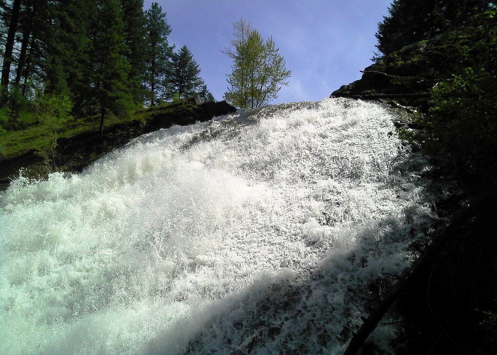
Spring and early summer are ideal times to visit, as the water flow is typically higher due to snowmelt. Fall offers beautiful foliage, while winter provides a quieter experience.
Seasonal Access
The best time to visit is Spring, Summer, Fall, and Winter.
Safety Information
Stay on designated trails and avoid climbing on rocks near the falls, as they can be slippery. Be cautious around the river, especially during high water flow.
Current Water Conditions
139 ft³/s
Current discharge — how much water is flowing
Lower than usual for this time of year
Based on 96 years of record
10.91 ft
Water depth at gauge
7-Day Discharge Trend
What does this mean for your visit?
Flow is lower than usual for this time of year.
About This Gauge
7-Day Flow Outlook
Based on the USGS gauge EAST FORK LEWIS RIVER NEAR HEISSON, WA (2 km away).
Today
Barely Flowing
139 cfs
4/10Tomorrow
Barely Flowing
137 cfs
5/10Tue
Barely Flowing
131 cfs
5/10Wed
Barely Flowing
131 cfs
5/10Thu
Barely Flowing
141 cfs
3/10Fri
Low
145 cfs
4/10Sat
Low
136 cfs
4/10Best window: Tomorrow — barely flowing flow, sunny (trip score 5/10).
Best time of year: this gauge typically runs highest from late November to late January, peaking in December.
How we calculate this
This is a transparent outlook, not a precise forecast. We take the waterfall's current flow strength (how it ranks against its historical normal for today, from the nearest USGS stream gauge), carry that ranking forward along the gauge's seasonal curve, and nudge it for forecast rain. Confidence is highest for the next day or two and falls further out. Always check official conditions and your own judgment before visiting — high flows can be dangerous.
Know when to go.
Get a free email alert when waterfalls near Yacolt hit peak flow. We only send when conditions are worth the trip — no weekly newsletters, no spam.
Weather Forecast
Location & Access
Getting There
Lucia Falls is located in Lucia Falls Regional Park, near Yacolt, Washington. It is accessible via NE Lucia Falls Road. The park is well-marked and easy to find.
Get Directions on Google MapsParking
There is a designated parking area at Lucia Falls Regional Park, which is free to use. The parking lot is typically sufficient for visitors, but it may fill up during peak times.
Elevation
413 feet above sea level
Coordinates
45.839559° N, -122.446486° W
Land Management
Managed by CNTY
Visitor Tips & Gear
Visit early in the morning or on weekdays to avoid crowds. Wear sturdy shoes as the trail may be uneven in some areas. Bring a camera to capture the beautiful scenery.
As an Amazon Associate, we earn from qualifying purchases.
With 2.4 miles and 350 ft of elevation gain, sturdy boots and trekking poles will help on this moderate trail. Icy conditions are common in winter — traction cleats are a smart addition.

Columbia Watertight II Rain Jacket
Packs into its own pocket, seam-sealed, and keeps you dry from spray and surprise rain.

Polarized Sunglasses (Knockaround)
Cuts glare off the water so you actually see the falls — and your photos turn out better too.

Earth Pak Waterproof Dry Bag
Keeps your phone and gear dry when waterfall mist soaks everything else.

Waterproof Phone Pouch (AiRunTech)
Cheap insurance — take photos right next to the falls without killing your phone.

Timberland Euro Sprint Mid Waterproof
Trusted waterproof boot with premium leather and grippy rubber sole — reliable on rocky, wet trails.

TrailBuddy Trekking Poles
Lightweight aluminum, cork grips, and flip-locks that actually hold — a best-seller for good reason.
Where to Stay

Best Western Plus Battleground Inn & Suites

Heathman Lodge

La Quinta by Wyndham Vancouver

Lewis River Inn
Browse vacation cabins and private rentals nearby
Unique outdoor stays — tents, yurts, and treehouses
Rent a campervan or RV for your waterfall road trip
Some links are affiliate links. We may earn a commission at no extra cost to you.
Nearby Campground
Sunset Falls Campground
9.6 miles away · 18 sites
Overview Sunset Campground is located in the Gifford Pinchot National Forest. Visitors enjoy scenic views of the river and a waterfall within the campground. The campground is open all year. Recreation There are several hiking trails nearby, including the Silver Star trail which offers excellent views of Portland, Oregon. The area is also popular with kayakers that visit the East Fork Lewis River.Facilities Sunset Campground offers 18 standard sites that accommodate tents and RVs (22 feet), but n
Book on Recreation.govNearby Hot Springs
Hot springs near Yacolt, Washington
Rock Creek Hot Springs
Rock Creek Hot Springs emerges in the Columbia River Gorge in Skamania County, Washington, with water documented as 'hot' witho...

Mt St Helens Fumaroles
Mount St. Helens fumaroles reach 190 degrees at 6,906 feet elevation on the crater rim, emerging 159.1 degrees above ambient in...
Moffetts (Bonneville) Hot Springs
Moffetts Hot Springs, also called Bonneville Hot Springs, flows at 97 degrees in the Gifford Pinchot National Forest at just 75...
St Martins Hot Springs
St. Martins Hot Springs flows at 120 degrees Fahrenheit at just 432 feet elevation in the Columbia River Gorge near Carson in S...
Green River Soda Spring
Green River Soda Spring produces 86-degree carbonated water at 1,644 feet elevation, flowing 37.5 degrees above ambient tempera...

Collins Hot Springs
Collins Hot Springs emerges at 122 degrees just 127 feet above sea level in the Columbia River Gorge, producing water 68.4 degr...
Looking for a soak after your hike? Explore more hot springs near Yacolt, Washington on SoakingSprings.
Explore Washington springsAdditional Information
Nearby Attractions
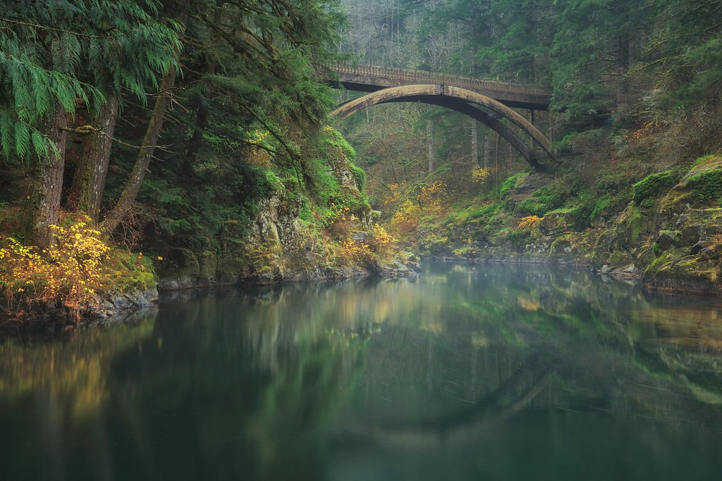
Moulton Falls, Cedar Creek Grist Mill, and Battle Ground Lake State Park are nearby attractions worth visiting.
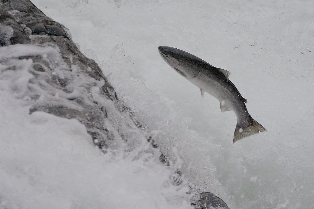
Wildlife
The area is home to various bird species, deer, and salmon, which can often be seen during their spawning season.
Cities near Lucia Falls
Nearby Waterfalls
Writing about Lucia Falls? Embed this waterfall on your site for free.