Big Falls
By Armen Suny · Last verified May 2026
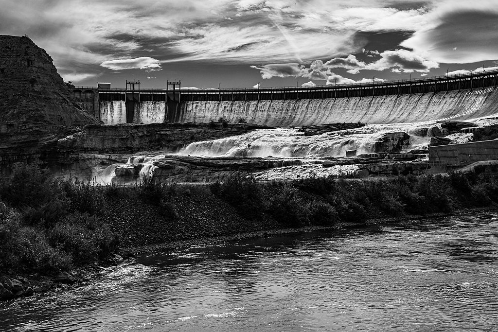
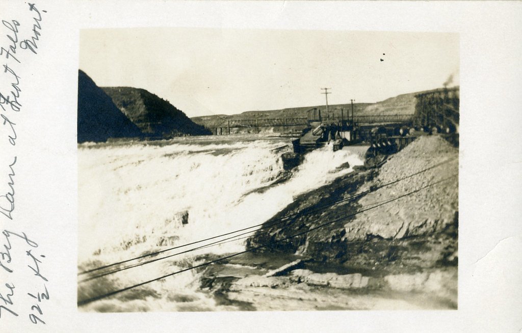
Photo Credits (3)
Difficulty
Easy
Trail Length
0.6 miles
Trail Type
Out And Back
Elevation Gain
100 ft
About Big Falls
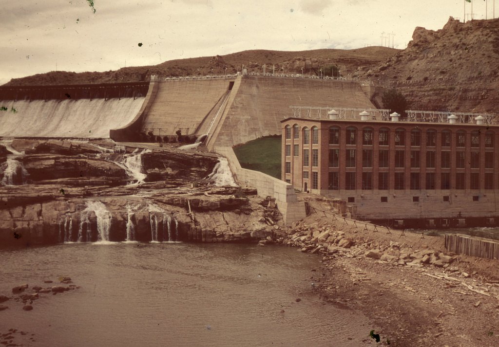
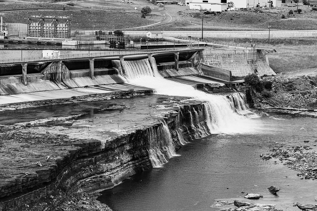
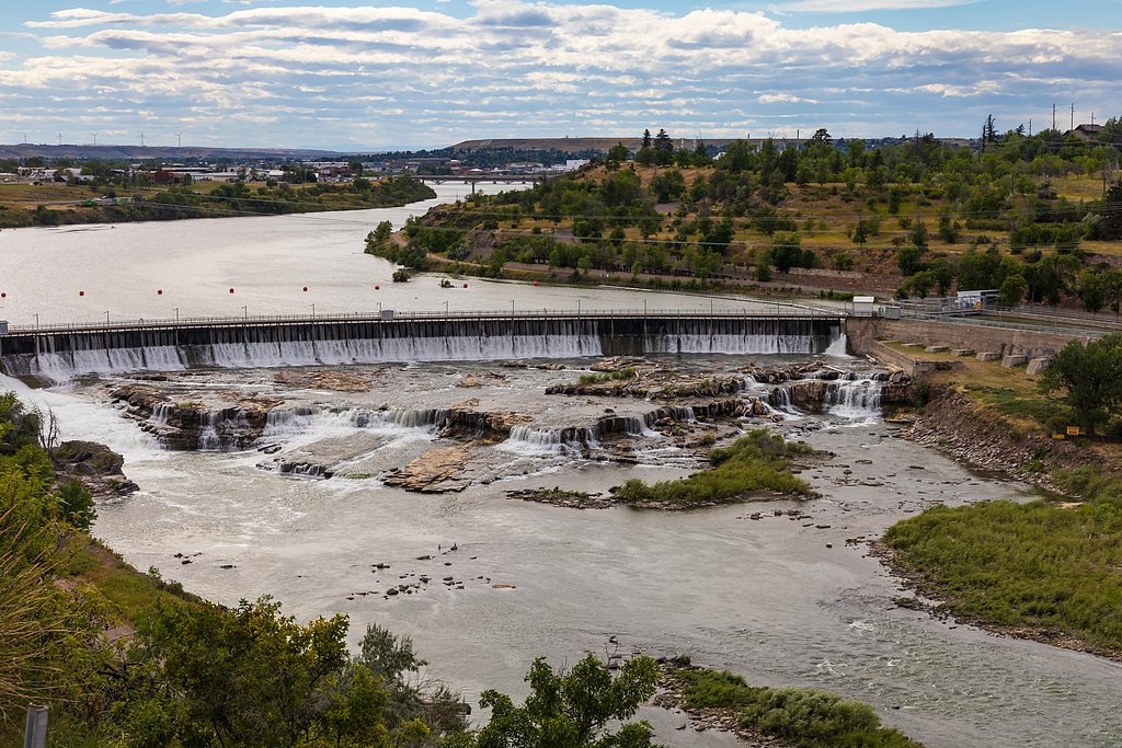
Big Falls — historically called Great Falls or the Roar of Steam — is the lowermost and largest of the Great Falls of the Missouri. The curtain of water plunges about 87 feet (27 m) and can spread as wide as 900 feet (270 m) at peak flow, a striking reminder of the Missouri River’s power. Today most of the river’s flow is diverted to the 60-megawatt hydroelectric plant at nearby Ryan Dam, so what once roared year-round can be reduced to a trickle during summer months, giving visitors a vivid view of how hydropower has reshaped the river. Big Falls makes for an easy, rewarding stop for day hikers, families, and photographers drawn to Montana’s river landscapes and industrial history. Short access and clear viewpoints let you quickly reach dramatic overlooks of the falls and the Missouri River; bring a camera and expect changing water levels that tell the story of natural drama and engineered change.
The Setting
Big Falls sits at 3,012 feet along the Missouri River, in the mountains of Montana.
Trail & Hike Details
The Approach
The easy 0.6-mile out-and-back trail gains 100 feet of elevation on the way to the falls.
Trail Description
The access to Big Falls is an easy out-and-back of about 0.6 miles with roughly 100 feet of elevation gain. The short route is suitable for most fitness levels and leads to established viewpoints of the falls and the Missouri River; plan on a brief, scenic walk to reach the main lookout.
What to Expect
Dogs are welcome.
Accessibility
The trail is short and relatively flat, but the surface may be uneven. Contact the managing agency for accessibility details.
Frequently Asked Questions
🐶 Are Dogs Allowed at Big Falls?
✅ Dogs are allowed
Are There Any Fees or Permits Required?
🆖 No fees required
🏊 Is There Swimming at Big Falls?
❌ Swimming is not allowed
When to Visit
Spring and early summer are ideal for visiting Big Falls, as the snowmelt ensures a strong flow. Fall offers beautiful foliage, while summer provides warm weather for hiking.
Seasonal Access
The best time to visit is Spring, Summer, and Fall. Winter access may be limited.
Safety Information
Exercise caution near the waterfall, as rocks can be slippery. Be prepared for changing weather conditions and carry bear spray if hiking in bear country.
Current Water Conditions
4,250 ft³/s
Current discharge — how much water is flowing
Much lower than usual for this time of year
Based on 69 years of record
3.04 ft
Water depth at gauge
7-Day Discharge Trend
What does this mean for your visit?
Flow is well below normal for this time of year, so the waterfall may be a trickle.
About This Gauge
7-Day Flow Outlook
Based on the USGS gauge Missouri River near Great Falls MT (5 km away).
Today
Moderate
4590 cfs
5/10Tomorrow
Moderate
4998 cfs
4/10Tue
Moderate
4996 cfs
5/10Wed
Moderate
4709 cfs
4/10Thu
Moderate
5143 cfs
4/10Fri
Moderate
5120 cfs
4/10Sat
Moderate
4833 cfs
5/10Best window: Today — moderate flow, rain (trip score 5/10).
Best time of year: this gauge typically runs highest from mid April to mid July, peaking in June.
How we calculate this
This is a transparent outlook, not a precise forecast. We take the waterfall's current flow strength (how it ranks against its historical normal for today, from the nearest USGS stream gauge), carry that ranking forward along the gauge's seasonal curve, and nudge it for forecast rain. Confidence is highest for the next day or two and falls further out. Always check official conditions and your own judgment before visiting — high flows can be dangerous.
Know when to go.
Get a free email alert when waterfalls near Malmstrom AFB hit peak flow. We only send when conditions are worth the trip — no weekly newsletters, no spam.
Weather Forecast
Location & Access
Getting There
Big Falls is located within the Lewis and Clark National Forest. Access typically involves driving to a trailhead near the falls, with the nearest town being Great Falls, Montana. Specific directions may vary depending on the chosen route.
Get Directions on Google MapsParking
Parking is available at the trailhead, but spaces may be limited during peak seasons.
Elevation
3,012 feet above sea level
Coordinates
47.569964° N, -111.123024° W
Visitor Tips & Gear
Visit during spring or early summer for the best water flow. Wear sturdy shoes as the trail may be uneven in places. Arrive early to secure parking, especially during weekends.
As an Amazon Associate, we earn from qualifying purchases.
For this easy 0.6 miles trail, lightweight trail shoes and a water bottle are usually sufficient. Sun exposure on the trail makes good sun protection a must in summer.

Polarized Sunglasses (Knockaround)
Cuts glare off the water so you actually see the falls — and your photos turn out better too.

Columbia Watertight II Rain Jacket
Packs into its own pocket, seam-sealed, and keeps you dry from spray and surprise rain.

Earth Pak Waterproof Dry Bag
Keeps your phone and gear dry when waterfall mist soaks everything else.

Waterproof Phone Pouch (AiRunTech)
Cheap insurance — take photos right next to the falls without killing your phone.

JOBY GorillaPod Starter Kit
Wraps around railings and rocks for long-exposure waterfall shots — no flat surface needed.

Osprey Daylite Daypack
Light, organized, and just the right size for a day hike — fits water, snacks, and layers.
Where to Stay

Wingate by Wyndham Great Falls

The Great Falls Inn By Riversage

The Gibson Hotel Great Falls, an Ascend Collection Hotel

Hotel Arvon
Browse vacation cabins and private rentals nearby
Unique outdoor stays — tents, yurts, and treehouses
Rent a campervan or RV for your waterfall road trip
Some links are affiliate links. We may earn a commission at no extra cost to you.
Additional Information
Nearby Attractions
Other attractions in the area include Giant Springs State Park and the Lewis and Clark Interpretive Center.
Wildlife
The area is home to various wildlife, including deer, birds, and small mammals. Be cautious of bears and carry bear spray if hiking in the region.
Cities near Big Falls
Nearby Waterfalls
Other waterfalls named Big Falls
23 other waterfalls share this name across the U.S.
Writing about Big Falls? Embed this waterfall on your site for free.