Colter Falls (historical)
By Armen Suny · Last verified May 2026
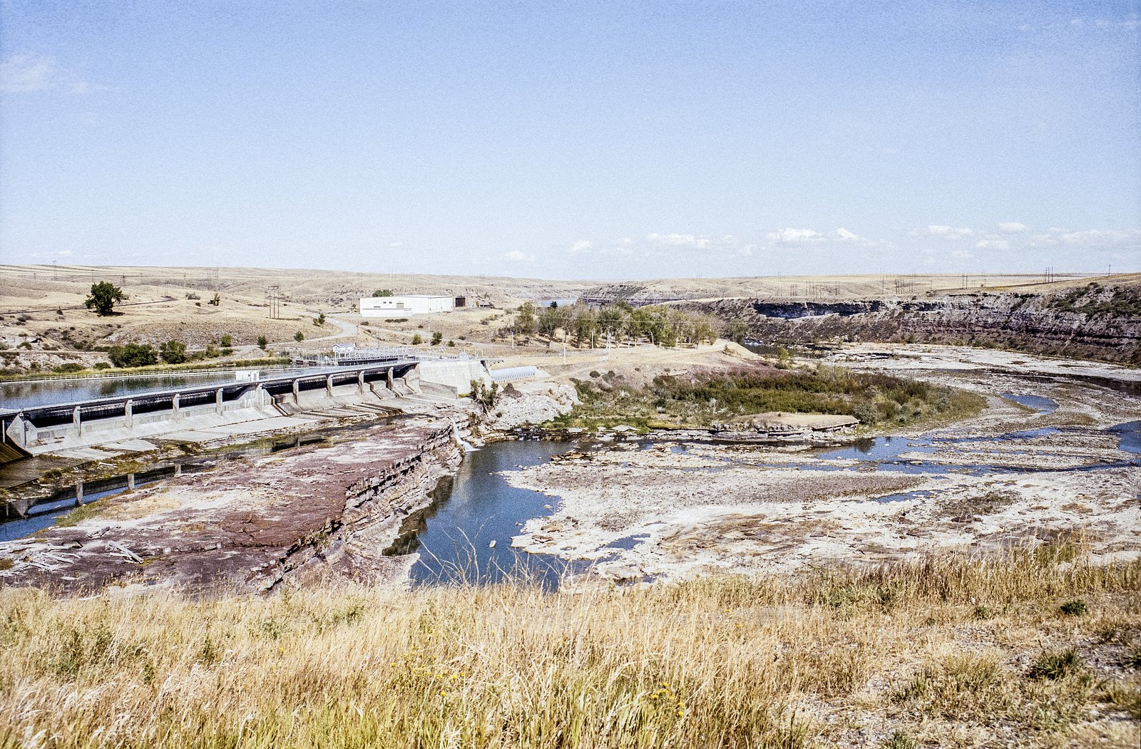
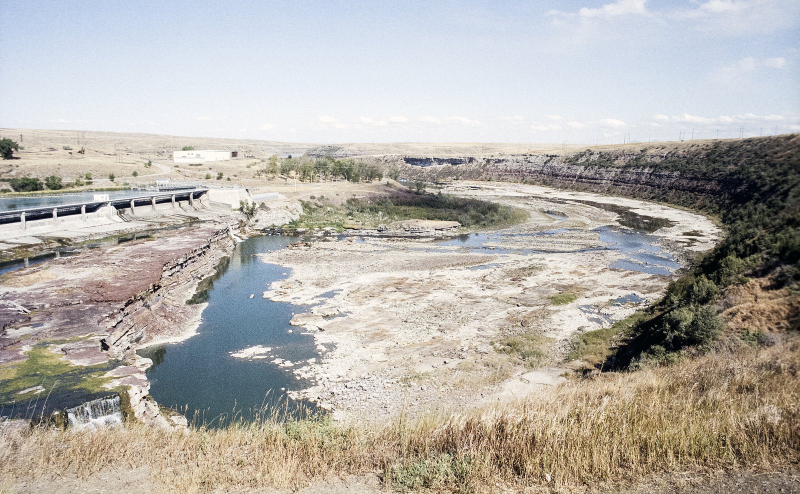
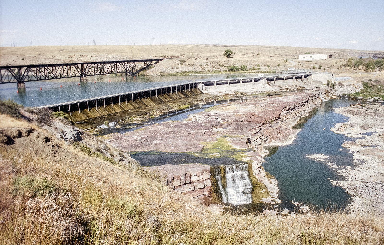
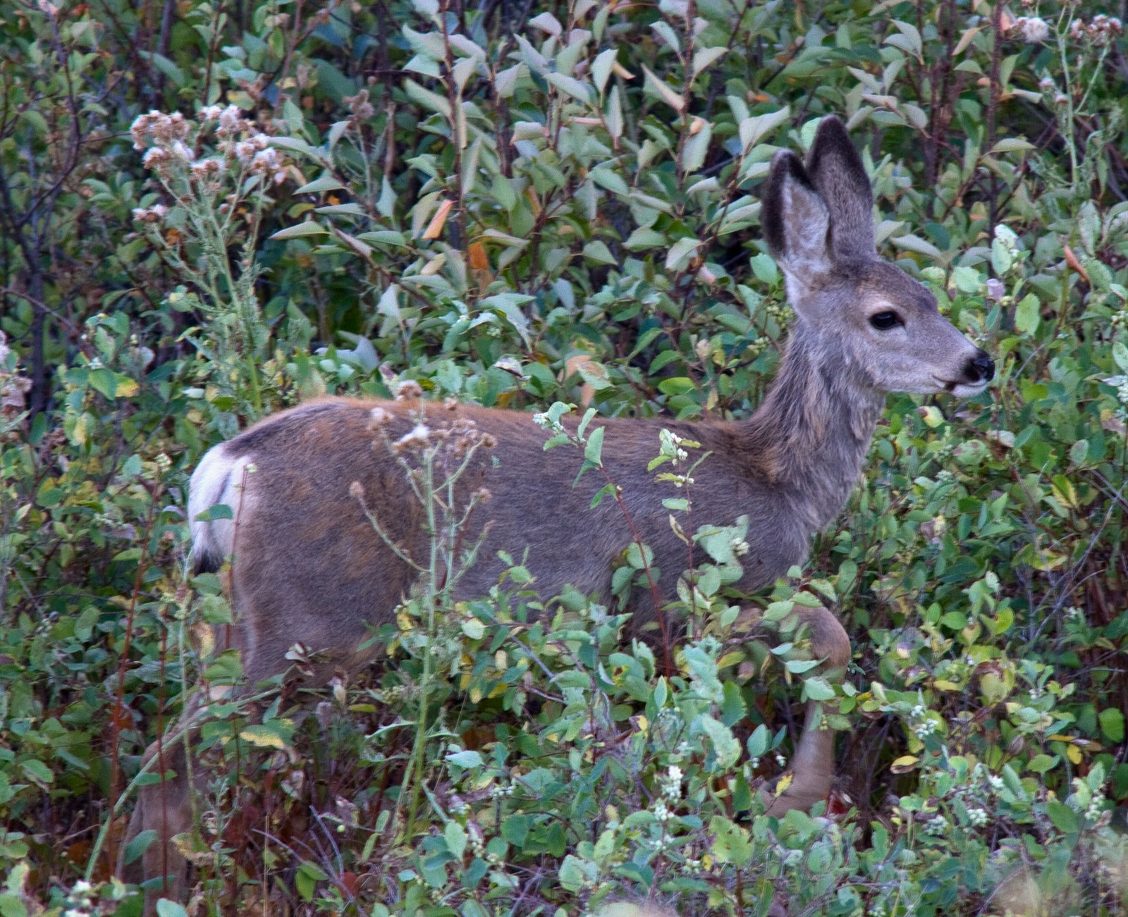
Photo Credits (5)
Difficulty
Moderate
Trail Length
2.4 miles
Trail Type
Out And Back
Elevation Gain
350 ft
About Colter Falls (historical)
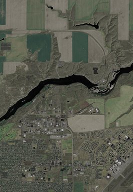
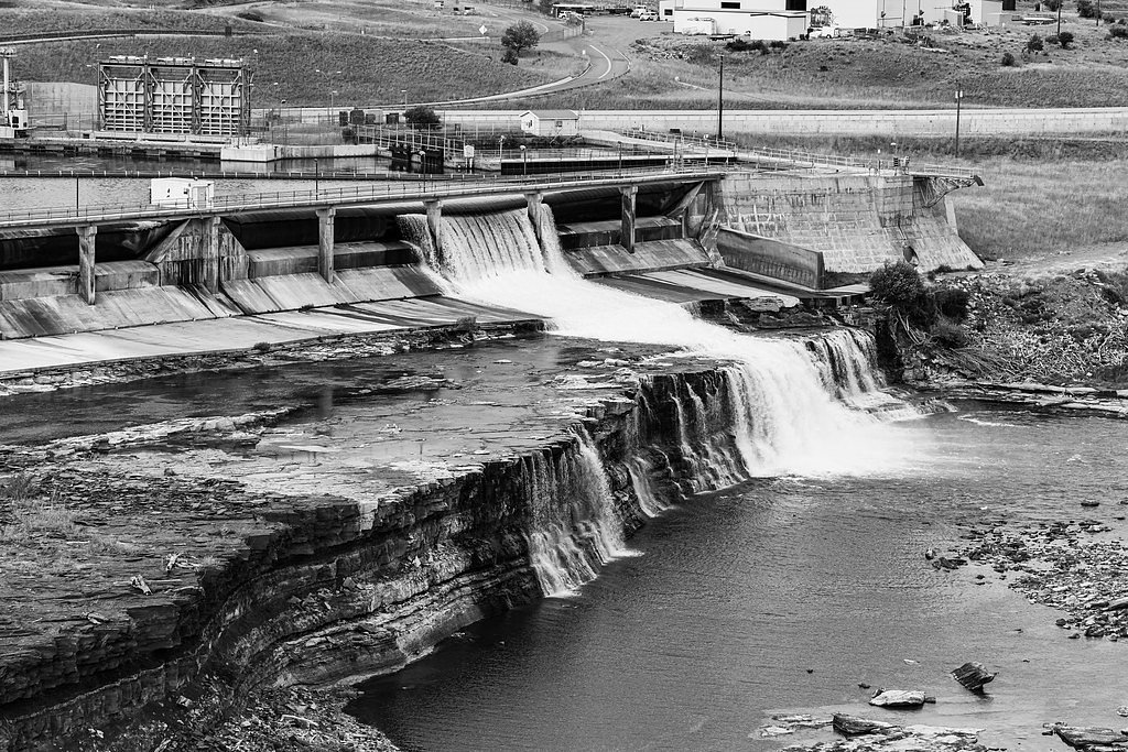
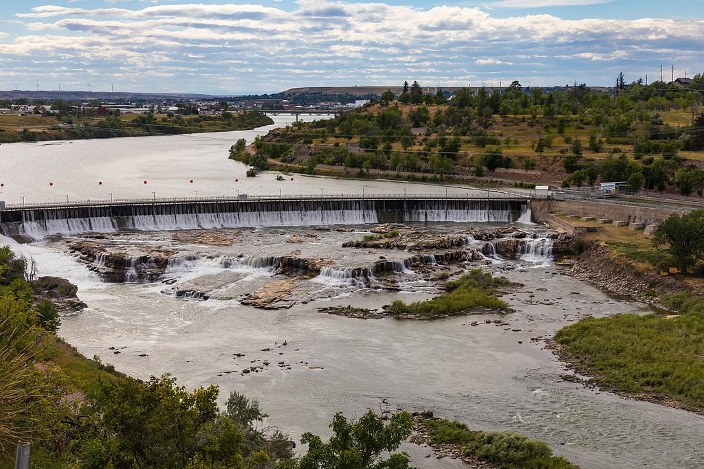
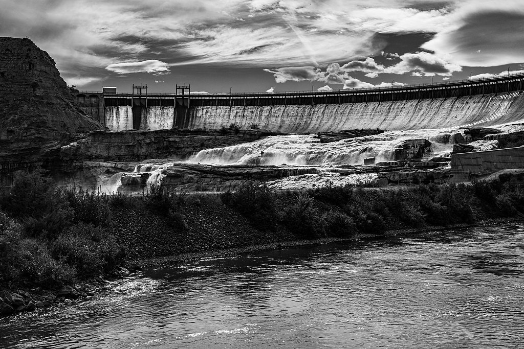
Colter Falls is a historical cascade on the upper Missouri River in north-central Montana and was the second of the Great Falls of the Missouri River series along a roughly 10-mile (16 km) stretch. Before the early 20th-century construction of Rainbow Dam the drop at Colter Falls measured about 6 feet 7 inches (2.01 m). Today the falls themselves sit submerged beneath the reservoir created by Rainbow Dam, so the site is valued more for its place in the river’s dramatic waterfall corridor and regional history than as an active, visible waterfall. While you won’t find a free-flowing drop to admire, the Colter Falls locale is inviting for hikers and riverfront visitors who want to experience the Great Falls corridor. Trails and viewpoints near Rainbow Dam and along the Missouri River let you trace the same riverine landscape that once featured Colter’s brief cascade, offering a quiet, interpretive outing for those interested in geology and the river’s changing uses over time.
The Setting
Colter Falls (historical) sits at 3,251 feet along the Missouri River, in the mountains of Montana.
Trail & Hike Details
The Approach
The moderate 2.4-mile out-and-back trail gains 350 feet of elevation on the way to the falls.
Trail Description
There is no dedicated trail that leads directly to Colter Falls because the falls are submerged. The nearest maintained route is an out-and-back trail approximately 2.4 miles long with about 350 feet of elevation gain, typically rated moderate in difficulty. No specific USFS trail name or number, and no detailed USFS surface/grade/class information, are provided for a trail to the submerged falls; instead hikers use nearby riverfront trails and viewpoints around Rainbow Dam to view and learn about the historic waterfall site.
What to Expect
Visitors should not expect to see Colter Falls, as it is no longer visible. Instead, the area offers views of the Missouri River, the Rainbow Dam, and surrounding landscapes.
Accessibility
The trail is not wheelchair accessible. Uneven terrain and elevation changes require steady footing.
Frequently Asked Questions
🐶 Are Dogs Allowed at Colter Falls (historical)?
❌ Dogs are not allowed
Are There Any Fees or Permits Required?
🆖 No fees required
🏊 Is There Swimming at Colter Falls (historical)?
❌ Swimming is not allowed
When to Visit
Spring and summer are ideal for visiting the area around Rainbow Dam, as the weather is typically mild and the surrounding landscapes are lush.
Seasonal Access
The best time to visit is Spring, Summer, and Fall. Winter access may be limited.
Safety Information
Visitors should exercise caution near the dam and reservoir due to strong currents and restricted areas. Follow all posted signs and guidelines.
Current Water Conditions
4,350 ft³/s
Current discharge — how much water is flowing
Much lower than usual for this time of year
Based on 69 years of record
3.07 ft
Water depth at gauge
7-Day Discharge Trend
What does this mean for your visit?
Flow is well below normal for this time of year, so the waterfall may be a trickle.
About This Gauge
This gauge is on a nearby waterway and may not reflect exact conditions at the falls.
7-Day Flow Outlook
Based on the USGS gauge Missouri River near Great Falls MT (13 km away).
Today
Moderate
4959 cfs
4/10Tomorrow
Moderate
4815 cfs
6/10Mon
Moderate
4674 cfs
5/10Tue
Moderate
5051 cfs
6/10Wed
Moderate
4207 cfs
8/10Thu
Moderate
4774 cfs
4/10Fri
Moderate
4461 cfs
8/10Best window: Wed — moderate flow, mostly sunny (trip score 8/10).
Best time of year: this gauge typically runs highest from mid April to mid July, peaking in June.
How we calculate this
This is a transparent outlook, not a precise forecast. We take the waterfall's current flow strength (how it ranks against its historical normal for today, from the nearest USGS stream gauge), carry that ranking forward along the gauge's seasonal curve, and nudge it for forecast rain. Confidence is highest for the next day or two and falls further out. Always check official conditions and your own judgment before visiting — high flows can be dangerous.
Know when to go.
Get a free email alert when waterfalls near Black Eagle hit peak flow. We only send when conditions are worth the trip — no weekly newsletters, no spam.
Weather Forecast
Location & Access
Getting There
Colter Falls was located near Great Falls, Montana, on the Missouri River. The site is now submerged under the reservoir created by Rainbow Dam.
Get Directions on Google MapsParking
Parking is available near the Rainbow Dam area, which provides access to views of the Missouri River and the surrounding landscape.
Elevation
3,251 feet above sea level
Coordinates
47.537460° N, -111.214695° W
Visitor Tips & Gear
Bring a camera to capture the scenic views of the Missouri River and Rainbow Dam. Check local regulations for access and safety guidelines.
As an Amazon Associate, we earn from qualifying purchases.
With 2.4 miles and 350 ft of elevation gain, sturdy boots and trekking poles will help on this moderate trail. Sun exposure on the trail makes good sun protection a must in summer.

Polarized Sunglasses (Knockaround)
Cuts glare off the water so you actually see the falls — and your photos turn out better too.

Columbia Watertight II Rain Jacket
Packs into its own pocket, seam-sealed, and keeps you dry from spray and surprise rain.

Earth Pak Waterproof Dry Bag
Keeps your phone and gear dry when waterfall mist soaks everything else.

Waterproof Phone Pouch (AiRunTech)
Cheap insurance — take photos right next to the falls without killing your phone.

Timberland Euro Sprint Mid Waterproof
Trusted waterproof boot with premium leather and grippy rubber sole — reliable on rocky, wet trails.

TrailBuddy Trekking Poles
Lightweight aluminum, cork grips, and flip-locks that actually hold — a best-seller for good reason.
Where to Stay

Wingate by Wyndham Great Falls

The Gibson Hotel Great Falls, an Ascend Collection Hotel

Hotel Arvon

Comfort Inn Great Falls South
Browse vacation cabins and private rentals nearby
Unique outdoor stays — tents, yurts, and treehouses
Rent a campervan or RV for your waterfall road trip
Some links are affiliate links. We may earn a commission at no extra cost to you.
Additional Information
Nearby Attractions
Nearby attractions include Giant Springs State Park, the Lewis and Clark Interpretive Center, and other waterfalls along the Missouri River such as Rainbow Falls and Black Eagle Falls.
Wildlife
The area around the Missouri River is home to various bird species, deer, and other wildlife. Visitors may spot animals while exploring the region.
Cities near Colter Falls (historical)
Nearby Waterfalls
Writing about Colter Falls (historical)? Embed this waterfall on your site for free.