Photo Credits (5)
Difficulty
Moderate
Trail Length
2.4 miles
Trail Type
Out And Back
Elevation Gain
350 ft
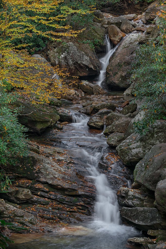
About Big Falls
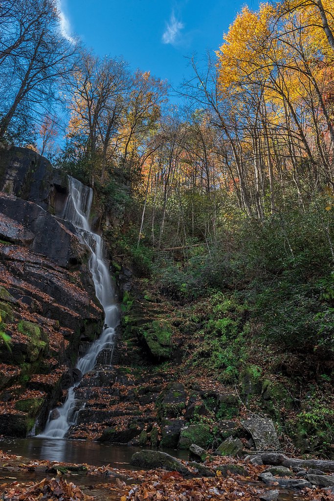
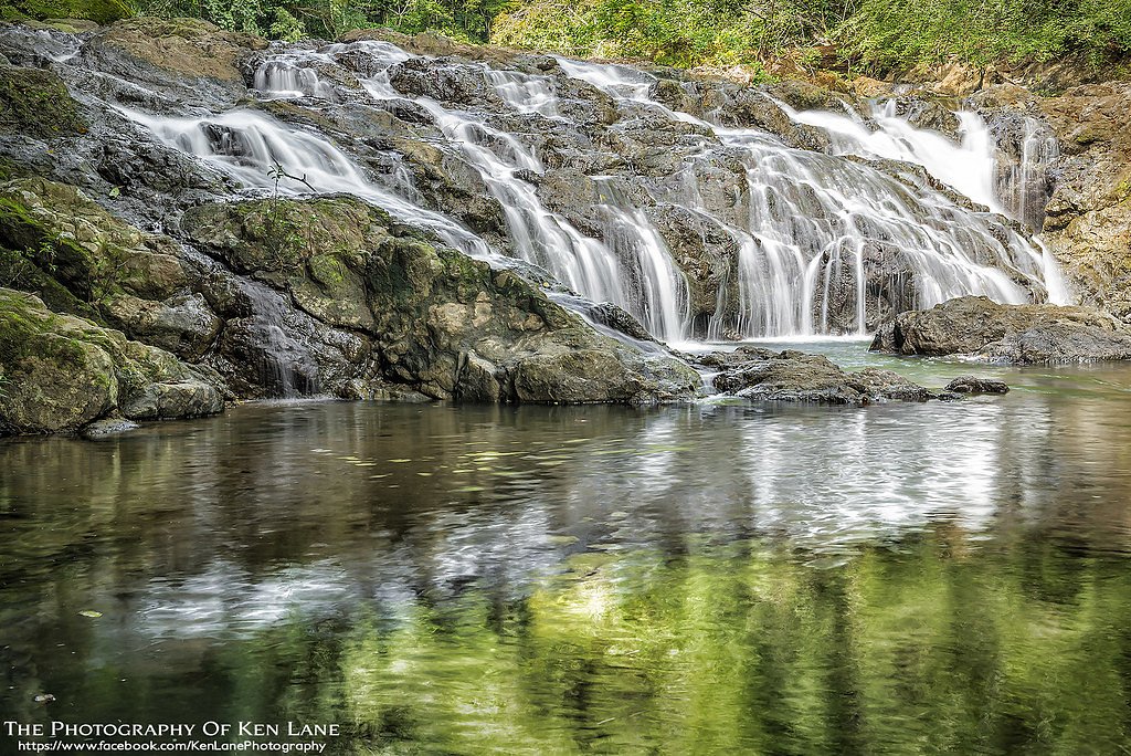
Big Falls is a scenic waterfall located in the Nantahala National Forest near Marble, North Carolina. It is known for its cascading waters and serene surroundings, making it a popular destination for nature enthusiasts. The waterfall is relatively remote and requires some effort to access, offering a rewarding experience for those who visit.
The Setting
Big Falls sits at 3,369 feet within Nantahala National Forest, fed by the Valley River, in the mountains of North Carolina.
Trail & Hike Details
The Approach
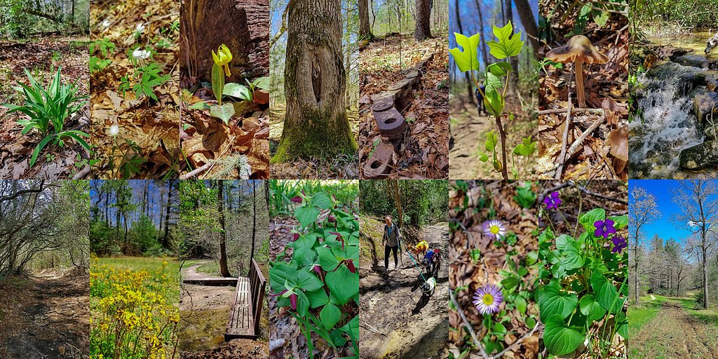
The moderate hike follows Big Snowbird (#TR64), a 2.4-mile out-and-back trail over natural surface. Expect 350 feet of elevation gain. The trail is moderately developed (Class 2).
USFS Trail
BIG SNOWBIRD #TR64
Trail Class
Moderately Developed
Surface
USFS Segment
8.40 miTrail Description
The trail to Big Falls is an out-and-back route that winds through the Nantahala National Forest. It features moderate elevation gain and may include uneven terrain, making it suitable for hikers with some experience. The trail offers scenic views of the surrounding forest and leads to the base of the waterfall.
What to Expect
Dogs are welcome.
Accessibility
The trail is not wheelchair accessible. Uneven terrain and elevation changes require steady footing.
Frequently Asked Questions
🐶 Are Dogs Allowed at Big Falls?
✅ Dogs are allowed
Are There Any Fees or Permits Required?
🆖 No fees required
🏊 Is There Swimming at Big Falls?
❌ Swimming is not allowed
When to Visit
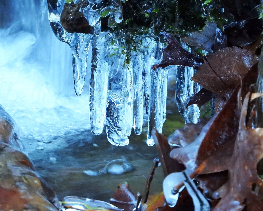
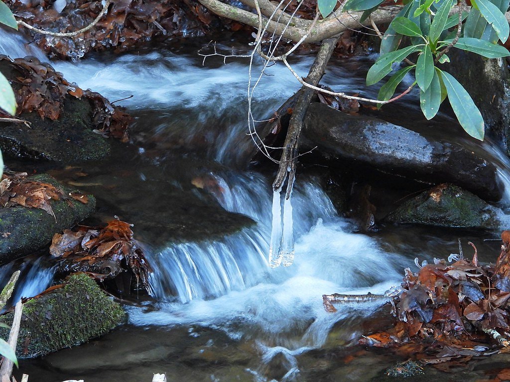
Spring and early summer are ideal times to visit, as the waterfall is typically at its fullest due to seasonal rainfall. Fall offers beautiful foliage, while winter may provide a quieter experience but could have icy conditions.
Seasonal Access
The best time to visit is Spring, Summer, and Fall. Winter access may be limited. Check with Nantahala National Forest for seasonal road closures.
Safety Information
The rocks around the waterfall can be slippery, especially after rain. Visitors should exercise caution and avoid getting too close to the edge. Be prepared for changing weather conditions and carry a map or GPS device, as cell service may be limited.
Current Water Conditions
142 ft³/s
Current discharge — how much water is flowing
About average for this time of year
Based on 115 years of record
2.13 ft
Water depth at gauge
7-Day Discharge Trend
What does this mean for your visit?
Flow is about average for this time of year.
About This Gauge
This gauge is on a nearby waterway and may not reflect exact conditions at the falls.
7-Day Flow Outlook
Based on the USGS gauge VALLEY RIVER AT TOMOTLA, NC (14 km away).
Today
Roaring
153 cfs
6/10Tomorrow
Roaring
145 cfs
9/10Thu
Roaring
148 cfs
9/10Fri
Roaring
164 cfs
6/10Sat
Roaring
168 cfs
6/10Sun
Roaring
161 cfs
6/10Mon
Roaring
168 cfs
6/10Best window: Tomorrow — roaring flow, mostly sunny (trip score 9/10).
Best time of year: this gauge typically runs highest from mid January to mid April, peaking in March.
How we calculate this
This is a transparent outlook, not a precise forecast. We take the waterfall's current flow strength (how it ranks against its historical normal for today, from the nearest USGS stream gauge), carry that ranking forward along the gauge's seasonal curve, and nudge it for forecast rain. Confidence is highest for the next day or two and falls further out. Always check official conditions and your own judgment before visiting — high flows can be dangerous.
Know when to go.
Get a free email alert when waterfalls near Marble hit peak flow. We only send when conditions are worth the trip — no weekly newsletters, no spam.
Weather Forecast
Location & Access
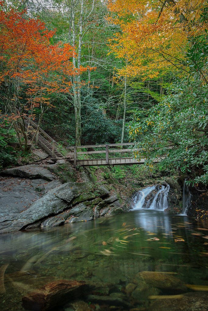
Getting There
Big Falls is located approximately 6 miles from Marble, 9 miles from Lake Santeetlah, and 9.2 miles from Andrews, North Carolina. The coordinates for the waterfall are 35.2656, -83.966. Access typically involves driving on forest roads and hiking a trail to reach the falls.
Get Directions on Google MapsParking
Parking is available near the trailhead, but spaces may be limited. Visitors should be prepared for unpaved or gravel parking areas.
Elevation
3,369 feet above sea level
Coordinates
35.265641° N, -83.966020° W
Land Management
Managed by USFS
Visitor Tips & Gear
Wear sturdy hiking shoes and bring plenty of water. Check the weather forecast before your visit, as the trail can become slippery in wet conditions. Arrive early to secure parking and enjoy a quieter experience.
As an Amazon Associate, we earn from qualifying purchases.
With 2.4 miles and 350 ft of elevation gain, sturdy boots and trekking poles will help on this moderate trail. Sun exposure on the trail makes good sun protection a must in summer.

Polarized Sunglasses (Knockaround)
Cuts glare off the water so you actually see the falls — and your photos turn out better too.

Columbia Watertight II Rain Jacket
Packs into its own pocket, seam-sealed, and keeps you dry from spray and surprise rain.

Earth Pak Waterproof Dry Bag
Keeps your phone and gear dry when waterfall mist soaks everything else.

Waterproof Phone Pouch (AiRunTech)
Cheap insurance — take photos right next to the falls without killing your phone.

Timberland Euro Sprint Mid Waterproof
Trusted waterproof boot with premium leather and grippy rubber sole — reliable on rocky, wet trails.

TrailBuddy Trekking Poles
Lightweight aluminum, cork grips, and flip-locks that actually hold — a best-seller for good reason.
Where to Stay

The Junction

Mistletoe Cabin- Private cabin w views, Hottub, pet friendly

Quality Inn & Suites Robbinsville

Stonebrook Lodge Murphy
Browse vacation cabins and private rentals nearby
Unique outdoor stays — tents, yurts, and treehouses
Rent a campervan or RV for your waterfall road trip
Some links are affiliate links. We may earn a commission at no extra cost to you.
Nearby Campground
SWAN CABIN
6.8 miles away · 1 sites
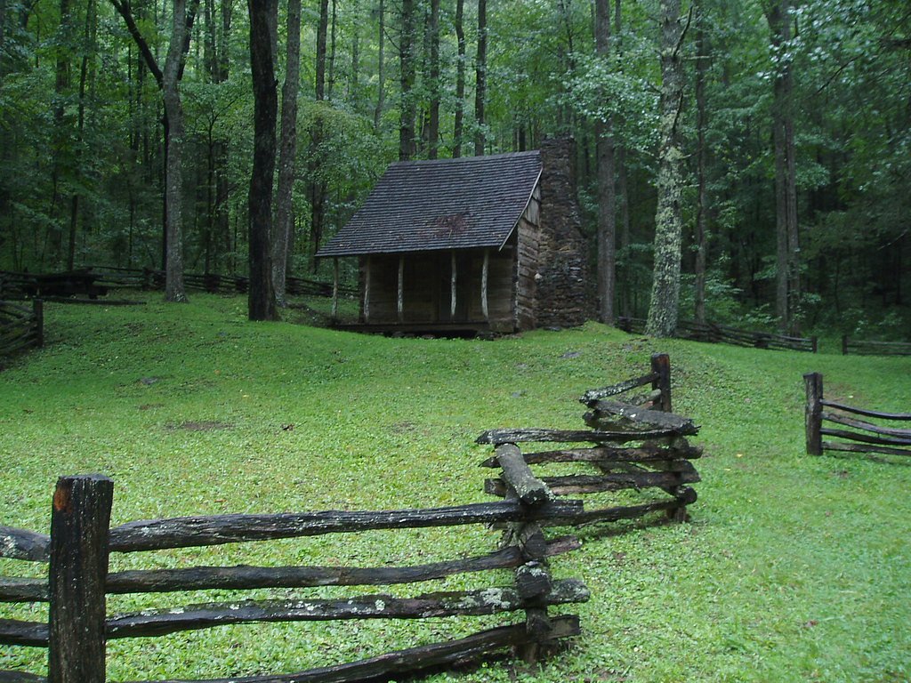
Overview Nestled in a remote area of Nantahala National Forest, this primitive log cabin was built in 1931 by Frank Swan in a different location, then later it was moved to its current location near the Joyce Kilmer-Slickrock Wilderness. The cabin and the surrounding meadows are named for the Swan Family, who came to the area from Pennsylvania in the late 19th century. Swan Cabin offers a peaceful, quiet retreat where visitors can relax on the front porch and enjoy birdsong and views of the surro
Book on Recreation.govAdditional Information
Nearby Attractions
Nearby attractions include Lake Santeetlah, the Joyce Kilmer Memorial Forest, and the town of Andrews, which offers dining and lodging options.
Wildlife
The area is home to a variety of wildlife, including birds, deer, and small mammals. Visitors should be cautious of snakes and other potentially hazardous animals.
Cities near Big Falls
Nearby Waterfalls
Other waterfalls named Big Falls
23 other waterfalls share this name across the U.S.
Writing about Big Falls? Embed this waterfall on your site for free.