
Big Falls
By Armen Suny · Last verified Oct 2026
LiDAR & 3D terrain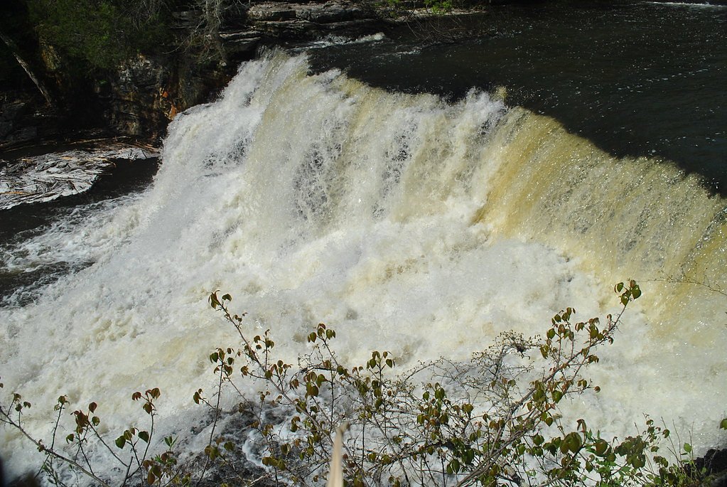


Photo Credits (5)
Difficulty
Easy
Trail Length
1.3 miles
Trail Type
Loop
Elevation Gain
118 ft
About Big Falls
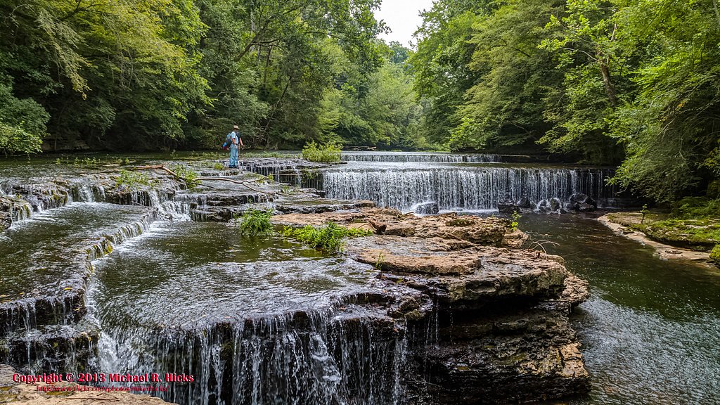
Big Falls is a wide, stair-stepped drop on the Little Duck River inside Old Stone Fort State Archaeological Park in Manchester, Tennessee. Guides give its height as roughly 15 to 30 feet. It sits below the walls of the ancient Native American ceremonial enclosure the park protects, next to the ruins of a 19th-century paper mill.
The Setting
Big Falls sits at 935 feet within Old Stone Fort, in the foothills of Tennessee.
Trail & Hike Details
The Approach
The easy 1.3-mile loop trail gains 118 feet of elevation on the way to the falls.
Trail Description
Blue Hole Falls and Big Falls both lie along the Enclosure Trail, a loop of about 1.3 to 1.4 miles that starts behind the park museum and follows the walls of the ancient enclosure past Step Falls, Blue Hole Falls and Big Falls. The tread is mostly dirt with short rocky and rooty sections and a few steep spots near the bluffs. A longer loop of about 2.9 miles adds the Little Duck River, Backbone and Moat trails.
What to Expect
Dogs are welcome.
Accessibility
The trail is not wheelchair accessible. Uneven terrain and elevation changes require steady footing.
Frequently Asked Questions
🐶 Are Dogs Allowed at Big Falls?
✅ Dogs are allowed
Leashed dogs are allowed on trails in Tennessee state parks.
Are There Any Fees or Permits Required?
🆖 No fees required
🏊 Is There Swimming at Big Falls?
❌ Swimming is not allowed
When to Visit
Spring and early summer are ideal times to visit, as the waterfall flow is typically stronger due to seasonal rainfall.
Seasonal Access
The best time to visit is Spring, Summer, and Fall. Winter access may be limited.
Safety Information
Stay back from the bluff edges along the enclosure walls, and expect slick rock around the falls. Check park rules before swimming in the pool below the falls.
Current Water Conditions
These readings come from the USGS gauge on Duck River, 1.2 miles away, not on Big Falls's own stream. Use them as a sign of whether the area is running wet or dry.
21 ft³/s
Current discharge — how much water is flowing
Much lower than usual for this time of year
Based on 78 years of record
-0.10 ft
Water depth at gauge
7-Day Discharge Trend
What does this mean for your visit?
Flow is well below normal for this time of year, so the waterfall may be a trickle.
About This Gauge
7-Day Flow Outlook
Based on the USGS gauge DUCK RIVER BELOW MANCHESTER, TN (2 km away).
Today
Moderate
21 cfs
8/10Tomorrow
Moderate
21 cfs
8/10Tue
Moderate
21 cfs
8/10Wed
Moderate
22 cfs
8/10Thu
Moderate
24 cfs
8/10Fri
Moderate
24 cfs
8/10Sat
Moderate
26 cfs
8/10Best window: Today — moderate flow, widespread frost then sunny (trip score 8/10).
Best time of year: this gauge typically runs highest from early February to late March, peaking in March.
How we calculate this
This is a transparent outlook, not a precise forecast. We take the waterfall's current flow strength (how it ranks against its historical normal for today, from the nearest USGS stream gauge), carry that ranking forward along the gauge's seasonal curve, and nudge it for forecast rain. Confidence is highest for the next day or two and falls further out. Always check official conditions and your own judgment before visiting — high flows can be dangerous.
Know when to go.
Get a free email alert when waterfalls near Manchester hit peak flow. We only send when conditions are worth the trip — no weekly newsletters, no spam.
Is Big Falls Frozen?
Updated about 17 hours agoNot frozen highs above freezing lately
Big Falls is not frozen right now; highs have been above freezing. Yesterday ran 43°F to 34°F.
- Days below freezing
- 0 of the last 14
- Current cold streak
- 0 days
- Freezing days ahead
- 0 of the next 7
- Flow
- 21 ft³/s
Winter safety. Frozen falls are the one waterfall trip with a documented injury pattern: falling ice, and ice-glazed rock and trail. Wear microspikes, keep well back from the base and from overhangs, and never walk out on ice over moving water.
Estimate from Open-Meteo daily temperatures at the falls, the LiDAR-measured facing direction, and the nearest stream gauge. It is a likelihood, not a report from the trail.
Weather Forecast
The Terrain, Seen by LiDAR
Aircraft-mounted lasers measured this ground to within inches. Trees and buildings are digitally stripped away, leaving the bare shape of the land the water has carved.
Here the descent is spread out: 1-meter lidar measures about 85 feet of drop through Big Falls, stretched along the creek rather than stacked in one wall. The brink sits at about 934 feet above sea level.
The ground changes about 37 feet in the 500 feet above the falls and 20 feet in the 500 feet below. The falls face west and glow in afternoon and evening light.
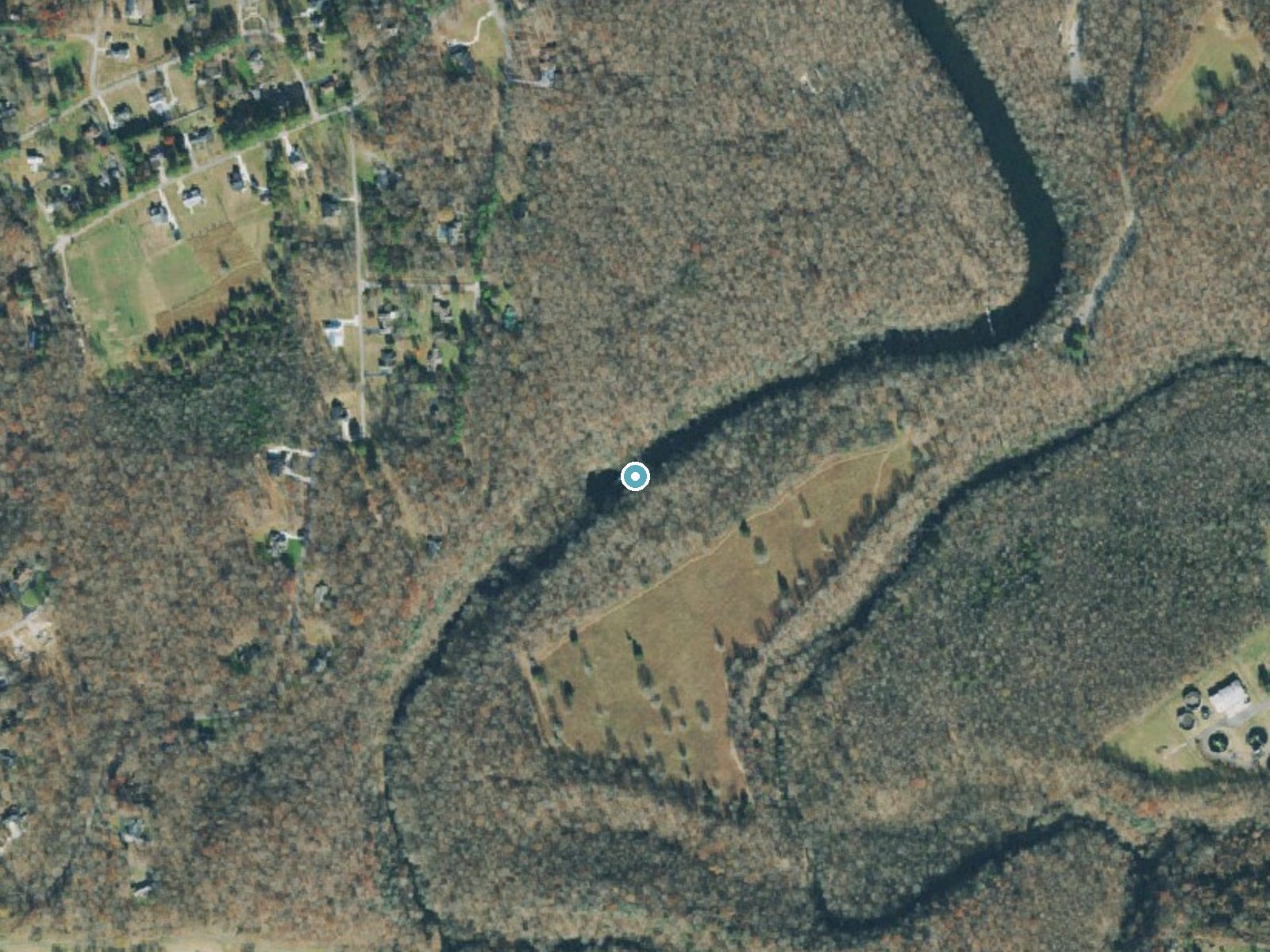
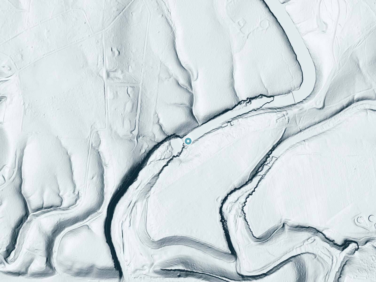
Drag to compare. The dot marks the waterfall. The frame is about a mile across.
- Ground elevation
- 934 feet
- Measured by 1-meter lidar
- Drop at the falls
- About 85 feet
- Change in ground height within ~250 feet of the falls
- Faces
- West
- Glows in afternoon and evening light.
A slice through the lidar ground surface, from above the falls to downstream (heading west).
Elevation data: USGS 3D Elevation Program. Aerial imagery: USGS The National Map. Public domain.
Location & Access
Getting There
Old Stone Fort State Archaeological Park is at 732 Stone Fort Drive in Manchester, Tennessee. Park at the museum and visitor center and start on the Enclosure Trail behind the museum.
Get Directions on Google MapsParking
Park in the lot at the park museum and visitor center, where the Enclosure Trail begins.
Elevation
935 feet above sea level
Coordinates
35.484926° N, -86.107951° W
Land Management
Managed by OTHS
Visitor Tips & Gear
Wear sturdy hiking shoes, as the trail can be uneven and slippery in places. Bring water and snacks, and consider visiting early in the day to avoid crowds.
As an Amazon Associate, we earn from qualifying purchases.
This easy 1.3 miles hike is straightforward — comfortable trail shoes and plenty of water should do. Sun exposure on the trail makes good sun protection a must in summer.

Polarized Sunglasses (Knockaround)
Cuts glare off the water so you actually see the falls — and your photos turn out better too.

Columbia Watertight II Rain Jacket
Packs into its own pocket, seam-sealed, and keeps you dry from spray and surprise rain.

Earth Pak Waterproof Dry Bag
Keeps your phone and gear dry when waterfall mist soaks everything else.
Waterproof Phone Pouch (AiRunTech)
Cheap insurance — take photos right next to the falls without killing your phone.

JOBY GorillaPod Starter Kit
Wraps around railings and rocks for long-exposure waterfall shots — no flat surface needed.

Osprey Daylite Daypack
Light, organized, and just the right size for a day hike — fits water, snacks, and layers.
Where to Stay

Comfort Suites Manchester near Arnold AFB

La Quinta Inn & Suites by Wyndham Manchester - Arnold AFB

Best Western Manchester

Microtel Inn & Suites by Wyndham Manchester - Newly Renovated
Browse vacation cabins and private rentals nearby
Unique outdoor stays — tents, yurts, and treehouses
Rent a campervan or RV for your waterfall road trip
Some links are affiliate links. We may earn a commission at no extra cost to you.
Additional Information
Nearby Attractions
Step Falls and Blue Hole Falls are on the same loop, and Rutledge Falls is a few miles south toward Tullahoma.
Wildlife
The area is home to a variety of wildlife, including birds, deer, and small mammals. Be mindful of your surroundings and avoid disturbing the animals.
Cities near Big Falls
Nearby Waterfalls
 LiDAR
Other waterfalls named Big Falls
23 other waterfalls share this name across the U.S.
Writing about Big Falls? Embed this waterfall on your site for free.