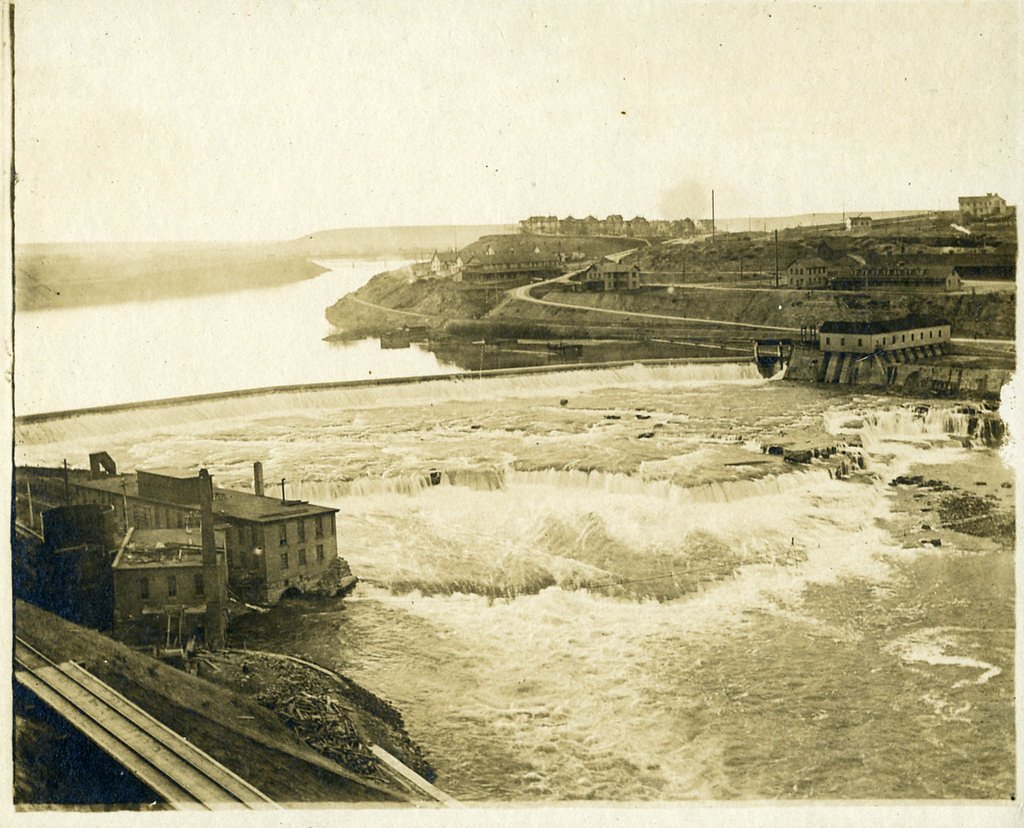
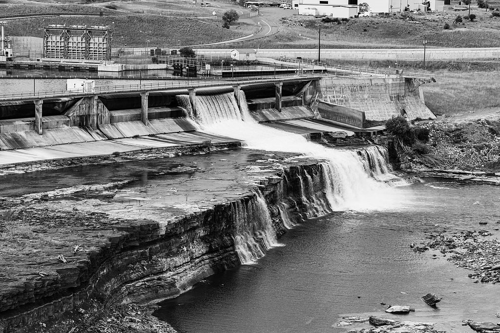
Black Eagle Falls
By Armen Suny · Last verified Mar 2026
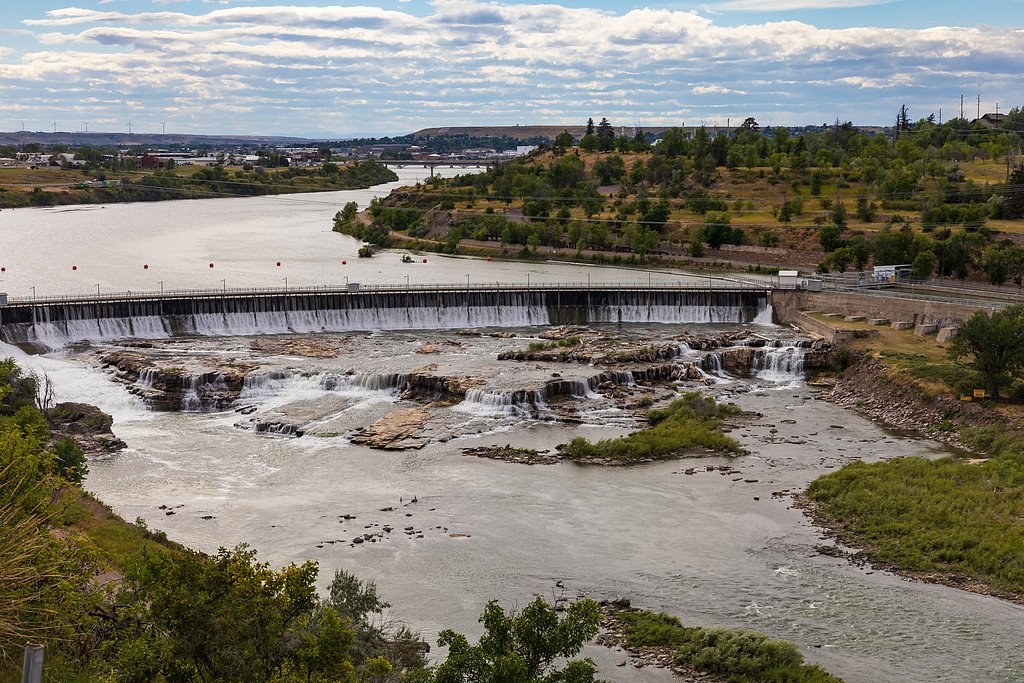
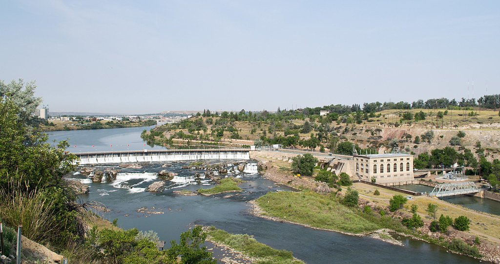
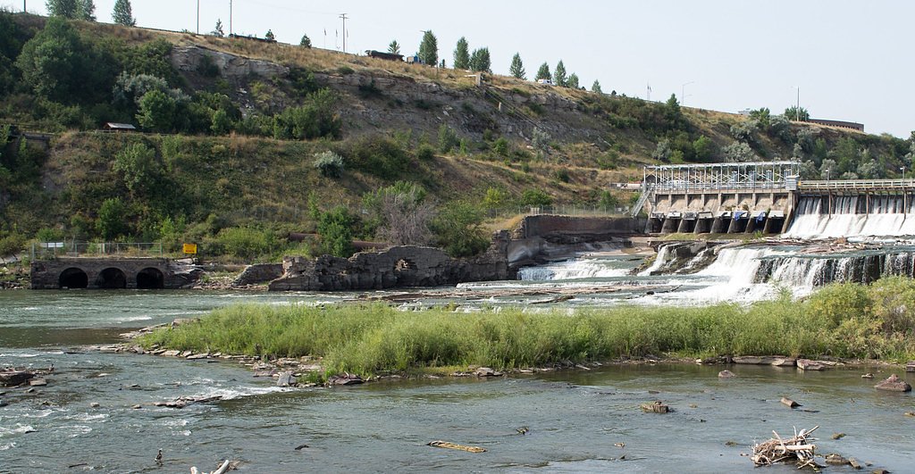
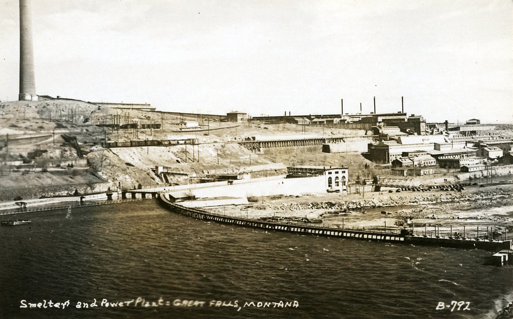

Photo Credits (5)
Difficulty
Drive Up
Trail Length
0.1 miles
Trail Type
Out And Back
Elevation Gain
50 ft
About Black Eagle Falls
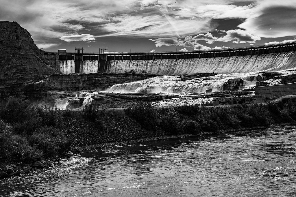
Black Eagle Falls is one of the five Great Falls of the Missouri River, tumbling through the heart of Great Falls, Montana near the Black Eagle Dam. The cascade and its viewpoints are managed within the city’s parklands and sit adjacent to Giant Springs State Park (managed by SPR), making it an easy stop on a riverfront walk or a short sightseeing detour. The sequence of falls here was famously recorded by the Lewis and Clark Expedition, and Black Eagle remains a favorite for photography and riverside viewing. The setting is urban but dramatic, with river views and accessible overlooks that draw both locals and visitors. Expect a short approach from nearby parking to the main viewing area; the falls are an easy outing for families and photographers wanting a quick dose of Montana river scenery without a long hike.
The Setting
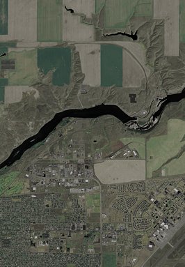
Black Eagle Falls sits at 3,278 feet within Giant Springs State Park, fed by the Missouri River, in the mountains of Montana.
Trail & Hike Details
The Approach
No hiking required. Black Eagle Falls is accessible by vehicle with a roadside viewing area.
Trail Description
This is a very short, out-and-back route: 0.1 miles round trip with roughly 50 feet of elevation gain. Classified as a drive-up access point (drive_up difficulty), the trail requires only a brief walk from the parking/viewing area to reach the overlook. The route is suitable for most visitors, including families and casual photographers; specific surface, grade, and USFS trail designations are not provided for this site.
What to Expect
Dogs are welcome.
Accessibility
This waterfall is viewable from a vehicle-accessible area. No hiking is required.
Frequently Asked Questions
🐶 Are Dogs Allowed at Black Eagle Falls?
✅ Dogs are allowed
Are There Any Fees or Permits Required?
🆖 No fees required
🏊 Is There Swimming at Black Eagle Falls?
❌ Swimming is not allowed
When to Visit
Spring and early summer are the best times to visit, as the water flow is usually at its peak due to snowmelt.
Seasonal Access
The best time to visit is Spring, Summer, and Fall. Winter access may be limited.
Safety Information
Stay on designated paths and viewing areas. Do not attempt to approach the water near the dam, as currents can be strong and dangerous.
Current Water Conditions
3,420 ft³/s
Current discharge — how much water is flowing
Much lower than usual for this time of year
Based on 67 years of record
3.07 ft
Water depth at gauge
7-Day Discharge Trend
What does this mean for your visit?
Flow is well below normal for this time of year, so the waterfall may be a trickle.
About This Gauge
This gauge is on a nearby waterway and may not reflect exact conditions at the falls.
7-Day Flow Outlook
Based on the USGS gauge Missouri River near Ulm MT (13 km away).
Today
Low
3887 cfs
3/10Tomorrow
Moderate
3642 cfs
5/10Sun
Low
3478 cfs
4/10Mon
Moderate
3878 cfs
4/10Tue
Low
3300 cfs
6/10Wed
Low
3206 cfs
3/10Thu
Low
3463 cfs
6/10Best window: Tue — low flow, mostly sunny (trip score 6/10).
Best time of year: this gauge typically runs highest from mid April to mid July, peaking in June.
How we calculate this
This is a transparent outlook, not a precise forecast. We take the waterfall's current flow strength (how it ranks against its historical normal for today, from the nearest USGS stream gauge), carry that ranking forward along the gauge's seasonal curve, and nudge it for forecast rain. Confidence is highest for the next day or two and falls further out. Always check official conditions and your own judgment before visiting — high flows can be dangerous.
Know when to go.
Get a free email alert when waterfalls near Black Eagle hit peak flow. We only send when conditions are worth the trip — no weekly newsletters, no spam.
Weather Forecast
Location & Access
Getting There
Black Eagle Falls is located in Great Falls, Montana, and can be accessed via River Drive North. The falls are near the Black Eagle Memorial Island Park, which provides a good viewing area.
Get Directions on Google MapsParking
Parking is available near Black Eagle Memorial Island Park and along River Drive North.
Elevation
3,278 feet above sea level
Coordinates
47.520791° N, -111.261919° W
Land Management
Managed by SPR
Visitor Tips & Gear
Visit in the spring or early summer when water flow is typically higher for a more dramatic view of the falls. Bring a camera and binoculars for wildlife viewing.
As an Amazon Associate, we earn from qualifying purchases.
For this easy 0.1 miles trail, lightweight trail shoes and a water bottle are usually sufficient. Sun exposure on the trail makes good sun protection a must in summer.

Polarized Sunglasses (Knockaround)
Cuts glare off the water so you actually see the falls — and your photos turn out better too.

Columbia Watertight II Rain Jacket
Packs into its own pocket, seam-sealed, and keeps you dry from spray and surprise rain.

Earth Pak Waterproof Dry Bag
Keeps your phone and gear dry when waterfall mist soaks everything else.

Waterproof Phone Pouch (AiRunTech)
Cheap insurance — take photos right next to the falls without killing your phone.

JOBY GorillaPod Starter Kit
Wraps around railings and rocks for long-exposure waterfall shots — no flat surface needed.

OR Sombriolet Sun Hat
UPF 50+ sun protection with vents so your head doesn't cook on exposed trail sections.
Where to Stay

Wingate by Wyndham Great Falls

Best Western Plus Riverfront Hotel and Suites

Hotel Arvon

The Great Falls Inn By Riversage
Browse vacation cabins and private rentals nearby
Unique outdoor stays — tents, yurts, and treehouses
Rent a campervan or RV for your waterfall road trip
Some links are affiliate links. We may earn a commission at no extra cost to you.
Additional Information
Nearby Attractions
Other waterfalls in the Great Falls area, such as Rainbow Falls and Crooked Falls. The Lewis and Clark Interpretive Center is also nearby.
Wildlife
Bird species such as eagles, osprey, and waterfowl are commonly seen in the area.
Cities near Black Eagle Falls
Nearby Waterfalls
Writing about Black Eagle Falls? Embed this waterfall on your site for free.