
Photo Credits (5)
Difficulty
Moderate
Trail Length
2.4 miles
Trail Type
Out And Back
Elevation Gain
350 ft
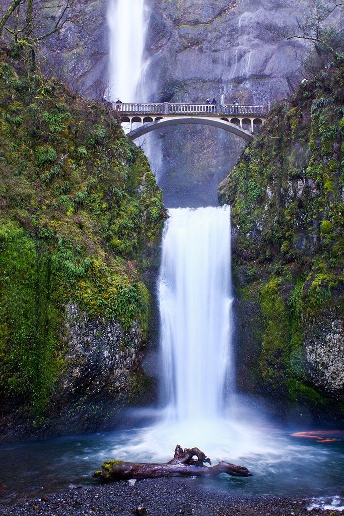
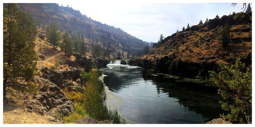
About Big Falls
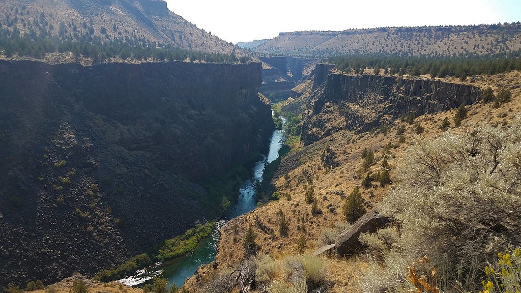
Big Falls is a scenic plunge on the Deschutes River Segment D, part of a corridor designated WSR (Wild and Scenic River) and managed by the Bureau of Land Management. Set against a backdrop of dense Pacific Northwest forest, the falls offer a striking cascade and several natural viewpoints that make it a favorite for photographers and day hikers alike. The site lies on land identified as DESG and is presented with the rugged, river-carved character typical of the Deschutes River corridor. Access to the falls feels immediate but rewarding: a short, moderate hike brings you to an intimate vantage where you can watch the water drop and listen to the river below. The approach is popular for year-round visits; while there’s no campground immediately adjacent to the trailhead, the nearest organized group camping is at South Shore Group Sites, roughly 17.6 km away, so plan accordingly for day trips or overnight stays in the region.
The Setting
Big Falls sits at 2,480 feet within Deschutes River Segment D, fed by the Crooked River, in the hills of Oregon.
Trail & Hike Details
The Approach
The moderate 2.4-mile out-and-back trail gains 350 feet of elevation on the way to the falls.
Trail Description
The trail to Big Falls is an out-and-back route of approximately 2.4 miles with about 350 feet of elevation gain and is generally rated moderate. The path is a well-marked forest route that climbs steadily but without technical sections; specific USFS surface/grade/class or trail number were not provided in the available data. Hikers can expect a straightforward approach that culminates at a dedicated viewing area for the falls—good footwear and standard day-hike preparation are recommended.
What to Expect
Dogs are welcome.
Accessibility
The trail is not wheelchair accessible. Uneven terrain and elevation changes require steady footing.
Frequently Asked Questions
🐶 Are Dogs Allowed at Big Falls?
✅ Dogs are allowed
Are There Any Fees or Permits Required?
🆖 No fees required
🏊 Is There Swimming at Big Falls?
❌ Swimming is not allowed
When to Visit
Spring and early summer are the best times to visit, as the waterfall is typically at its fullest due to snowmelt and seasonal rains.
Seasonal Access
The best time to visit is Spring, Summer, and Fall. Winter access may be limited.
Safety Information
The rocks near the waterfall can be slippery, so visitors should exercise caution. Be prepared for changing weather conditions, and carry a map or GPS device as cell service may be unreliable.
Current Water Conditions
84 ft³/s
Current discharge — how much water is flowing
Much lower than usual for this time of year
Based on 22 years of record
1.62 ft
Water depth at gauge
7-Day Discharge Trend
What does this mean for your visit?
Flow is well below normal for this time of year, so the waterfall may be a trickle.
About This Gauge
7-Day Flow Outlook
Based on the USGS gauge CROOKED RIVER BLW OSBORNE CANYON, NR OPAL CITY, OR (8 km away).
Today
Barely Flowing
84 cfs
5/10Tomorrow
Barely Flowing
82 cfs
4/10Sat
Barely Flowing
93 cfs
3/10Sun
Low
97 cfs
4/10Mon
Barely Flowing
87 cfs
5/10Tue
Barely Flowing
88 cfs
5/10Wed
Barely Flowing
87 cfs
5/10Best window: Today — barely flowing flow, mostly sunny (trip score 5/10).
Best time of year: this gauge typically runs highest from mid March to mid May, peaking in April.
How we calculate this
This is a transparent outlook, not a precise forecast. We take the waterfall's current flow strength (how it ranks against its historical normal for today, from the nearest USGS stream gauge), carry that ranking forward along the gauge's seasonal curve, and nudge it for forecast rain. Confidence is highest for the next day or two and falls further out. Always check official conditions and your own judgment before visiting — high flows can be dangerous.
Know when to go.
Get a free email alert when waterfalls near Crooked River Ranch hit peak flow. We only send when conditions are worth the trip — no weekly newsletters, no spam.
Weather Forecast
Location & Access
Getting There
Big Falls is located in the Umpqua National Forest. To reach the falls, visitors typically drive along forest roads, which may require a high-clearance vehicle depending on conditions. Directions should be verified with local ranger stations or reliable trail resources.
Get Directions on Google MapsParking
There is a small parking area near the trailhead, but availability may be limited during peak seasons.
Elevation
2,480 feet above sea level
Coordinates
44.371404° N, -121.292485° W
Land Management
Managed by BLM
Visitor Tips & Gear
Wear sturdy footwear as the trail may be muddy or uneven in places. Bring insect repellent during warmer months, and check weather conditions before visiting. Cell service may be limited in the area.
As an Amazon Associate, we earn from qualifying purchases.
With 2.4 miles and 350 ft of elevation gain, sturdy boots and trekking poles will help on this moderate trail. Sun exposure on the trail makes good sun protection a must in summer.

Polarized Sunglasses (Knockaround)
Cuts glare off the water so you actually see the falls — and your photos turn out better too.

Columbia Watertight II Rain Jacket
Packs into its own pocket, seam-sealed, and keeps you dry from spray and surprise rain.

Earth Pak Waterproof Dry Bag
Keeps your phone and gear dry when waterfall mist soaks everything else.

Waterproof Phone Pouch (AiRunTech)
Cheap insurance — take photos right next to the falls without killing your phone.

Timberland Euro Sprint Mid Waterproof
Trusted waterproof boot with premium leather and grippy rubber sole — reliable on rocky, wet trails.

TrailBuddy Trekking Poles
Lightweight aluminum, cork grips, and flip-locks that actually hold — a best-seller for good reason.
Where to Stay

Crooked River Ranch Cabins

Canyon Rim at Eagle Crest

Sisters Inn & Suites

Juniper Preserve
Browse vacation cabins and private rentals nearby
Unique outdoor stays — tents, yurts, and treehouses
Rent a campervan or RV for your waterfall road trip
Some links are affiliate links. We may earn a commission at no extra cost to you.
Nearby Campground
SOUTH SHORE GROUP SITES
10.9 miles away · 2 sites
OverviewHaystack South Shore Group Campground is the only group campground on Haystack Reservoir. Each of the two campsites holds up to 50 people. This is a year-round facility ideal for large events such as family reunions or groups of rock climbers visiting nearby Smith Rock State Park. Natural Features:South Shore is located in the high desert landscape with views of Mt. Jefferson as a scenic backdrop. Juniper trees and sagebrush dot the landscape. The combination of a low forest canopy and 3,
Book on Recreation.govNearby Hot Springs
Hot springs near Crooked River Ranch, Oregon

Springs
These thermal springs emerge at 125°F on sovereign Warm Springs Reservation land in Jefferson County, creating a 72-degree temp...
Kahneeta Hot Springs
Kahneeta Hot Springs flows at 126°F on Warm Springs Reservation tribal land at 1,450 feet elevation, sitting just 6 meters from...
Paulina Springs
Paulina Springs emerges at 70°F within Newberry National Volcanic Monument in Deschutes County, flowing at 6,338 feet elevation...

East Lake Hot Springs
East Lake Hot Springs emerges at 144°F on the shore of East Lake within the Newberry Volcano caldera, flowing 103.8°F above the...

Bigelow Hot Springs
Bigelow Hot Springs, also called Deer Creek Hot Springs, emerges at 142°F just 400 feet from Deer Creek Road in the Willamette ...
Belknap Springs
Belknap Springs flows at 160°F along the McKenzie River in the Cascade Range, emerging just 510 feet from North Belknap Springs...
Looking for a soak after your hike? Explore more hot springs near Crooked River Ranch, Oregon on SoakingSprings.
Explore Oregon springsAdditional Information
Nearby Attractions
Other attractions in the Umpqua National Forest include Toketee Falls, Watson Falls, and the Umpqua Hot Springs.
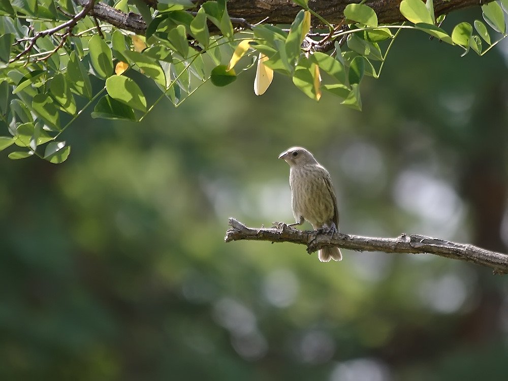
Wildlife
The area is home to a variety of wildlife, including deer, birds, and small mammals. Visitors should be cautious of bears and other larger animals.
Cities near Big Falls
Nearby Waterfalls
Other waterfalls named Big Falls
23 other waterfalls share this name across the U.S.
Writing about Big Falls? Embed this waterfall on your site for free.