Photo Credits (2)
Difficulty
Moderate
Trail Length
2.0 miles
Trail Type
Out And Back
Elevation Gain
300 ft
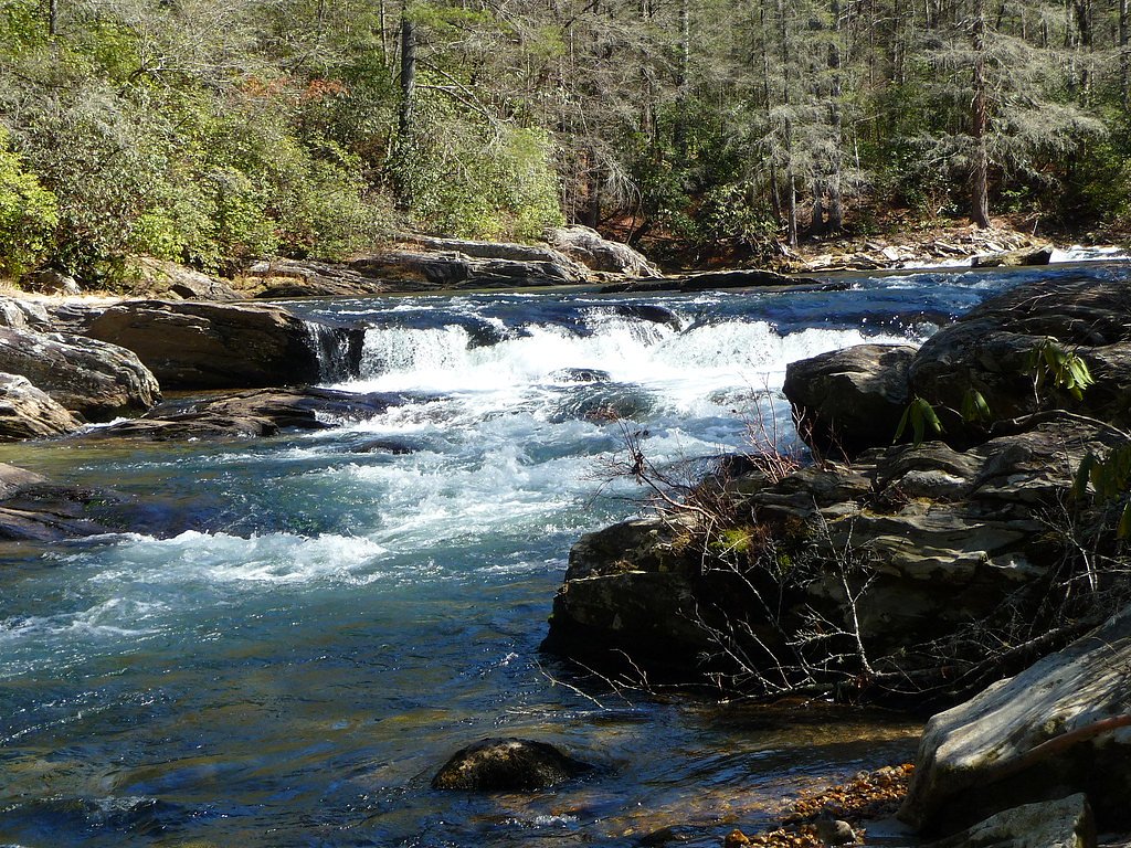
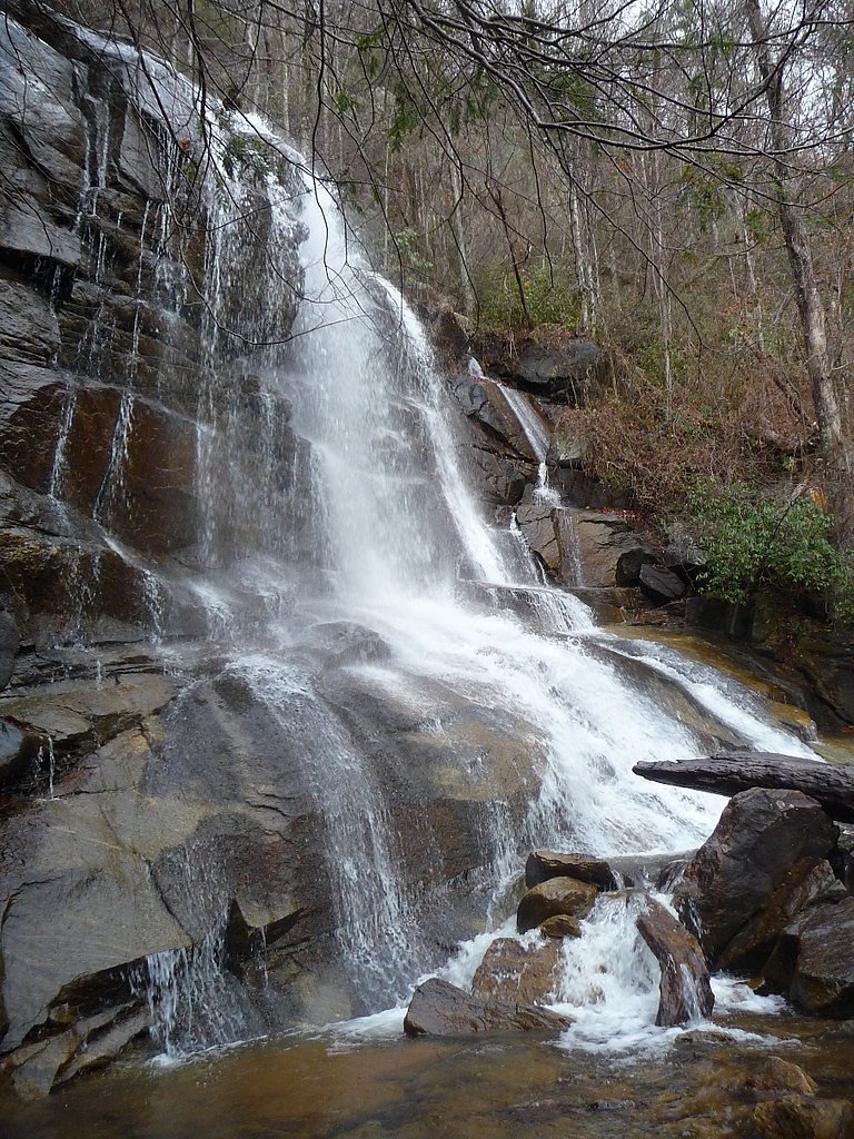
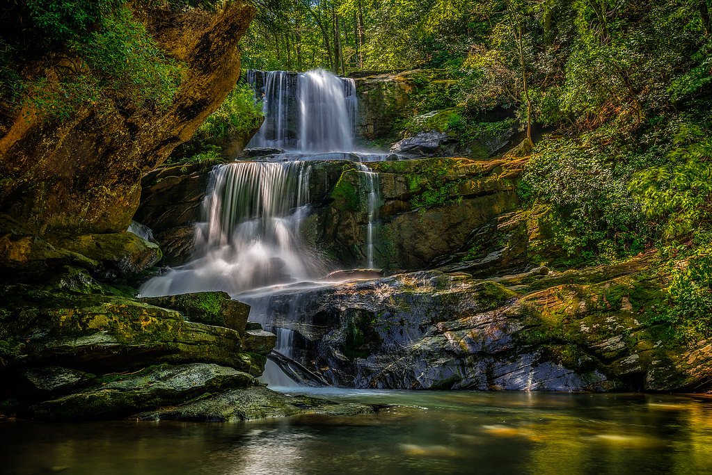
About Big Falls
Big Falls sits quietly within the North Saluda Watershed, a city-managed site designated WPA, and offers a restorative slice of South Carolina woodland. The waterfall itself is a pleasant, lesser-known destination—perfect for hikers who prefer a calm, natural setting over crowded overlooks. Because the area is managed by the city, visitors should expect a relatively low-key experience with an emphasis on preserving the watershed's natural character. The trail to Big Falls is a 2.0-mile out-and-back with roughly 300 feet of elevation gain and is typically rated moderate. The route winds through mature forest and delivers a mix of gentle grades and short, steeper pitches that reward hikers with peaceful forest scenery and the sound of tumbling water. Sturdy footwear is recommended, as sections of the path can be uneven with exposed roots and rocks.
The Setting
Big Falls sits at 1,414 feet within North Saluda Watershed, fed by the Middle Saluda River, in the foothills of South Carolina.
Nearby Falls Worth Visiting
Pearsons Falls (90 ft) lies 4.8 miles to the northeast. Also nearby: Bradley Falls (75 ft, 9.3 mi).
Trail & Hike Details
The Approach
The moderate 2.0-mile out-and-back trail gains 300 feet of elevation on the way to the falls.
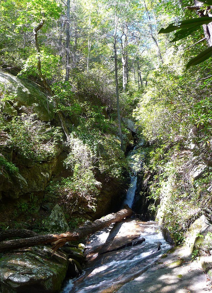
Trail Description
Length: 2.0 miles (out-and-back); Elevation gain: ~300 ft; Difficulty: moderate. The path passes through forested terrain in the North Saluda Watershed and alternates between gentle grades and moderately steep sections. Surface is natural tread and can be uneven in places with roots and rocks, so expect non-technical hiking conditions that require sure footing. The route is suitable for hikers comfortable with a moderate climb and rustic trail conditions; there are minimal built facilities along the way due to city watershed management.
What to Expect
Visitors can expect a tranquil hike through lush greenery, culminating in a picturesque waterfall surrounded by natural rock formations. The area is typically quiet, making it ideal for those seeking solitude.
Accessibility
The trail is not wheelchair accessible. Uneven terrain and elevation changes require steady footing.
Frequently Asked Questions
🐶 Are Dogs Allowed at Big Falls?
❌ Dogs are not allowed
Are There Any Fees or Permits Required?
🆖 No fees required
🏊 Is There Swimming at Big Falls?
❌ Swimming is not allowed
When to Visit
Spring and fall are the best times to visit, as the weather is mild and the waterfall flow is often at its peak. Summer can also be enjoyable, but be prepared for heat and humidity.
Seasonal Access
The best time to visit is Spring, Summer, and Fall. Winter access may be limited.
Safety Information
The trail can be slippery, especially after rain. Watch for loose rocks and roots. Always stay on marked paths and avoid getting too close to the edge of the waterfall.
Current Water Conditions
26 ft³/s
Current discharge — how much water is flowing
Lower than usual for this time of year
Based on 36 years of record
1.49 ft
Water depth at gauge
7-Day Discharge Trend
What does this mean for your visit?
Flow is lower than usual for this time of year.
About This Gauge
This gauge is on a nearby waterway and may not reflect exact conditions at the falls.
7-Day Flow Outlook
Based on the USGS gauge MIDDLE SALUDA RIVER NEAR CLEVELAND, SC (14 km away).
Today
Moderate
29 cfs
4/10Tomorrow
Moderate
29 cfs
4/10Mon
Moderate
30 cfs
4/10Tue
Low
27 cfs
6/10Wed
Low
23 cfs
6/10Thu
Moderate
28 cfs
4/10Fri
Moderate
29 cfs
4/10Best window: Tue — low flow, sunny (trip score 6/10).
Best time of year: this gauge typically runs highest from late March to early May, peaking in April.
How we calculate this
This is a transparent outlook, not a precise forecast. We take the waterfall's current flow strength (how it ranks against its historical normal for today, from the nearest USGS stream gauge), carry that ranking forward along the gauge's seasonal curve, and nudge it for forecast rain. Confidence is highest for the next day or two and falls further out. Always check official conditions and your own judgment before visiting — high flows can be dangerous.
Know when to go.
Get a free email alert when waterfalls near The Cliffs Valley hit peak flow. We only send when conditions are worth the trip — no weekly newsletters, no spam.
Weather Forecast
Location & Access
Getting There
Big Falls is located in a remote area of South Carolina. Access typically involves driving to a nearby trailhead, followed by a hike to the waterfall. Exact directions may vary depending on the starting point.
Get Directions on Google MapsParking
Parking is available near the trailhead, but spaces may be limited. Visitors are advised to arrive early, especially during peak seasons.
Elevation
1,414 feet above sea level
Coordinates
35.163172° N, -82.393174° W
Land Management
Managed by CITY
Visitor Tips & Gear
Bring plenty of water, wear sturdy hiking shoes, and consider using trekking poles for stability. Bug spray is recommended during warmer months. Cell service may be limited, so plan accordingly.
As an Amazon Associate, we earn from qualifying purchases.
With 2.0 miles and 300 ft of elevation gain, sturdy boots and trekking poles will help on this moderate trail. Sun exposure on the trail makes good sun protection a must in summer.

Polarized Sunglasses (Knockaround)
Cuts glare off the water so you actually see the falls — and your photos turn out better too.

Columbia Watertight II Rain Jacket
Packs into its own pocket, seam-sealed, and keeps you dry from spray and surprise rain.

Earth Pak Waterproof Dry Bag
Keeps your phone and gear dry when waterfall mist soaks everything else.

Waterproof Phone Pouch (AiRunTech)
Cheap insurance — take photos right next to the falls without killing your phone.

Timberland Euro Sprint Mid Waterproof
Trusted waterproof boot with premium leather and grippy rubber sole — reliable on rocky, wet trails.

TrailBuddy Trekking Poles
Lightweight aluminum, cork grips, and flip-locks that actually hold — a best-seller for good reason.
Where to Stay

Golden Dawn at Saluda Mountain Retreats

Green River Lodge

CedarWood Inn

1850s Settlers Cabin at Wethero Ridge
Browse vacation cabins and private rentals nearby
Unique outdoor stays — tents, yurts, and treehouses
Rent a campervan or RV for your waterfall road trip
Some links are affiliate links. We may earn a commission at no extra cost to you.
Nearby Campground
SYCAMORE FLATS PICNIC SHELTER
19.5 miles away · 1 sites
Overview Sycamore Flats Picnic Shelter is located along the Davidson River on the Pisgah National Forest. This picnic area was named for the sycamore trees which line the banks of the river.The shelter is available on a first come, first served basis from mid-November to April 15th. Reservations are available April 16th through mid-November. Some amenities may not be available during the off-season. This is a popular destination with limited parking, please plan accordingly.Recreation Sycamore Fl
Book on Recreation.govAdditional Information
Nearby Attractions
Other nearby attractions may include additional hiking trails, scenic overlooks, and local parks. Research the area for more options.
Wildlife
The area is home to a variety of wildlife, including birds, deer, and small mammals. Be mindful of your surroundings and avoid feeding animals.
Cities near Big Falls
Nearby Waterfalls
Other waterfalls named Big Falls
23 other waterfalls share this name across the U.S.
Writing about Big Falls? Embed this waterfall on your site for free.