Photo Credits (5)
Difficulty
Moderate
Trail Type
Out And Back
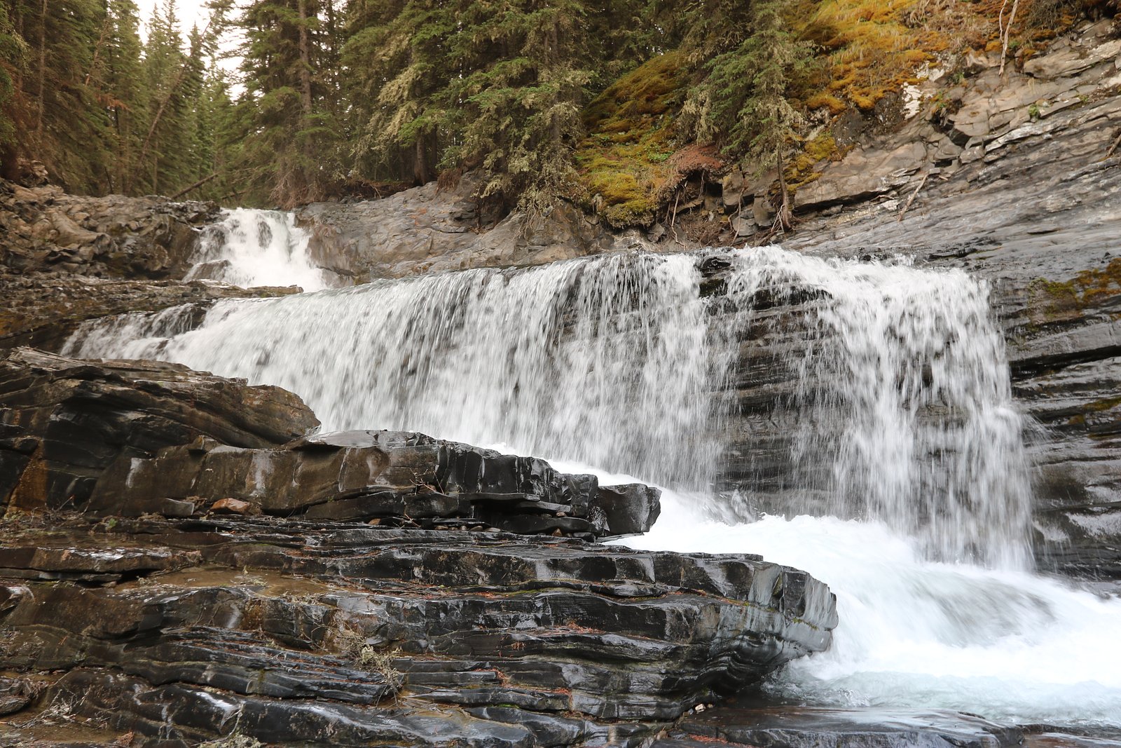
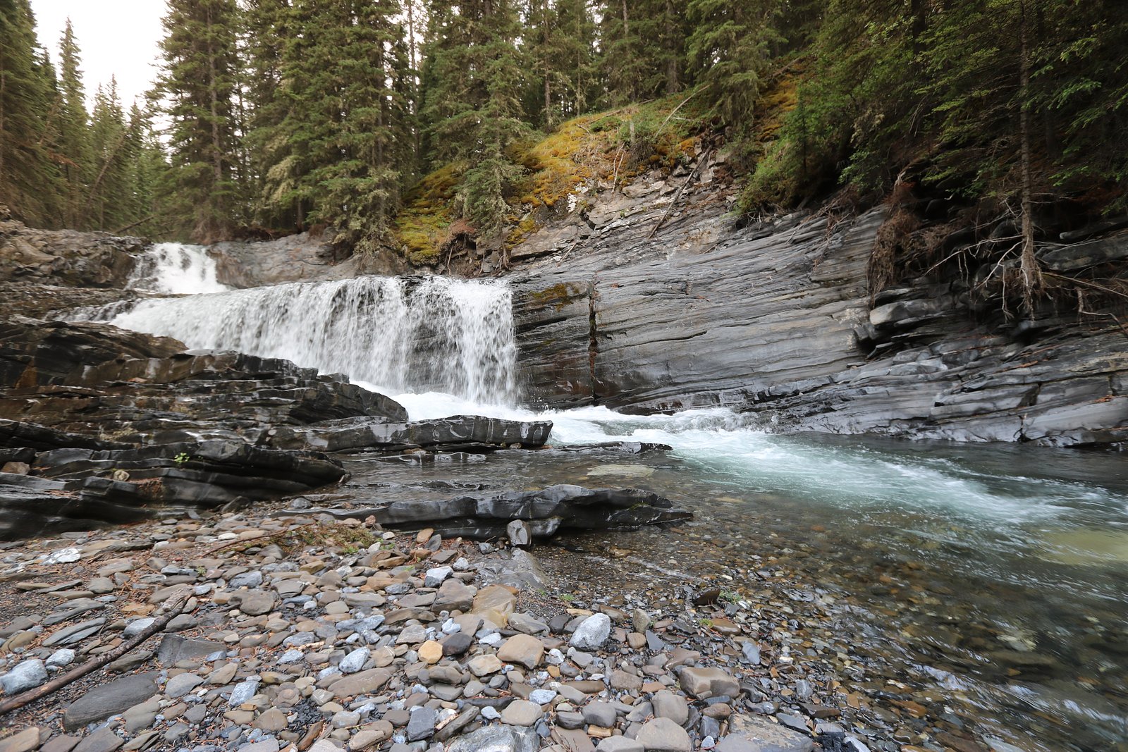
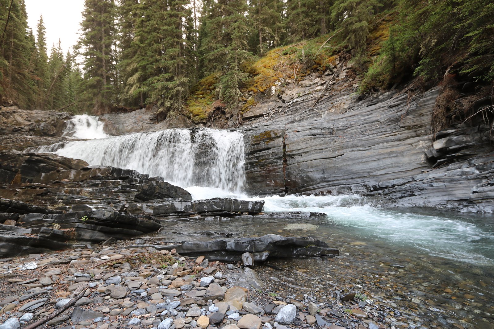
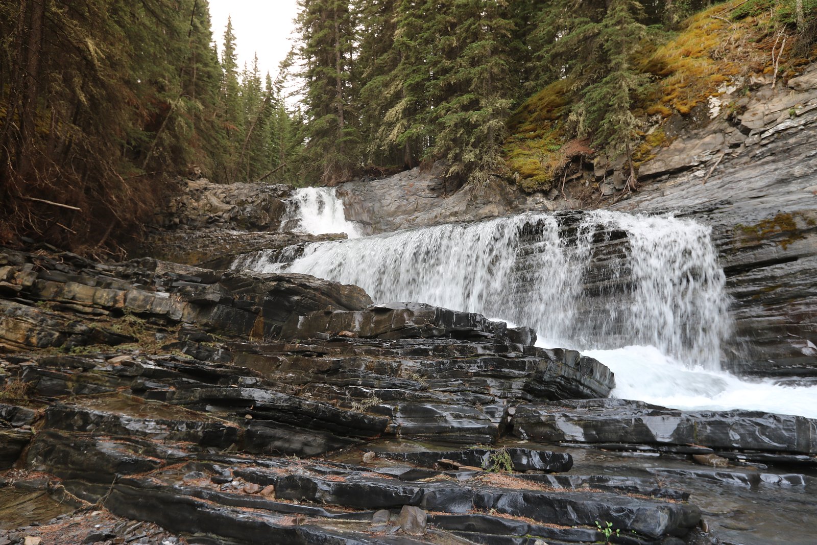
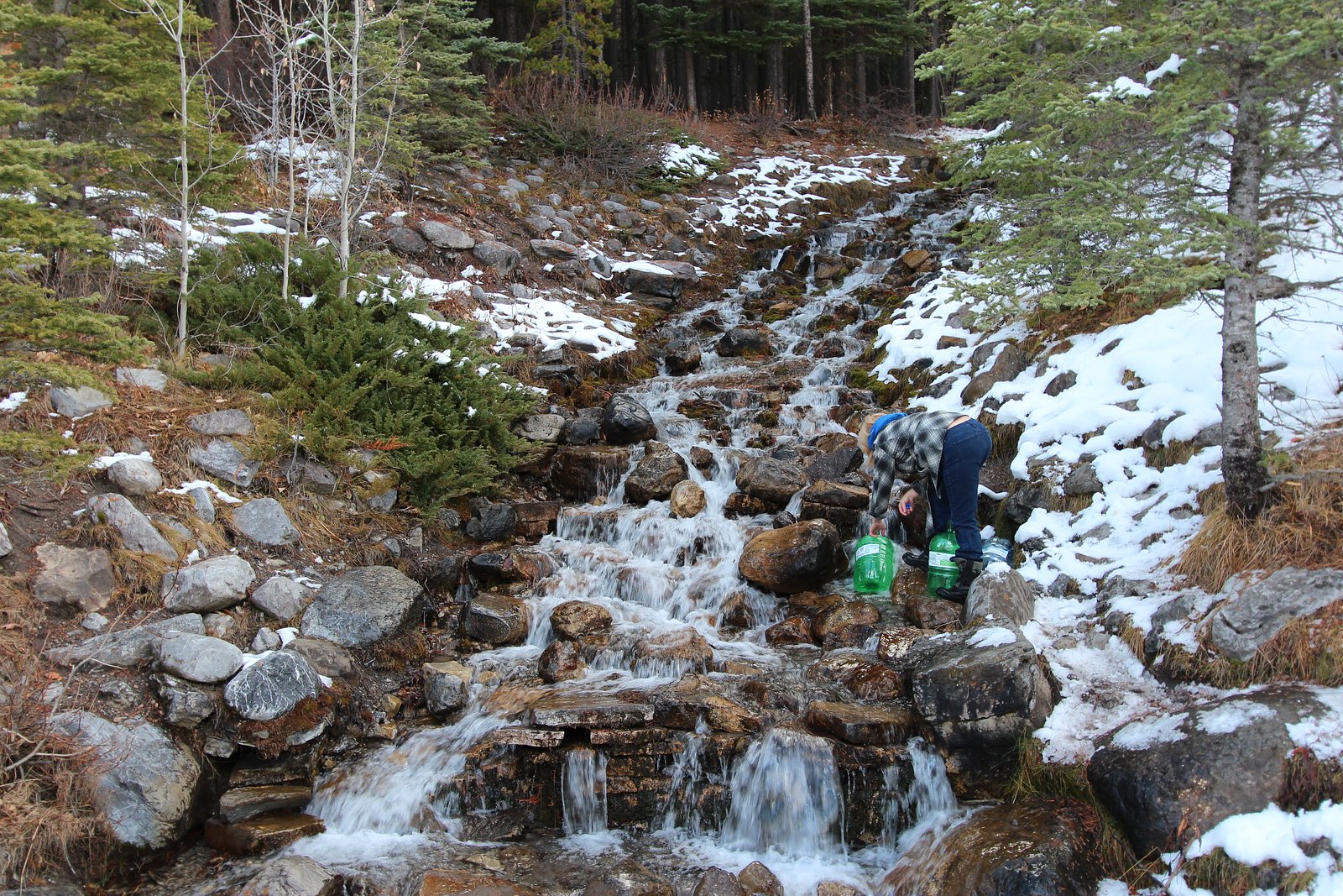
About Lower Spray Falls
Lower Spray Falls is a cascade on the Spray River system in the Spray Valley area near Banff, Alberta (approximate coordinates 51.032, -115.2513). It is commonly visited for its scenic spray, steep rocky canyon setting and proximity to other Spray Valley attractions. Specifics such as exact measured height and official signage vary by source; visitors should treat details here as approximate and confirm current conditions with local park authorities before travelling.
Why This Waterfall Exists
Lower Spray Falls flows over hard intrusive rock laid down about 359-419 million years ago. These resistant rocks form a durable ledge that water cannot easily wear away, creating the falls where softer material downstream has already eroded.
Nearby Falls Worth Visiting
O'Shaughnessy Falls (7 m) lies 12.9 kilometres to the east.
Trail & Hike Details
Trail Description
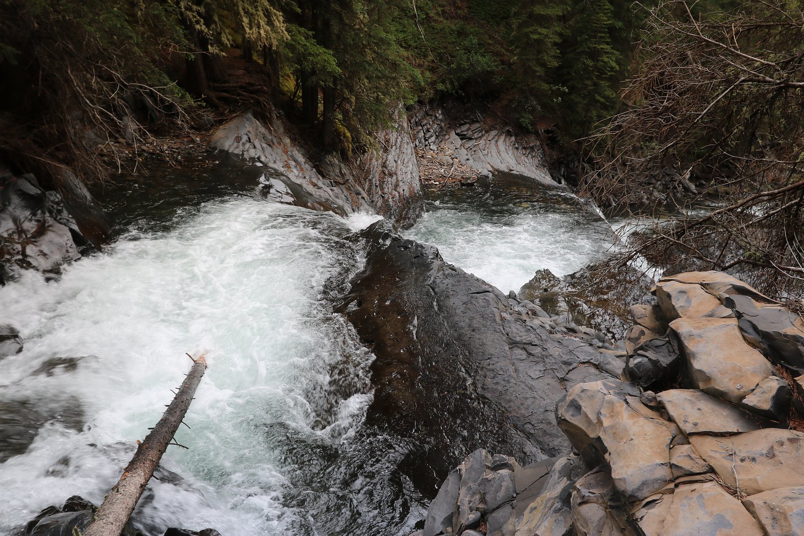
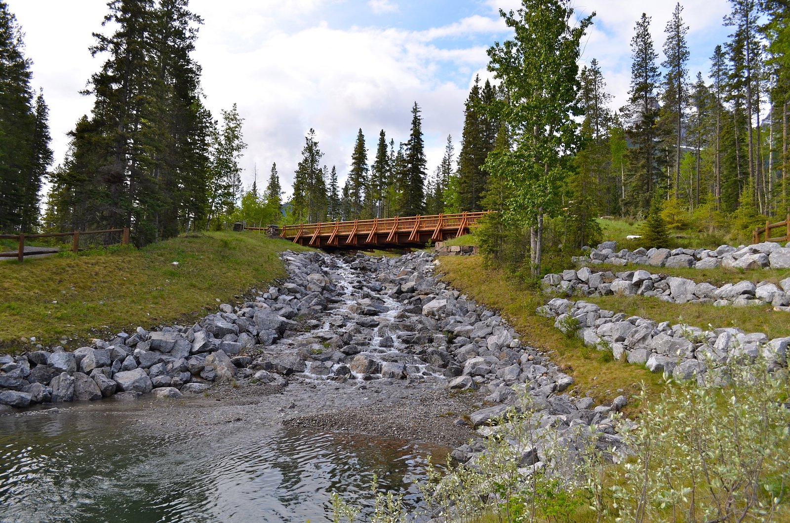
The route to Lower Spray Falls generally follows a valley/river corridor and can be forested with sections of exposed rocky terrain near the stream. The trail is most commonly an out-and-back route to a viewpoint above or beside the cascade. Exact trail routing and distance depend on the trailhead used; approaches can include short forest walks or longer valley hikes from nearby roads. Near the falls the terrain may be steep, with wet and slippery rock surfaces. There may be informal social routes closer to the water that require scrambling, stay on designated trails where present.
What to Expect
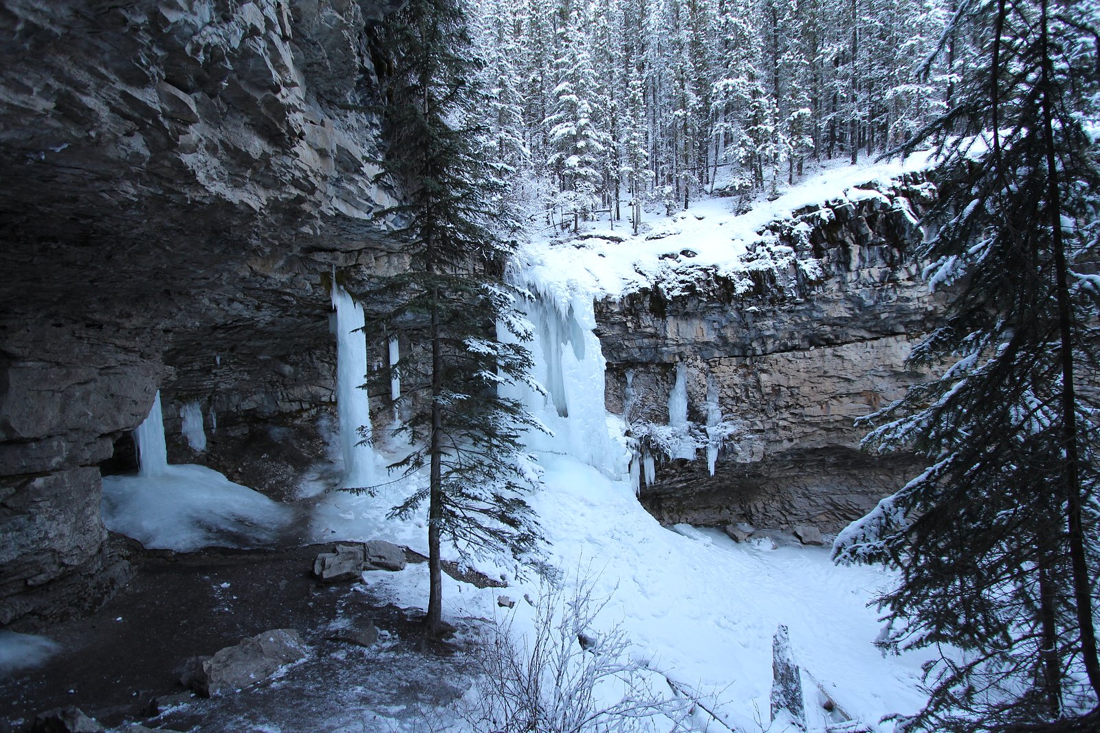
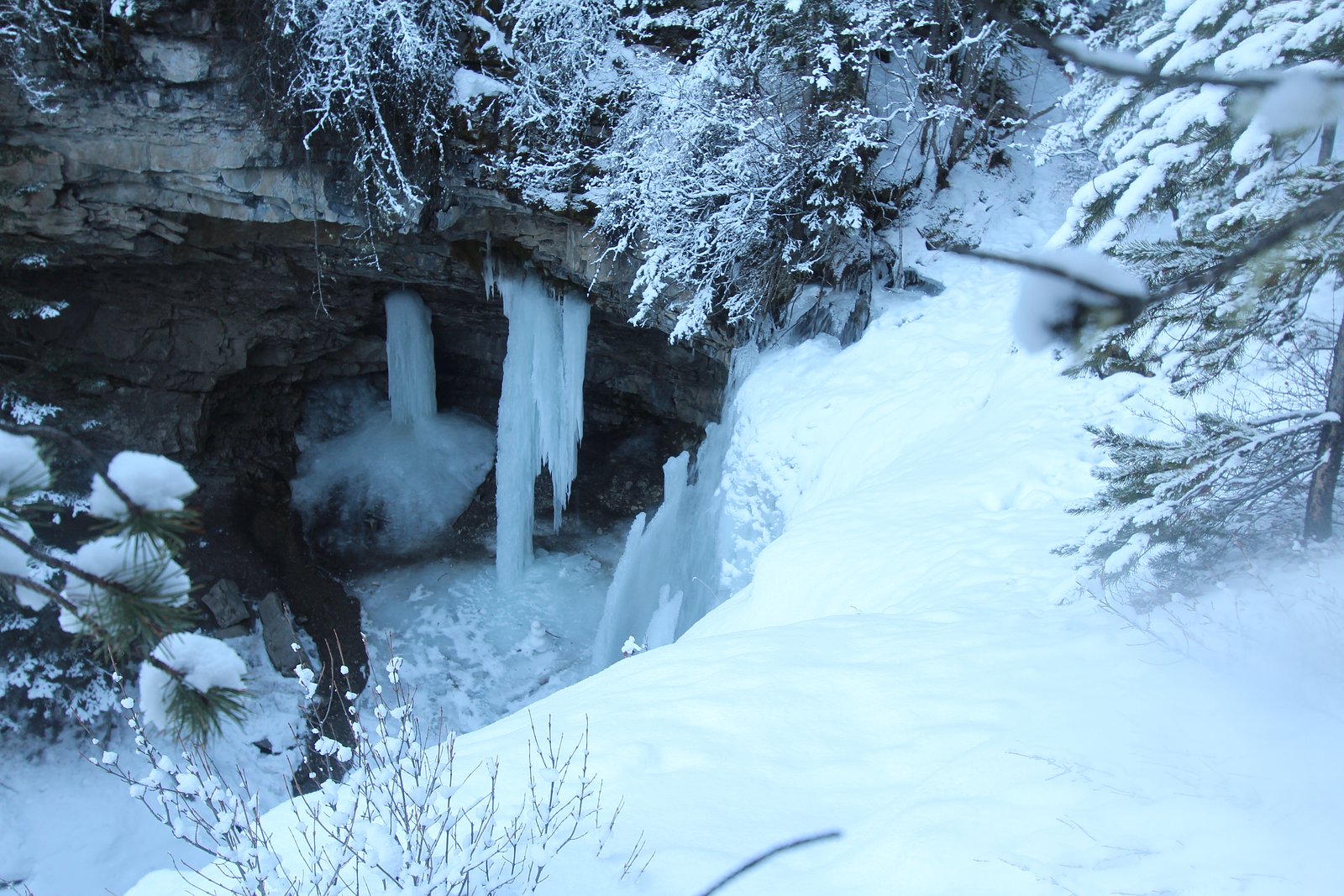
Expect a mountain-river waterfall environment: steep valley walls, mist/spray near the falls (stronger in spring and early summer runoff), rocky banks, and forested approaches. Facilities (toilets, potable water, marked trails) may be minimal or absent. In winter the falls and approaches can be icy and frozen, creating spectacular ice but also hazardous conditions. Wildlife (including bears, elk, and smaller mammals) can be present in the area.
Accessibility
The trail is not wheelchair accessible. Uneven terrain and elevation changes require steady footing.
Frequently Asked Questions
🐶 Are Dogs Allowed at Lower Spray Falls?
❌ Dogs are not allowed
Are There Any Fees or Permits Required?
🆖 No fees required
🏊 Is There Swimming at Lower Spray Falls?
❌ Swimming is not allowed
When to Visit
Late spring and early summer for highest flows from snowmelt and lush surroundings; mid-to-late summer for easier access and warmer weather; fall for autumn color and fewer crowds. Winter offers frozen falls and scenic ice features but requires winter travel skills and equipment and carries higher risk (ice, avalanche, short daylight).
Seasonal Access
The best time to visit is Spring, Summer, Fall, and Winter. Check with the managing park or local authority for current conditions.
Safety Information
Hazards can include slippery rock and wet surfaces near the falls, steep drop-offs, fast currents, sudden water surges during spring melt or after heavy rain, cold water temperatures, and wildlife encounters. In winter expect icy trails, deep snow, and potential avalanche hazard in off-trail or steep areas. Carry appropriate gear, tell someone your plans, and check local alerts before heading out. If uncertain about conditions, err on the side of caution and stay away from cliff edges and riverbanks.
Current Water Conditions
0.3 m³/s
Current discharge — how much water is flowing
About average for this time of year
Based on 48 years of record
0.37 m
Water depth at gauge
7-Day Discharge Trend
What does this mean for your visit?
Flow is about average for this time of year.
About This Gauge
This gauge is on a nearby waterway and may not reflect exact conditions at the falls.
7-Day Flow Outlook
Based on the WSC gauge JUMPINGPOUND CREEK NEAR COX HILL (22 km away).
Today
Moderate
0.2 m³/s
8/10Tomorrow
Moderate
0.3 m³/s
5/10Tue
Moderate
0.2 m³/s
5/10Wed
Moderate
0.2 m³/s
5/10Thu
Moderate
0.2 m³/s
5/10Fri
Moderate
0.2 m³/s
6/10Sat
Moderate
0.2 m³/s
6/10Best window: Today — moderate flow, mainly sunny (trip score 8/10).
Best time of year: this gauge typically runs highest from mid May to late June, peaking in May.
How we calculate this
This is a transparent outlook, not a precise forecast. We take the waterfall's current flow strength (how it ranks against its historical normal for today, from the nearest WSC stream gauge), carry that ranking forward along the gauge's seasonal curve, and nudge it for forecast rain. Confidence is highest for the next day or two and falls further out. Always check official conditions and your own judgment before visiting — high flows can be dangerous.
Know when to go.
Get a free email alert when waterfalls near Banff hit peak flow. We only send when conditions are worth the trip — no weekly newsletters, no spam.
Weather Forecast
Location & Access
Getting There
Access is from the Spray Valley / Spray Lakes area southeast of Banff. Typical approach is by road from the Trans-Canada Highway toward the Spray Lakes Road / forestry roads and parking pullouts near the Spray River. Final approach is on foot; exact vehicle access can include unpaved or gravel roads and may require a high-clearance vehicle at times. Check local maps and Parks Canada/Alberta Parks information for the most current access routes and road conditions.
Get Directions on Google MapsParking
Parking is usually informal: small trailhead lots or roadside pullouts near the Spray River corridor. Space may be limited; do not block gates or private driveways. In busy seasons park in designated areas only. Confirm where parking is allowed and obey signage, parking and access rules may vary depending on land manager.
Elevation
1,385 metres above sea level
Coordinates
51.032025° N, -115.251260° W
Visitor Tips & Gear
• Check current road and trail conditions with Parks Canada/Alberta Parks or local ranger offices before travelling. • Carry bear spray and know how to use it; keep dogs leashed and under control where permitted. • Wear sturdy, grippy footwear; expect wet, muddy, or slippery rock near the falls. • Stay on established trails and behind safety barriers; do not climb wet rocks near the brink. • Pack out all trash and follow Leave No Trace. • In winter bring traction devices (microspikes/crampons) and be avalanche-aware if venturing into steep terrain.
Where to Stay
Browse vacation cabins and private rentals nearby
Unique outdoor stays — tents, yurts, and treehouses
Rent a campervan or RV for your waterfall road trip
Some links are affiliate links. We may earn a commission at no extra cost to you.
Nearby Campground
Three Sisters Campground
1.5 km away
Additional Information
Nearby Attractions
Banff townsite (~20 miles/approx.), Spray Lakes Reservoir and valley trails, other Spray River cascades and viewpoints, backcountry hiking and alpine areas in Banff and Kananaskis regions. Lake Louise is further (~59 miles as provided) and offers additional well-known attractions.
Wildlife
Black and grizzly bears, elk, deer, mountain goats, bighorn sheep and smaller mammals and birds are possible. Observe wildlife from a distance and follow park guidance.
Cities near Lower Spray Falls
Nearby Waterfalls
Writing about Lower Spray Falls? Embed this waterfall on your site for free.