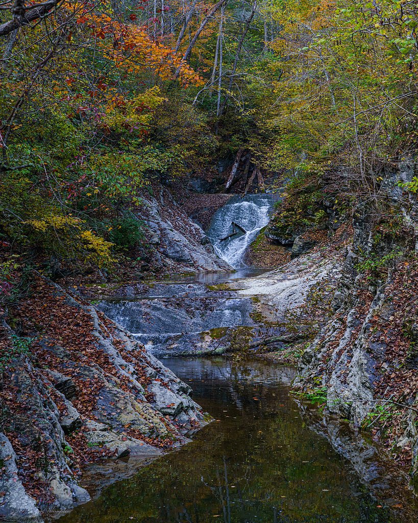
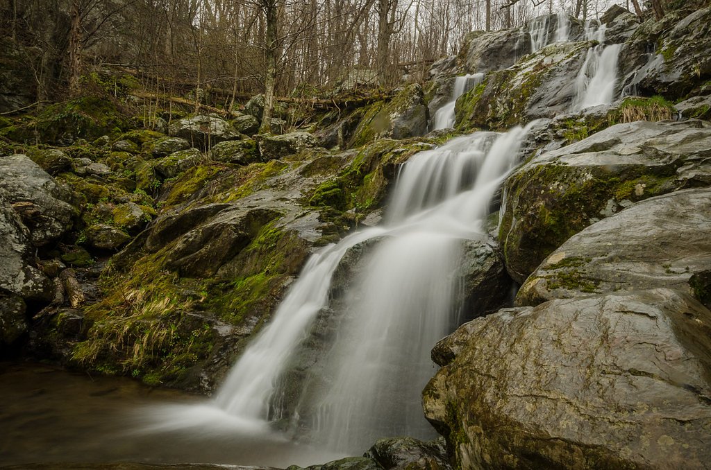
Cedar Falls
Virginia • Shenandoah National Park
By Armen Suny · Last verified Mar 2026
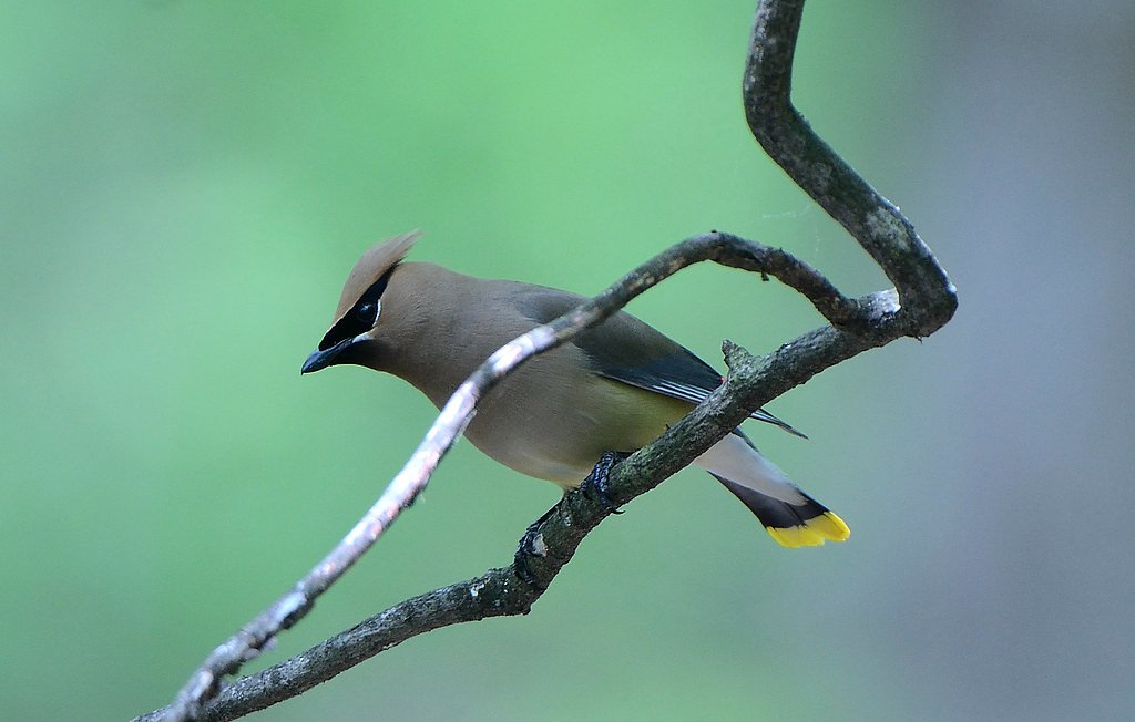
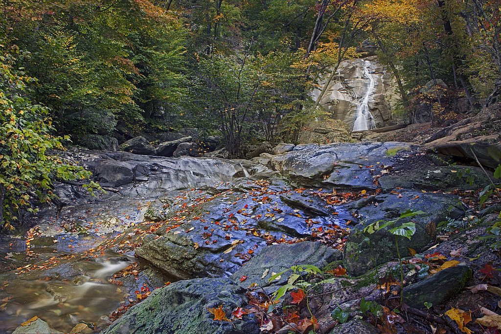
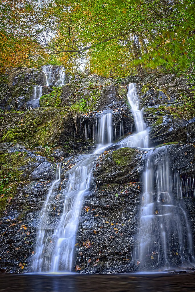
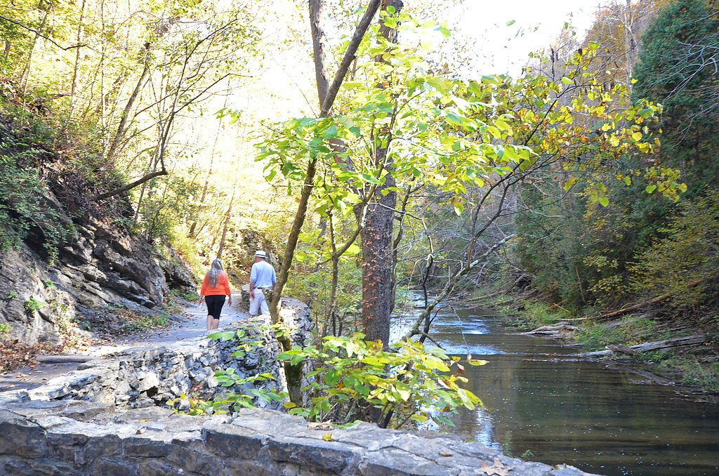
Photo Credits (5)
Difficulty
Moderate
Trail Length
2.4 miles
Trail Type
Out And Back
Elevation Gain
350 ft
About Cedar Falls
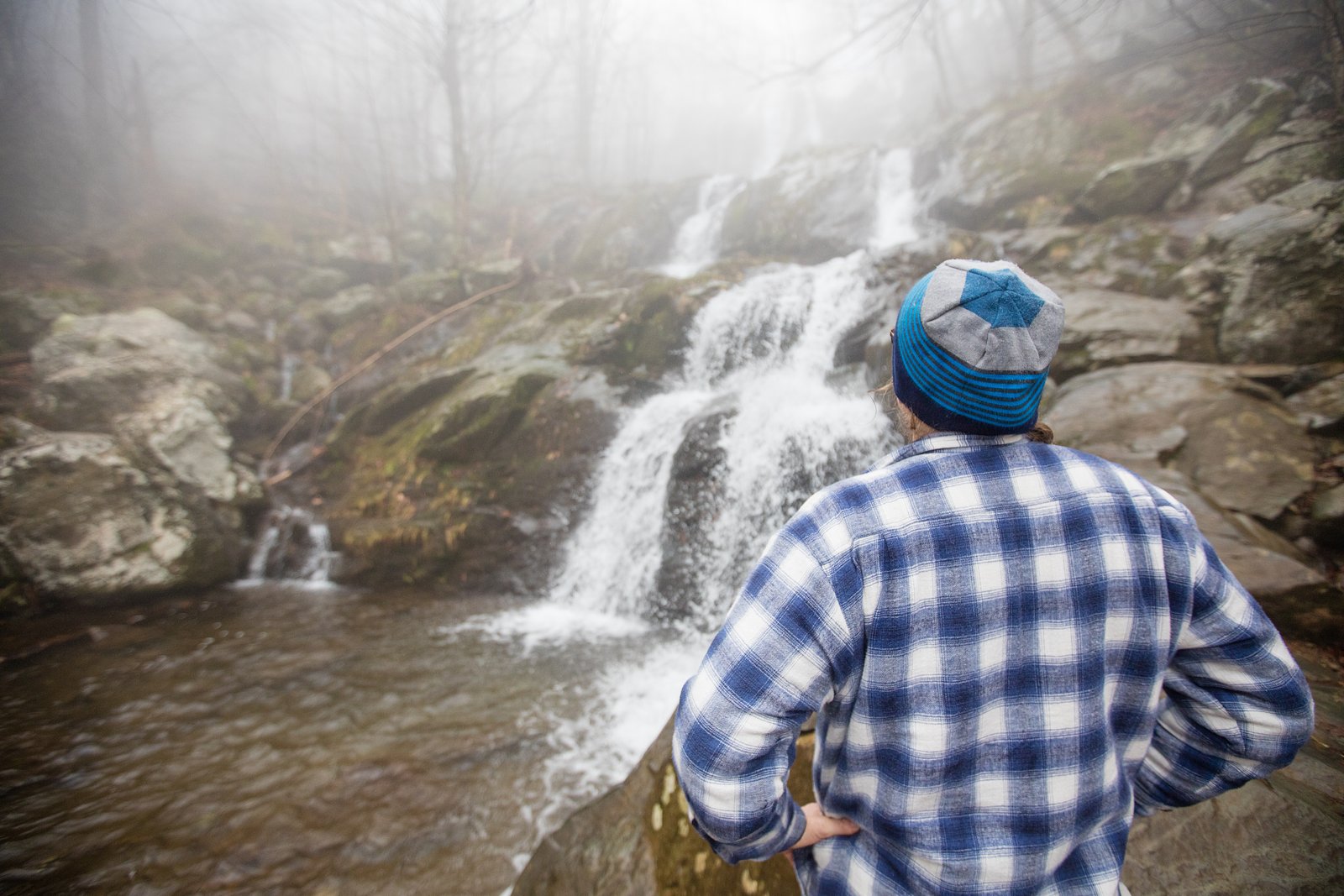
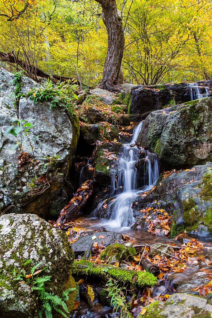
Cedar Falls is a scenic cascade set within the forested ridges of Shenandoah National Park, offering a peaceful stop for hikers exploring the park’s highlands. Though the name “Cedar Falls” can refer to multiple places (Wikipedia notes the name’s ambiguity), the waterfall here is a compact, photogenic drop framed by mixed hardwoods and typical Shenandoah understory. Land-unit records list this site as Rhm-Vof-2177 (designation OTHE) with management code OTHS and a private-owner notation (PVT), while the feature itself sits within the park boundary and is commonly visited by day hikers.
The Setting
Cedar Falls sits at 2,041 feet within Shenandoah National Park, fed by the S F Shenandoah River, in the hills of Virginia.
Nearby Falls Worth Visiting
South River Falls (83 ft) lies 2.4 miles to the east. Also nearby: Lewis Spring Falls (81 ft, 10.0 mi) and Dark Hollow Falls (70 ft, 10.7 mi).
Trail & Hike Details
The Approach
The moderate 2.4-mile out-and-back trail gains 350 feet of elevation on the way to the falls.
Trail Description
The most commonly used route to Cedar Falls is an out-and-back hike of about 2.4 miles round trip with roughly 350 feet of elevation gain; the route is typically rated moderate and is suitable for most fit hikers. No USFS trail name or number is listed for this approach, and specific USFS trail surface/grade/class data are not available in the provided records. Expect a moderate forest trail with elevation changes over uneven ground; pack appropriate footwear and water. Lewis Mountain Campground is the closest developed camping option, approximately 7.14 km away, for those wanting an overnight stay near the park.
What to Expect
Visitors can expect a peaceful natural setting with a waterfall surrounded by forested landscapes. The area may have uneven terrain and limited facilities.
Accessibility
The trail is not wheelchair accessible. Uneven terrain and elevation changes require steady footing.
Frequently Asked Questions
🐶 Are Dogs Allowed at Cedar Falls?
❌ Dogs are not allowed
Are There Any Fees or Permits Required?
🆖 No fees required
🏊 Is There Swimming at Cedar Falls?
❌ Swimming is not allowed
When to Visit
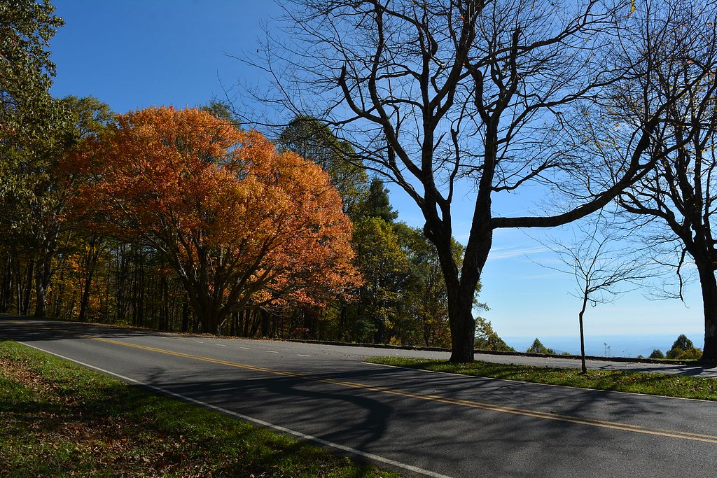
Spring and fall are typically the best times to visit due to pleasant weather and vibrant foliage.
Seasonal Access
The best time to visit is Spring, Summer, and Fall. Winter access may be limited. Check with Shenandoah National Park for current conditions.
Safety Information
Visitors should be cautious of slippery rocks near the waterfall and uneven terrain. Always stay on marked trails and avoid visiting during inclement weather.
Current Water Conditions
235 ft³/s
Current discharge — how much water is flowing
Much lower than usual for this time of year
Based on 95 years of record
2.26 ft
Water depth at gauge
7-Day Discharge Trend
What does this mean for your visit?
Flow is well below normal for this time of year, so the waterfall may be a trickle.
About This Gauge
This gauge is on a nearby waterway and may not reflect exact conditions at the falls.
7-Day Flow Outlook
Based on the USGS gauge S F SHENANDOAH RIVER NEAR LYNNWOOD, VA (20 km away).
Today
Moderate
268 cfs
6/10Tomorrow
Moderate
274 cfs
8/10Sun
Moderate
266 cfs
6/10Mon
Moderate
275 cfs
6/10Tue
Moderate
247 cfs
9/10Wed
Moderate
221 cfs
8/10Thu
Moderate
220 cfs
8/10Best window: Tue — moderate flow, sunny (trip score 9/10).
Best time of year: this gauge typically runs highest from mid February to early May, peaking in March.
How we calculate this
This is a transparent outlook, not a precise forecast. We take the waterfall's current flow strength (how it ranks against its historical normal for today, from the nearest USGS stream gauge), carry that ranking forward along the gauge's seasonal curve, and nudge it for forecast rain. Confidence is highest for the next day or two and falls further out. Always check official conditions and your own judgment before visiting — high flows can be dangerous.
Know when to go.
Get a free email alert when waterfalls near Elkton hit peak flow. We only send when conditions are worth the trip — no weekly newsletters, no spam.
Weather Forecast
Location & Access
Getting There
The exact location and directions to Cedar Falls in Virginia are not well-documented. Visitors are advised to consult local resources or trail guides for accurate directions.
Get Directions on Google MapsParking
Parking availability is unclear. Visitors should check local resources or contact nearby park services for information.
Elevation
2,041 feet above sea level
Coordinates
38.394849° N, -78.541401° W
Land Management
Managed by OTHS
Visitor Tips & Gear
Bring sturdy footwear and plenty of water. Check weather conditions and trail reports before visiting.
As an Amazon Associate, we earn from qualifying purchases.
With 2.4 miles and 350 ft of elevation gain, sturdy boots and trekking poles will help on this moderate trail. Sun exposure on the trail makes good sun protection a must in summer.

Polarized Sunglasses (Knockaround)
Cuts glare off the water so you actually see the falls — and your photos turn out better too.

Columbia Watertight II Rain Jacket
Packs into its own pocket, seam-sealed, and keeps you dry from spray and surprise rain.

Earth Pak Waterproof Dry Bag
Keeps your phone and gear dry when waterfall mist soaks everything else.

Waterproof Phone Pouch (AiRunTech)
Cheap insurance — take photos right next to the falls without killing your phone.

Timberland Euro Sprint Mid Waterproof
Trusted waterproof boot with premium leather and grippy rubber sole — reliable on rocky, wet trails.

TrailBuddy Trekking Poles
Lightweight aluminum, cork grips, and flip-locks that actually hold — a best-seller for good reason.
Where to Stay

Chateau Merlot - Private Appalachian Cottage

Waterfront Cabin 20 Mins to National Park & Massanutten!

Shenandoah dog friendly cabin in the trees - River access, BBQ, propane fire pit, outdoor dining & lounging, wood fireplace, screened in front porch and gated back deck!

NEW! Shenandoah family & dog friendly cabin - 5 min walk river with private river access, BBQ, playground, fire pit
Browse vacation cabins and private rentals nearby
Unique outdoor stays — tents, yurts, and treehouses
Rent a campervan or RV for your waterfall road trip
Some links are affiliate links. We may earn a commission at no extra cost to you.
Nearby Campground
Lewis Mountain Campground
4.4 miles away · 32 sites
Overview This location is available on a first-come, first-served basis only. Visitors are required to physically arrive at the campground to purchase and claim a site. Once on-site, you can pay for your campsite(s) by scanning a QR code using the Recreation.gov mobile app . Download the free Recreation.gov mobile app on Android or iOS prior to your arrival as some remote areas have limited or no cellular service. Recreation Shenandoah National Park has over 500 miles of trails, including 101
Book on Recreation.govNearby Hot Springs
Hot springs near Elkton, Virginia
Thorn Spring
Thorn Spring flows at 72°F from Thorn Spring Park, a non-profit owned property just 14.5 meters from the road in Pendleton Coun...
Rockbridge Baths
Rockbridge Baths emerges at 72 degrees Fahrenheit, flowing 18.9 degrees above ambient temperature at 1,807 feet elevation in Ro...
Looking for a soak after your hike? Explore more hot springs near Elkton, Virginia on SoakingSprings.
Explore Virginia springsAdditional Information
Nearby Attractions
Nearby attractions are not well-documented. Visitors may explore other natural areas or parks in the region.
Wildlife
The area may feature typical Virginia wildlife, including birds, deer, and small mammals. Be cautious of ticks and other insects.
Cities near Cedar Falls
Nearby Waterfalls
Other waterfalls named Cedar Falls
8 other waterfalls share this name across the U.S.
Writing about Cedar Falls? Embed this waterfall on your site for free.