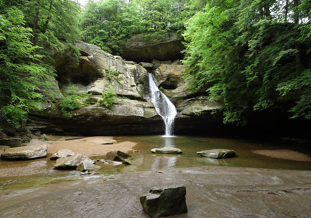
Cedar Falls
Ohio • 50 ft
By Armen Suny · Last verified Mar 2026
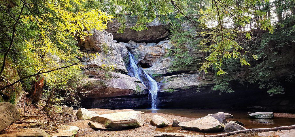
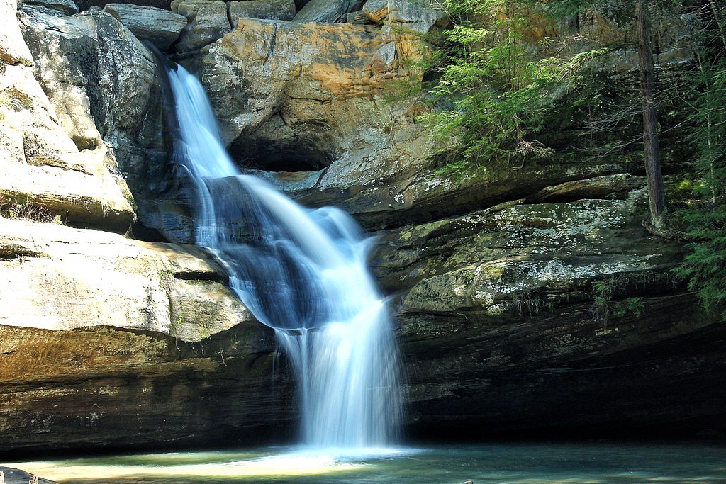
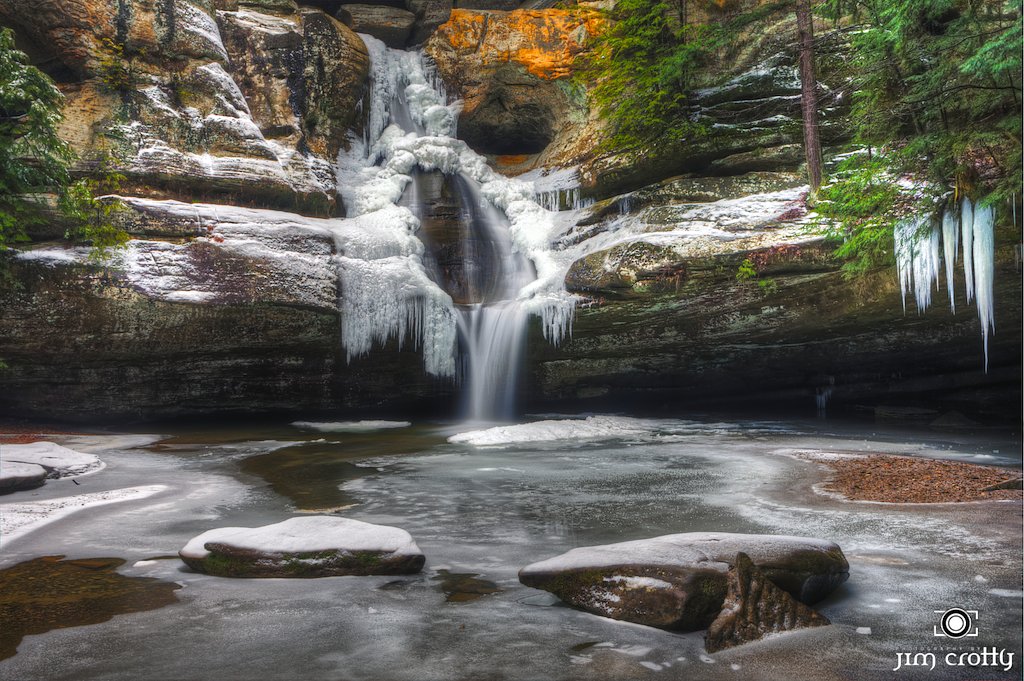
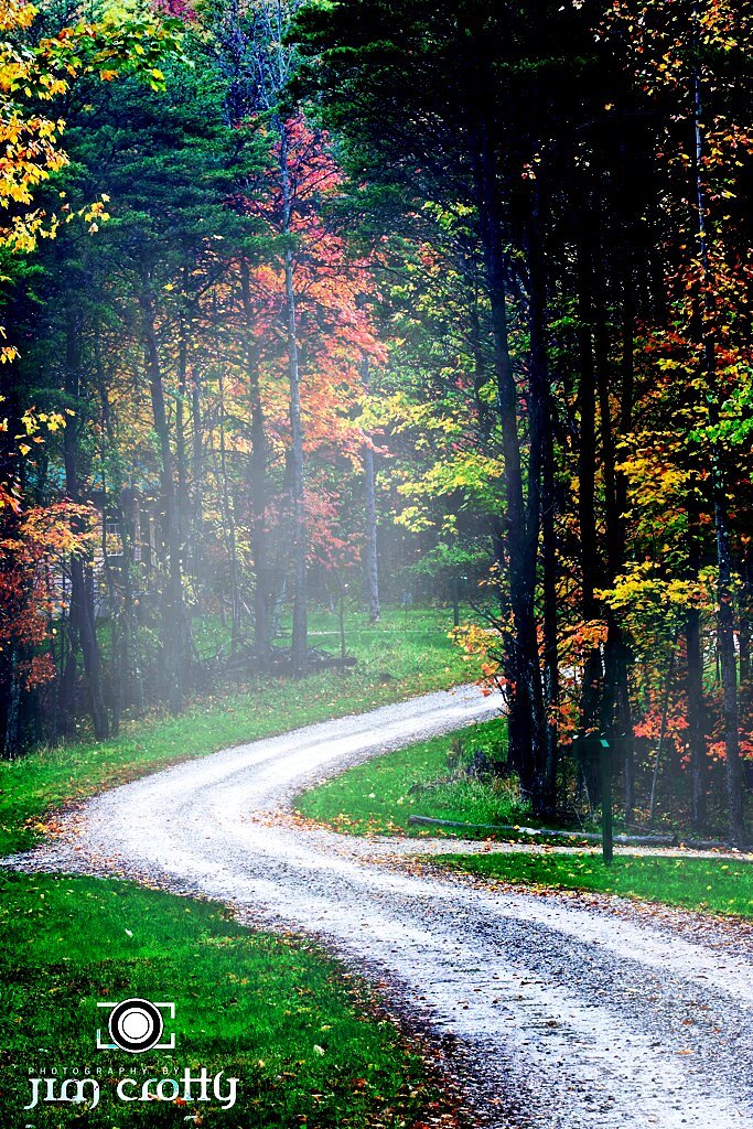
Photo Credits (5)
Difficulty
Easy
Trail Length
0.9 miles
Trail Type
Out And Back
Elevation Gain
100 ft
About Cedar Falls
Cedar Falls is one of Hocking Hills State Park’s most photographed highlights — a roughly 50-foot cascade that pours over layered sandstone into a cool, semicircular pool framed by fern-filled ledges and mature hardwoods. The falls’ broad curtain of water and the hoodoos and alcoves carved into the rock make it a striking stop for photographers and families alike, especially in spring and after heavy rains when flows are at their best. Note that “Cedar Falls” is a common place name (see the disambiguation note on Wikipedia); this entry refers specifically to the Cedar Falls in Hocking Hills State Park, Ohio. The immediate setting is protected on the Cedar Falls Fee land unit (designation: PCON) and is managed by a local conservation NGO, which helps maintain trails and preserve the gorge habitat. The site’s accessible layout and scenic viewing areas make it an excellent half-day outing within the park — a compact but rewarding experience for casual hikers and nature lovers.
The Setting
Cedar Falls sits at 699 feet within Cedar Falls Fee, fed by the Ohio Brush Creek, in the foothills of Ohio. The falls drop 50 feet.
Height: 50 feet
Trail & Hike Details
The Approach
The easy 0.9-mile out-and-back trail gains 100 feet of elevation on the way to the falls.
Trail Description
The trail to Cedar Falls is an easy, out-and-back route of about 0.9 miles with roughly 100 feet of elevation gain, making it a family-friendly hike with a gentle climb. The path is well-maintained and primarily a natural dirt tread punctuated by carved stone steps and a wooden footbridge as it winds through the shaded gorge; expect scenic rock formations and narrow alcoves along the way. Difficulty is rated easy, and the short distance and clear routing make the route suitable for most visitors looking for a quick, scenic hike.
What to Expect
The falls drop 50 feet. Dogs are welcome.
Accessibility
The trail is short and relatively flat, but the surface may be uneven. Contact the managing agency for accessibility details.
Frequently Asked Questions
🐶 Are Dogs Allowed at Cedar Falls?
✅ Dogs are allowed
Are There Any Fees or Permits Required?
🆖 No fees required
🏊 Is There Swimming at Cedar Falls?
❌ Swimming is not allowed
When to Visit
Spring is the best time to visit Cedar Falls, as the waterfall is typically at its fullest due to seasonal rainfall. However, it is a beautiful destination year-round.
Seasonal Access
The best time to visit is Spring, Summer, Fall, and Winter.
Safety Information
The trail can be slippery, especially after rain. Stay on marked paths and avoid climbing on rocks near the waterfall. Exercise caution around the water's edge.
Current Water Conditions
102 ft³/s
Current discharge — how much water is flowing
About average for this time of year
Based on 94 years of record
2.57 ft
Water depth at gauge
7-Day Discharge Trend
What does this mean for your visit?
Flow is about average for this time of year.
About This Gauge
7-Day Flow Outlook
Based on the USGS gauge Ohio Brush Creek near West Union OH (5 km away).
Today
Low
116 cfs
3/10Tomorrow
Low
113 cfs
3/10Sun
Barely Flowing
90 cfs
5/10Mon
Barely Flowing
75 cfs
5/10Tue
Barely Flowing
71 cfs
5/10Wed
Barely Flowing
72 cfs
5/10Thu
Barely Flowing
72 cfs
5/10Best window: Sun — barely flowing flow, partly sunny (trip score 5/10).
Best time of year: this gauge typically runs highest from early February to mid April, peaking in March.
How we calculate this
This is a transparent outlook, not a precise forecast. We take the waterfall's current flow strength (how it ranks against its historical normal for today, from the nearest USGS stream gauge), carry that ranking forward along the gauge's seasonal curve, and nudge it for forecast rain. Confidence is highest for the next day or two and falls further out. Always check official conditions and your own judgment before visiting — high flows can be dangerous.
Know when to go.
Get a free email alert when waterfalls near Peebles hit peak flow. We only send when conditions are worth the trip — no weekly newsletters, no spam.
Weather Forecast
Location & Access
Getting There
Cedar Falls is located within Hocking Hills State Park in southeastern Ohio. The trailhead is accessible via State Route 374, with clear signage directing visitors to the Cedar Falls parking area.
Get Directions on Google MapsParking
There is a designated parking lot near the trailhead for Cedar Falls. Parking is free but can fill up quickly during peak seasons.
Elevation
699 feet above sea level
Coordinates
38.836739° N, -83.375466° W
Land Management
Managed by NGO
Visitor Tips & Gear
Arrive early in the day to avoid crowds, especially during weekends and peak seasons. Wear sturdy shoes as the trail can be slippery, especially after rain. Bring water and a camera to capture the beautiful scenery.
As an Amazon Associate, we earn from qualifying purchases.
For this easy 0.9 miles trail, lightweight trail shoes and a water bottle are usually sufficient. Icy conditions are common in winter — traction cleats are a smart addition.

Columbia Watertight II Rain Jacket
Packs into its own pocket, seam-sealed, and keeps you dry from spray and surprise rain.

Polarized Sunglasses (Knockaround)
Cuts glare off the water so you actually see the falls — and your photos turn out better too.

Earth Pak Waterproof Dry Bag
Keeps your phone and gear dry when waterfall mist soaks everything else.

Waterproof Phone Pouch (AiRunTech)
Cheap insurance — take photos right next to the falls without killing your phone.

Kahtoola MICROspikes
Cult-favorite traction cleats that grip ice and wet rock — essential for winter waterfall hikes.

JOBY GorillaPod Starter Kit
Wraps around railings and rocks for long-exposure waterfall shots — no flat surface needed.
Where to Stay

Ohio Starlight Glamping Cabins - A Peaceful Woodland Retreat

Country Nights Inn

Days Inn by Wyndham Maysville Kentucky

Holiday Inn Portsmouth Downtown by IHG
Browse vacation cabins and private rentals nearby
Unique outdoor stays — tents, yurts, and treehouses
Rent a campervan or RV for your waterfall road trip
Some links are affiliate links. We may earn a commission at no extra cost to you.
Additional Information
Nearby Attractions
Other attractions in Hocking Hills State Park include Old Man's Cave, Ash Cave, and Rock House. The park also offers additional hiking trails and scenic overlooks.
Wildlife
Visitors may encounter deer, squirrels, birds, and other small wildlife along the trail. The area is rich in biodiversity.
Cities near Cedar Falls
Other waterfalls named Cedar Falls
8 other waterfalls share this name across the U.S.
Writing about Cedar Falls? Embed this waterfall on your site for free.