
Photo Credits (5)
Difficulty
Moderate
Trail Length
2.0 miles
Trail Type
Out And Back
Elevation Gain
200 ft
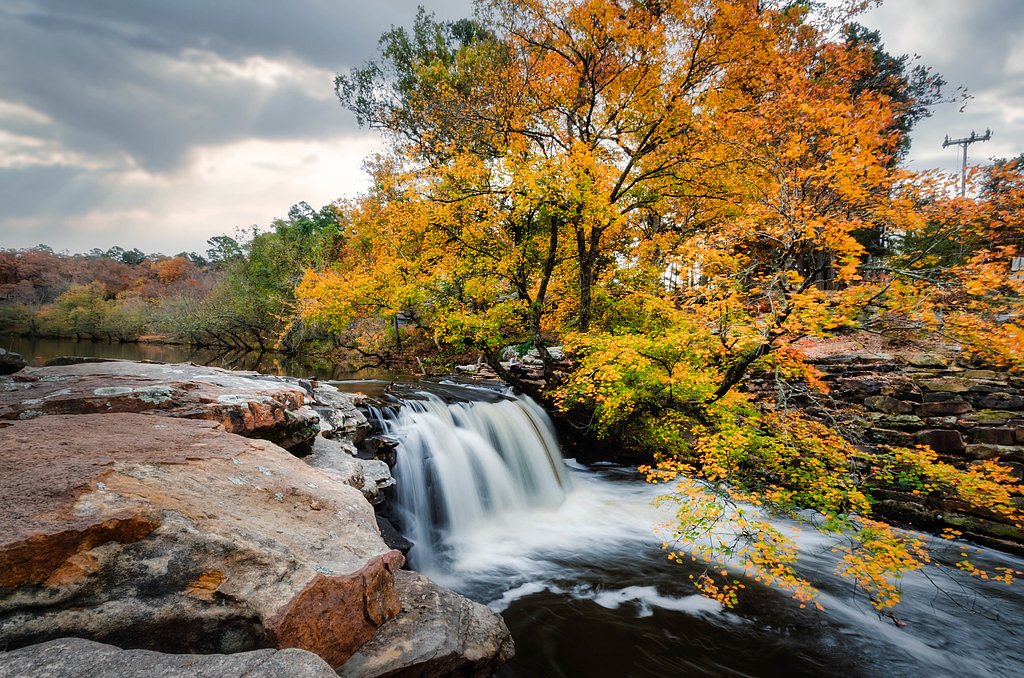
About Cedar Falls
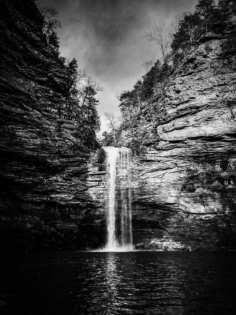
Cedar Falls is a stunning 95-foot waterfall located in Petit Jean State Park, Arkansas. It is one of the most iconic waterfalls in the state, known for its dramatic drop into a picturesque canyon surrounded by lush greenery.
The Setting
Cedar Falls sits at 748 feet within Petit Jean State Park, in the foothills of Arkansas. The falls drop 95 feet.
Height: 95 feet
Trail & Hike Details
The Approach
The moderate 2.0-mile out-and-back trail gains 200 feet of elevation on the way to the falls.
Trail Description
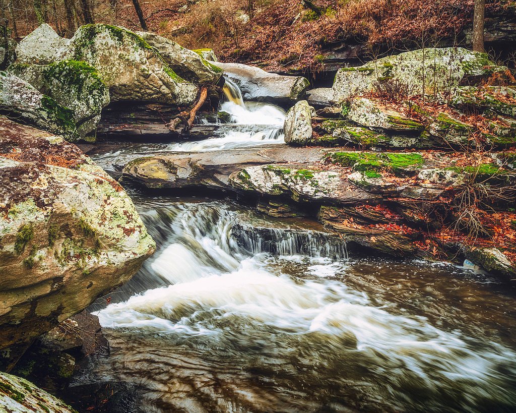
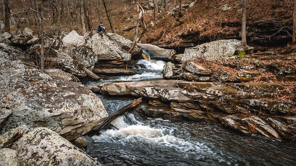
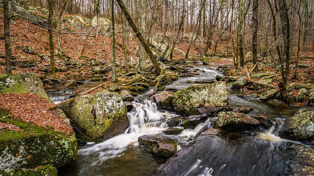
The Cedar Falls Trail is a well-maintained path that descends into Cedar Creek Canyon. The trail features rocky terrain, stone steps, and a few steep sections, making it moderately challenging. Hikers will pass through a scenic forested area before reaching the base of the waterfall.
What to Expect
The falls cascade 95 feet. Dogs are welcome.
Accessibility
The trail is not wheelchair accessible. Uneven terrain and elevation changes require steady footing.
Frequently Asked Questions
🐶 Are Dogs Allowed at Cedar Falls?
✅ Dogs are allowed
Are There Any Fees or Permits Required?
🆖 No fees required
🏊 Is There Swimming at Cedar Falls?
❌ Swimming is not allowed
When to Visit
Spring is the best time to visit Cedar Falls, as the waterfall is typically at its fullest due to seasonal rainfall. Fall is also popular for its vibrant foliage.
Seasonal Access
The best time to visit is Spring, Summer, Fall, and Winter.
Safety Information
The trail can be slippery after rain, so exercise caution. Stay on the marked trail to avoid getting lost or encountering hazardous areas. Bring plenty of water, especially during hot weather.
Know when to go.
Get a free email alert when waterfalls near Adona hit peak flow. We only send when conditions are worth the trip — no weekly newsletters, no spam.
Weather Forecast
Location & Access
Getting There
Cedar Falls is located within Petit Jean State Park, which is approximately 60 miles northwest of Little Rock, Arkansas. The trailhead begins near Mather Lodge, the park's main lodge.
Get Directions on Google MapsParking
Parking is available near Mather Lodge, with ample space for visitors. It is recommended to arrive early during peak seasons to secure a spot.
Elevation
748 feet above sea level
Coordinates
35.121475° N, -92.933781° W
Land Management
Managed by SPR
Visitor Tips & Gear
Wear sturdy hiking shoes as the trail can be rocky and slippery, especially after rain. Bring water and snacks, as there are no facilities along the trail. Arrive early to avoid crowds, particularly on weekends and holidays.
As an Amazon Associate, we earn from qualifying purchases.
With 2.0 miles and 200 ft of elevation gain, sturdy boots and trekking poles will help on this moderate trail. Icy conditions are common in winter — traction cleats are a smart addition.

Columbia Watertight II Rain Jacket
Packs into its own pocket, seam-sealed, and keeps you dry from spray and surprise rain.

Polarized Sunglasses (Knockaround)
Cuts glare off the water so you actually see the falls — and your photos turn out better too.

Earth Pak Waterproof Dry Bag
Keeps your phone and gear dry when waterfall mist soaks everything else.

Waterproof Phone Pouch (AiRunTech)
Cheap insurance — take photos right next to the falls without killing your phone.

Timberland Euro Sprint Mid Waterproof
Trusted waterproof boot with premium leather and grippy rubber sole — reliable on rocky, wet trails.

TrailBuddy Trekking Poles
Lightweight aluminum, cork grips, and flip-locks that actually hold — a best-seller for good reason.
Where to Stay

Super 8 by Wyndham Morrilton

Motel 6 Morrilton, AR

Nordins Hidden Hillside Cabin

Comfort Inn & Suites Russellville I-40
Browse vacation cabins and private rentals nearby
Unique outdoor stays — tents, yurts, and treehouses
Rent a campervan or RV for your waterfall road trip
Some links are affiliate links. We may earn a commission at no extra cost to you.
Nearby Campground
Cherokee (Arkansas River)
8.3 miles away · 35 sites
Overview PLEASE NOTE: This is Cherokee Park on the Arkansas River in Morrilton, Arkansas. This is not Cherokee Park at Greers Ferry. You can download a park map HERE You can download a Customer Comment card HERE Special Event Permit Recreation Camping, picnics, boating, fishing, and nature watching are all highly prized at Cherokee park. Facilities Cherokee Campground offers 33 spacious campsites with 30 or 50 amp electric hookups and water, along with two large group picnic shelters. Amenities
Book on Recreation.govNearby Hot Springs
Hot springs near Adona, Arkansas

Big Chalybeate Spring
Big Chalybeate Spring flows at 79 degrees Fahrenheit within Hot Springs National Park in Garland County, emerging 16.3 degrees ...

Hot Springs
Hot Springs flows at a remarkable 147 degrees Fahrenheit (63.9 degrees Celsius) in the city of Hot Springs, Arkansas, ranking a...
Looking for a soak after your hike? Explore more hot springs near Adona, Arkansas on SoakingSprings.
Explore Arkansas springsAdditional Information
Nearby Attractions
Other attractions in Petit Jean State Park include the Seven Hollows Trail, Rock House Cave, and the Petit Jean Grave Site overlook.
Wildlife
The area is home to deer, squirrels, various bird species, and other small wildlife. Keep an eye out for these animals along the trail.
Cities near Cedar Falls
Other waterfalls named Cedar Falls
8 other waterfalls share this name across the U.S.
Writing about Cedar Falls? Embed this waterfall on your site for free.