Photo Credits (5)
Difficulty
Moderate
Trail Length
2.4 miles
Trail Type
Out And Back
Elevation Gain
350 ft
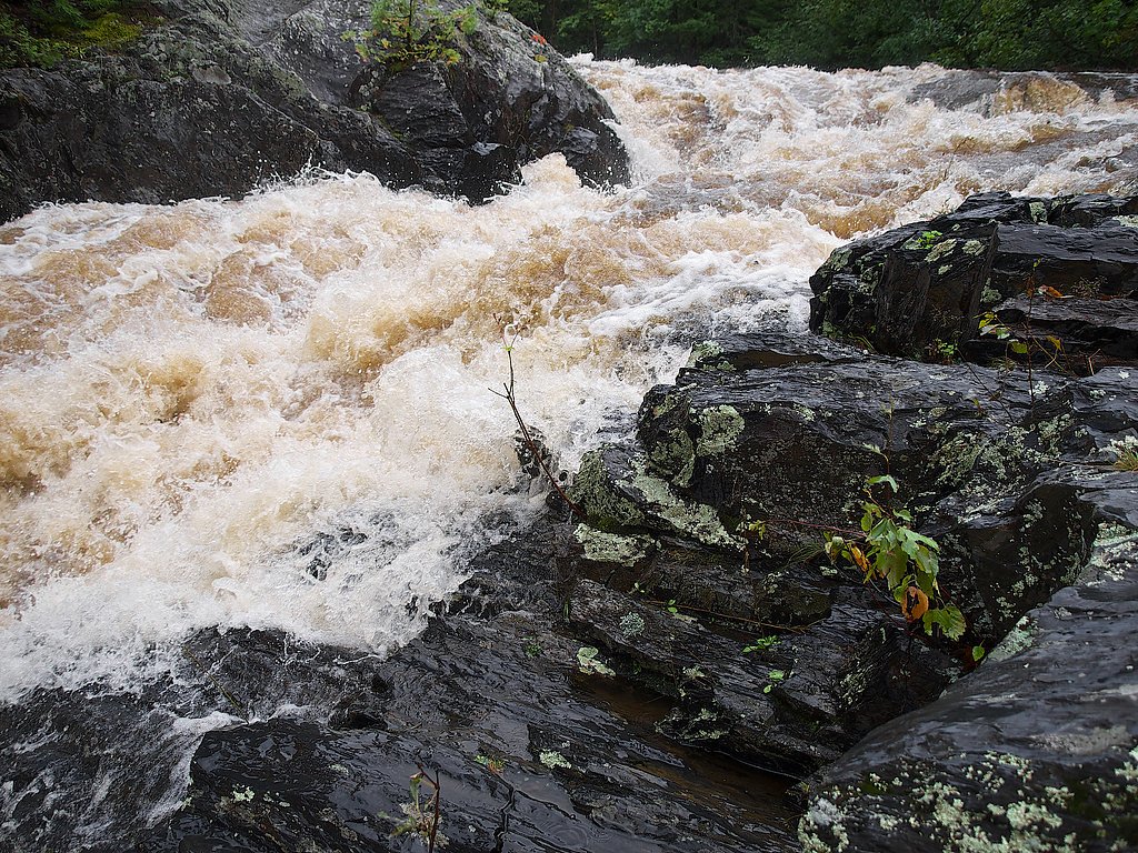
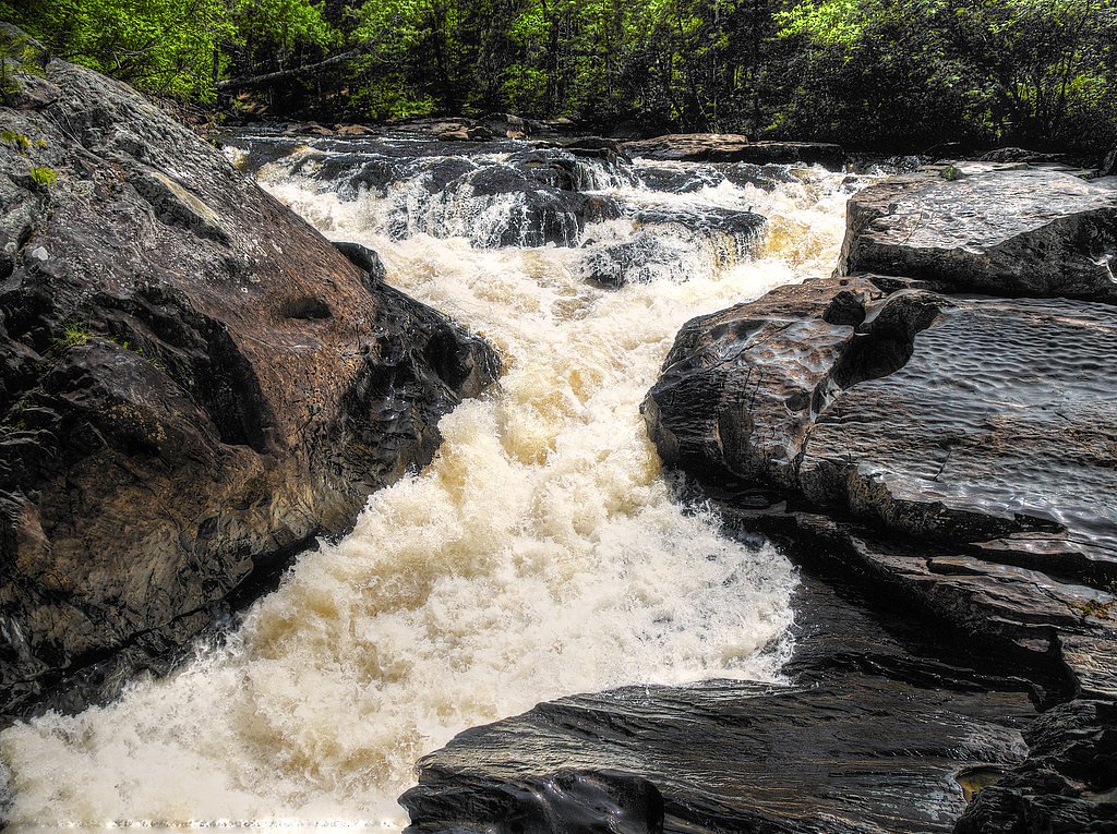
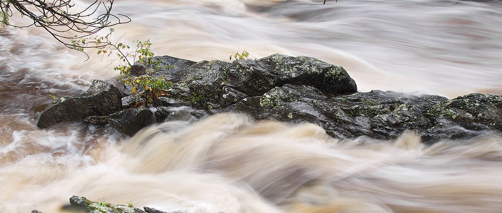
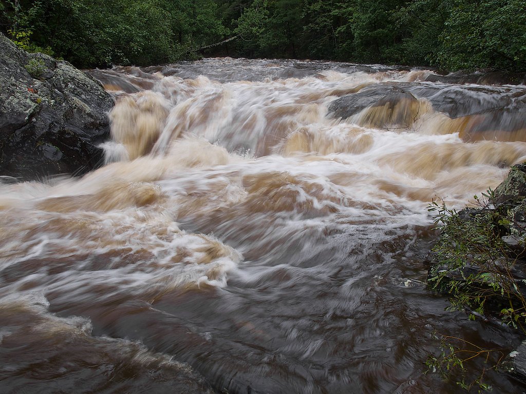
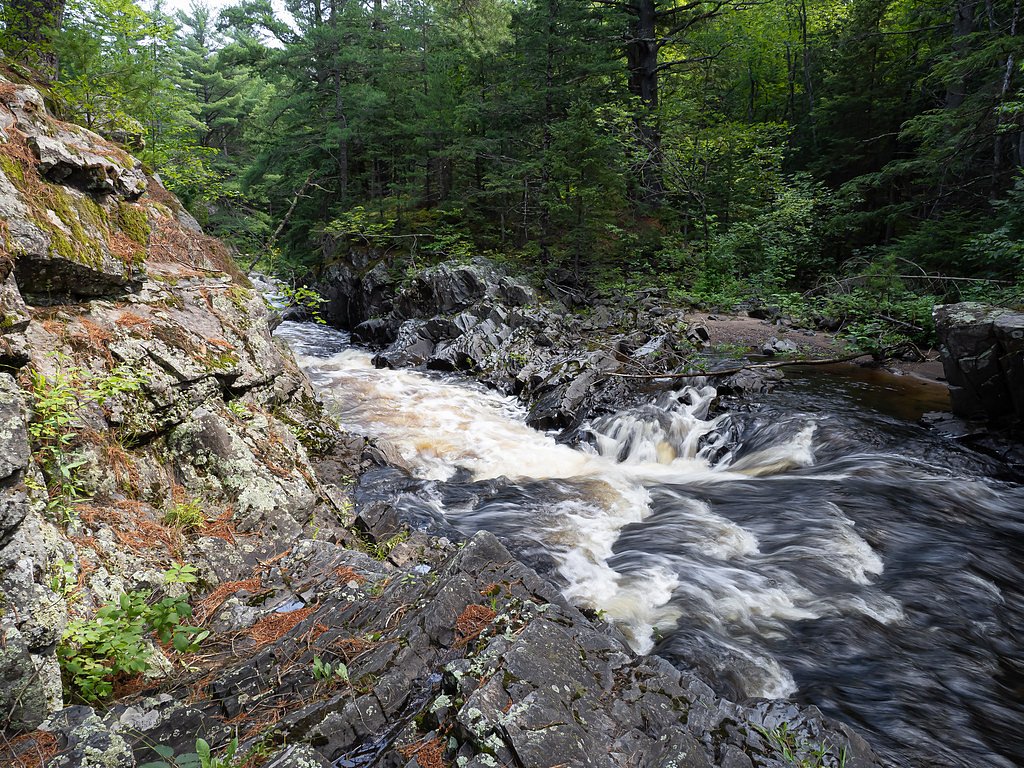
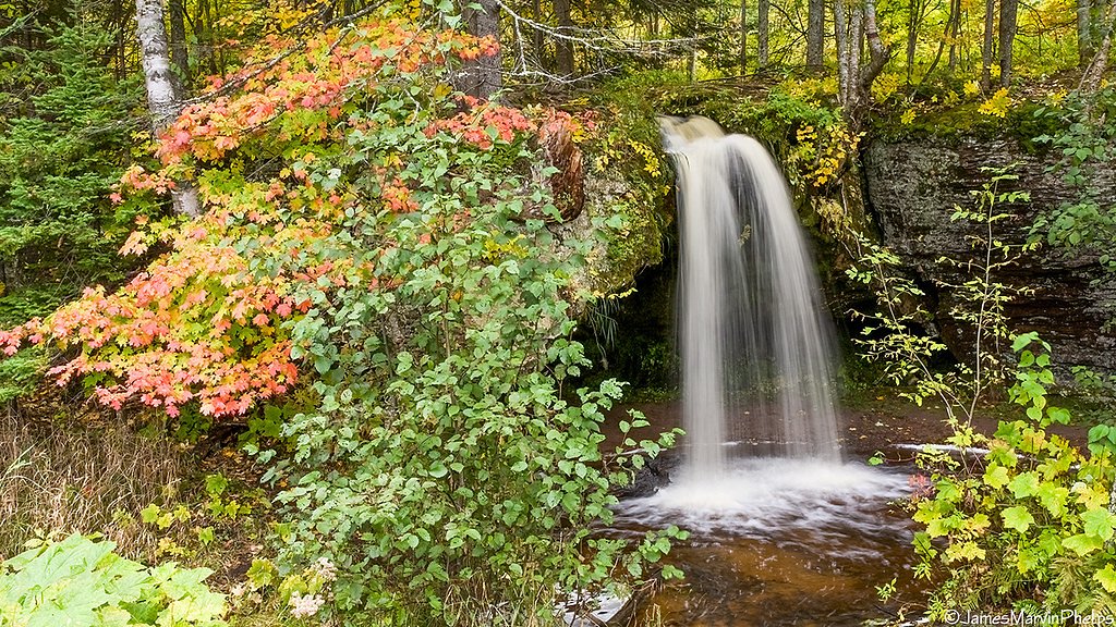
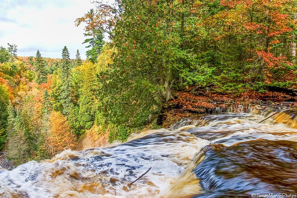
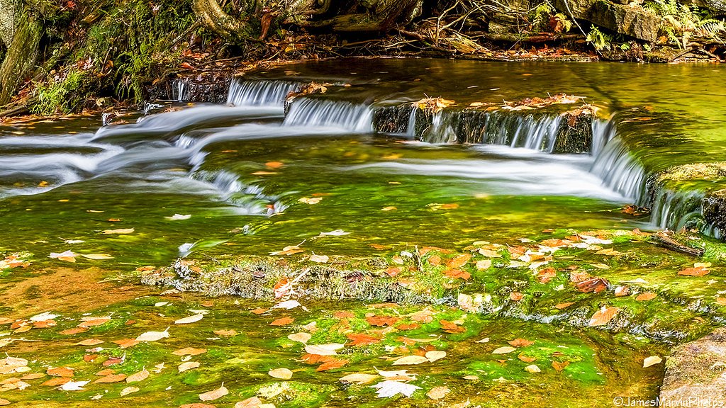
About Silver Falls
Silver Falls is a peaceful, multi-cascade waterfall on the Silver River in Michigan’s Upper Peninsula, just outside Chatham. Nestled within the Hiawatha National Forest and managed by the U.S. Forest Service, the falls cut through a densely wooded corridor that’s particularly striking in spring runoff when the flow is highest. The setting combines easy-access scenery with a genuine backcountry feel, making it a favorite stop for photographers and families seeking a short nature escape. The most common approach follows a segment of the North Country National Scenic Trail — West (USFS Trail #915) and rewards visitors with several vantage points of the cascades framed by hardwoods and pines. The hike to the primary viewpoint is moderate in effort but excellent for those who want a short outing with a scenic payoff; seasonal changes bring colourful foliage in autumn and ice sculptures in winter for year-round interest.
The Setting
Silver Falls sits at 886 feet within Hiawatha National Forest, fed by the Dead River, in the foothills of Michigan.
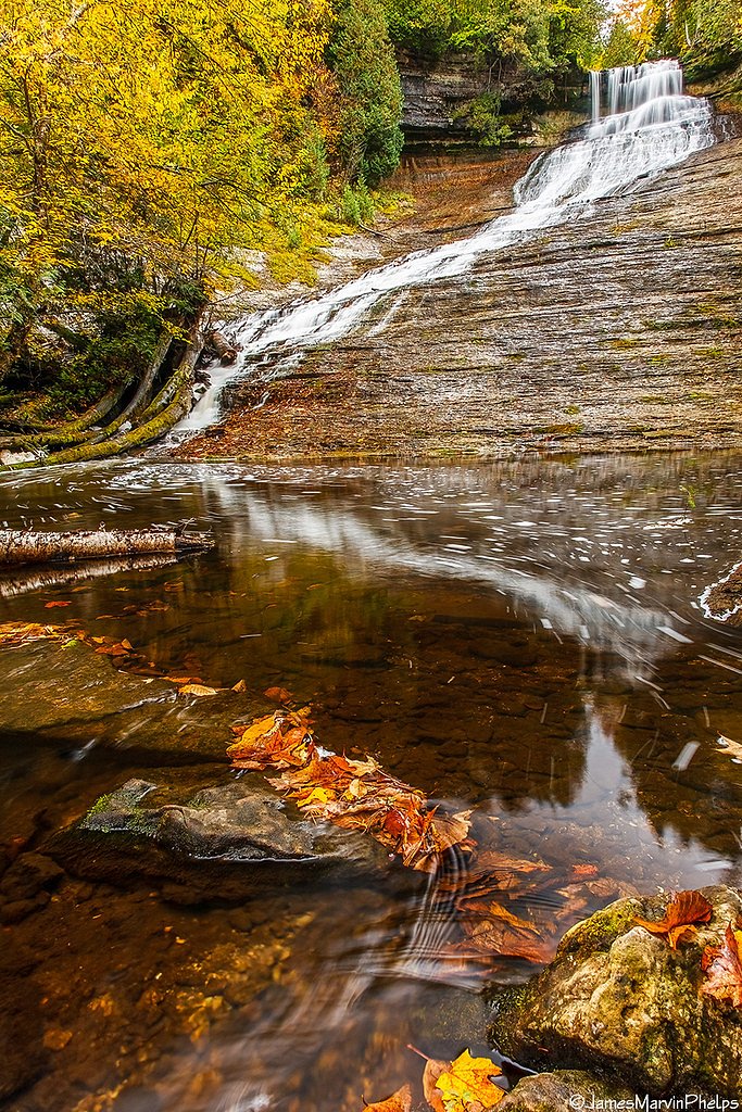
Nearby Falls Worth Visiting
Laughing Whitefish Falls, the tallest waterfall in Michigan at 100 feet, lies 6.6 miles to the southwest. Also nearby: Rock River Falls (15 ft, 2.8 mi) and Scott Falls (10 ft, 7.5 mi).
Trail & Hike Details
The Approach
The moderate hike follows North Country Ntl Scenic West (#915), a 2.4-mile out-and-back trail over imported compacted material. Expect 350 feet of elevation gain with grades of 5-8%. The trail is developed (Class 3).
USFS Trail
NORTH COUNTRY NTL SCENIC -WEST #915
Trail Class
Developed
Surface
Avg Grade
USFS Segment
6.21 miTrail Description
Out-and-back, 2.4 miles round trip with approximately 350 feet of elevation gain; rated moderate. The route follows a segment of the North Country NTL Scenic — West (USFS Trail #915). According to USFS trail data, Trail #915 is Class 3 with an imported compacted material surface and a typical grade of 5–8%. USFS mapping shows 6.21 GIS miles for the trail corridor in this area; the maintained approach to the falls is the 2.4-mile section described here. Expect an established, compacted tread that can become muddy or slick after rain; good footwear is recommended.
What to Expect
Dogs are welcome.
Accessibility
The trail is not wheelchair accessible. Uneven terrain and elevation changes require steady footing.
Frequently Asked Questions
🐶 Are Dogs Allowed at Silver Falls?
✅ Dogs are allowed
Are There Any Fees or Permits Required?
🆖 No fees required
🏊 Is There Swimming at Silver Falls?
❌ Swimming is not allowed
When to Visit
Spring and early summer are the best times to visit, as the water flow is strongest. Fall offers beautiful foliage, and winter provides a unique view of the frozen falls.
Seasonal Access
The best time to visit is Spring, Summer, Fall, and Winter. Check with Hiawatha National Forest for seasonal road closures.
Safety Information
Exercise caution near the falls, as rocks can be slippery. In winter, icy conditions may make the trail hazardous. Always stay on marked trails to avoid getting lost.
Current Water Conditions
Based on a USGS gauge 22.5 miles away
159 ft³/s
Current discharge — how much water is flowing
Lower than usual for this time of year
Based on 10 years of record
5.93 ft
Water depth at gauge
7-Day Discharge Trend
What does this mean for your visit?
Flow is lower than usual for this time of year.
About This Gauge
This gauge is on a regional waterway. Conditions at the falls may differ, especially after local rain.
7-Day Flow Outlook
Based on the USGS gauge DEAD RIVER AT MARQUETTE, MI (36 km away).
Today
Roaring
181 cfs
6/10Tomorrow
Roaring
181 cfs
6/10Thu
Roaring
139 cfs
6/10Fri
Roaring
138 cfs
6/10Sat
Roaring
137 cfs
6/10Sun
Roaring
145 cfs
6/10Mon
Roaring
117 cfs
9/10Best window: Mon — roaring flow, mostly sunny (trip score 9/10).
Best time of year: this gauge typically runs highest from early April to mid June, peaking in May.
How we calculate this
This is a transparent outlook, not a precise forecast. We take the waterfall's current flow strength (how it ranks against its historical normal for today, from the nearest USGS stream gauge), carry that ranking forward along the gauge's seasonal curve, and nudge it for forecast rain. Confidence is highest for the next day or two and falls further out. Always check official conditions and your own judgment before visiting — high flows can be dangerous.
Know when to go.
Get a free email alert when waterfalls near Chatham hit peak flow. We only send when conditions are worth the trip — no weekly newsletters, no spam.
Weather Forecast
Location & Access
Getting There
Silver Falls is located approximately 6.9 miles from Chatham, 15.5 miles from Munising, and 17.9 miles from Harvey. The coordinates for the falls are 46.4511, -86.9708. Visitors can access the falls via a short drive on local roads, with signage leading to the area.
Get Directions on Google MapsParking
There is a small parking area near the trailhead, but space may be limited during peak seasons.
Elevation
886 feet above sea level
Coordinates
46.451147° N, -86.970847° W
Land Management
Managed by USFS
Visitor Tips & Gear
Visit early in the day to avoid crowds, especially during summer and fall. Bring sturdy footwear, as the trail can be muddy. Bug spray is recommended during warmer months.
As an Amazon Associate, we earn from qualifying purchases.
With 2.4 miles and 350 ft of elevation gain, sturdy boots and trekking poles will help on this moderate trail. Icy conditions are common in winter — traction cleats are a smart addition.

Columbia Watertight II Rain Jacket
Packs into its own pocket, seam-sealed, and keeps you dry from spray and surprise rain.

Polarized Sunglasses (Knockaround)
Cuts glare off the water so you actually see the falls — and your photos turn out better too.

Earth Pak Waterproof Dry Bag
Keeps your phone and gear dry when waterfall mist soaks everything else.

Waterproof Phone Pouch (AiRunTech)
Cheap insurance — take photos right next to the falls without killing your phone.

Timberland Euro Sprint Mid Waterproof
Trusted waterproof boot with premium leather and grippy rubber sole — reliable on rocky, wet trails.

TrailBuddy Trekking Poles
Lightweight aluminum, cork grips, and flip-locks that actually hold — a best-seller for good reason.
Where to Stay

Roam Inn

Days Inn by Wyndham Marquette

Comfort Suites Marquette

Holiday Inn Marquette by IHG
Browse vacation cabins and private rentals nearby
Unique outdoor stays — tents, yurts, and treehouses
Rent a campervan or RV for your waterfall road trip
Some links are affiliate links. We may earn a commission at no extra cost to you.
Nearby Campground
BAY FURNACE CAMPGROUND
12.5 miles away · 49 sites
Overview Bay Furnace Campground is located on the south shores of Lake Superior, near Pictured Rocks National Lakeshore. Favorite to many, the campground is centered to various waterfalls, as well as other sightseeing attractions, including boat tours and visits to Grand Island.Recreation Fishing in Lake Superior is best by boat. There is no access to the lake at Bay Furnace, but there is a boat ramp approximately 10 miles west, at AuTrain, and in Munising. Anglers can enjoy a variety of lake tro
Book on Recreation.govAdditional Information
Nearby Attractions
Nearby attractions include Munising Falls, Pictured Rocks National Lakeshore, and Wagner Falls.
Wildlife
The area is home to various wildlife, including birds, deer, and small mammals. Be cautious of mosquitoes and other insects during warmer months.
Cities near Silver Falls
Nearby Waterfalls
Other waterfalls named Silver Falls
16 other waterfalls share this name across the U.S.
Writing about Silver Falls? Embed this waterfall on your site for free.