Silver Falls
Oregon • 177 ft
By Armen Suny · Last verified May 2026
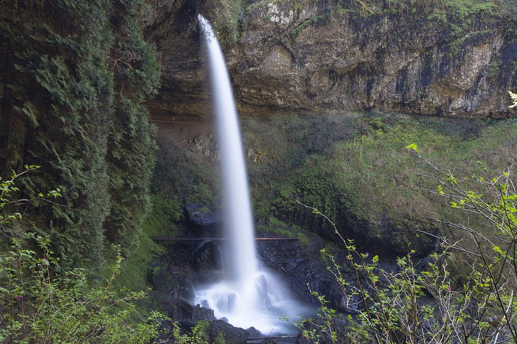
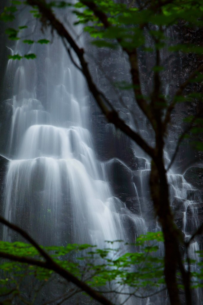
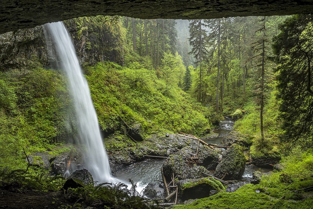
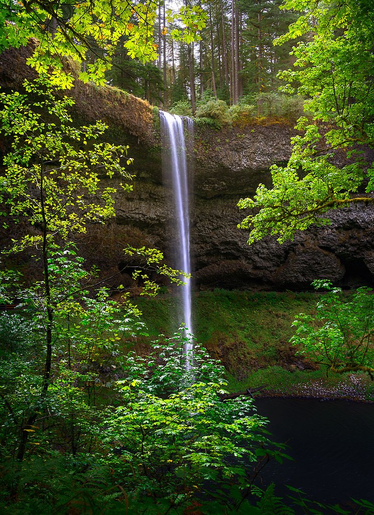
Photo Credits (5)
Difficulty
Moderate
Trail Length
7.2 miles
Trail Type
Loop
Elevation Gain
800 ft
About Silver Falls
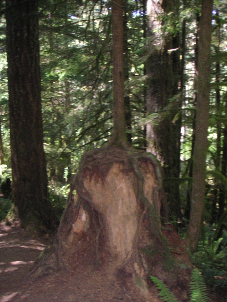
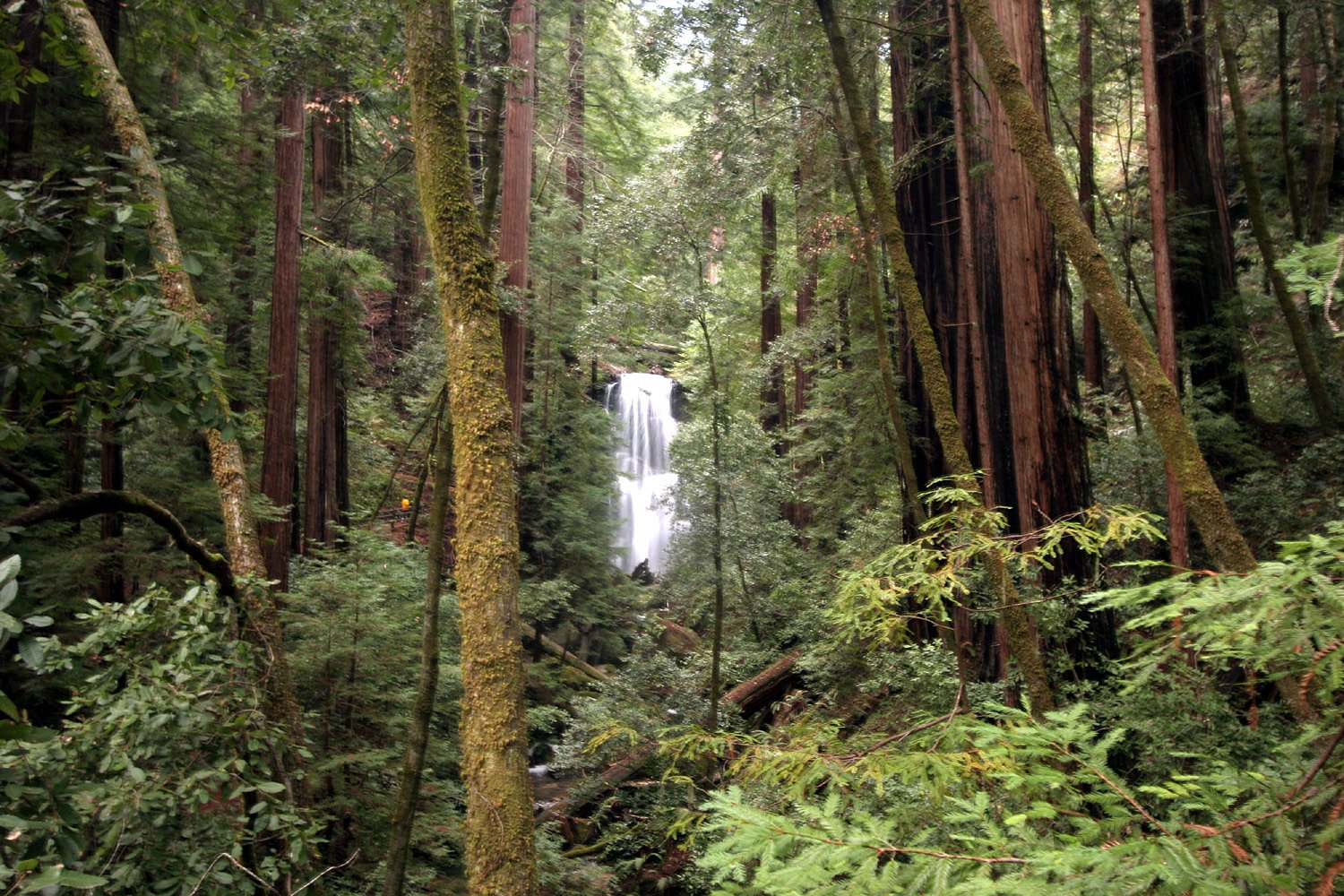
Silver Falls plunges a dramatic 177 feet through a mossy basalt amphitheater tucked inside Silver Falls State Park in Oregon. As the most striking stop along the Park’s Trail of Ten Falls, the scene is a photographer’s dream — a broad curtain of water framed by old-growth forest and fern-carpeted cliffs. The setting feels immersive and wild while remaining very accessible, making it a favorite for day hikes and nature lovers exploring the state park. The waterfall and its surrounding trails invite a leisurely pace: you can admire vantage points from above, below, and in several places walk behind falling water for a unique perspective. The Trail of Ten Falls is a thoughtfully maintained loop that showcases multiple cascades and the lush temperate forest of the park, offering a mix of viewpoints, forested corridors, and close-up encounters with Silver Falls itself.
The Setting
Silver Falls sits at 2,789 feet along the Siletz River, in the hills of Oregon. At 177 feet, it is among the taller waterfalls in Oregon.
Height: 177 feet
Trail & Hike Details
The Approach
The moderate 7.2-mile loop trail gains 800 feet of elevation on the way to the falls.
Trail Description
Trail of Ten Falls is a 7.2-mile loop with roughly 800 feet of elevation gain and is rated moderate in difficulty. The route weaves past ten notable waterfalls, including Silver Falls (177 ft), and includes sections where the trail drops close to the falls and even passes behind some cascades for dramatic views. The loop is well-established and heavily used; expect rooted, natural tread through forest and occasional stair or boardwalk features where the trail negotiates steep or exposed sections. Pace the hike for photo stops and slippery rock approaches near viewpoints.
What to Expect
The falls plunge 177 feet. Dogs are welcome.
Accessibility
The trail is not wheelchair accessible. Uneven terrain and elevation changes require steady footing.
Frequently Asked Questions
🐶 Are Dogs Allowed at Silver Falls?
✅ Dogs are allowed
Are There Any Fees or Permits Required?
🤑 Fee: $5.00
🏊 Is There Swimming at Silver Falls?
❌ Swimming is not allowed
When to Visit
Spring and early summer are ideal times to visit, as the waterfalls are at their fullest due to seasonal rainfall. Fall offers beautiful foliage, while winter provides a quieter experience with fewer crowds.
Seasonal Access
The best time to visit is Spring, Summer, Fall, and Winter.
Safety Information
The trail can be slippery near the waterfalls, so exercise caution. Stay on designated trails and avoid climbing on rocks near the falls. Be prepared for changing weather conditions, as the area can be damp and cool even in summer.
Current Water Conditions
Based on a USGS gauge 18.7 miles away
255 ft³/s
Current discharge — how much water is flowing
Much higher than usual for this time of year
Based on 1 years of record
7.69 ft
Water depth at gauge
63°F
CoolRefreshing for swimming
7-Day Discharge Trend
What does this mean for your visit?
The water is flowing much higher than usual, expect an impressive display. Water temperature is a refreshing 63 degrees F, good for a quick swim.
About This Gauge
This gauge is on a regional waterway. Conditions at the falls may differ, especially after local rain.
7-Day Flow Outlook
Based on the USGS gauge SILETZ RIVER NEAR SILETZ, OR (30 km away).
Today
Roaring
291 cfs
6/10Tomorrow
Roaring
279 cfs
6/10Mon
Roaring
255 cfs
6/10Tue
Roaring
224 cfs
9/10Wed
Roaring
206 cfs
9/10Thu
Roaring
217 cfs
6/10Fri
Roaring
222 cfs
6/10Best window: Tue — roaring flow, partly sunny (trip score 9/10).
Best time of year: this gauge typically runs highest from early December to mid January, peaking in December.
How we calculate this
This is a transparent outlook, not a precise forecast. We take the waterfall's current flow strength (how it ranks against its historical normal for today, from the nearest USGS stream gauge), carry that ranking forward along the gauge's seasonal curve, and nudge it for forecast rain. Confidence is highest for the next day or two and falls further out. Always check official conditions and your own judgment before visiting — high flows can be dangerous.
Know when to go.
Get a free email alert when waterfalls near Falls City hit peak flow. We only send when conditions are worth the trip — no weekly newsletters, no spam.
Weather Forecast
Location & Access
Getting There
Silver Falls State Park is located about 20 miles east of Salem, Oregon. The main entrance is accessible via Highway 214, and the park is well-signposted.
Get Directions on Google MapsParking
Ample parking is available at the South Falls Day Use Area, which serves as the main trailhead for the Trail of Ten Falls.
Hours
Elevation
2,789 feet above sea level
Coordinates
44.903171° N, -123.585109° W
Visitor Tips & Gear
Arrive early, especially on weekends, as the park can get crowded. Wear sturdy hiking shoes, as the trail can be slippery near the waterfalls. Bring a rain jacket or waterproof gear, as the mist from the falls can make the area damp.
As an Amazon Associate, we earn from qualifying purchases.
With 7.2 miles and 800 ft of elevation gain, sturdy boots and trekking poles will help on this moderate trail. Icy conditions are common in winter — traction cleats are a smart addition.

Columbia Watertight II Rain Jacket
Packs into its own pocket, seam-sealed, and keeps you dry from spray and surprise rain.

Polarized Sunglasses (Knockaround)
Cuts glare off the water so you actually see the falls — and your photos turn out better too.

Earth Pak Waterproof Dry Bag
Keeps your phone and gear dry when waterfall mist soaks everything else.

Waterproof Phone Pouch (AiRunTech)
Cheap insurance — take photos right next to the falls without killing your phone.

Timberland Euro Sprint Mid Waterproof
Trusted waterproof boot with premium leather and grippy rubber sole — reliable on rocky, wet trails.

TrailBuddy Trekking Poles
Lightweight aluminum, cork grips, and flip-locks that actually hold — a best-seller for good reason.
Where to Stay

Surfland Hotel

Moolack Shores Inn

The Coho Oceanfront Lodge

West Beach Suites
Browse vacation cabins and private rentals nearby
Unique outdoor stays — tents, yurts, and treehouses
Rent a campervan or RV for your waterfall road trip
Some links are affiliate links. We may earn a commission at no extra cost to you.
Nearby Campground
Tillamook to Newport
20.9 miles away · 0 sites
A visitor to the Siuslaw National Forest traveling from Tillamook to Newport will find farmland, rolling hills, sand dunes at Sand Lake Recreation Area, and by choosing the Three Cape Scenic Loop, gorgeous headlands with fantastic views of the Pacific Ocean.Moving inland, the Forest is lush, wet and green. Visitors can hike, camp, picnic or ride their off-highway vehicle. Highway 101, the Pacific Coast Scenic Byway, transports travelers from Tillamook to Newport with connecting routes of Highway
Book on Recreation.govAdditional Information
Nearby Attractions
Nearby attractions include the Oregon Garden in Silverton and the historic town of Silverton itself, which offers dining and shopping options.
Wildlife
The park is home to a variety of wildlife, including deer, squirrels, and numerous bird species. Keep an eye out for woodpeckers and owls in the forested areas.
Cities near Silver Falls
Nearby Waterfalls

Other waterfalls named Silver Falls
16 other waterfalls share this name across the U.S.
Writing about Silver Falls? Embed this waterfall on your site for free.