Laughing Whitefish Falls
Michigan • 100 ft
By Armen Suny · Last verified Mar 2026
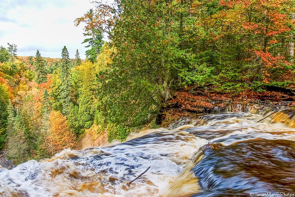
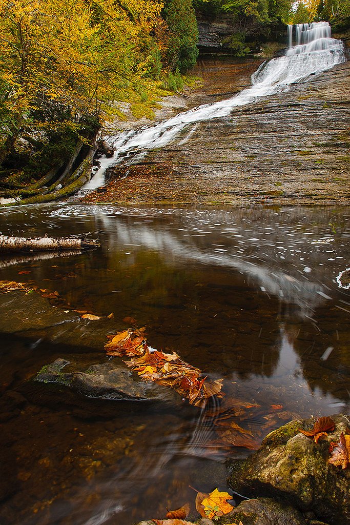
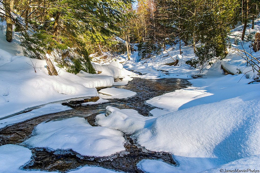

Photo Credits (5)
Difficulty
Easy
Trail Length
0.4 miles
Trail Type
Out And Back
Elevation Gain
50 ft
About Laughing Whitefish Falls
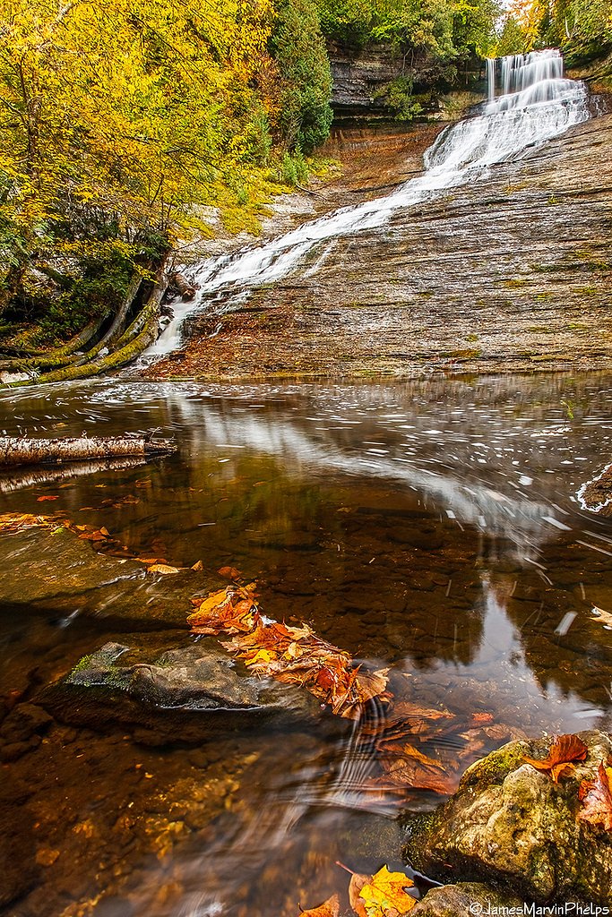
Laughing Whitefish Falls is one of Michigan’s most photogenic cascades — a broad, fan-shaped waterfall dropping about 100 feet along the Laughing Whitefish River. The falls sit in the southern portion of Laughing Whitefish Falls State Park, a 960-acre state recreation area that protects river valleys in Onota and Rock River townships in far western Alger County. You’ll find the falls roughly eight miles (13 km) south of Lake Superior and about three miles north of M‑94, making it an easy nature detour when touring Michigan’s Upper Peninsula. The site is managed as Laughing Whitefish Falls State Park (landowner: SDNR; manager: SPR) and offers a compact, visitor-friendly setting for photographers, families and casual hikers. A short, forested path leads to a wooden staircase and a viewing platform near the base of the falls, where the cascading fan of water is framed by mossy rock and trees. The park’s sheltered canyon and accessible viewpoints make this a rewarding stop for a quick outing or a mellow half-day adventure.
The Setting
Laughing Whitefish Falls sits at 974 feet within Laughing Whitefish Falls State Park, fed by the Dead River, in the foothills of Michigan. At 100 feet, it is among the taller waterfalls in Michigan.
Height: 100 feet
Trail & Hike Details
The Approach
The easy 0.4-mile out-and-back trail gains 50 feet of elevation on the way to the falls.
Trail Description
This is an easy, out-and-back trail of about 0.4 miles round trip with roughly 50 feet of elevation gain. The path is well-maintained through mixed northern hardwood forest, consisting mainly of a compacted dirt tread with tree roots in places; a short wooden staircase leads down to a viewing platform close to the falls. The grade is gentle, the route is short and family-friendly, and the main attraction — the 100-foot fan-shaped cascade — is reachable without technical terrain or scrambling.
What to Expect
The falls cascade 100 feet. Dogs are welcome.
Accessibility
The trail is short and relatively flat, but the surface may be uneven. Contact the managing agency for accessibility details.
Frequently Asked Questions
🐶 Are Dogs Allowed at Laughing Whitefish Falls?
✅ Dogs are allowed
Are There Any Fees or Permits Required?
🤑 Fee: $9.00
🏊 Is There Swimming at Laughing Whitefish Falls?
❌ Swimming is not allowed
When to Visit
Spring and early summer are the best times to visit, as the water flow is strongest during these seasons. Fall offers beautiful foliage, while winter provides a unique view of the frozen waterfall.
Seasonal Access
The best time to visit is Spring, Summer, and Fall. Winter access may be limited.
Safety Information
The wooden stairs and viewing platform may be slippery when wet or icy. Stay on marked trails and avoid climbing on rocks near the falls.
Current Water Conditions
Based on a USGS gauge 20.8 miles away
138 ft³/s
Current discharge — how much water is flowing
Lower than usual for this time of year
Based on 10 years of record
5.85 ft
Water depth at gauge
7-Day Discharge Trend
What does this mean for your visit?
Flow is lower than usual for this time of year.
About This Gauge
This gauge is on a regional waterway. Conditions at the falls may differ, especially after local rain.
7-Day Flow Outlook
Based on the USGS gauge DEAD RIVER AT MARQUETTE, MI (33 km away).
Today
Low
140 cfs
6/10Tomorrow
Low
144 cfs
6/10Sun
Moderate
159 cfs
5/10Mon
Moderate
171 cfs
4/10Tue
Moderate
191 cfs
4/10Wed
Moderate
180 cfs
4/10Thu
Moderate
145 cfs
4/10Best window: Today — low flow, mostly sunny (trip score 6/10).
Best time of year: this gauge typically runs highest from early April to mid June, peaking in May.
How we calculate this
This is a transparent outlook, not a precise forecast. We take the waterfall's current flow strength (how it ranks against its historical normal for today, from the nearest USGS stream gauge), carry that ranking forward along the gauge's seasonal curve, and nudge it for forecast rain. Confidence is highest for the next day or two and falls further out. Always check official conditions and your own judgment before visiting — high flows can be dangerous.
Know when to go.
Get a free email alert when waterfalls near Chatham hit peak flow. We only send when conditions are worth the trip — no weekly newsletters, no spam.
Weather Forecast
Location & Access
Getting There
Laughing Whitefish Falls is located in the Laughing Whitefish Falls State Park, approximately 30 miles southeast of Marquette, Michigan. The trailhead is accessible via County Road 327.
Get Directions on Google MapsParking
There is a small parking area near the trailhead, which is free to use.
Elevation
974 feet above sea level
Coordinates
46.383831° N, -87.068478° W
Land Management
Managed by SPR
Visitor Tips & Gear
Wear sturdy shoes as the trail may be muddy after rain. Visit in the morning or late afternoon for the best lighting for photography. Be cautious on the wooden stairs, especially in wet or icy conditions.
As an Amazon Associate, we earn from qualifying purchases.
For this easy 0.4 miles trail, lightweight trail shoes and a water bottle are usually sufficient. Sun exposure on the trail makes good sun protection a must in summer.

Polarized Sunglasses (Knockaround)
Cuts glare off the water so you actually see the falls — and your photos turn out better too.

Columbia Watertight II Rain Jacket
Packs into its own pocket, seam-sealed, and keeps you dry from spray and surprise rain.

Earth Pak Waterproof Dry Bag
Keeps your phone and gear dry when waterfall mist soaks everything else.

Waterproof Phone Pouch (AiRunTech)
Cheap insurance — take photos right next to the falls without killing your phone.

JOBY GorillaPod Starter Kit
Wraps around railings and rocks for long-exposure waterfall shots — no flat surface needed.

Osprey Daylite Daypack
Light, organized, and just the right size for a day hike — fits water, snacks, and layers.
Where to Stay

Days Inn by Wyndham Marquette

Comfort Suites Marquette

Holiday Inn Marquette by IHG

Staybridge Suites Marquette by IHG
Browse vacation cabins and private rentals nearby
Unique outdoor stays — tents, yurts, and treehouses
Rent a campervan or RV for your waterfall road trip
Some links are affiliate links. We may earn a commission at no extra cost to you.
Nearby Campground
BAY FURNACE CAMPGROUND
17.6 miles away · 49 sites
Overview Bay Furnace Campground is located on the south shores of Lake Superior, near Pictured Rocks National Lakeshore. Favorite to many, the campground is centered to various waterfalls, as well as other sightseeing attractions, including boat tours and visits to Grand Island.Recreation Fishing in Lake Superior is best by boat. There is no access to the lake at Bay Furnace, but there is a boat ramp approximately 10 miles west, at AuTrain, and in Munising. Anglers can enjoy a variety of lake tro
Book on Recreation.govAdditional Information
Nearby Attractions
Nearby attractions include Pictured Rocks National Lakeshore, Munising Falls, and Marquette's Presque Isle Park.
Wildlife
The area is home to a variety of wildlife, including deer, birds, and small mammals. Be cautious of ticks in the warmer months.
Cities near Laughing Whitefish Falls
Nearby Waterfalls
Writing about Laughing Whitefish Falls? Embed this waterfall on your site for free.