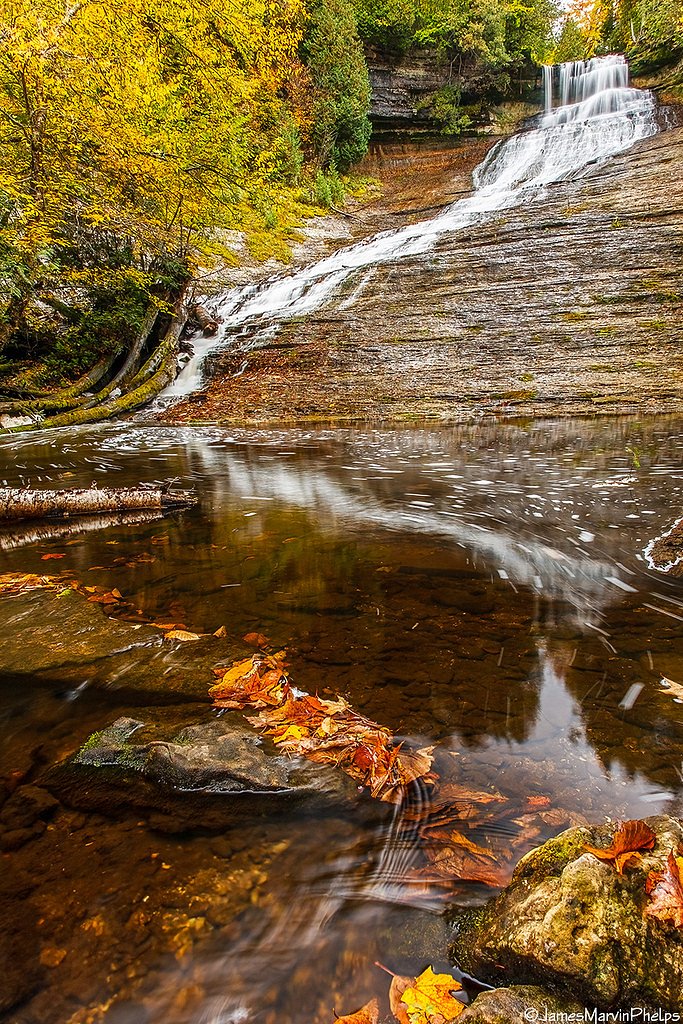
Rock River Falls
Michigan • 15 ft
By Armen Suny · Last verified Mar 2026
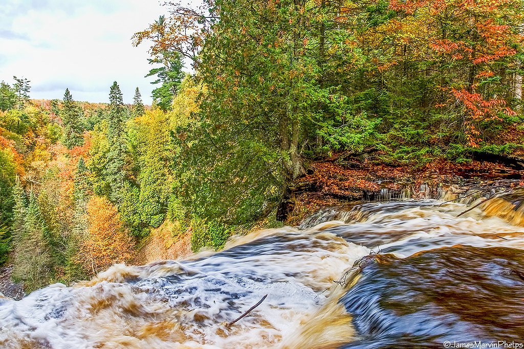
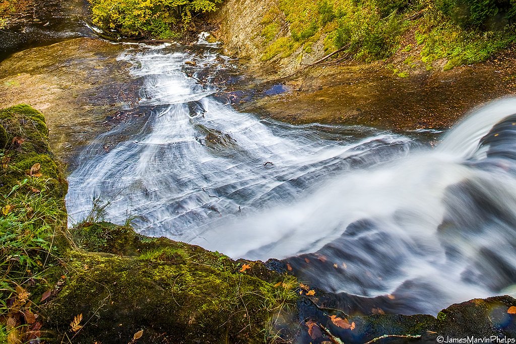
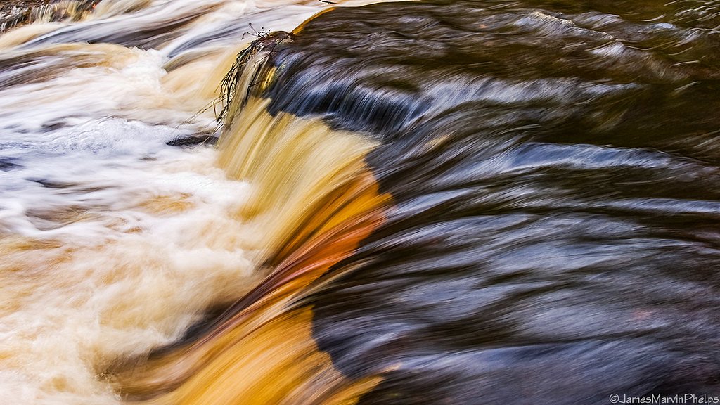
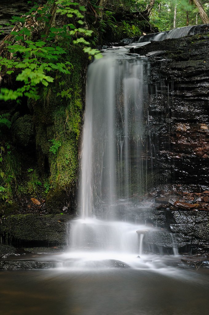
Photo Credits (5)
Difficulty
Moderate
Trail Length
2.4 miles
Trail Type
Out And Back
Elevation Gain
350 ft
About Rock River Falls
Rock River Falls is a secluded, picturesque 15-foot cascade tucked into the Rock River Wilderness of Michigan’s Upper Peninsula. Nestled within the Hiawatha National Forest and managed by the U.S. Forest Service, the falls drop into a quiet, heavily wooded ravine that’s perfect for anyone seeking a peaceful outing away from crowded viewpoints. The setting is intimate and photogenic year-round, with close-up views of the river dropping over bedrock ledges. Access is via the USFS ROCK RIVER FALLS HIKE (Trail #318). The route is commonly hiked as a moderate 2.4-mile out-and-back with about 350 feet of elevation gain; USFS GIS mapping lists the trail length at 0.92 miles. The hike rewards visitors with a short, forested approach and a serene waterfall destination — a great half-day trip for hikers who enjoy quiet, natural settings and short climbs.
The Setting
Rock River Falls sits at 761 feet within Hiawatha National Forest, fed by the Dead River, in the foothills of Michigan. The falls drop 15 feet.
Height: 15 feet
Nearby Falls Worth Visiting
Laughing Whitefish Falls, the tallest waterfall in Michigan at 100 feet, lies 4.8 miles to the west. Also nearby: Scott Falls (10 ft, 7.9 mi).
Trail & Hike Details
The Approach
The moderate hike follows Rock River Falls Hike (#318), a 2.4-mile out-and-back trail over natural surface. Expect 350 feet of elevation gain with grades of 0-5%. The trail is moderately developed (Class 2).
USFS Trail
ROCK RIVER FALLS HIKE #318
Trail Class
Moderately Developed
Surface
Avg Grade
USFS Segment
0.92 miTrail Description
The USFS-maintained ROCK RIVER FALLS HIKE (Trail #318) is a Class 2, out-and-back route with a native-material tread and a typical grade of 0–5%. Hikers should expect roughly 2.4 miles round-trip (USFS GIS length 0.92 miles) with about 350 feet of elevation gain; the route is rated moderate. The surface is natural forest floor—roots, rocks and occasional muddy sections are common—so sturdy footwear is recommended. The trail ends at a secluded 15-foot waterfall set in a narrow river gorge, offering close-up views and a peaceful place to rest before returning the way you came.
What to Expect
The falls drop a gentle 15 feet. Dogs are welcome.
Accessibility
The trail is not wheelchair accessible. Uneven terrain and elevation changes require steady footing.
Frequently Asked Questions
🐶 Are Dogs Allowed at Rock River Falls?
✅ Dogs are allowed
Are There Any Fees or Permits Required?
🆖 No fees required
🏊 Is There Swimming at Rock River Falls?
❌ Swimming is not allowed
When to Visit
Spring and early summer are ideal times to visit when water flow is at its peak. Fall offers beautiful foliage, and winter provides a unique opportunity to see the falls frozen.
Seasonal Access
The best time to visit is Spring, Summer, and Fall. Winter access may be limited. Check with Hiawatha National Forest for seasonal road closures.
Safety Information
The trail may be slippery or muddy, especially after rain. Visitors should exercise caution near the waterfall as rocks can be slippery. Cell service is limited, so inform someone of your plans before visiting.
Current Water Conditions
Based on a USGS gauge 23.4 miles away
140 ft³/s
Current discharge — how much water is flowing
Lower than usual for this time of year
Based on 10 years of record
5.86 ft
Water depth at gauge
7-Day Discharge Trend
What does this mean for your visit?
Flow is lower than usual for this time of year.
About This Gauge
This gauge is on a regional waterway. Conditions at the falls may differ, especially after local rain.
7-Day Flow Outlook
Based on the USGS gauge DEAD RIVER AT MARQUETTE, MI (38 km away).
Today
Moderate
140 cfs
8/10Tomorrow
Moderate
143 cfs
8/10Mon
Moderate
161 cfs
4/10Tue
Moderate
177 cfs
5/10Wed
Moderate
170 cfs
4/10Thu
Moderate
141 cfs
4/10Fri
Moderate
137 cfs
4/10Best window: Today — moderate flow, sunny (trip score 8/10).
Best time of year: this gauge typically runs highest from early April to mid June, peaking in May.
How we calculate this
This is a transparent outlook, not a precise forecast. We take the waterfall's current flow strength (how it ranks against its historical normal for today, from the nearest USGS stream gauge), carry that ranking forward along the gauge's seasonal curve, and nudge it for forecast rain. Confidence is highest for the next day or two and falls further out. Always check official conditions and your own judgment before visiting — high flows can be dangerous.
Know when to go.
Get a free email alert when waterfalls near Chatham hit peak flow. We only send when conditions are worth the trip — no weekly newsletters, no spam.
Weather Forecast
Location & Access
Getting There
Rock River Falls is located near Chatham, Michigan, in Alger County. Access requires driving on unpaved forest roads, and the trailhead can be reached via Forest Road 2276. Visitors should use a reliable map or GPS as signage may be limited.
Get Directions on Google MapsParking
There is a small parking area near the trailhead, but it may be unmarked and can accommodate only a few vehicles.
Elevation
761 feet above sea level
Coordinates
46.411346° N, -86.976194° W
Land Management
Managed by USFS
Visitor Tips & Gear
Bring bug spray during the summer months as mosquitoes can be prevalent. The trail may be muddy after rain, so wear appropriate footwear. Cell service is limited in the area, so plan accordingly.
As an Amazon Associate, we earn from qualifying purchases.
With 2.4 miles and 350 ft of elevation gain, sturdy boots and trekking poles will help on this moderate trail. Sun exposure on the trail makes good sun protection a must in summer.

Polarized Sunglasses (Knockaround)
Cuts glare off the water so you actually see the falls — and your photos turn out better too.

Columbia Watertight II Rain Jacket
Packs into its own pocket, seam-sealed, and keeps you dry from spray and surprise rain.

Earth Pak Waterproof Dry Bag
Keeps your phone and gear dry when waterfall mist soaks everything else.

Waterproof Phone Pouch (AiRunTech)
Cheap insurance — take photos right next to the falls without killing your phone.

Timberland Euro Sprint Mid Waterproof
Trusted waterproof boot with premium leather and grippy rubber sole — reliable on rocky, wet trails.

TrailBuddy Trekking Poles
Lightweight aluminum, cork grips, and flip-locks that actually hold — a best-seller for good reason.
Where to Stay

Roam Inn

Days Inn by Wyndham Marquette

Comfort Suites Marquette

Holiday Inn Marquette by IHG
Browse vacation cabins and private rentals nearby
Unique outdoor stays — tents, yurts, and treehouses
Rent a campervan or RV for your waterfall road trip
Some links are affiliate links. We may earn a commission at no extra cost to you.
Nearby Campground
BAY FURNACE CAMPGROUND
12.9 miles away · 49 sites
Overview Bay Furnace Campground is located on the south shores of Lake Superior, near Pictured Rocks National Lakeshore. Favorite to many, the campground is centered to various waterfalls, as well as other sightseeing attractions, including boat tours and visits to Grand Island.Recreation Fishing in Lake Superior is best by boat. There is no access to the lake at Bay Furnace, but there is a boat ramp approximately 10 miles west, at AuTrain, and in Munising. Anglers can enjoy a variety of lake tro
Book on Recreation.govAdditional Information
Nearby Attractions
Other nearby attractions include Eben Ice Caves, Laughing Whitefish Falls, and Pictured Rocks National Lakeshore.
Wildlife
The area is home to a variety of wildlife, including deer, birds, and small mammals. Be cautious of ticks and other insects.
Cities near Rock River Falls
Nearby Waterfalls

Writing about Rock River Falls? Embed this waterfall on your site for free.