Photo Credits (5)
Difficulty
Drive Up
Trail Length
0.1 miles
Trail Type
Out And Back
Elevation Gain
10 ft
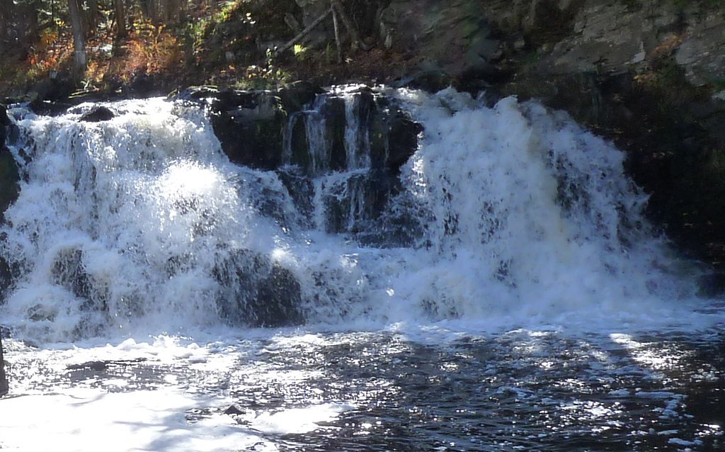
About Power Dam Falls
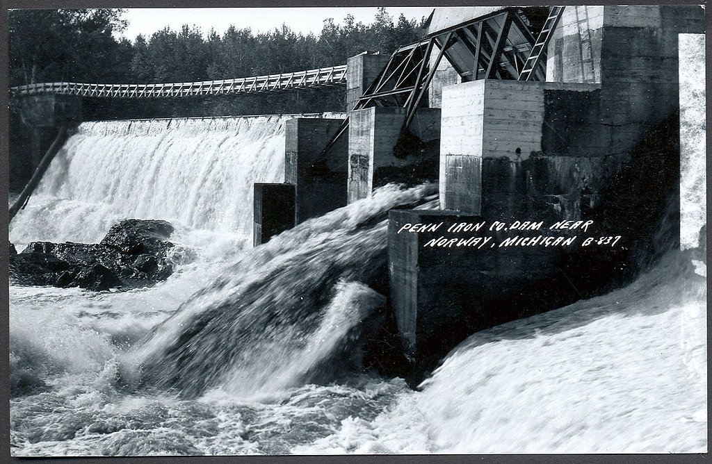
Power Dam Falls is a small but scenic waterfall located near Norway, Michigan. It is part of the Menominee River and is situated near a hydroelectric dam, which influences the water flow. The falls are surrounded by forested areas, offering a peaceful and picturesque setting.
The Setting
Power Dam Falls sits at 883 feet along the Sturgeon River, in the foothills of Michigan.
Trail & Hike Details
The Approach
No hiking required. Power Dam Falls is accessible by vehicle with a roadside viewing area.
Trail Description
The trail to Power Dam Falls is short and relatively flat, making it accessible for most visitors. It leads through a wooded area to a viewing spot near the falls. The trail may be uneven in some places, so sturdy footwear is recommended.
What to Expect
Dogs are welcome.
Accessibility
This waterfall is viewable from a vehicle-accessible area. No hiking is required.
Frequently Asked Questions
🐶 Are Dogs Allowed at Power Dam Falls?
✅ Dogs are allowed
Are There Any Fees or Permits Required?
🆖 No fees required
🏊 Is There Swimming at Power Dam Falls?
❌ Swimming is not allowed
When to Visit
Spring and early summer are ideal times to visit, as water levels are typically higher due to snowmelt and rainfall.
Seasonal Access
The best time to visit is Spring, Summer, and Fall. Winter access may be limited.
Safety Information
Exercise caution near the water, as rocks can be slippery and currents may be strong. Stay on marked trails and avoid venturing too close to the dam.
Current Water Conditions
316 ft³/s
Current discharge — how much water is flowing
About average for this time of year
Based on 15 years of record
2.31 ft
Water depth at gauge
7-Day Discharge Trend
What does this mean for your visit?
Flow is about average for this time of year.
About This Gauge
7-Day Flow Outlook
Based on the USGS gauge STURGEON RIVER AT US HWY-2 AT LORETTO, MI (4 km away).
Today
Moderate
360 cfs
6/10Tomorrow
Strong
365 cfs
7/10Wed
Strong
326 cfs
7/10Thu
Strong
379 cfs
7/10Fri
Strong
345 cfs
7/10Sat
Moderate
283 cfs
6/10Sun
Moderate
277 cfs
6/10Best window: Tomorrow — strong flow, mostly sunny then chance showers and thunderstorms (trip score 7/10).
Best time of year: this gauge typically runs highest from late March to mid June, peaking in April.
How we calculate this
This is a transparent outlook, not a precise forecast. We take the waterfall's current flow strength (how it ranks against its historical normal for today, from the nearest USGS stream gauge), carry that ranking forward along the gauge's seasonal curve, and nudge it for forecast rain. Confidence is highest for the next day or two and falls further out. Always check official conditions and your own judgment before visiting — high flows can be dangerous.
Know when to go.
Get a free email alert when waterfalls near Norway hit peak flow. We only send when conditions are worth the trip — no weekly newsletters, no spam.
Weather Forecast
Location & Access
Getting There
Power Dam Falls is located approximately 6 miles from Norway, Michigan. The falls can be accessed via Power Dam Road, which leads to the vicinity of the hydroelectric dam. Visitors should follow signs for the dam and park in designated areas nearby.
Get Directions on Google MapsParking
There is limited parking available near the dam. Visitors should ensure they park in designated areas and avoid blocking access roads.
Elevation
883 feet above sea level
Coordinates
45.790000° N, -87.783333° W
Visitor Tips & Gear
Visit during spring or after heavy rains for the best water flow. Bring insect repellent during summer months, as mosquitoes may be present. Be cautious near the water, as rocks can be slippery.
As an Amazon Associate, we earn from qualifying purchases.
For this easy 0.1 miles trail, lightweight trail shoes and a water bottle are usually sufficient. Sun exposure on the trail makes good sun protection a must in summer.

Polarized Sunglasses (Knockaround)
Cuts glare off the water so you actually see the falls — and your photos turn out better too.

Columbia Watertight II Rain Jacket
Packs into its own pocket, seam-sealed, and keeps you dry from spray and surprise rain.

Earth Pak Waterproof Dry Bag
Keeps your phone and gear dry when waterfall mist soaks everything else.

Waterproof Phone Pouch (AiRunTech)
Cheap insurance — take photos right next to the falls without killing your phone.

JOBY GorillaPod Starter Kit
Wraps around railings and rocks for long-exposure waterfall shots — no flat surface needed.

OR Sombriolet Sun Hat
UPF 50+ sun protection with vents so your head doesn't cook on exposed trail sections.
Where to Stay

Pine Mountain Resort

Mountain Host Motor Inn

Comfort Inn Iron Mountain North

Motel 6 Norway MI
Browse vacation cabins and private rentals nearby
Unique outdoor stays — tents, yurts, and treehouses
Rent a campervan or RV for your waterfall road trip
Some links are affiliate links. We may earn a commission at no extra cost to you.
Additional Information
Nearby Attractions
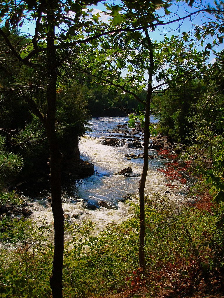
Nearby attractions include Piers Gorge, a popular spot for hiking and whitewater rafting, and the town of Norway, which offers dining and shopping options.
Wildlife
The area is home to a variety of wildlife, including deer, birds, and small mammals. Visitors may also spot fish in the river.
Cities near Power Dam Falls
Nearby Waterfalls
Other waterfalls named Power Dam Falls
1 other waterfall shares this name across the U.S.
Writing about Power Dam Falls? Embed this waterfall on your site for free.