Difficulty
Easy
Trail Length
0.8 miles
Trail Type
Out And Back
Elevation Gain
100 ft
About Quiver Falls
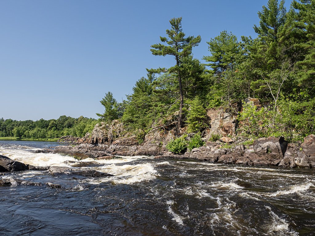
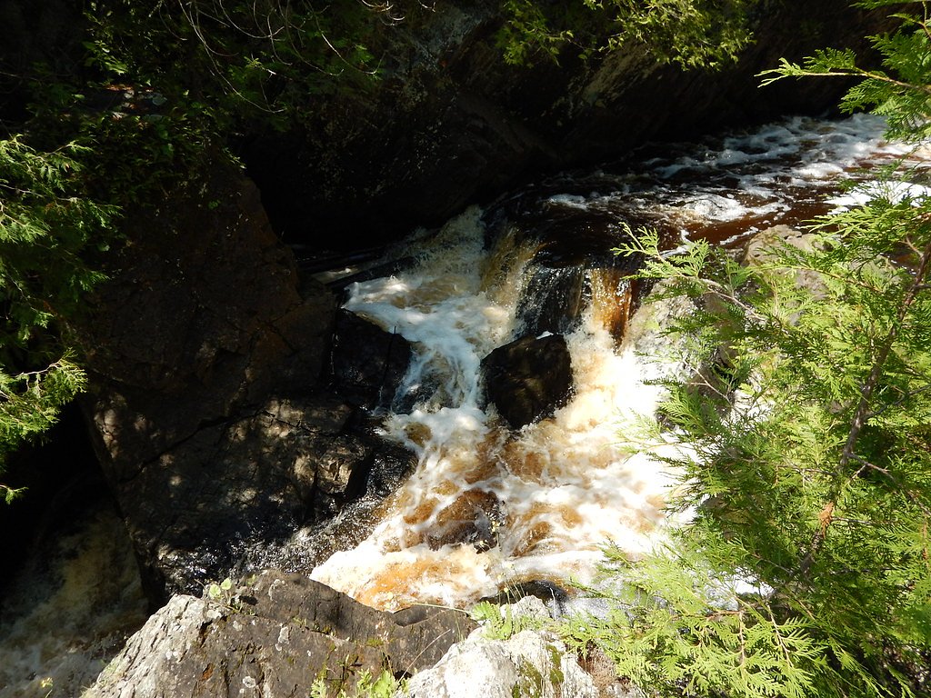
Quiver Falls is a lesser-known waterfall located in Wisconsin, offering a serene and picturesque setting. It is surrounded by lush greenery and is a popular spot for nature enthusiasts seeking a peaceful retreat. The waterfall may vary in flow depending on the season, with spring and early summer typically providing the most robust water flow.
The Setting
Quiver Falls sits at 778 feet along the Menominee River, in the foothills of Wisconsin.
Trail & Hike Details
The Approach
The easy 0.8-mile out-and-back trail gains 100 feet of elevation on the way to the falls.
Trail Description
Details about the trail leading to Quiver Falls are not well-documented. The trail may involve navigating through forested areas, and conditions could vary depending on the season.
What to Expect
Visitors can expect a tranquil natural setting with a waterfall that may vary in flow depending on recent rainfall and the time of year. The area is likely to be less crowded, offering a peaceful experience.
Accessibility
The trail is short and relatively flat, but the surface may be uneven. Contact the managing agency for accessibility details.
Frequently Asked Questions
🐶 Are Dogs Allowed at Quiver Falls?
❌ Dogs are not allowed
Are There Any Fees or Permits Required?
🆖 No fees required
🏊 Is There Swimming at Quiver Falls?
❌ Swimming is not allowed
When to Visit
Spring and early summer are typically the best times to visit, as the waterfall is likely to have the most water flow during these seasons.
Seasonal Access
The best time to visit is Spring, Summer, and Fall. Winter access may be limited.
Safety Information
The trail and waterfall area may have uneven terrain, slippery rocks, and limited signage. Visitors should exercise caution and avoid visiting during inclement weather.
Current Water Conditions
2,430 ft³/s
Current discharge — how much water is flowing
About average for this time of year
Based on 43 years of record
8.07 ft
Water depth at gauge
7-Day Discharge Trend
What does this mean for your visit?
Flow is about average for this time of year.
About This Gauge
This gauge is on a nearby waterway and may not reflect exact conditions at the falls.
7-Day Flow Outlook
Based on the USGS gauge MENOMINEE RIVER BELOW PEMENE CREEK NR PEMBINE, WI (9 km away).
Today
Moderate
2839 cfs
6/10Tomorrow
Moderate
2911 cfs
6/10Wed
Moderate
2797 cfs
6/10Thu
Moderate
2530 cfs
6/10Fri
Moderate
2632 cfs
6/10Sat
Moderate
2465 cfs
6/10Sun
Moderate
2306 cfs
6/10Best window: Today — moderate flow, chance showers and thunderstorms then mostly cloudy (trip score 6/10).
Best time of year: this gauge typically runs highest from late March to early June, peaking in April.
How we calculate this
This is a transparent outlook, not a precise forecast. We take the waterfall's current flow strength (how it ranks against its historical normal for today, from the nearest USGS stream gauge), carry that ranking forward along the gauge's seasonal curve, and nudge it for forecast rain. Confidence is highest for the next day or two and falls further out. Always check official conditions and your own judgment before visiting — high flows can be dangerous.
Know when to go.
Get a free email alert when waterfalls near Pembine hit peak flow. We only send when conditions are worth the trip — no weekly newsletters, no spam.
Weather Forecast
Location & Access
Getting There
The exact location of Quiver Falls is not widely documented. Visitors are advised to consult local resources or hiking guides for directions. It may be located within a forested area, requiring some navigation.
Get Directions on Google MapsParking
Parking availability is unclear. Visitors should prepare for limited or roadside parking if the area is remote.
Elevation
778 feet above sea level
Coordinates
45.654771° N, -87.823867° W
Visitor Tips & Gear
Bring a map or GPS device as the location may not be well-marked. Wear sturdy footwear and be prepared for uneven terrain. Check weather conditions before visiting.
As an Amazon Associate, we earn from qualifying purchases.
For this easy 0.8 miles trail, lightweight trail shoes and a water bottle are usually sufficient. Sun exposure on the trail makes good sun protection a must in summer.

Columbia Watertight II Rain Jacket
Packs into its own pocket, seam-sealed, and keeps you dry from spray and surprise rain.

Earth Pak Waterproof Dry Bag
Keeps your phone and gear dry when waterfall mist soaks everything else.

Waterproof Phone Pouch (AiRunTech)
Cheap insurance — take photos right next to the falls without killing your phone.

Polarized Sunglasses (Knockaround)
Cuts glare off the water so you actually see the falls — and your photos turn out better too.

Osprey Daylite Daypack
Light, organized, and just the right size for a day hike — fits water, snacks, and layers.

OR Sombriolet Sun Hat
UPF 50+ sun protection with vents so your head doesn't cook on exposed trail sections.
Where to Stay

Pine Mountain Resort

Comfort Inn Iron Mountain North

Four Seasons Island Resort

Days Inn by Wyndham Iron Mountain
Browse vacation cabins and private rentals nearby
Unique outdoor stays — tents, yurts, and treehouses
Rent a campervan or RV for your waterfall road trip
Some links are affiliate links. We may earn a commission at no extra cost to you.
Additional Information
Nearby Attractions
Nearby attractions are not well-documented. Visitors may explore other natural areas or parks in Wisconsin.
Wildlife
The area may be home to typical Wisconsin wildlife, including birds, deer, and small mammals. Be cautious of ticks and other insects.
Cities near Quiver Falls
Nearby Waterfalls
Writing about Quiver Falls? Embed this waterfall on your site for free.