Photo Credits (5)
Difficulty
Moderate
Trail Length
2.4 miles
Trail Type
Out And Back
Elevation Gain
350 ft
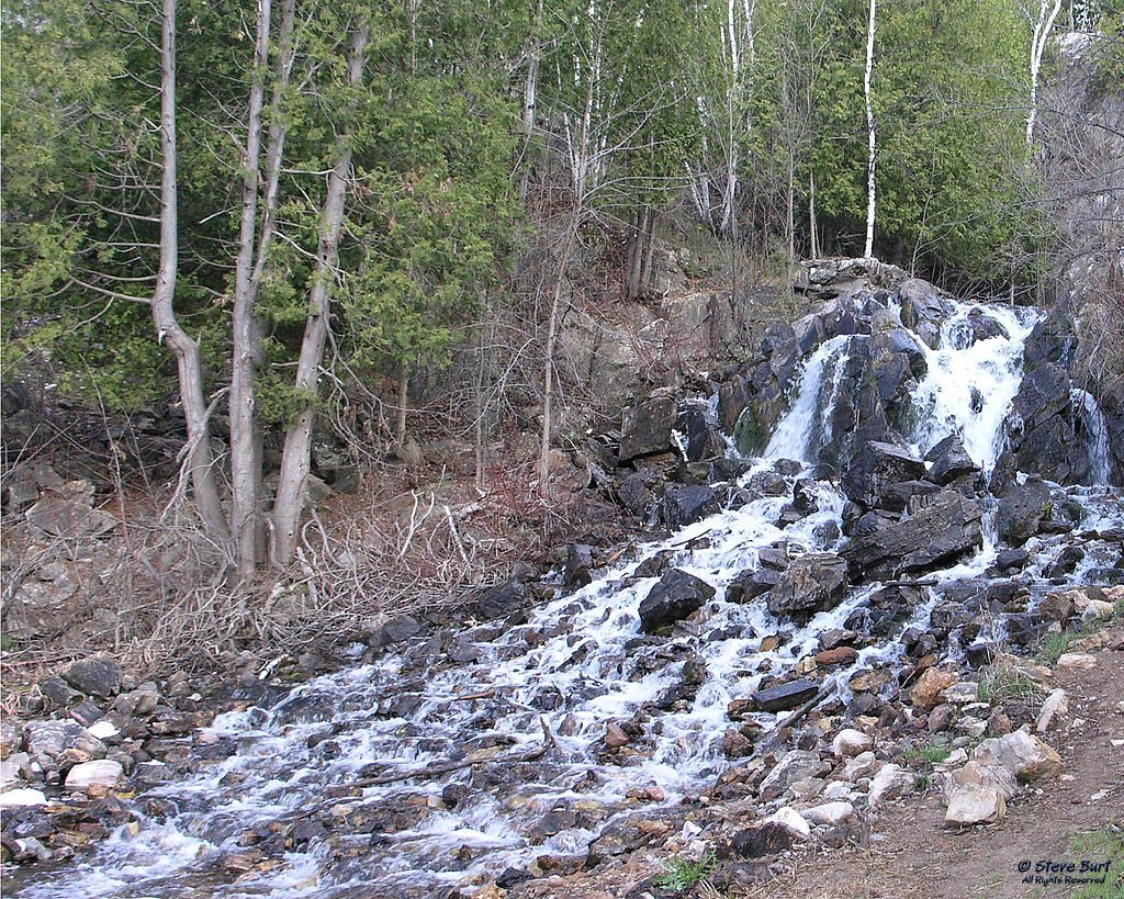
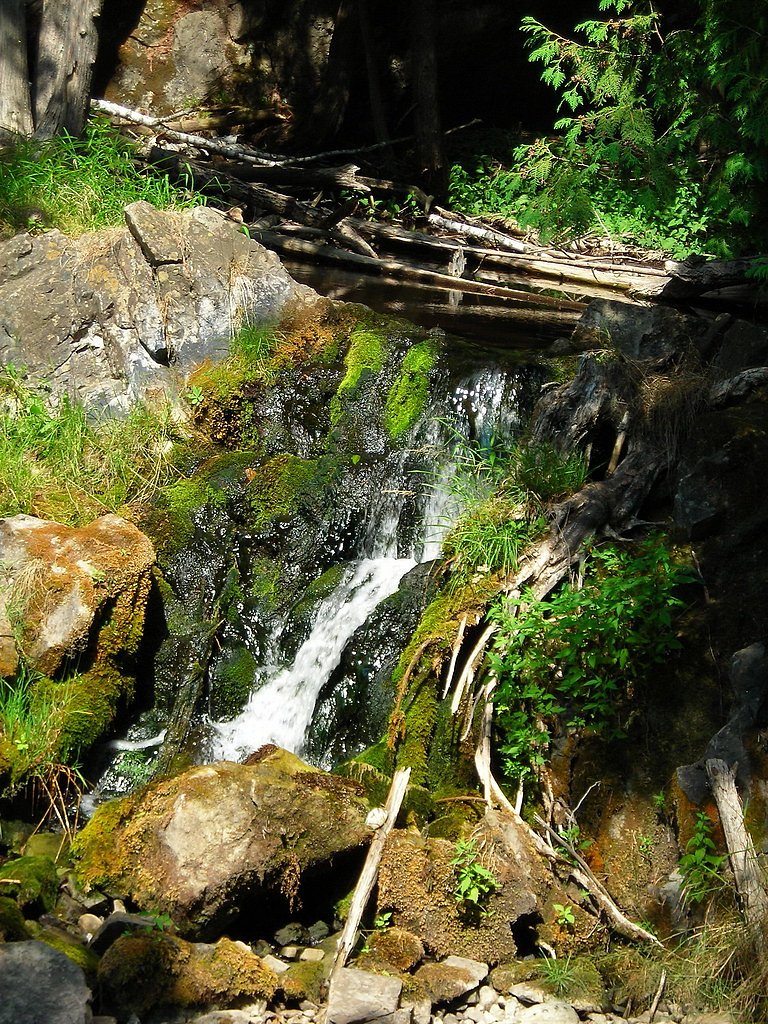
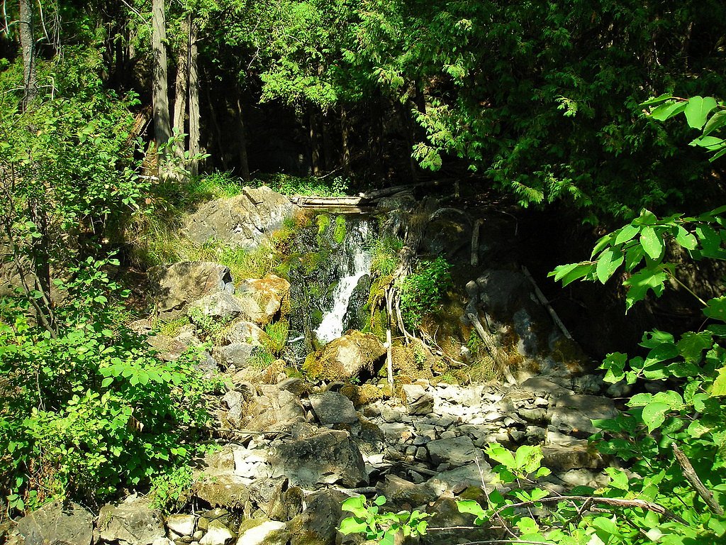
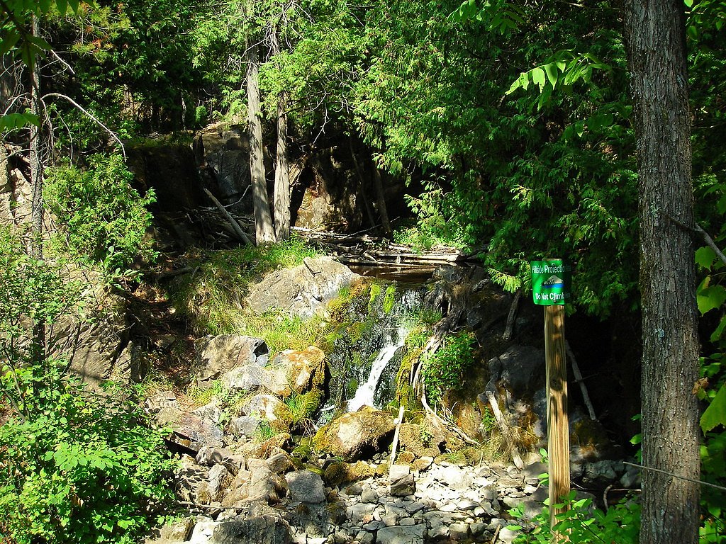
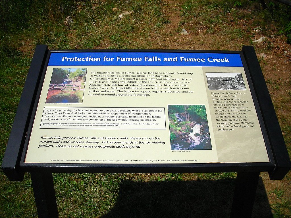
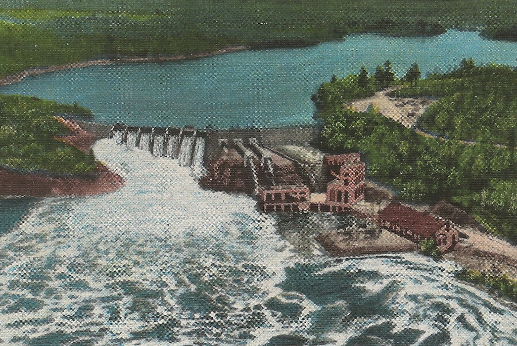
About Fumee Falls
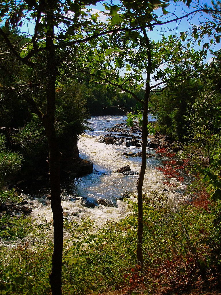
Fumee Falls is a scenic, multi-tiered roadside cascade tucked into Michigan’s Upper Peninsula just off US-2 near the town of Norway. The falls tumble down a rocky hillside and make for an easy, photogenic stop on a drive across the region. The site sits within Fume Creek Roadside Park and is managed by the city, so you’ll find a small, park-like setting around the parking area and viewpoints. While many visitors know Fumee Falls as a quick pull-off to admire the water and take photos, Fume Creek Roadside Park also offers a longer route for hikers who want more of a walk. The setting is family-friendly and accessible for most visitors, and the combination of a short viewpoint path plus a designated trail through the park makes it a flexible outing whether you’re stopping briefly or planning a moderate hike.
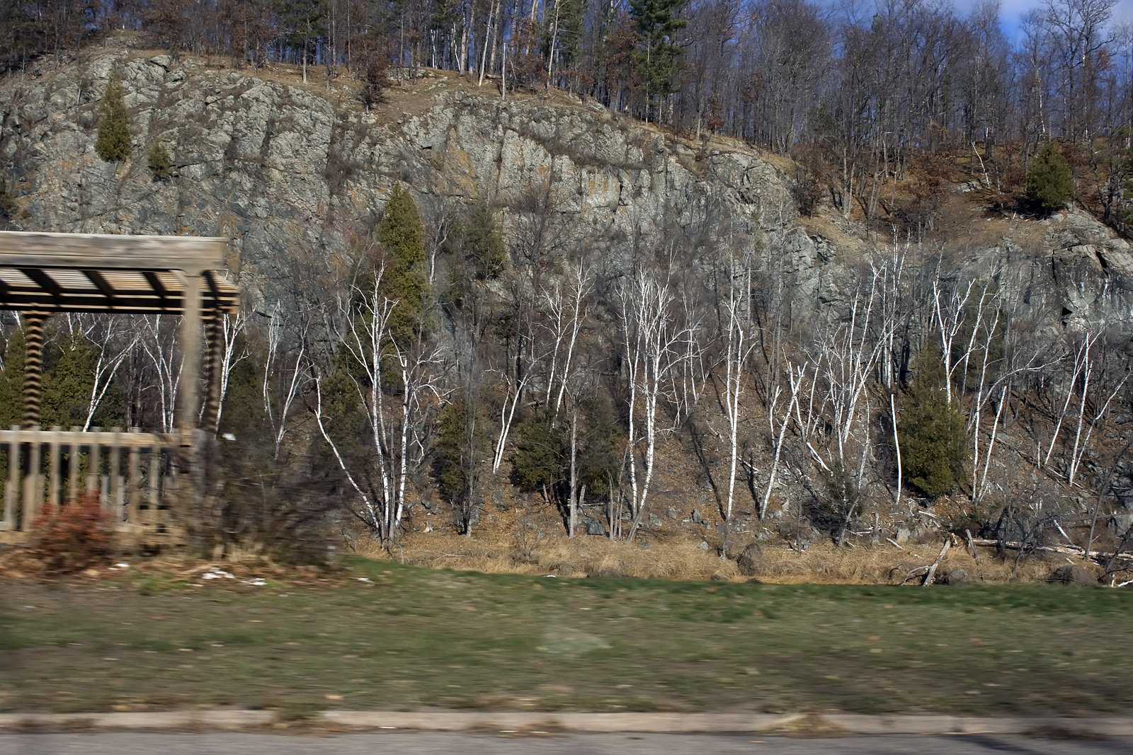
The Setting
Fumee Falls sits at 1,027 feet within Fume Creek Roadside Park, fed by the Menominee River, in the foothills of Michigan.
Trail & Hike Details
The Approach
The moderate 2.4-mile out-and-back trail gains 350 feet of elevation on the way to the falls.
Trail Description
The official trail in Fume Creek Roadside Park is an out-and-back route of approximately 2.4 miles with about 350 feet of elevation gain and is rated moderate in difficulty. The trail is suitable for hikers looking for a compact hike that still includes some climbing and varied terrain. For those just wanting to see the waterfall, a very short, well-marked pathway from the parking area leads down to the base and viewpoints of Fumee Falls and is suitable for most visitors; the longer out-and-back route extends beyond that immediate access for a more sustained hike.
What to Expect
Dogs are welcome.
Accessibility
The trail is not wheelchair accessible. Uneven terrain and elevation changes require steady footing.
Frequently Asked Questions
🐶 Are Dogs Allowed at Fumee Falls?
✅ Dogs are allowed
Are There Any Fees or Permits Required?
🆖 No fees required
🏊 Is There Swimming at Fumee Falls?
❌ Swimming is not allowed
When to Visit
Spring and early summer are the best times to visit, as the water flow is strongest during these seasons. Fall offers beautiful foliage, while winter provides a unique frozen waterfall view.
Seasonal Access
The best time to visit is Spring, Summer, and Fall. Winter access may be limited.
Safety Information
Be cautious of slippery rocks near the falls, especially after rain or during winter. The parking area is close to the highway, so watch for traffic when entering or exiting.
Current Water Conditions
2,580 ft³/s
Current discharge — how much water is flowing
About average for this time of year
Based on 33 years of record
6.98 ft
Water depth at gauge
7-Day Discharge Trend
What does this mean for your visit?
Flow is about average for this time of year.
About This Gauge
7-Day Flow Outlook
Based on the USGS gauge MENOMINEE RIVER AT NIAGARA, WI (4 km away).
Today
Strong
2580 cfs
10/10Tomorrow
Strong
2636 cfs
10/10Mon
Roaring
3053 cfs
6/10Tue
Roaring
3257 cfs
6/10Wed
Roaring
3021 cfs
6/10Thu
Roaring
2953 cfs
6/10Fri
Roaring
3004 cfs
6/10Best window: Today — strong flow, sunny (trip score 10/10).
Best time of year: this gauge typically runs highest from late March to early June, peaking in April.
How we calculate this
This is a transparent outlook, not a precise forecast. We take the waterfall's current flow strength (how it ranks against its historical normal for today, from the nearest USGS stream gauge), carry that ranking forward along the gauge's seasonal curve, and nudge it for forecast rain. Confidence is highest for the next day or two and falls further out. Always check official conditions and your own judgment before visiting — high flows can be dangerous.
Know when to go.
Get a free email alert when waterfalls near Quinnesec hit peak flow. We only send when conditions are worth the trip — no weekly newsletters, no spam.
Weather Forecast
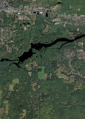
Location & Access
Getting There
Fumee Falls is located directly off US-2, approximately 3 miles west of Norway, Michigan. There is a small parking area adjacent to the falls, making it easily accessible.
Get Directions on Google MapsParking
A small parking lot is available near the falls, with enough space for several vehicles.
Elevation
1,027 feet above sea level
Coordinates
45.806944° N, -87.978333° W
Land Management
Managed by CITY
Visitor Tips & Gear
Bring a camera to capture the beauty of the falls. If visiting in winter, be cautious of icy conditions near the falls and parking area.
As an Amazon Associate, we earn from qualifying purchases.
With 2.4 miles and 350 ft of elevation gain, sturdy boots and trekking poles will help on this moderate trail. Sun exposure on the trail makes good sun protection a must in summer.

Polarized Sunglasses (Knockaround)
Cuts glare off the water so you actually see the falls — and your photos turn out better too.

Columbia Watertight II Rain Jacket
Packs into its own pocket, seam-sealed, and keeps you dry from spray and surprise rain.

Earth Pak Waterproof Dry Bag
Keeps your phone and gear dry when waterfall mist soaks everything else.

Waterproof Phone Pouch (AiRunTech)
Cheap insurance — take photos right next to the falls without killing your phone.

Timberland Euro Sprint Mid Waterproof
Trusted waterproof boot with premium leather and grippy rubber sole — reliable on rocky, wet trails.

TrailBuddy Trekking Poles
Lightweight aluminum, cork grips, and flip-locks that actually hold — a best-seller for good reason.
Where to Stay

Mountain Host Motor Inn

Pine Mountain Resort

Comfort Inn Iron Mountain North

Baymont by Wyndham Iron Mountain
Browse vacation cabins and private rentals nearby
Unique outdoor stays — tents, yurts, and treehouses
Rent a campervan or RV for your waterfall road trip
Some links are affiliate links. We may earn a commission at no extra cost to you.
Additional Information
Nearby Attractions
Fumee Lake Natural Area, Piers Gorge, Iron Mountain Iron Mine.
Wildlife
The area around the falls may feature birds, squirrels, and other small wildlife typical of Michigan's forests.
Cities near Fumee Falls
Nearby Waterfalls
Writing about Fumee Falls? Embed this waterfall on your site for free.