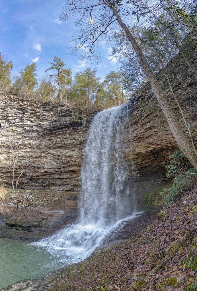
Laurel Falls
Tennessee • 80 ft
By Armen Suny · Last verified Mar 2026
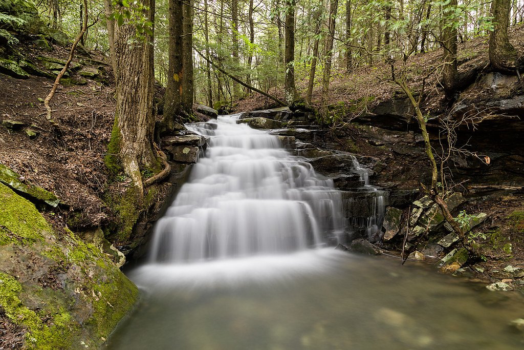
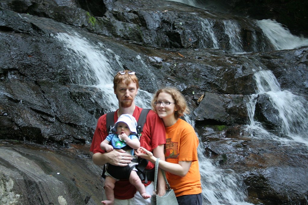
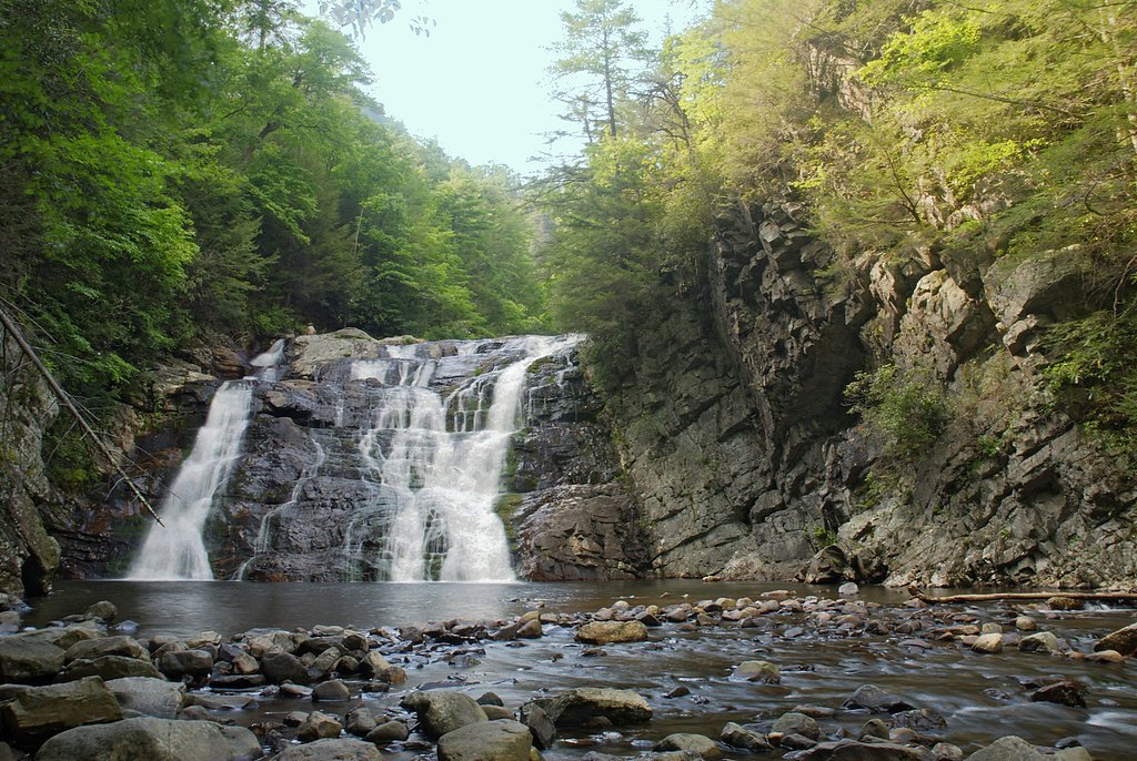

Photo Credits (5)
Difficulty
Easy
Trail Length
2.6 miles
Trail Type
Out And Back
Elevation Gain
314 ft
About Laurel Falls
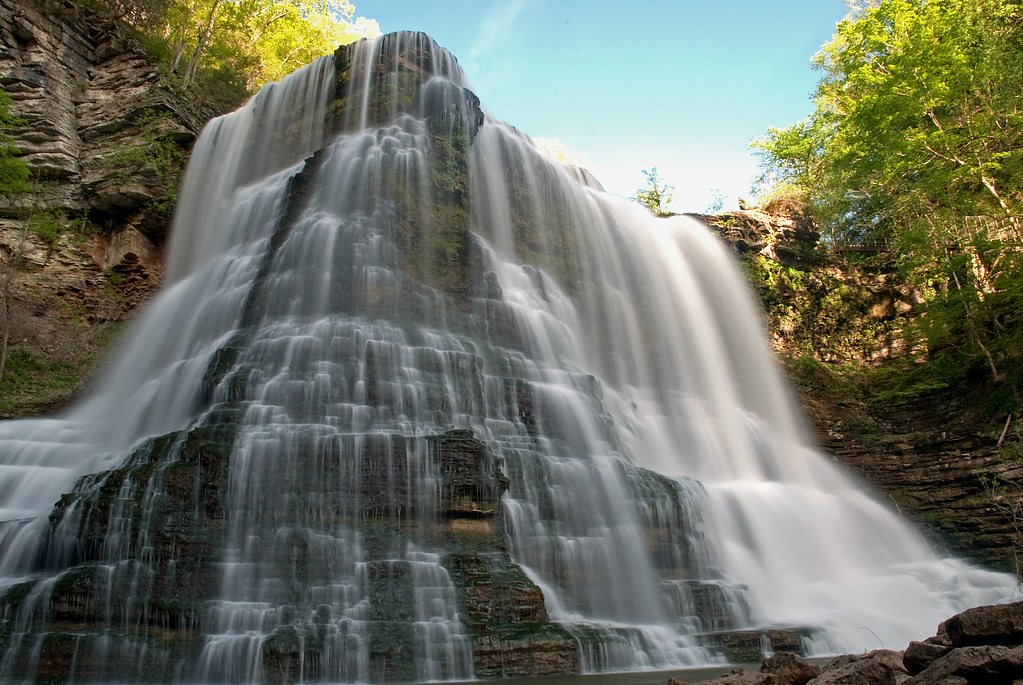
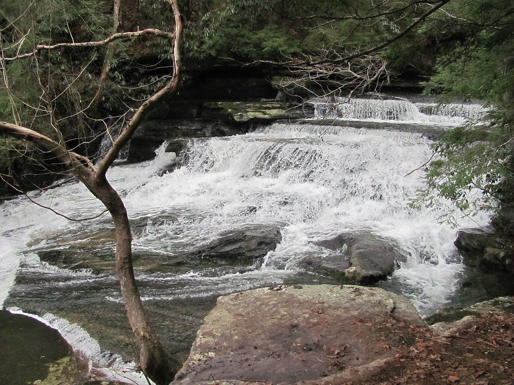
Laurel Falls is a picturesque, two-tiered waterfall (roughly 80 feet in height) tucked into the Great Smoky Mountains National Park and managed by the National Park Service. The falls take their name from the mountain laurel that blooms along the route each spring, and the upper and lower cascades offer photographers and casual visitors a classic Smokies scene. Its paved approach and modest elevation make it one of the park’s most accessible waterfall hikes while still feeling immersed in the forest. The trail sees steady foot traffic from families and day-hikers attracted to the short distance and scenic payoff. Expect a forested walk that opens to the cascades and offers typical Smoky Mountains views; because the path is paved, many visitors find it easier to navigate than most backcountry trails, though wet rock and roots can still be slick after rain.
The Setting
Laurel Falls sits at 1,115 feet along the Daddys Creek, in the foothills of Tennessee. The falls drop 80 feet.
Height: 80 feet
Nearby Falls Worth Visiting
Ozone Falls (110 ft) lies 5.6 miles to the north. Also nearby: Upper Piney Falls (80 ft, 6.4 mi) and Lower Piney Falls (40 ft, 6.6 mi).
Trail & Hike Details
The Approach
The easy 2.6-mile out-and-back trail gains 314 feet of elevation on the way to the falls.
Trail Description
Out-and-back, 2.6 miles round-trip with about 314 feet of elevation gain; difficulty: easy. Surface: paved path; grade: generally gentle with short steeper pitches. The Laurel Falls Trail is a short, well-defined route through mixed hardwood forest that leads steadily to viewpoints of the upper and lower falls—the paved surface makes it accessible for most hikers, including families, but watch for wet or uneven sections near the cascade.
What to Expect
The falls cascade 80 feet.
Accessibility
The trail is not wheelchair accessible. Uneven terrain and elevation changes require steady footing.
Frequently Asked Questions
🐶 Are Dogs Allowed at Laurel Falls?
❌ Dogs are not allowed
Are There Any Fees or Permits Required?
🤑 Fee: $5.00
🏊 Is There Swimming at Laurel Falls?
❌ Swimming is not allowed
When to Visit
Spring and early summer are the best times to visit, as the mountain laurel and other wildflowers are in bloom. Fall offers beautiful foliage, while winter provides a quieter experience with potential ice formations on the falls.
Seasonal Access
The best time to visit is Spring, Summer, and Fall. Winter access may be limited.
Safety Information
Be cautious of slippery rocks near the waterfall. Stay on the trail to avoid damaging the environment and for your safety. Black bears are common in the area; follow park guidelines for bear safety.
Current Water Conditions
61 ft³/s
Current discharge — how much water is flowing
Much lower than usual for this time of year
1.87 ft
Water depth at gauge
74°F
ComfortablePleasant for swimming
7-Day Discharge Trend
What does this mean for your visit?
Flow is well below normal for this time of year, so the waterfall may be a trickle. The water is a comfortable 74 degrees F, pleasant for swimming. Expect crystal clear visibility and adequate dissolved oxygen levels. PH is normal at 7.6 and mineral content is typical.
Water Quality
Dissolved Oxygen
GoodAdequate oxygen levels
pH
NormalWithin healthy range (6.5-8.5)
Water Clarity
Crystal clearExcellent visibility
Conductance
Dissolved minerals in the water
About This Gauge
This gauge is on a nearby waterway and may not reflect exact conditions at the falls.
7-Day Flow Outlook
Based on the USGS gauge DADDYS CREEK NEAR HEBBERTSBURG, TN (22 km away).
Today
Barely Flowing
61 cfs
5/10Tomorrow
Low
56 cfs
3/10Tue
Low
54 cfs
3/10Wed
Barely Flowing
42 cfs
5/10Thu
Barely Flowing
49 cfs
5/10Fri
Low
49 cfs
3/10Sat
Low
52 cfs
3/10Best window: Today — barely flowing flow, partly sunny (trip score 5/10).
Best time of year: this gauge typically runs highest from early February to early March, peaking in February.
How we calculate this
This is a transparent outlook, not a precise forecast. We take the waterfall's current flow strength (how it ranks against its historical normal for today, from the nearest USGS stream gauge), carry that ranking forward along the gauge's seasonal curve, and nudge it for forecast rain. Confidence is highest for the next day or two and falls further out. Always check official conditions and your own judgment before visiting — high flows can be dangerous.
Know when to go.
Get a free email alert when waterfalls near Rockwood hit peak flow. We only send when conditions are worth the trip — no weekly newsletters, no spam.
Weather Forecast
Location & Access
Getting There
Laurel Falls is located off Little River Road in the Great Smoky Mountains National Park. The trailhead is approximately 3.8 miles from the Sugarlands Visitor Center.
Get Directions on Google MapsParking
Parking is available at the trailhead, but it is limited and fills up quickly, especially during peak seasons. Arrive early to secure a spot.
Elevation
1,115 feet above sea level
Coordinates
35.801543° N, -84.789922° W
Visitor Tips & Gear
Arrive early to avoid crowds and secure parking. Wear sturdy shoes as the trail can be slippery, especially after rain. Bring water and snacks, as there are no facilities along the trail. Be cautious near the waterfall, as rocks can be wet and slippery.
As an Amazon Associate, we earn from qualifying purchases.
This easy 2.6 miles hike is straightforward — comfortable trail shoes and plenty of water should do. Sun exposure on the trail makes good sun protection a must in summer.

Polarized Sunglasses (Knockaround)
Cuts glare off the water so you actually see the falls — and your photos turn out better too.

Columbia Watertight II Rain Jacket
Packs into its own pocket, seam-sealed, and keeps you dry from spray and surprise rain.

Earth Pak Waterproof Dry Bag
Keeps your phone and gear dry when waterfall mist soaks everything else.

Waterproof Phone Pouch (AiRunTech)
Cheap insurance — take photos right next to the falls without killing your phone.

JOBY GorillaPod Starter Kit
Wraps around railings and rocks for long-exposure waterfall shots — no flat surface needed.

Osprey Daylite Daypack
Light, organized, and just the right size for a day hike — fits water, snacks, and layers.
Where to Stay

Holiday Inn Express & Suites Crossville by IHG

Comfort Inn Harriman

Comfort Suites Crossville

Hampton Inn Crossville
Browse vacation cabins and private rentals nearby
Unique outdoor stays — tents, yurts, and treehouses
Rent a campervan or RV for your waterfall road trip
Some links are affiliate links. We may earn a commission at no extra cost to you.
Nearby Campground
Rock Creek Campground (TN)
19.9 miles away · 11 sites
Overview Rock Creek Campground is located near the Emory River in the Obed Wild and Scenic River.Recreation Whitewater paddling is available seasonally in the Obed WSR. Rock climbing is another challenging activity, as is boulder climbing. The Obed WSR sports several unique trails for hikers, most notably the Point Trail and a portion of the Cumberland Trail. Those who like to fish will enjoy the Obed WSR, as a variety of bass, bluegill, catfish and other fish populate the river. Birdwatching is
Book on Recreation.govAdditional Information
Nearby Attractions
Nearby attractions include the Sugarlands Visitor Center, Cades Cove, and Clingmans Dome.
Wildlife
Visitors may encounter wildlife such as black bears, deer, and various bird species. Always maintain a safe distance from wildlife.
Cities near Laurel Falls
Nearby Waterfalls
Other waterfalls named Laurel Falls
5 other waterfalls share this name across the U.S.
Writing about Laurel Falls? Embed this waterfall on your site for free.