Photo Credits (5)
Difficulty
Moderate
Trail Length
2.3 miles
Trail Type
Out And Back
Elevation Gain
300 ft
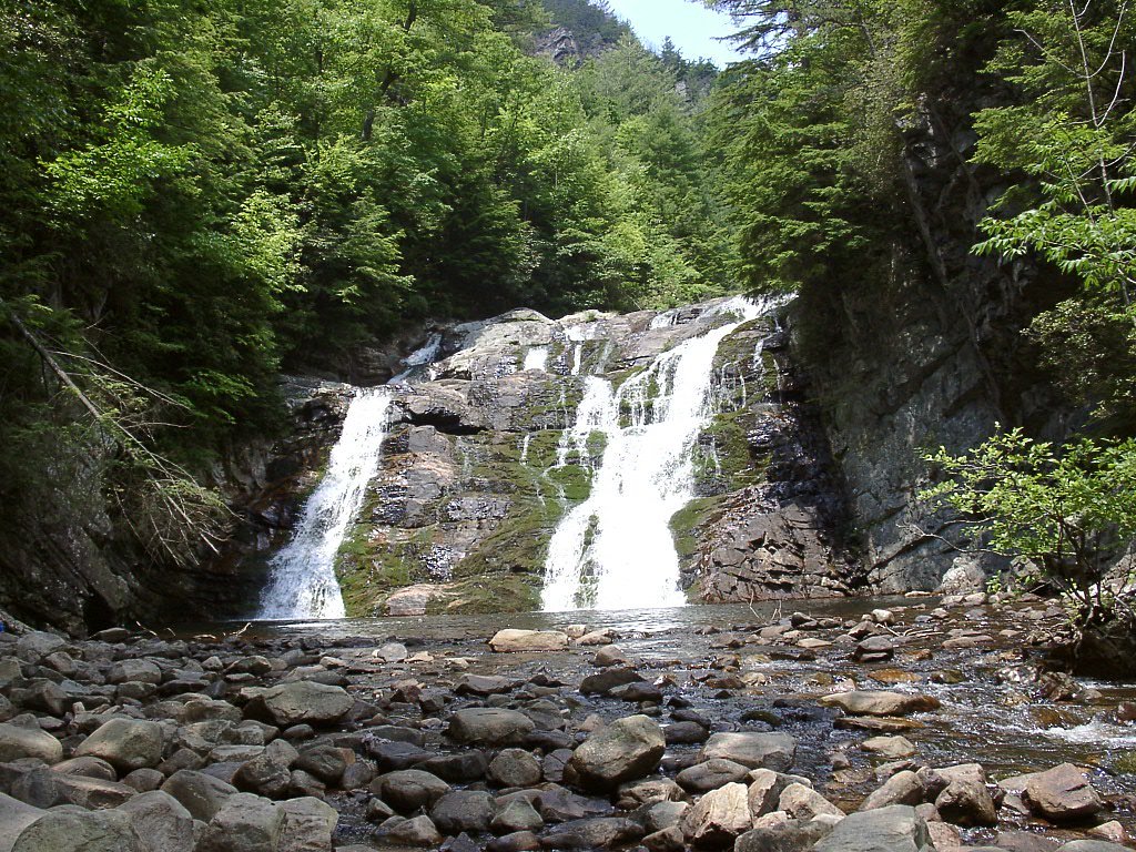
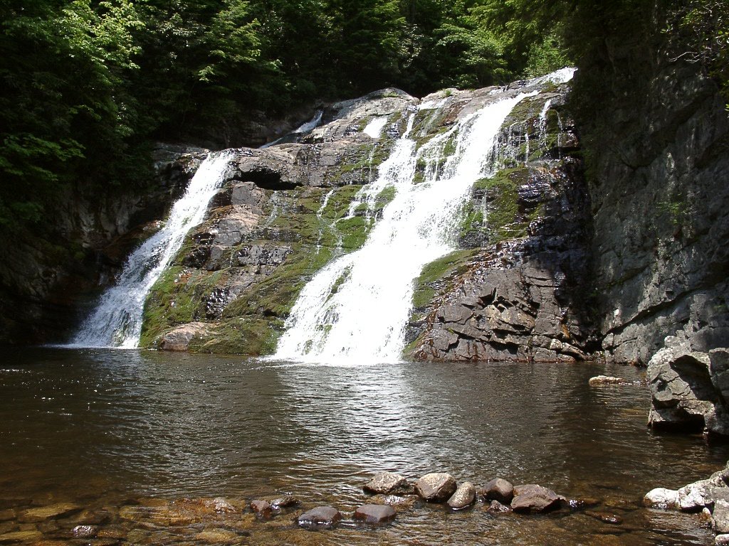
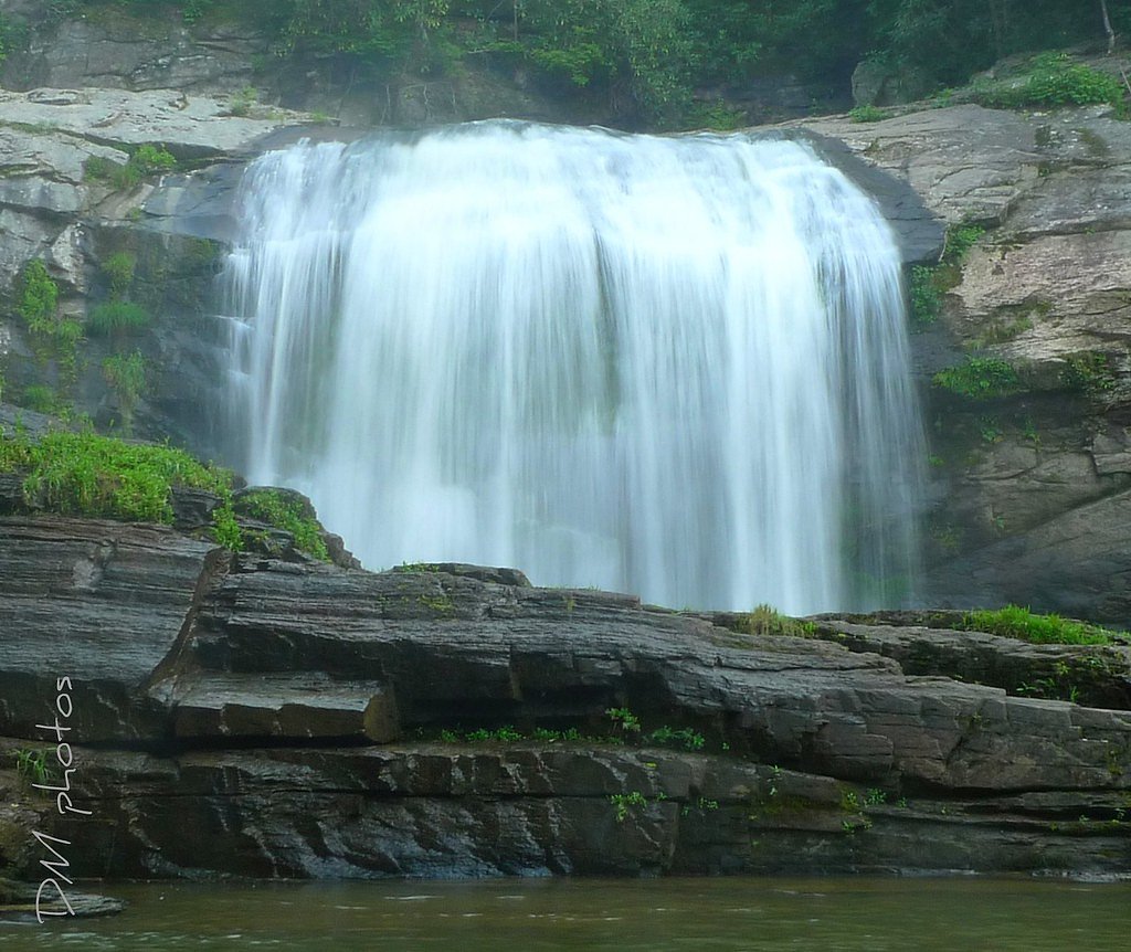
About Laurel Falls
Laurel Falls is a picturesque waterfall located in the Cherokee National Forest near Hampton, Tennessee. It is a popular destination for hikers and nature enthusiasts, offering a serene setting with cascading water surrounded by lush forest.
The Setting
Laurel Falls sits at 2,149 feet within Cherokee National Forest, fed by the Watauga River, in the hills of Tennessee.
Trail & Hike Details
The Approach
The moderate hike follows High Water Alternate Trail (#502), a 2.3-mile out-and-back trail over n/a. Expect 300 feet of elevation gain with grades of N/A.
USFS Trail
HIGH WATER ALTERNATE TRAIL #502
Trail Class
Class 0
Surface
Avg Grade
USFS Segment
0.32 miTrail Description
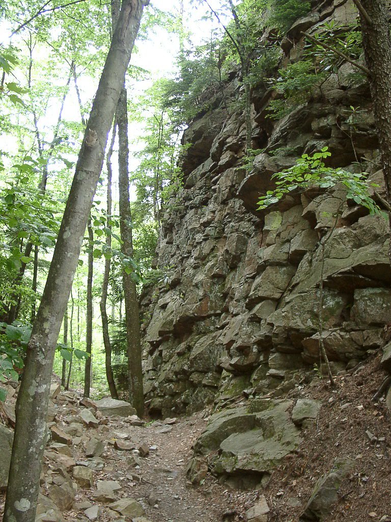
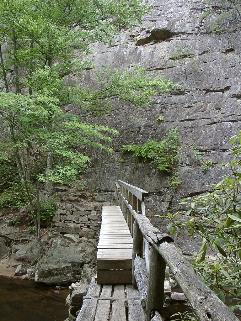
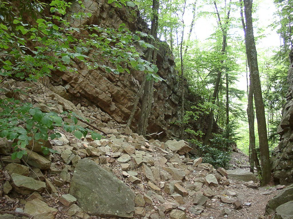
The trail to Laurel Falls is a moderately challenging out-and-back hike that follows a well-maintained path through the Cherokee National Forest. The trail includes some rocky and uneven sections, as well as a few small stream crossings. The waterfall is located at the end of the trail, offering a rewarding view for hikers.
What to Expect
Dogs are welcome.
Accessibility
The trail is not wheelchair accessible. Uneven terrain and elevation changes require steady footing.
Frequently Asked Questions
🐶 Are Dogs Allowed at Laurel Falls?
✅ Dogs are allowed
Are There Any Fees or Permits Required?
🆖 No fees required
🏊 Is There Swimming at Laurel Falls?
❌ Swimming is not allowed
When to Visit
Spring and fall are the best times to visit Laurel Falls, as the weather is mild, and the waterfall flow is typically stronger due to seasonal rainfall.
Seasonal Access
The best time to visit is Spring, Summer, and Fall. Winter access may be limited. Check with Cherokee National Forest for seasonal road closures.
Safety Information
Exercise caution around the waterfall, as rocks can be slippery. Be prepared for changing weather conditions, and carry a map or GPS device. Cell service may be limited in the area.
Current Water Conditions
1,100 ft³/s
Current discharge — how much water is flowing
About average for this time of year
Based on 9 years of record
4.02 ft
Water depth at gauge
7-Day Discharge Trend
What does this mean for your visit?
Flow is about average for this time of year.
About This Gauge
This gauge is on a nearby waterway and may not reflect exact conditions at the falls.
7-Day Flow Outlook
Based on the USGS gauge WATAUGA RIVER AT ELIZABETHTON, TN (12 km away).
Today
Moderate
1100 cfs
8/10Tomorrow
Moderate
1071 cfs
6/10Wed
Moderate
1390 cfs
6/10Thu
Moderate
1269 cfs
6/10Fri
Moderate
1187 cfs
6/10Sat
Moderate
1293 cfs
6/10Sun
Moderate
1112 cfs
6/10Best window: Today — moderate flow, areas of fog then mostly sunny (trip score 8/10).
Best time of year: this gauge typically runs highest from mid February to mid March, peaking in May.
How we calculate this
This is a transparent outlook, not a precise forecast. We take the waterfall's current flow strength (how it ranks against its historical normal for today, from the nearest USGS stream gauge), carry that ranking forward along the gauge's seasonal curve, and nudge it for forecast rain. Confidence is highest for the next day or two and falls further out. Always check official conditions and your own judgment before visiting — high flows can be dangerous.
Know when to go.
Get a free email alert when waterfalls near Hampton hit peak flow. We only send when conditions are worth the trip — no weekly newsletters, no spam.
Weather Forecast
Location & Access
Getting There
Laurel Falls is accessible via the Dennis Cove Trailhead, located off Dennis Cove Road near Hampton, Tennessee. The trailhead is well-marked and can be reached by car.
Get Directions on Google MapsParking
Parking is available at the Dennis Cove Trailhead, but it may be limited during peak seasons. Arrive early to secure a spot.
Elevation
2,149 feet above sea level
Coordinates
36.272964° N, -82.135042° W
Land Management
Managed by USFS
Visitor Tips & Gear
Wear sturdy hiking shoes, as the trail can be rocky and uneven. Bring water and snacks, especially during warmer months. Arrive early to avoid crowds and secure parking. Be cautious around the waterfall, as rocks may be slippery.
As an Amazon Associate, we earn from qualifying purchases.
With 2.3 miles and 300 ft of elevation gain, sturdy boots and trekking poles will help on this moderate trail. Sun exposure on the trail makes good sun protection a must in summer.

Polarized Sunglasses (Knockaround)
Cuts glare off the water so you actually see the falls — and your photos turn out better too.

Columbia Watertight II Rain Jacket
Packs into its own pocket, seam-sealed, and keeps you dry from spray and surprise rain.

Earth Pak Waterproof Dry Bag
Keeps your phone and gear dry when waterfall mist soaks everything else.

Waterproof Phone Pouch (AiRunTech)
Cheap insurance — take photos right next to the falls without killing your phone.

Timberland Euro Sprint Mid Waterproof
Trusted waterproof boot with premium leather and grippy rubber sole — reliable on rocky, wet trails.

TrailBuddy Trekking Poles
Lightweight aluminum, cork grips, and flip-locks that actually hold — a best-seller for good reason.
Where to Stay

Stringer's Peak Retreat

The Embers Hotel

The Sanctuary Company Johnson City

Graystone Lodge, an Ascend Collection Hotel
Browse vacation cabins and private rentals nearby
Unique outdoor stays — tents, yurts, and treehouses
Rent a campervan or RV for your waterfall road trip
Some links are affiliate links. We may earn a commission at no extra cost to you.
Nearby Campground
DENNIS COVE CAMPGROUND
1.7 miles away · 14 sites
Overview Dennis Cove Campground is a secluded campground along Laurel Fork Creek at an elevation of 2,650 feet in Carter County. This remote developed campground is popular with those seeking a rustic experience. The altitude, creek side location and lush forest surroundings make Dennis Cove particularly desirable during hot summer months. With 15 campsites, Dennis Cove is a great option for family camping. Recreation Along with camping, Laurel Fork Creek is stocked with rainbow trout below the
Book on Recreation.govNearby Hot Springs
Hot springs near Hampton, Tennessee

Looking for a soak after your hike? Explore more hot springs near Hampton, Tennessee on SoakingSprings.
Explore Tennessee springsAdditional Information
Nearby Attractions
Other nearby attractions include the Appalachian Trail, Watauga Lake, and Roan Mountain State Park.
Wildlife
The area is home to various wildlife, including deer, birds, and small mammals. Be cautious of snakes, especially during warmer months.
Cities near Laurel Falls
Nearby Waterfalls
Other waterfalls named Laurel Falls
5 other waterfalls share this name across the U.S.
Writing about Laurel Falls? Embed this waterfall on your site for free.