
Photo Credits (5)
Difficulty
Easy
Trail Length
2.6 miles
Trail Type
Out And Back
Elevation Gain
314 ft
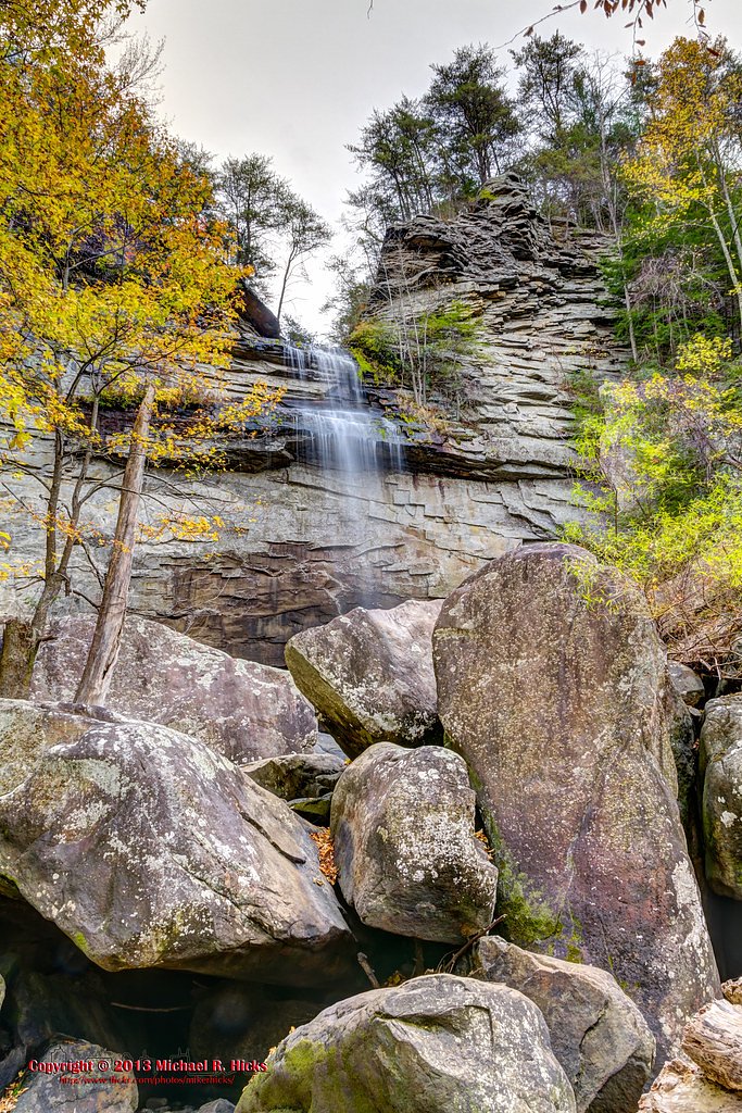
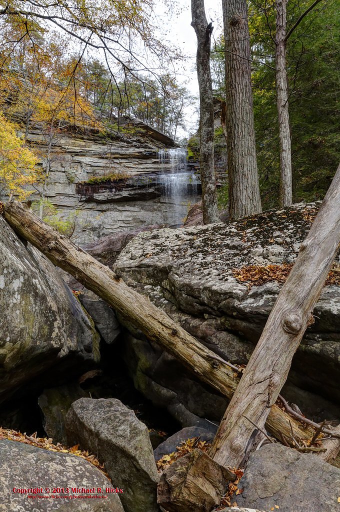
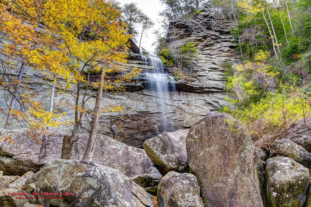
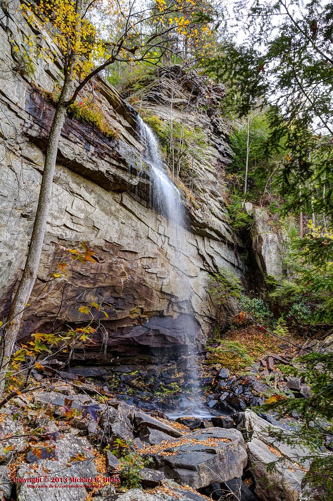
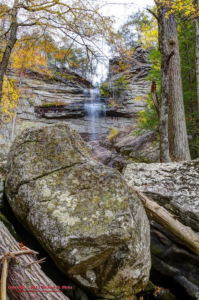
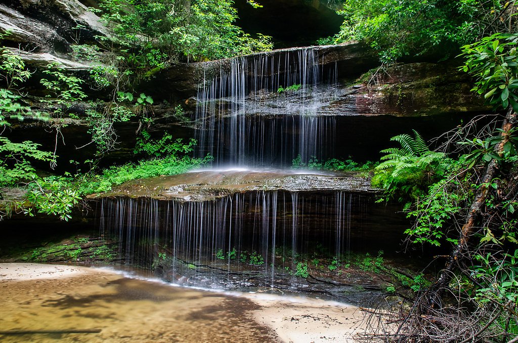
About Laurel Falls
Laurel Falls is a picturesque cascade tucked inside the Laurel Snow Pocket Designated State Natural Area, managed by SPR. The falls drop a combined 80 feet and take their name from the mountain laurel shrubs that bloom along the route each spring, lending the walk a burst of color and fragrance. Visitors will find both an upper and lower section to admire, making it a rewarding short destination for photographers and families alike. The setting is quietly wooded and inviting, with a trail that stays accessible without sacrificing a sense of wildness. Managed as part of the SCA-designated Laurel Snow Pocket unit, the site offers an easy, scenic outing for hikers who want a relatively short, low-effort waterfall experience within a protected natural area.
The Setting
Laurel Falls sits at 1,575 feet within Laurel Snow Pocket Designated State Natural Area, in the hills of Tennessee. The falls drop 80 feet.
Height: 80 feet
Trail & Hike Details
The Approach
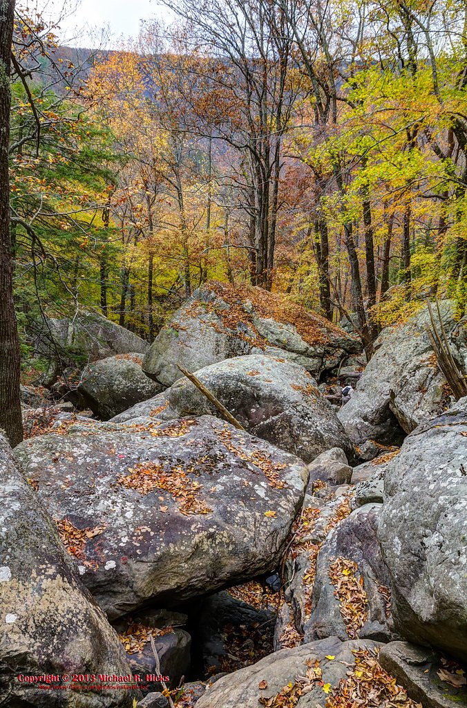
The easy 2.6-mile out-and-back trail gains 314 feet of elevation on the way to the falls.
Trail Description
This is an easy out-and-back trail of approximately 2.6 miles with about 314 feet of elevation gain. The grade is gentle and the route is rated easy, making it suitable for most hikers and families; the path is well-defined and primarily a short, steady climb to the viewing areas for the upper and lower sections of the falls.
What to Expect
The falls cascade 80 feet.
Accessibility
The trail is not wheelchair accessible. Uneven terrain and elevation changes require steady footing.
Frequently Asked Questions
🐶 Are Dogs Allowed at Laurel Falls?
❌ Dogs are not allowed
Are There Any Fees or Permits Required?
🤑 Fee: $5.00
🏊 Is There Swimming at Laurel Falls?
❌ Swimming is not allowed
When to Visit
Spring and fall are the best times to visit due to pleasant weather and seasonal scenery. Summer is also popular, but the trail can be crowded.
Seasonal Access
The best time to visit is Spring, Summer, and Fall. Winter access may be limited.
Safety Information
The trail can be slippery near the waterfall, so exercise caution. Be aware of wildlife and do not feed or approach animals. Carry water and be prepared for sudden weather changes.
Know when to go.
Get a free email alert when waterfalls near Dayton hit peak flow. We only send when conditions are worth the trip — no weekly newsletters, no spam.
Weather Forecast
Location & Access
Getting There
Laurel Falls is located off Little River Road in the Great Smoky Mountains National Park. The trailhead is well-marked and easily accessible by car.
Get Directions on Google MapsParking
Parking is available at the trailhead, but it can fill up quickly, especially during peak seasons. Arrive early to secure a spot.
Elevation
1,575 feet above sea level
Coordinates
35.547569° N, -85.024121° W
Land Management
Managed by SPR
Visitor Tips & Gear
Arrive early to avoid crowds and secure parking. Wear sturdy shoes as the trail can be slippery near the waterfall. Bring water and snacks, and be prepared for limited cell service in the area.
As an Amazon Associate, we earn from qualifying purchases.
This easy 2.6 miles hike is straightforward — comfortable trail shoes and plenty of water should do. Sun exposure on the trail makes good sun protection a must in summer.

Polarized Sunglasses (Knockaround)
Cuts glare off the water so you actually see the falls — and your photos turn out better too.

Columbia Watertight II Rain Jacket
Packs into its own pocket, seam-sealed, and keeps you dry from spray and surprise rain.

Earth Pak Waterproof Dry Bag
Keeps your phone and gear dry when waterfall mist soaks everything else.

Waterproof Phone Pouch (AiRunTech)
Cheap insurance — take photos right next to the falls without killing your phone.

JOBY GorillaPod Starter Kit
Wraps around railings and rocks for long-exposure waterfall shots — no flat surface needed.

Osprey Daylite Daypack
Light, organized, and just the right size for a day hike — fits water, snacks, and layers.
Where to Stay

Sleep Inn & Suites Dayton South

Econo Lodge Dayton North

Best Western Dayton

Comfort Inn Dayton South
Browse vacation cabins and private rentals nearby
Unique outdoor stays — tents, yurts, and treehouses
Rent a campervan or RV for your waterfall road trip
Some links are affiliate links. We may earn a commission at no extra cost to you.
Additional Information
Nearby Attractions
Nearby attractions include Cades Cove, Clingmans Dome, and the Sugarlands Visitor Center.
Wildlife
The area is home to diverse wildlife, including black bears, deer, and various bird species. Always maintain a safe distance from wildlife.
Cities near Laurel Falls
Nearby Waterfalls
Other waterfalls named Laurel Falls
5 other waterfalls share this name across the U.S.
Writing about Laurel Falls? Embed this waterfall on your site for free.