Florence Falls
By Armen Suny · Last verified May 2026
Difficulty
Moderate
Trail Length
8.0 miles
Trail Type
Out And Back
Elevation Gain
800 ft
About Florence Falls
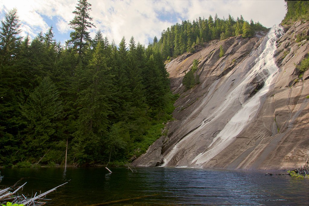
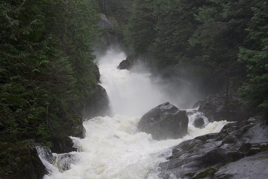
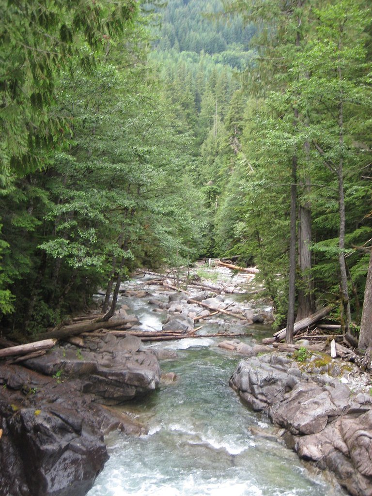
Florence Falls is a tucked-away cascade set in the deep, mossy forests of the Snoqualmie National Forest, managed by the U.S. Forest Service. The falls drop through a verdant canyon, framed by old-growth fir and hemlock, creating a peaceful curtain of water that rewards hikers who make the trek. It’s a classic Pacific Northwest spot — photogenic, quiet, and shaded most of the year. Access to the falls is typically via the USFS Lake Dorothy Trail (Trail #1072). The approach is an out-and-back route of roughly 8.0 miles round trip with about 800 feet of elevation gain, rated moderate. Expect native dirt tread, some short steep pitches, and a few class‑3 scrambling sections where handholds make the route more interesting. Pack good shoes and a sense of adventure — the falls are well worth the effort.
The Setting
Florence Falls sits at 2,070 feet within Snoqualmie National Forest, fed by the South Fork Skykomish River, in the hills of Washington.
Trail & Hike Details
The Approach
The moderate hike follows Lake Dorothy (#1072), a 8.0-mile out-and-back trail over natural surface. Expect 800 feet of elevation gain with grades of 12-20%. The trail is developed (Class 3).
USFS Trail
LAKE DOROTHY #1072
Trail Class
Developed
Surface
Avg Grade
USFS Segment
0.29 miTrail Description
USFS trail: Lake Dorothy Trail (Trail #1072). Trail type: out-and-back; total route ~8.0 miles with ~800 ft elevation gain; difficulty: moderate. Surface: NAT (native material) — mostly natural dirt tread; typical grade: 12–20% on steeper pitches. Class: 3 in places, meaning short sections of scrambling where hands are needed for balance. GIS-recorded segment: 0.29 miles (trail mapping segment); expect uneven tread and natural obstacles; use caution on wet or mossy rock.
What to Expect
Dogs are welcome.
Accessibility
The trail is not wheelchair accessible. Uneven terrain and elevation changes require steady footing.
Frequently Asked Questions
🐶 Are Dogs Allowed at Florence Falls?
✅ Dogs are allowed
Are There Any Fees or Permits Required?
🤑 Fee: $5.00
Permit required
A Northwest Forest Pass or America the Beautiful Pass is required for parking at the trailhead.
🏊 Is There Swimming at Florence Falls?
❌ Swimming is not allowed
When to Visit
Spring and early summer are ideal times to visit, as the waterfall is typically at its fullest due to snowmelt. Fall offers beautiful foliage, while summer provides warmer weather for hiking.
Seasonal Access
The best time to visit is Spring, Summer, and Fall. Winter access may be limited. Check with Snoqualmie National Forest for seasonal road closures.
Safety Information
Be cautious of slippery rocks near the waterfall. Check trail conditions before visiting, especially during winter or after heavy rain, as the trail may become hazardous.
Current Water Conditions
694 ft³/s
Current discharge — how much water is flowing
Lower than usual for this time of year
Based on 9 years of record
18.10 ft
Water depth at gauge
7-Day Discharge Trend
What does this mean for your visit?
Flow is lower than usual for this time of year.
About This Gauge
This gauge is on a nearby waterway and may not reflect exact conditions at the falls.
7-Day Flow Outlook
Based on the USGS gauge SOUTH FORK SKYKOMISH RIVER AT SKYKOMISH, WA (11 km away).
Today
Low
750 cfs
4/10Tomorrow
Low
756 cfs
3/10Sat
Low
679 cfs
4/10Sun
Low
682 cfs
4/10Mon
Low
606 cfs
4/10Tue
Low
578 cfs
4/10Wed
Low
554 cfs
4/10Best window: Today — low flow, chance light rain (trip score 4/10).
Best time of year: this gauge typically runs highest from mid April to late June, peaking in May.
How we calculate this
This is a transparent outlook, not a precise forecast. We take the waterfall's current flow strength (how it ranks against its historical normal for today, from the nearest USGS stream gauge), carry that ranking forward along the gauge's seasonal curve, and nudge it for forecast rain. Confidence is highest for the next day or two and falls further out. Always check official conditions and your own judgment before visiting — high flows can be dangerous.
Know when to go.
Get a free email alert when waterfalls near Skykomish hit peak flow. We only send when conditions are worth the trip — no weekly newsletters, no spam.
Weather Forecast
Location & Access
Getting There
Florence Falls can be accessed via the Lewis River Trail (#31), which is located in the Gifford Pinchot National Forest. The trailhead is typically reached by driving along Forest Road 90.
Get Directions on Google MapsParking
Parking is available at the trailhead for the Lewis River Trail. However, spaces may be limited during peak seasons.
Elevation
2,070 feet above sea level
Coordinates
47.610110° N, -121.391209° W
Land Management
Managed by USFS
Visitor Tips & Gear
Start your hike early to avoid crowds and ensure parking availability. Wear sturdy hiking shoes, as the trail can be uneven and muddy in places. Bring plenty of water and snacks, as there are no facilities along the trail.
As an Amazon Associate, we earn from qualifying purchases.
With 8.0 miles and 800 ft of elevation gain, sturdy boots and trekking poles will help on this moderate trail. Sun exposure on the trail makes good sun protection a must in summer.

Columbia Watertight II Rain Jacket
Packs into its own pocket, seam-sealed, and keeps you dry from spray and surprise rain.

Earth Pak Waterproof Dry Bag
Keeps your phone and gear dry when waterfall mist soaks everything else.

Waterproof Phone Pouch (AiRunTech)
Cheap insurance — take photos right next to the falls without killing your phone.

Timberland Euro Sprint Mid Waterproof
Trusted waterproof boot with premium leather and grippy rubber sole — reliable on rocky, wet trails.

TrailBuddy Trekking Poles
Lightweight aluminum, cork grips, and flip-locks that actually hold — a best-seller for good reason.

Sawyer Squeeze Water Filter
The backcountry standard — filters 99.9% of bacteria and weighs just 3 oz.
Where to Stay

Snoqualmie Inn by Hotel America

Moon River Suites #5

Luxury A-Frame with Hot Tub, Fireplace & Firepit

Moon River Suites #3
Browse vacation cabins and private rentals nearby
Unique outdoor stays — tents, yurts, and treehouses
Rent a campervan or RV for your waterfall road trip
Some links are affiliate links. We may earn a commission at no extra cost to you.
Nearby Campground
Money Creek Campground
8.3 miles away · 24 sites
Overview Situated on the banks of the South Fork Skykomish River in Mt. Baker-Snoqualmie National Forest, Money Creek campground offers some of the most stunning scenery in the northern Cascade Range in Washington. Scattered beneath a towering canopy of old-growth forest, the sites in this campground are widely spaced and several are at the river's edge, making it an ideal setting for visitors wanting to camp in a private, rustic setting.Recreation In addition to being a prime location for hiking
Book on Recreation.govNearby Hot Springs
Hot springs near Skykomish, Washington
Goldmeyer Hot Springs
Goldmeyer Hot Springs emerges at 127 degrees in the central Cascades, producing water 78.9 degrees above ambient temperature at...
Scenic Hot Springs
Scenic Hot Springs delivers genuinely hot water at 122 degrees Fahrenheit at 2,246 feet elevation in the Cascade Mountains near...
Garland Mineral Springs
Garland Mineral Springs flows at 84 degrees in the Snoqualmie National Forest, producing water 39.6 degrees above ambient tempe...
Lester Hot Springs
This 120-degree spring sits within the City of Tacoma Watershed at 1,582 feet elevation, emerging 72.3 degrees above ambient in...
Kennedy Hot Spring
Kennedy Hot Spring flows at 100 degrees at 3,520 feet elevation in the Mt. Baker National Forest, emerging 58.7 degrees above a...
Gamma Hot Springs
Gamma Hot Springs produces 140-degree water at 5,397 feet elevation in the Mt. Baker National Forest, emerging 104.6 degrees ab...
Looking for a soak after your hike? Explore more hot springs near Skykomish, Washington on SoakingSprings.
Explore Washington springsAdditional Information
Nearby Attractions
Other waterfalls along the Lewis River Trail, such as Lower Lewis River Falls and Middle Lewis River Falls.
Wildlife
The area is home to deer, birds, and other forest wildlife. Be cautious of bears and carry bear spray if hiking in remote areas.
Cities near Florence Falls
Nearby Waterfalls
Other waterfalls named Florence Falls
1 other waterfall shares this name across the U.S.
Writing about Florence Falls? Embed this waterfall on your site for free.