Photo Credits (5)
Difficulty
Moderate
Trail Length
9.0 miles
Trail Type
Out And Back
Elevation Gain
700 ft
About Otter Falls
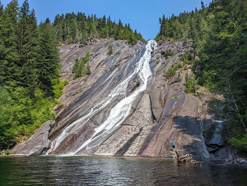
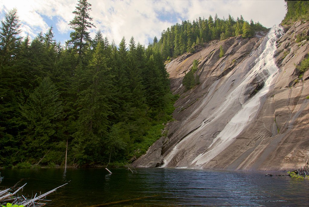
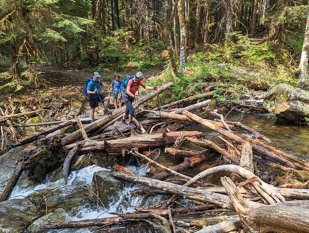
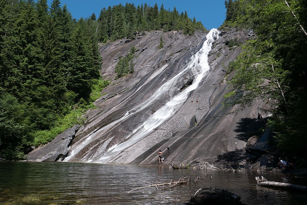
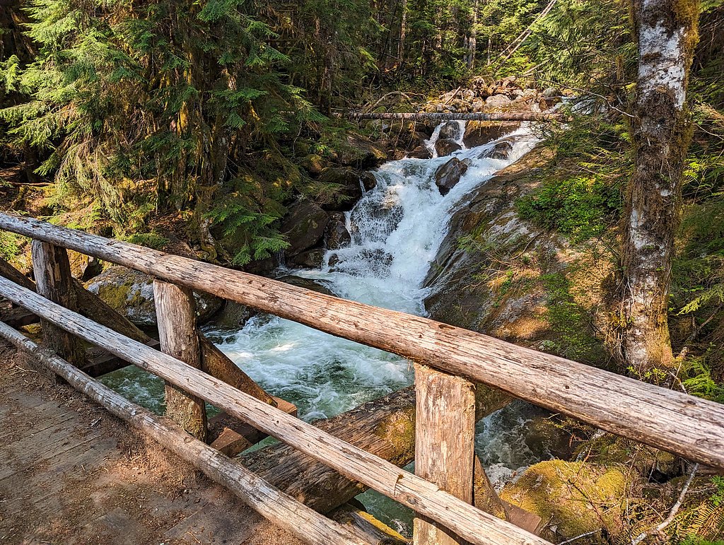
Otter Falls (also called Otter Slide, Otter Slide Falls or Otter Creek Falls) tumbles down the southern wall of Mount Anderson in King County, Washington, within the Alpine Lakes Wilderness. Managed by the U.S. Forest Service as part of Snoqualmie National Forest, the falls have a cumulative drop of about 1,600 feet, though the mountainside’s moderate pitch means only roughly a third of that height is visible from the valley floor. The creek’s drainage is fairly small and runs mostly over granite that doesn’t retain water, so flow can be modest outside peak snowmelt—making for dramatic granite slides and photogenic cascades when conditions are right. The trailhead approach follows forested terrain along the Taylor River and uses sections of the USFS NORDRUM LAKE (Trail #1004). Expect a moderately challenging backcountry outing: the route to Otter Falls is typically done as a 9.0-mile out-and-back with about 700 feet of elevation gain and is rated moderate. If you’re camping, Middle Fork Campground is the closest option at roughly 7.1 km away, and the entire area is managed by the USFS, so plan for wilderness conditions and variable water flow.
The Setting
Otter Falls sits at 1,804 feet within Snoqualmie National Forest, fed by the South Fork Skykomish River, in the hills of Washington.
Trail & Hike Details
The Approach
The moderate hike follows Nordrum Lake (#1004), a 9.0-mile out and back trail over natural surface. Expect 700 feet of elevation gain with grades of 12-20%. The trail is moderately developed (Class 2).
USFS Trail
NORDRUM LAKE #1004
Trail Class
Moderately Developed
Surface
Avg Grade
USFS Segment
0.24 miTrail Description
The hike to Otter Falls is an out-and-back of about 9.0 miles round trip with roughly 700 feet of elevation gain and a moderate difficulty rating. Much of the approach is forested terrain along the Taylor River; footing is on native surfaces (USFS surface: NAT - native material). The route includes sections of USFS NORDRUM LAKE, Trail #1004 (mapped GIS segment 0.24 miles), which is Class 2 and is characterized by a typical grade in the 12–20% range. Expect mostly singletrack on natural tread with some steeper pitches; the trail is suitable for experienced day-hikers comfortable with sustained grades and backcountry conditions.
What to Expect
Dogs are welcome.
Accessibility
The trail is not wheelchair accessible. Uneven terrain and elevation changes require steady footing.
Frequently Asked Questions
🐶 Are Dogs Allowed at Otter Falls?
✅ Dogs are allowed
Are There Any Fees or Permits Required?
🆖 No fees required
🏊 Is There Swimming at Otter Falls?
❌ Swimming is not allowed
When to Visit
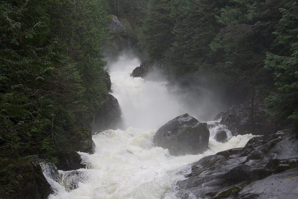
Spring and early summer are ideal for visiting Otter Falls, as the waterfall flow is strongest due to snowmelt. Fall offers beautiful foliage, while winter may bring snow, making the trail more challenging.
Seasonal Access
The best time to visit is Spring, Summer, and Fall. Winter access may be limited. Check with Snoqualmie National Forest for seasonal road closures.
Safety Information
The trail can be slippery after rain, and snow may make it difficult to navigate in winter. Always check weather conditions before heading out and carry the Ten Essentials.
Current Water Conditions
687 ft³/s
Current discharge — how much water is flowing
Lower than usual for this time of year
Based on 9 years of record
18.09 ft
Water depth at gauge
7-Day Discharge Trend
What does this mean for your visit?
Flow is lower than usual for this time of year.
About This Gauge
This gauge is on a nearby waterway and may not reflect exact conditions at the falls.
7-Day Flow Outlook
Based on the USGS gauge SOUTH FORK SKYKOMISH RIVER AT SKYKOMISH, WA (16 km away).
Today
Barely Flowing
687 cfs
4/10Tomorrow
Low
723 cfs
3/10Sat
Low
673 cfs
4/10Sun
Low
675 cfs
4/10Mon
Low
600 cfs
4/10Tue
Low
572 cfs
4/10Wed
Low
549 cfs
4/10Best window: Today — barely flowing flow, mostly cloudy (trip score 4/10).
Best time of year: this gauge typically runs highest from mid April to late June, peaking in May.
How we calculate this
This is a transparent outlook, not a precise forecast. We take the waterfall's current flow strength (how it ranks against its historical normal for today, from the nearest USGS stream gauge), carry that ranking forward along the gauge's seasonal curve, and nudge it for forecast rain. Confidence is highest for the next day or two and falls further out. Always check official conditions and your own judgment before visiting — high flows can be dangerous.
Know when to go.
Get a free email alert when waterfalls near Baring hit peak flow. We only send when conditions are worth the trip — no weekly newsletters, no spam.
Weather Forecast
Location & Access
Getting There
Otter Falls is accessed via the Snoqualmie Lake Trailhead, located off Forest Road 56 near North Bend, Washington. The trailhead is approximately a 1.5-hour drive from Seattle.
Get Directions on Google MapsParking
Parking is available at the Snoqualmie Lake Trailhead. The lot may fill up during weekends and peak seasons, so arriving early is recommended.
Hours
Elevation
1,804 feet above sea level
Coordinates
47.587888° N, -121.467042° W
Land Management
Managed by USFS
Visitor Tips & Gear
Wear sturdy hiking shoes as the trail can be muddy in places, especially after rain. Bring insect repellent during the summer months. Cell service is limited, so download maps or directions in advance.
As an Amazon Associate, we earn from qualifying purchases.
With 9.0 miles and 700 ft of elevation gain, sturdy boots and trekking poles will help on this moderate trail. Sun exposure on the trail makes good sun protection a must in summer.

Polarized Sunglasses (Knockaround)
Cuts glare off the water so you actually see the falls — and your photos turn out better too.

Columbia Watertight II Rain Jacket
Packs into its own pocket, seam-sealed, and keeps you dry from spray and surprise rain.

Earth Pak Waterproof Dry Bag
Keeps your phone and gear dry when waterfall mist soaks everything else.

Waterproof Phone Pouch (AiRunTech)
Cheap insurance — take photos right next to the falls without killing your phone.

Timberland Euro Sprint Mid Waterproof
Trusted waterproof boot with premium leather and grippy rubber sole — reliable on rocky, wet trails.

TrailBuddy Trekking Poles
Lightweight aluminum, cork grips, and flip-locks that actually hold — a best-seller for good reason.
Where to Stay

Snoqualmie Inn by Hotel America

Moon River Suites #5

Moon River Suites #4

Moon River Suites #3
Browse vacation cabins and private rentals nearby
Unique outdoor stays — tents, yurts, and treehouses
Rent a campervan or RV for your waterfall road trip
Some links are affiliate links. We may earn a commission at no extra cost to you.
Nearby Campground
Middle Fork Campground
4.4 miles away · 39 sites
Overview This campground is located along the Middle Fork of the scenic Snoqualmie River in Mt. Baker-Snoqualmie National Forest. Beneath a canopy of towering Douglas fir, cedar and Western hemlock, and located near several hiking trails within a short driving distance, this campground is a perfect site for both individual and small group camping excursions.Recreation In addition to being a prime location for hiking, fishing, horseback riding and picnicking in summer and early fall, Middle Fork o
Book on Recreation.govNearby Hot Springs
Hot springs near Baring, Washington
Goldmeyer Hot Springs
Goldmeyer Hot Springs emerges at 127 degrees in the central Cascades, producing water 78.9 degrees above ambient temperature at...
Scenic Hot Springs
Scenic Hot Springs delivers genuinely hot water at 122 degrees Fahrenheit at 2,246 feet elevation in the Cascade Mountains near...
Garland Mineral Springs
Garland Mineral Springs flows at 84 degrees in the Snoqualmie National Forest, producing water 39.6 degrees above ambient tempe...
Lester Hot Springs
This 120-degree spring sits within the City of Tacoma Watershed at 1,582 feet elevation, emerging 72.3 degrees above ambient in...
Kennedy Hot Spring
Kennedy Hot Spring flows at 100 degrees at 3,520 feet elevation in the Mt. Baker National Forest, emerging 58.7 degrees above a...
Gamma Hot Springs
Gamma Hot Springs produces 140-degree water at 5,397 feet elevation in the Mt. Baker National Forest, emerging 104.6 degrees ab...
Looking for a soak after your hike? Explore more hot springs near Baring, Washington on SoakingSprings.
Explore Washington springsAdditional Information
Nearby Attractions
Nearby attractions include Snoqualmie Falls, Rattlesnake Ledge, and the Alpine Lakes Wilderness.
Wildlife
Hikers may encounter wildlife such as deer, birds, and small mammals. Be cautious of bears and carry bear spray if hiking in the area.
Cities near Otter Falls
Nearby Waterfalls
Other waterfalls named Otter Falls
2 other waterfalls share this name across the U.S.
Writing about Otter Falls? Embed this waterfall on your site for free.