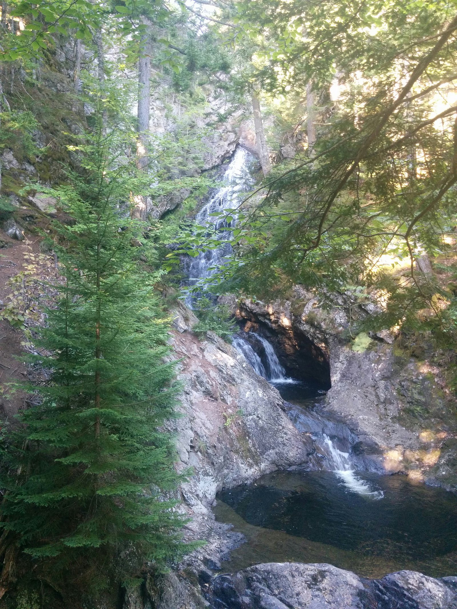
Hidden Falls
By Armen Suny · Last verified Jun 2026
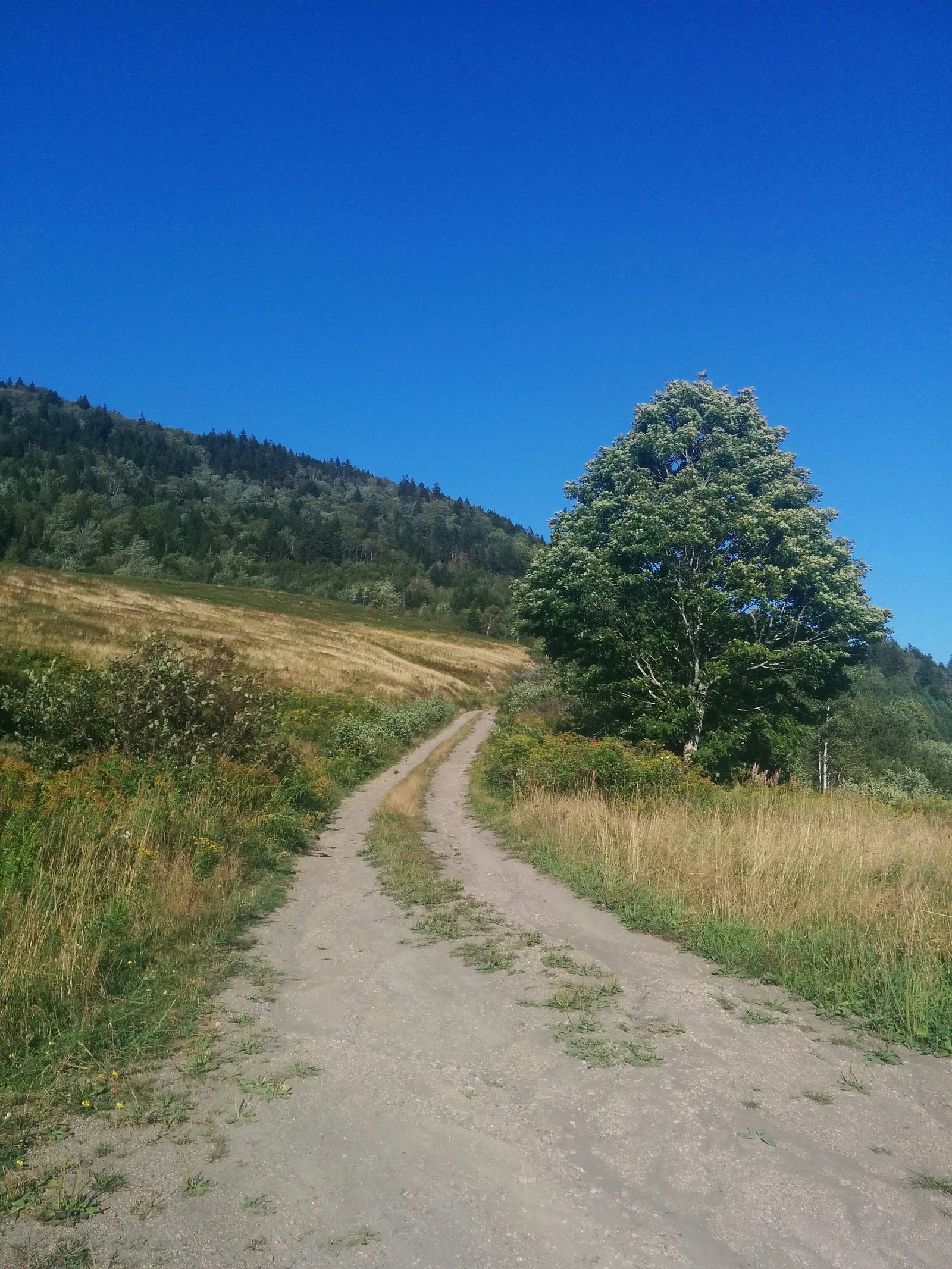
Photo Credits (2)
Difficulty
Moderate
Trail Length
6.0 km
Trail Type
Out And Back
About Hidden Falls
Hidden Falls is a small stream waterfall located in western Nova Scotia, roughly between Amherst (≈21.3 miles), Windsor (≈27.7 miles) and Moncton (≈55.5 miles). Coordinates: 45.4316, -64.2527. The waterfall appears to be a modest cascade or plunge on a forested stream and is likely seasonal, flow is typically highest in spring and after heavy rain. Exact height and official site management are not clearly documented online; information below is conservative and may reflect local/unofficial access.
Why This Waterfall Exists
Hidden Falls flows over layered sedimentary rock laid down about 299-359 million years ago. Over time, the stream has worn through these layers at different rates, creating the step that forms the waterfall.
Trail & Hike Details
Trail Description
Trail information is not well documented in major trail databases. Visitors should expect an informal, likely unmaintained footpath from a roadside parking area down to the stream. The approach may be steep in places with roots, rocks, and mud; route-finding could be required. There may be short scramble sections to get viewpoints near the top or base. Trails are likely under 2–3 miles round trip but this is not confirmed.
What to Expect
Wooded surroundings typical of Nova Scotia mixed Acadian forest, a small-to-medium cascade over ledge or bedrock, seasonal flow variability (higher in spring/rainy periods, lower in late summer/drought). Little to no infrastructure (no boardwalks, restrooms, or staffed facilities expected). Limited cell service may occur in more remote spots.
Accessibility
The trail is not wheelchair accessible. Uneven terrain and elevation changes require steady footing.
Frequently Asked Questions
🐶 Are Dogs Allowed at Hidden Falls?
❌ Dogs are not allowed
Are There Any Fees or Permits Required?
🆖 No fees required
🏊 Is There Swimming at Hidden Falls?
❌ Swimming is not allowed
When to Visit
Late spring (snowmelt and seasonal rains) for highest flows, or after rainy periods in summer/fall. Mornings and weekdays typically have fewer visitors. Avoid winter unless you are experienced in icy trail travel, falls and plunge pools can form hazardous ice.
Seasonal Access
The best time to visit is Spring, Summer, and Fall. Winter access may be limited. Check with the managing park or local authority for current conditions.
Safety Information
Hazards include slippery wet rock and ledges, unstable banks, rapid rise in water after rain, limited or no cell service in some areas, and possible private property boundaries. Weather can change quickly, layers and waterproof clothing recommended. If in doubt about land access, verify with local municipal offices or landowner signage. Use caution near edges and do not climb unstable rock faces.
Current Water Conditions
0.1 m³/s
Current discharge — how much water is flowing
Much lower than usual for this time of year
Based on 53 years of record
0.81 m
Water depth at gauge
7-Day Discharge Trend
What does this mean for your visit?
Flow is well below normal for this time of year, so the waterfall may be a trickle.
About This Gauge
This gauge is on a nearby waterway and may not reflect exact conditions at the falls.
7-Day Flow Outlook
Based on the WSC gauge KELLEY RIVER (MILL CREEK) AT EIGHT MILE FORD (23 km away).
Today
Barely Flowing
0.1 m³/s
3/10Tomorrow
Barely Flowing
0.1 m³/s
4/10Tue
Barely Flowing
0.1 m³/s
4/10Wed
Barely Flowing
0.1 m³/s
3/10Thu
Low
0.1 m³/s
4/10Fri
Barely Flowing
0.1 m³/s
4/10Sat
Barely Flowing
0.1 m³/s
3/10Best window: Tomorrow — barely flowing flow, partly cloudy (trip score 4/10).
Best time of year: this gauge typically runs highest from late March to early May, peaking in April.
How we calculate this
This is a transparent outlook, not a precise forecast. We take the waterfall's current flow strength (how it ranks against its historical normal for today, from the nearest WSC stream gauge), carry that ranking forward along the gauge's seasonal curve, and nudge it for forecast rain. Confidence is highest for the next day or two and falls further out. Always check official conditions and your own judgment before visiting — high flows can be dangerous.
Know when to go.
Get a free email alert when waterfalls near Amherst hit peak flow. We only send when conditions are worth the trip — no weekly newsletters, no spam.
Weather Forecast
Location & Access
Getting There
From Amherst the site is a roughly 20–25 mile drive (approximate) toward the coordinates 45.4316, -64.2527. Nearest towns mentioned by local references are Amherst (NS) and communities toward the Minas Basin / Chignecto Isthmus region. Access likely requires driving on local secondary roads; final approach may be on gravel roads or a short forest track. Confirm route locally and use a GPS with the provided coordinates.
Get Directions on Google MapsParking
No confirmed official parking lot. Expect a small roadside pullout or informal parking on a shoulder or at a trailhead. Park only where allowed, avoid blocking private driveways or gates. If signage is present follow posted restrictions.
Elevation
84 metres above sea level
Coordinates
45.431641° N, -64.252666° W
Visitor Tips & Gear
• Wear sturdy, waterproof footwear, trail may be muddy and slippery. • Expect minimal signage; bring a map/GPS with the coordinates. • Check private land/owner access before crossing fences or gates, some waterfall sites in Nova Scotia are on or abut private property. • Avoid visiting alone in remote areas; tell someone your plans. • Bring insect repellent in summer; ticks can be present. • Avoid cliff edges and wet rocks; they are very slippery. • Leave no trace, pack out all garbage.
Where to Stay
Browse vacation cabins and private rentals nearby
Unique outdoor stays — tents, yurts, and treehouses
Rent a campervan or RV for your waterfall road trip
Some links are affiliate links. We may earn a commission at no extra cost to you.
Nearby Campground
Glooscap Campground & RV
5.5 km away
Additional Information
Nearby Attractions
Nearest service towns include Amherst (historic downtown and services). Beyond local communities, broader regional attractions in western Nova Scotia and neighbouring New Brunswick include coastal viewpoints and historic sites, confirm driving distances before planning day trips.
Wildlife
Typical local species may include white-tailed deer, small mammals, songbirds, waterfowl, and the potential for black bears or moose in rural woodlands. Ticks and biting insects are common in warmer months. Always store food securely and be bear-aware where applicable.
Cities near Hidden Falls
Nearby Waterfalls
Other waterfalls named Hidden Falls
11 other waterfalls share this name across Canada.
Writing about Hidden Falls? Embed this waterfall on your site for free.