Photo Credits (4)
Difficulty
Moderate
Trail Length
2.5 miles
Trail Type
Out And Back
Elevation Gain
300 ft
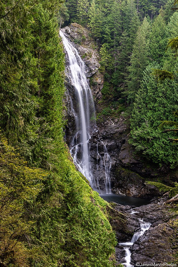
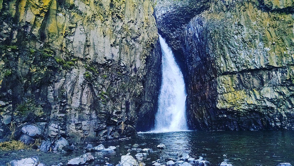
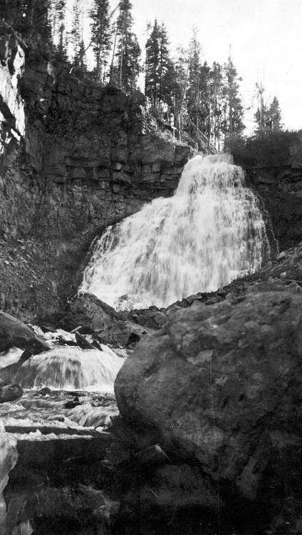
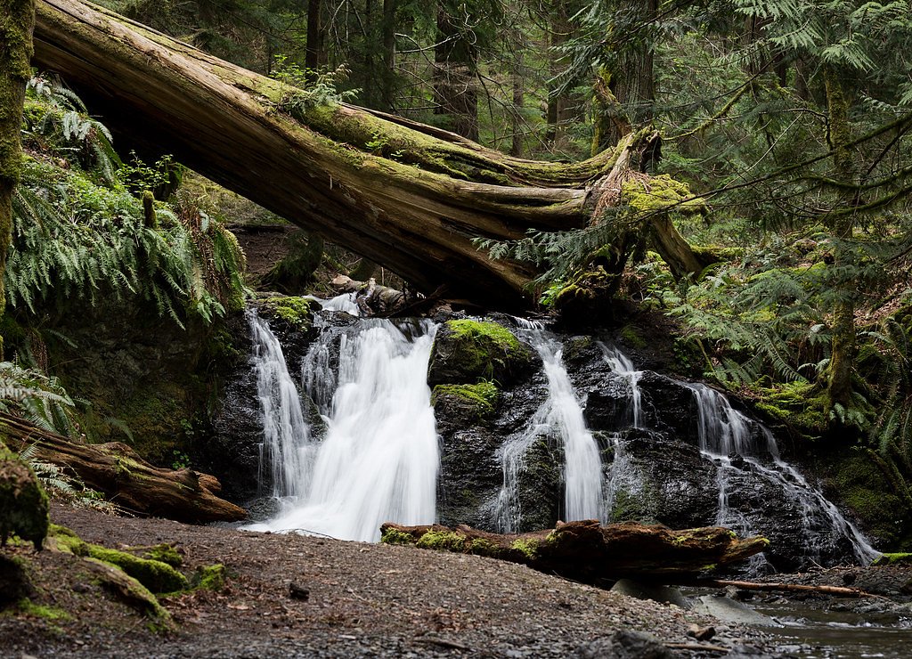
About Hidden Falls
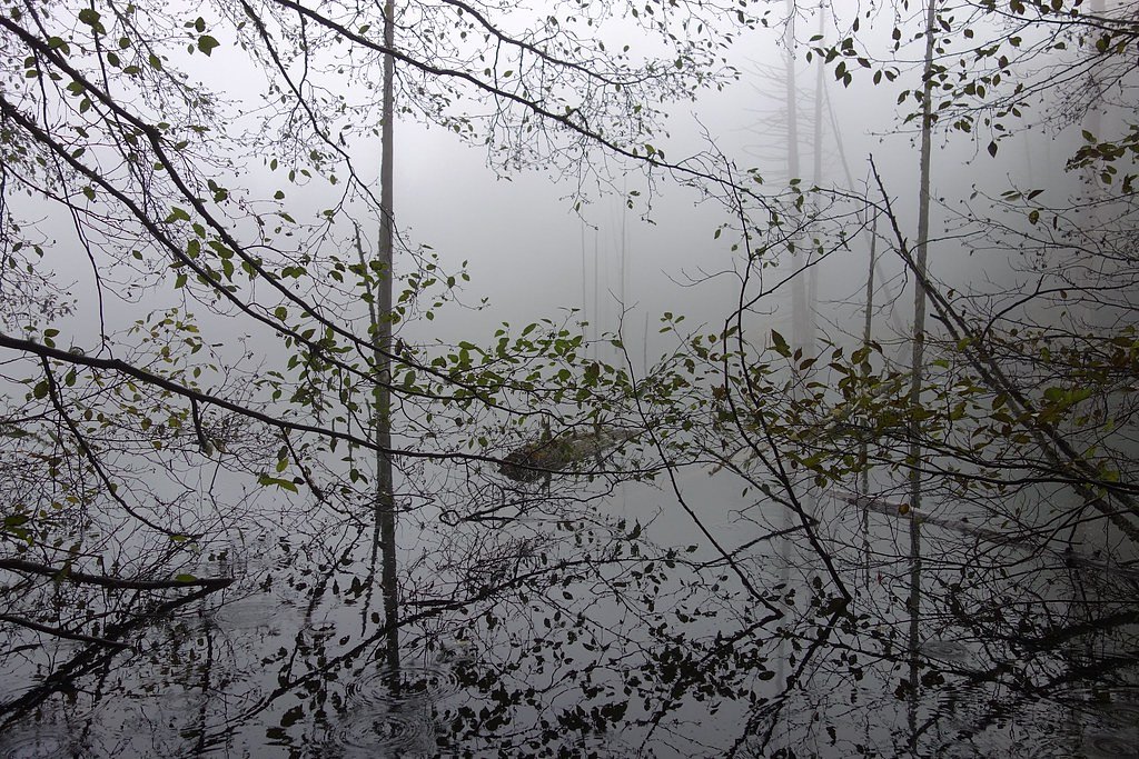
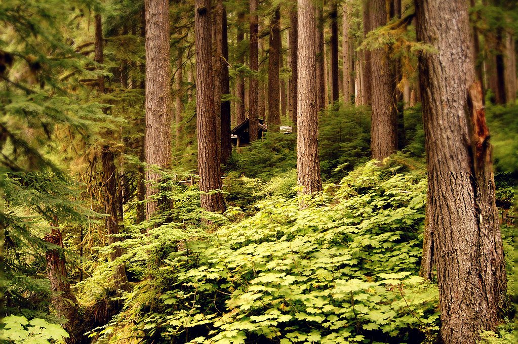
Hidden Falls is a secluded cascade tucked into the forested slopes of Cypress Island Marine Biological Preserve in San Juan County, Washington. Nestled within this marine-protected area (MPA), the falls sit on land managed by OTHS and owned by DESG, offering a peaceful retreat framed by dense evergreens, moss-draped rocks, and a small pool at the base. The setting feels intimate and quiet — a lovely spot for photographers and hikers looking to escape busier Puget Sound destinations. The route to the falls rewards a modest effort with tranquil, verdant scenery rather than dramatic elevation. Because the site lies inside a designated preserve, expect an experience that emphasizes natural character and low-impact visitation; visitors often describe the atmosphere as restorative and shaded, with the steady hiss of falling water underscoring the forest sounds.
The Setting
Hidden Falls sits at 719 feet within San Juan County/Cypress Island Marine Biological Preserve, fed by the Chuckanut Creek, in the foothills of Washington.
Trail & Hike Details
The Approach
The moderate 2.5-mile out and back trail gains 300 feet of elevation on the way to the falls.
Trail Description
The trail to Hidden Falls is an out-and-back route of about 2.5 miles total with roughly 300 feet of elevation gain, rated moderate in difficulty. The path is generally well-maintained but can become uneven or muddy after rain, and hikers will pass through dense vegetation and moss-covered rock areas as they approach the cascade. No USFS trail name or number is listed for this route, and specific USFS surface, grade, or class data are not available for this trail; expect natural tread typical of preserve trails rather than paved or heavily engineered surfaces.
What to Expect
Dogs are welcome.
Accessibility
The trail is not wheelchair accessible. Uneven terrain and elevation changes require steady footing.
Frequently Asked Questions
🐶 Are Dogs Allowed at Hidden Falls?
✅ Dogs are allowed
Are There Any Fees or Permits Required?
🆖 No fees required
🏊 Is There Swimming at Hidden Falls?
❌ Swimming is not allowed
When to Visit
Spring and early summer are ideal times to visit, as the waterfall is typically at its fullest due to snowmelt and rainfall.
Seasonal Access
The best time to visit is Spring, Summer, and Fall. Winter access may be limited.
Safety Information
Be cautious of slippery rocks near the waterfall. Stay on marked trails to avoid getting lost. Carry a map or GPS device, and let someone know your plans before heading out.
Current Water Conditions
Based on a USGS gauge 16 miles away
0 ft³/s
Current discharge — how much water is flowing
About average for this time of year
Based on 3 years of record
13.95 ft
Water depth at gauge
7-Day Discharge Trend
What does this mean for your visit?
Flow is about average for this time of year.
About This Gauge
This gauge is on a regional waterway. Conditions at the falls may differ, especially after local rain.
7-Day Flow Outlook
Based on the USGS gauge CHUCKANUT CREEK NEAR BELLINGHAM, WA (26 km away).
Today
Barely Flowing
0 cfs
3/10Tomorrow
Low
0 cfs
4/10Sat
Low
1 cfs
4/10Sun
Barely Flowing
1 cfs
5/10Mon
Barely Flowing
0 cfs
5/10Tue
Barely Flowing
0 cfs
3/10Wed
Barely Flowing
0 cfs
5/10Best window: Sun — barely flowing flow, partly sunny (trip score 5/10).
Best time of year: this gauge typically runs highest from mid February to mid March, peaking in December.
How we calculate this
This is a transparent outlook, not a precise forecast. We take the waterfall's current flow strength (how it ranks against its historical normal for today, from the nearest USGS stream gauge), carry that ranking forward along the gauge's seasonal curve, and nudge it for forecast rain. Confidence is highest for the next day or two and falls further out. Always check official conditions and your own judgment before visiting — high flows can be dangerous.
Know when to go.
Get a free email alert when waterfalls near Roche Harbor hit peak flow. We only send when conditions are worth the trip — no weekly newsletters, no spam.
Weather Forecast
Location & Access
Getting There
Hidden Falls is located within a forested area in Washington. The exact location may vary as there are multiple waterfalls with similar names in the state. It is recommended to use GPS coordinates or consult local trail maps for accurate directions.
Get Directions on Google MapsParking
Parking availability may vary depending on the specific trailhead used to access Hidden Falls. Some trailheads may have limited parking, so arriving early is advised.
Hours
Elevation
719 feet above sea level
Coordinates
48.648319° N, -122.822748° W
Land Management
Managed by OTHS
Visitor Tips & Gear
Wear sturdy hiking shoes as the trail may be uneven or slippery in places. Bring water and snacks, and consider visiting early in the day to avoid crowds. Check weather conditions before heading out.
As an Amazon Associate, we earn from qualifying purchases.
With 2.5 miles and 300 ft of elevation gain, sturdy boots and trekking poles will help on this moderate trail. Sun exposure on the trail makes good sun protection a must in summer.

Polarized Sunglasses (Knockaround)
Cuts glare off the water so you actually see the falls — and your photos turn out better too.

Columbia Watertight II Rain Jacket
Packs into its own pocket, seam-sealed, and keeps you dry from spray and surprise rain.

Earth Pak Waterproof Dry Bag
Keeps your phone and gear dry when waterfall mist soaks everything else.

Waterproof Phone Pouch (AiRunTech)
Cheap insurance — take photos right next to the falls without killing your phone.

Timberland Euro Sprint Mid Waterproof
Trusted waterproof boot with premium leather and grippy rubber sole — reliable on rocky, wet trails.

TrailBuddy Trekking Poles
Lightweight aluminum, cork grips, and flip-locks that actually hold — a best-seller for good reason.
Where to Stay

Otter's Pond Bed and Breakfast

The Landmark Inn on Orcas Island

Lopez Farm Cottages & Tent Camping

Majestic Inn and Spa
Browse vacation cabins and private rentals nearby
Unique outdoor stays — tents, yurts, and treehouses
Rent a campervan or RV for your waterfall road trip
Some links are affiliate links. We may earn a commission at no extra cost to you.
Nearby Campground
Blind Island
6.8 miles away · 0 sites
You made it to a designated site along the Cascadia Marine Trail, our Nation's longest recreation water trail! Blind Island is a small, three-acre marine camping park located on the north side of Shaw Island. All of the campsites are offered on a first-come, first-served basis and are for the exclusive use of boaters arriving by human or wind-powered watercraft. Recreational activities include camping, picnicking, non-motorized boating, and wildlife watching. The BLM cooperatively manages the are
Book on Recreation.govNearby Hot Springs
Hot springs near Roche Harbor, Washington

Sherman Crater Fumaroles
Sherman Crater Fumaroles register 266 degrees Fahrenheit at 9,463 feet elevation within the active volcanic crater atop Mount B...
Dorr Fumarole Field
Dorr Fumarole Field reaches 194 degrees at 8,168 feet elevation on Mount Baker's active volcanic slopes, producing superheated ...

Olympic Hot Springs
Olympic Hot Springs flows at 118 degrees within Olympic National Park at 2,000 feet elevation, emerging 72 degrees above ambien...

Sol Duc Hot Springs
Sol Duc Hot Springs flows at 122 degrees Fahrenheit in Olympic National Park with permanently protected Class 1 status under Na...
Looking for a soak after your hike? Explore more hot springs near Roche Harbor, Washington on SoakingSprings.
Explore Washington springsAdditional Information
Nearby Attractions
Other nearby attractions may include additional hiking trails, scenic viewpoints, and picnic areas. Check local maps for more options.
Wildlife
The area is home to a variety of wildlife, including birds, deer, and small mammals. Be cautious and respectful of the natural habitat.
Cities near Hidden Falls
Nearby Waterfalls

Other waterfalls named Hidden Falls
11 other waterfalls share this name across the U.S.
Writing about Hidden Falls? Embed this waterfall on your site for free.