Photo Credits (5)
Difficulty
Moderate
Trail Length
2.4 miles
Trail Type
Out And Back
Elevation Gain
350 ft
About Hidden Falls
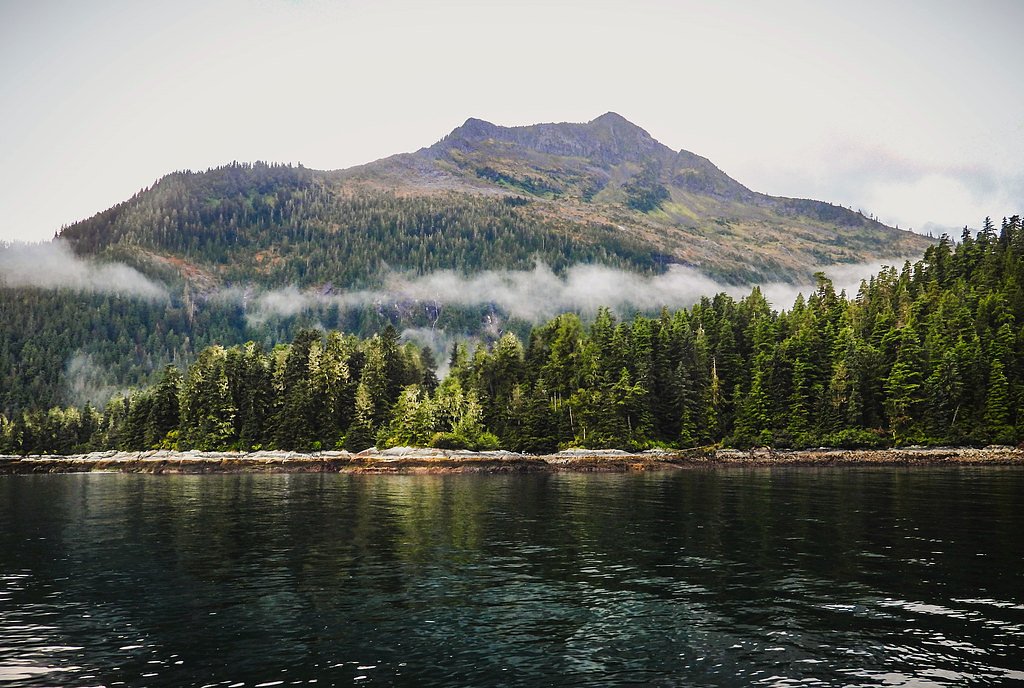
Hidden Falls is a picturesque waterfall located in the Tongass National Forest in Alaska. It is known for its serene surroundings and lush greenery, making it a popular spot for nature enthusiasts. The waterfall is often visited as part of a hike or boat trip in the area.
The Setting
Hidden Falls sits at 148 feet within Tongass National Forest, in the coastal lowlands of Alaska.
Trail & Hike Details
The Approach
The moderate 2.4-mile out-and-back trail gains 350 feet of elevation on the way to the falls.
Trail Description
There is no established hiking trail to Hidden Falls. Visitors typically access the area via boat or floatplane, and the terrain around the falls may be rugged and uneven.
What to Expect
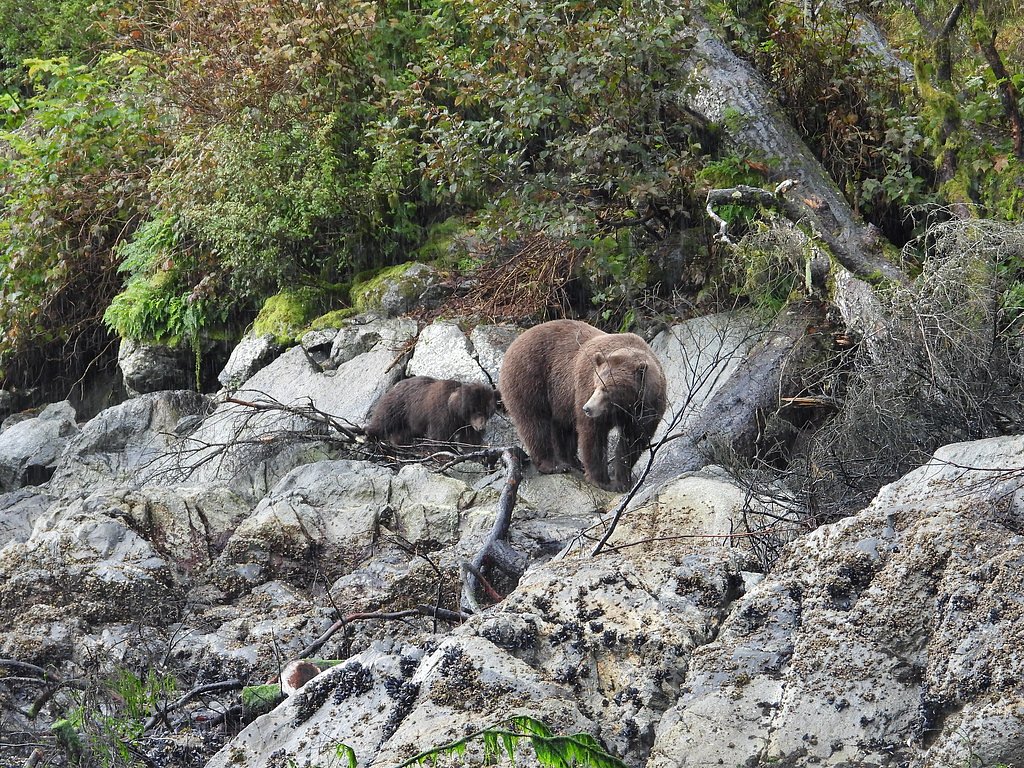
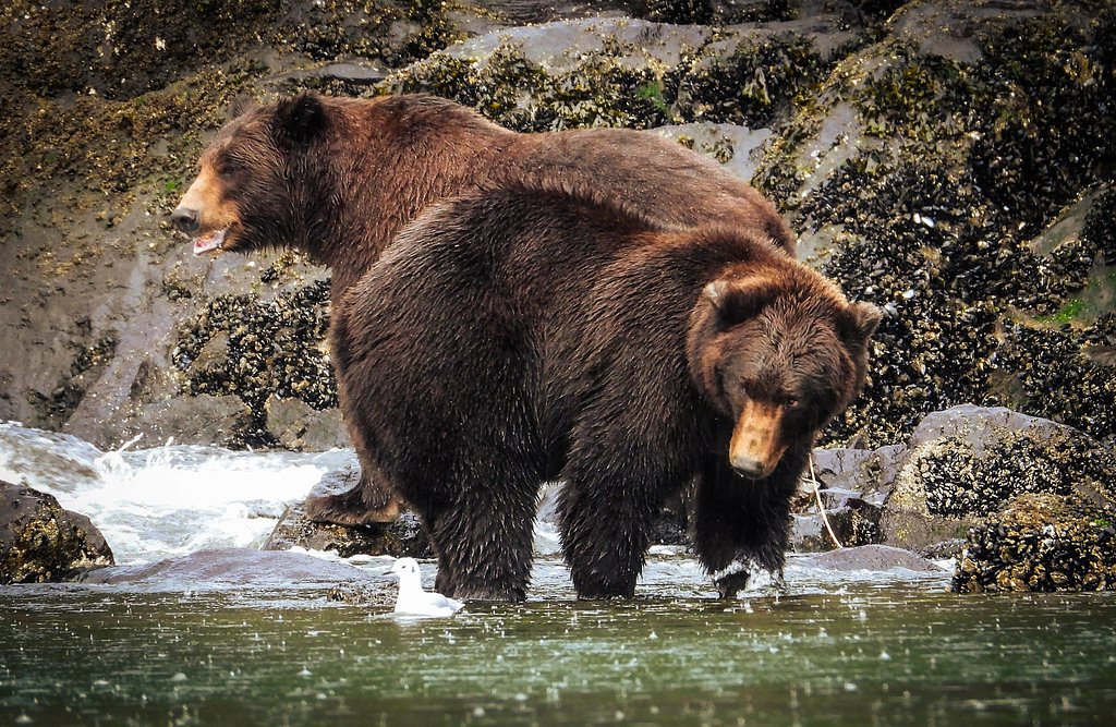
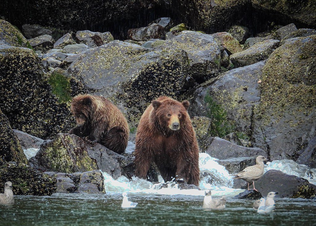
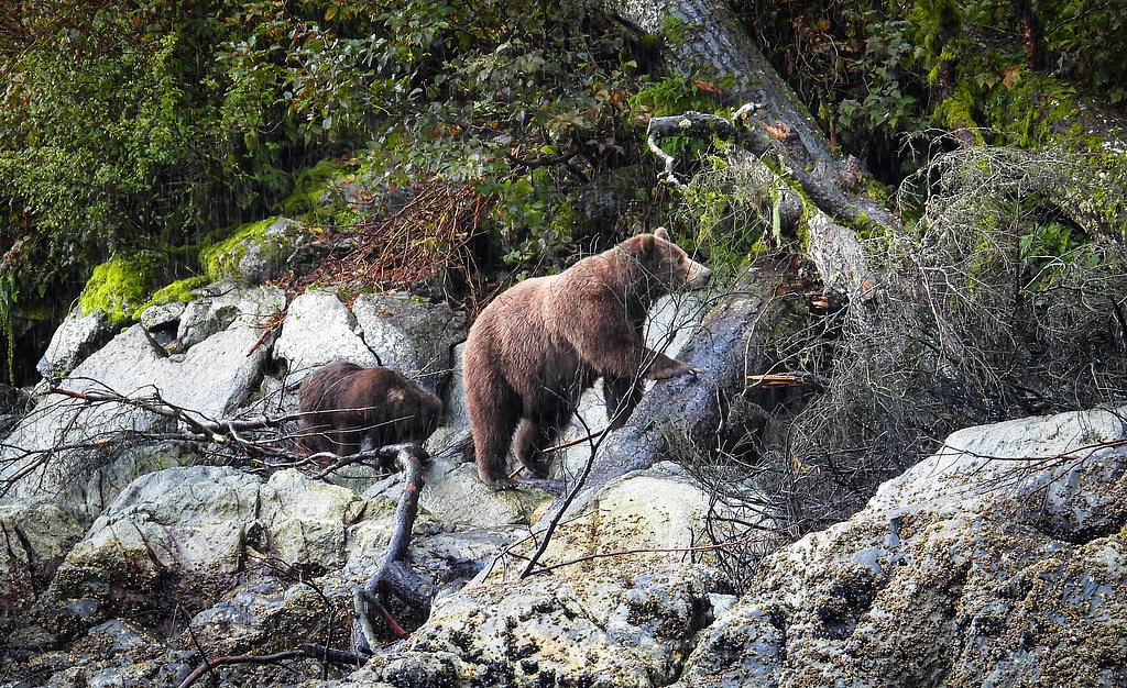
Expect a remote and tranquil experience surrounded by the natural beauty of Alaska's Tongass National Forest. Wildlife sightings, including bears and eagles, are common in the area. The falls themselves are a stunning feature, cascading amidst dense forest.
Accessibility
The trail is not wheelchair accessible. Uneven terrain and elevation changes require steady footing.
Frequently Asked Questions
🐶 Are Dogs Allowed at Hidden Falls?
❌ Dogs are not allowed
Are There Any Fees or Permits Required?
🆖 No fees required
🏊 Is There Swimming at Hidden Falls?
❌ Swimming is not allowed
When to Visit
The best time to visit is during the summer months (June to August) when the weather is milder and transportation options are more readily available.
Seasonal Access
The best time to visit is Spring, Summer, and Fall. Winter access may be limited. Check with Tongass National Forest for seasonal road closures.
Safety Information
Water temperature is currently 44°F — cold enough to cause numbness quickly. Avoid prolonged water contact and use caution near the falls.
Visitors should be aware of potential hazards, including slippery rocks, cold water, and wildlife encounters. Always travel with a guide or in a group, and carry bear spray if hiking in the area.
Current Water Conditions
Based on a USGS gauge 16.6 miles away
317 ft³/s
Current discharge — how much water is flowing
About average for this time of year
Based on 6 years of record
4.00 ft
Water depth at gauge
44°F
Very coldExpect numbness within minutes
7-Day Discharge Trend
What does this mean for your visit?
Flow is about average for this time of year. Water temperature is very cold at 44 degrees F, expect numbness within minutes.
About This Gauge
This gauge is on a regional waterway. Conditions at the falls may differ, especially after local rain.
7-Day Flow Outlook
Based on the USGS gauge SAWMILL C BL U TAILRACE NR SITKA AK (27 km away).
Today
Low
322 cfs
5/10Tomorrow
Low
322 cfs
5/10Sun
Low
322 cfs
6/10Mon
Moderate
348 cfs
5/10Tue
Moderate
361 cfs
5/10Wed
Moderate
373 cfs
5/10Thu
Moderate
377 cfs
5/10Best window: Sun — low flow, partly sunny (trip score 6/10).
Best time of year: this gauge typically runs highest from mid September to late October, peaking in September.
How we calculate this
This is a transparent outlook, not a precise forecast. We take the waterfall's current flow strength (how it ranks against its historical normal for today, from the nearest USGS stream gauge), carry that ranking forward along the gauge's seasonal curve, and nudge it for forecast rain. Confidence is highest for the next day or two and falls further out. Always check official conditions and your own judgment before visiting — high flows can be dangerous.
Know when to go.
Get a free email alert when waterfalls near Sitka hit peak flow. We only send when conditions are worth the trip — no weekly newsletters, no spam.
Weather Forecast
Location & Access
Getting There
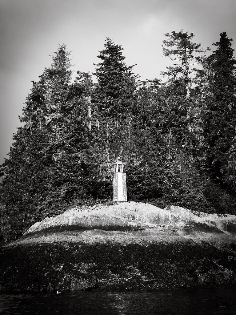
Hidden Falls is located on Baranof Island in Southeast Alaska. It is accessible primarily by boat or floatplane, as there are no roads leading to the area. Visitors often depart from Sitka or other nearby towns.
Get Directions on Google MapsParking
There is no parking available as the site is only accessible by water or air.
Elevation
148 feet above sea level
Coordinates
57.216389° N, -134.874167° W
Land Management
Managed by USFS
Visitor Tips & Gear
Plan your visit carefully, as access is limited and weather conditions can change rapidly. Bring appropriate gear for wet and cold conditions, and ensure you have a reliable guide or transportation plan.
As an Amazon Associate, we earn from qualifying purchases.
With 2.4 miles and 350 ft of elevation gain, sturdy boots and trekking poles will help on this moderate trail. Sun exposure on the trail makes good sun protection a must in summer.

Polarized Sunglasses (Knockaround)
Cuts glare off the water so you actually see the falls — and your photos turn out better too.

Columbia Watertight II Rain Jacket
Packs into its own pocket, seam-sealed, and keeps you dry from spray and surprise rain.

Earth Pak Waterproof Dry Bag
Keeps your phone and gear dry when waterfall mist soaks everything else.

Waterproof Phone Pouch (AiRunTech)
Cheap insurance — take photos right next to the falls without killing your phone.

Timberland Euro Sprint Mid Waterproof
Trusted waterproof boot with premium leather and grippy rubber sole — reliable on rocky, wet trails.

TrailBuddy Trekking Poles
Lightweight aluminum, cork grips, and flip-locks that actually hold — a best-seller for good reason.
Where to Stay

Aspen Suites Hotel Sitka

Hot Tub and Whale Watching! Scenic Sitka Escape

Walkable Sitka Getaway w/ Community Perks!
Browse vacation cabins and private rentals nearby
Unique outdoor stays — tents, yurts, and treehouses
Rent a campervan or RV for your waterfall road trip
Some links are affiliate links. We may earn a commission at no extra cost to you.
Nearby Campground
BARANOF LAKE CABIN
10.3 miles away · 1 sites
Overview Baranof Lake Cabin sits on the shores of greenish-blue Baranof Lake on the southwestern edge of Baranof Lake, 20 air miles east of of Sitka, Alaska. The cabin is generally available June through October, and makes an excellent base for experiencing this corner of Alaska. This is a remote site. The cabin can be accessed by a 25-minute floatplane trip, weather permitting. In poor weather and low clouds, flying time can double, as flights must go the northern route around Baranof Island. Vi
Book on Recreation.govNearby Hot Springs
Hot springs near Sitka, Alaska

Baranof Warm Springs
Baranof Warm Springs flow at 124 degrees Fahrenheit from ten distinct geothermal features on the eastern shore of Baranof Islan...
Baranof Warm Springs, Alaska
This thermal feature on eastern Baranof Island represents the same geothermal field as its neighbor to the south, emerging at 7...
Hot Spring Near Fish Bay
This spring produces 117-degree water rich in geothermal heat 75 degrees above the surrounding environment, emerging from the t...

Goddard Hot Springs
Goddard Hot Springs flows at 153 degrees Fahrenheit from just 60 feet elevation on Baranof Island south of Sitka, maintaining a...
Nylen Hot Springs
Nylen Hot Springs occupy protected National Forest land in Southeast Alaska at 1,664 feet elevation, where open public access c...

Tenakee Hot Springs
Tenakee Hot Springs flows at 43.5°C (110°F) in the small community of Tenakee Springs, a charming Southeast Alaska village wher...
Looking for a soak after your hike? Explore more hot springs near Sitka, Alaska on SoakingSprings.
Explore Alaska springsAdditional Information
Nearby Attractions
Nearby attractions include Sitka, the Tongass National Forest, and other scenic areas on Baranof Island.
Wildlife
The area is home to a variety of wildlife, including bears, eagles, and salmon. Visitors should exercise caution and follow wildlife safety guidelines.
Cities near Hidden Falls
Nearby Waterfalls
Other waterfalls named Hidden Falls
11 other waterfalls share this name across the U.S.
Writing about Hidden Falls? Embed this waterfall on your site for free.