Hidden Falls
By Armen Suny · Last verified Sep 2026
LiDAR & 3D terrain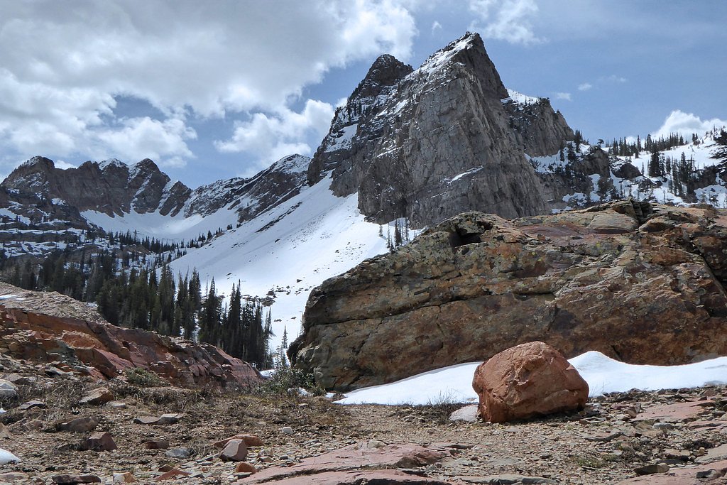
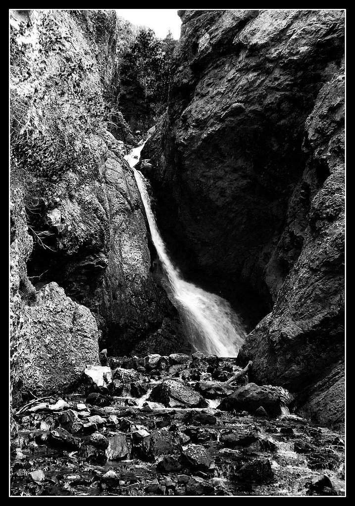
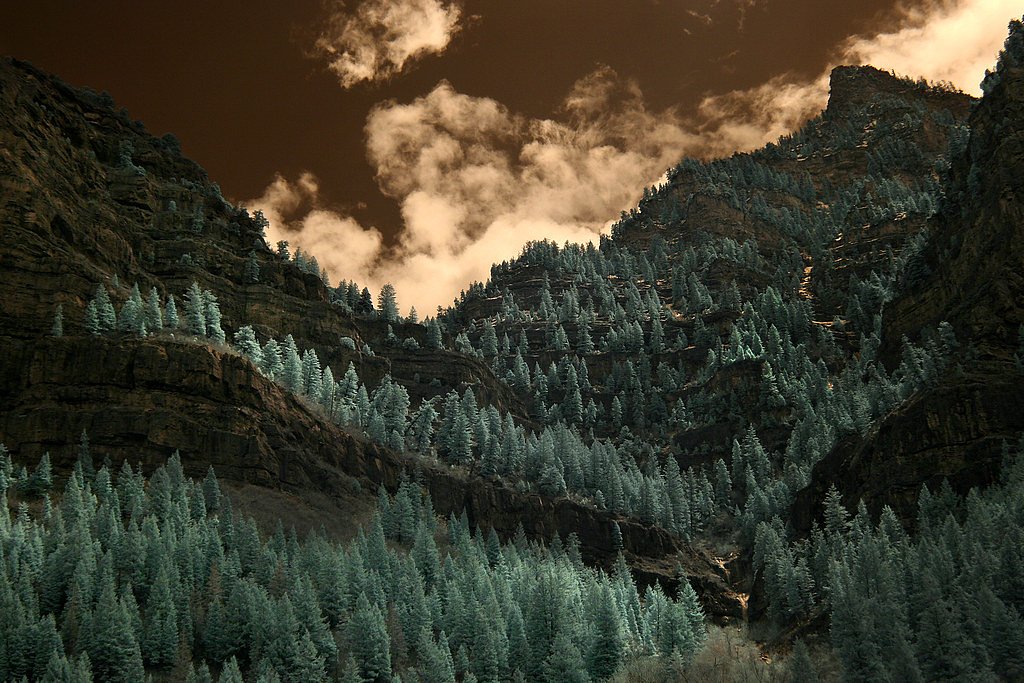
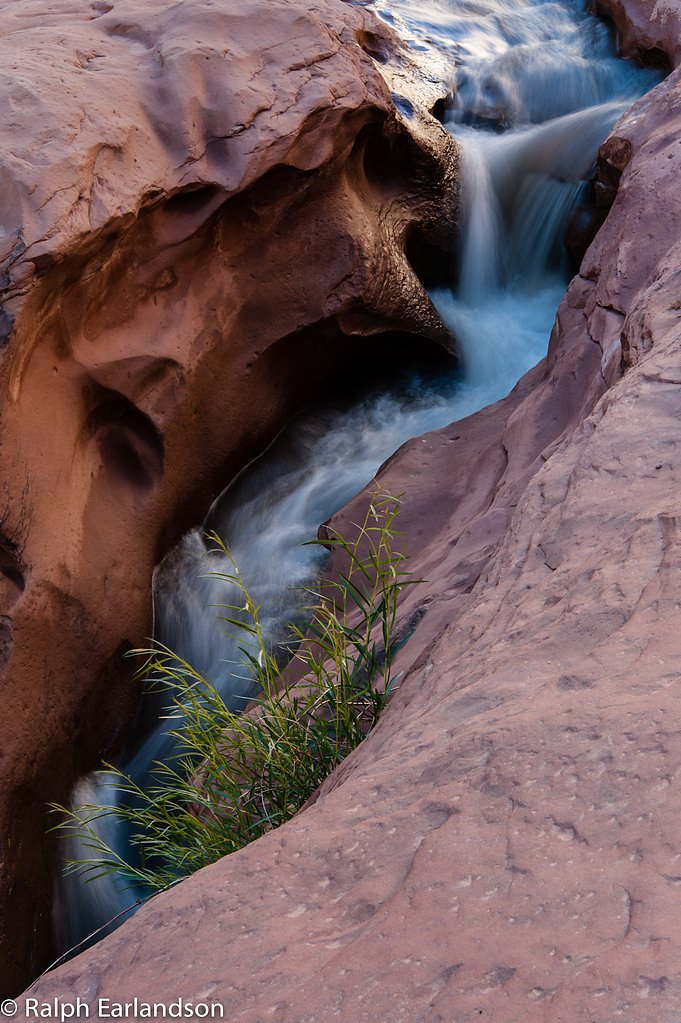

Photo Credits (5)
Difficulty
Easy
Trail Length
0.1 miles
Trail Type
Out And Back
About Hidden Falls
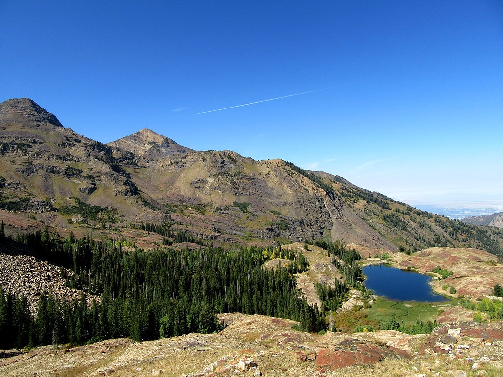
Hidden Falls is a small, picturesque cascade tucked into Big Cottonwood Canyon in Utah, nestled within the Wasatch National Forest and managed by the U.S. Forest Service. It’s a popular, easy-to-reach stop for canyon visitors—surrounded by rocky cliffs and greenery—offering a peaceful spot to rest between longer hikes. The route to the falls is associated with the USFS LAKE BLANCHE Trail (Trail #1151), and the Forest Service’s GIS shows a short 0.23-mile segment leading to the waterfall from the main trail corridor. While the LAKE BLANCHE route continues on for hikers seeking a longer day trip, the out-and-back to the falls is part of a 2.4-mile outing with about 350 feet of elevation gain and a moderate difficulty rating. If you’re planning an overnight or need a nearby base, the Storm Mountain Day Use Area is roughly 2.12 km away and is the closest established camping/day-use spot under Forest Service management.
The Setting
Hidden Falls sits at 6,329 feet within Wasatch National Forest, fed by the Little Cottonwood Creek @ Jordan River, in the high mountains of Utah.
Trail & Hike Details
The Approach
The easy hike follows Lake Blanche (#1151), a 0.1-mile out-and-back trail over natural surface. The trail is developed (Class 3).
USFS Trail
LAKE BLANCHE #1151
Trail Class
Developed
Surface
USFS Segment
0.23 miTrail Description
The approach is on USFS LAKE BLANCHE Trail #1151; the Forest Service maps note a 0.23-mile native-material segment at the falls. The full outing is an out-and-back of about 2.4 miles with approximately 350 feet of elevation gain and is rated moderate. The trail surface is native material and includes Class 3 sections, so expect some steeper or rockier footing—sturdy footwear and basic sure-footedness are recommended. Managed by the U.S. Forest Service within Wasatch National Forest, the trail connects to longer backpacking routes and the nearest campground/day-use area (Storm Mountain) is about 2.12 km away.
What to Expect
Visitors can expect a quick and easy walk to a small but beautiful waterfall surrounded by natural rock formations. The area is shaded and peaceful, making it a great spot for a brief stop or photo opportunity.
Accessibility
The trail is short and relatively flat, but the surface may be uneven. Contact the managing agency for accessibility details.
Frequently Asked Questions
🐶 Are Dogs Allowed at Hidden Falls?
❌ Dogs are not allowed
Are There Any Fees or Permits Required?
🆖 No fees required
🏊 Is There Swimming at Hidden Falls?
❌ Swimming is not allowed
When to Visit
Spring and early summer are the best times to visit, as the waterfall flow is strongest due to snowmelt. Fall offers beautiful foliage in the surrounding canyon.
Seasonal Access
The best time to visit is Spring, Summer, and Fall. Access roads and trails may close during winter due to snow. Watch for flash flood warnings during monsoon season (July through September). Check with Wasatch National Forest for seasonal road closures.
Safety Information
Be cautious when crossing the road to access the trailhead. The rocks near the waterfall can be slippery, so watch your footing. Always follow Leave No Trace principles to protect the environment.
Current Water Conditions
3 ft³/s
Current discharge — how much water is flowing
Much lower than usual for this time of year
Based on 27 years of record
7-Day Discharge Trend
What does this mean for your visit?
Flow is well below normal for this time of year, so the waterfall may be a trickle.
About This Gauge
This gauge is on a nearby waterway and may not reflect exact conditions at the falls.
7-Day Flow Outlook
Based on the USGS gauge LITTLE COTTONWOOD CREEK @ JORDAN RIVER NR SLC (15 km away).
Today
Barely Flowing
3 cfs
5/10Tomorrow
Barely Flowing
3 cfs
5/10Sun
Barely Flowing
3 cfs
5/10Mon
Low
3 cfs
3/10Tue
Moderate
3 cfs
4/10Wed
Low
3 cfs
6/10Thu
Barely Flowing
3 cfs
5/10Best window: Wed — low flow, sunny (trip score 6/10).
Best time of year: this gauge typically runs highest from late April to early July, peaking in June.
How we calculate this
This is a transparent outlook, not a precise forecast. We take the waterfall's current flow strength (how it ranks against its historical normal for today, from the nearest USGS stream gauge), carry that ranking forward along the gauge's seasonal curve, and nudge it for forecast rain. Confidence is highest for the next day or two and falls further out. Always check official conditions and your own judgment before visiting — high flows can be dangerous.
Know when to go.
Get a free email alert when waterfalls near Cottonwood Heights hit peak flow. We only send when conditions are worth the trip — no weekly newsletters, no spam.
Weather Forecast
The Terrain, Seen by LiDAR
Aircraft-mounted lasers measured this ground to within inches. Trees and buildings are digitally stripped away, leaving the bare shape of the land the water has carved.
Through the falls the surface drops roughly 222 feet over a short, steep run of tiers. Elevation at the pin is about 6,396 feet.
The whole reach is steep: about 161 feet of descent in the 500 feet above the falls and another 175 feet in the 500 feet below. The falls face southwest and glow in afternoon and evening light.
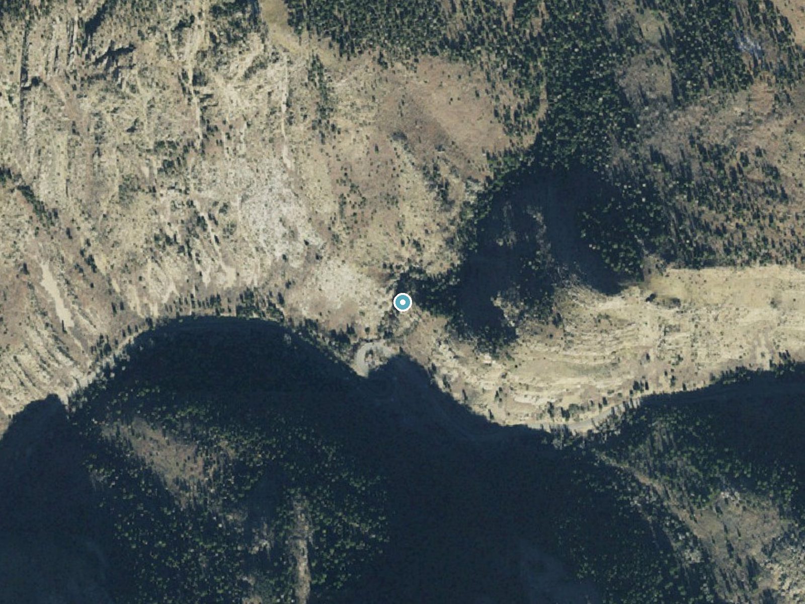
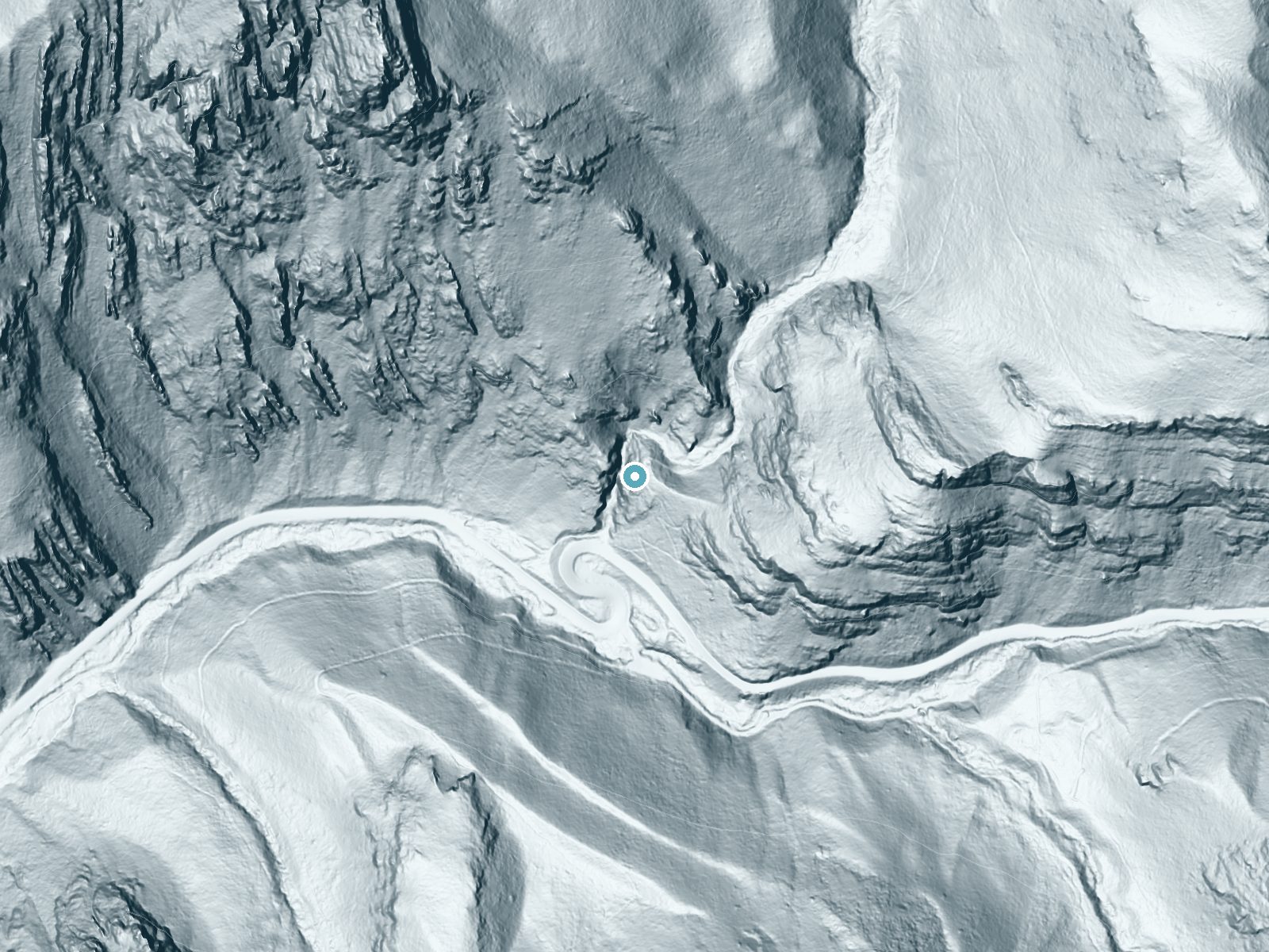
Drag to compare. The dot marks the waterfall. The frame is about a mile across.
- Ground elevation
- 6,396 feet
- Measured by 1-meter lidar
- Drop at the falls
- About 222 feet
- Change in ground height within ~250 feet of the falls
- Faces
- Southwest
- Glows in afternoon and evening light.
A slice through the lidar ground surface, from above the falls to downstream (heading southwest).
Elevation data: USGS 3D Elevation Program. Aerial imagery: USGS The National Map. Public domain.
Location & Access
Getting There
Hidden Falls is located just off the Big Cottonwood Canyon Road (UT-190). The trailhead is near the Mill B South Fork parking area, approximately 4.4 miles up the canyon from the base. Look for a small pullout on the right side of the road.
Get Directions on Google MapsParking
Parking is available at the Mill B South Fork parking area, but spaces are limited and can fill up quickly, especially on weekends. Arrive early to secure a spot.
Elevation
6,329 feet above sea level
Coordinates
40.635401° N, -111.723630° W
Land Management
Managed by USFS
Visitor Tips & Gear
Visit early in the morning or on weekdays to avoid crowds. Wear sturdy shoes as the trail can be rocky. Be cautious of traffic when parking or crossing the road to access the trailhead.
This trail sits at 6,329 ft above sea level
Elevated TrailUV radiation is roughly 25% stronger at this elevation than at sea level, and the dry air accelerates dehydration. Extra sun protection and fluids go a long way.
As an Amazon Associate, we earn from qualifying purchases.

Coppertone Sport SPF 50 Sunscreen
UV intensity jumps ~4% per 1,000 ft — at this elevation you can burn in half the time.

Sun Bum SPF 30 Lip Balm (3-Pack)
Lips have almost no natural UV protection and burn fast in thin, dry mountain air.

Liquid I.V. Electrolyte Packets
You lose moisture ~2x faster at elevation — electrolytes help you absorb water efficiently.

ROCKNIGHT Polarized UV400 Sunglasses
High-altitude glare off rock and water is intense — UV400 lenses block 99%+ of UVA/UVB.
Where to Stay
Carpe Montem - Modern, Views, Large Deck, Hot Tub, Private
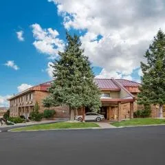
Best Western Plus Landmark Inn

Hyatt Place Salt Lake City/Cottonwood

Hampton Inn Salt Lake City Cottonwood
Browse vacation cabins and private rentals nearby
Unique outdoor stays — tents, yurts, and treehouses
Rent a campervan or RV for your waterfall road trip
Some links are affiliate links. We may earn a commission at no extra cost to you.
Nearby Campground
Storm Mountain Day Use Area
1.3 miles away · 20 sites
Overview Storm Mountain Day Use Area is just 3 miles up Big Cottonwood Canyon, conveniently close to Salt Lake City. Big Cottonwood Creek runs alongside the site. Visitors enjoy fishing, hiking and biking.Recreation Big Cottonwood Creek flows through the area, offering trout fishing. Hiking and mountain biking are popular activities on canyon trails.Facilities The picnic area contains four group sites and several single sites, most of which are accessible. All contain picnic tables and campfire r
Book on Recreation.govNearby Hot Springs
Hot springs near Salt Lake City, Utah
Unnamed Spring Summit County
This unnamed 70°F spring flows in Summit County near Snyderville, emerging 27.8 degrees above the 42.2°F ambient temperature at...
East Jordan Canal
East Jordan Canal flows at 73°F through Salt Lake County near South Jordan, emerging 23 meters from Alta Creek Circle at 4,395 ...

Wasatch Hot Springs
Flowing at 108 degrees Fahrenheit from Warm Springs Park in Salt Lake City, Wasatch Hot Springs ranks among Utah's hottest and ...

Crystal Hot Springs
Crystal Hot Springs near Bluffdale emerges at an extraordinary 187°F, ranking among Utah's absolute hottest thermal springs, th...

Warm Ditch Spring
A 115-degree spring in Wasatch County's Heber Valley, emerging 67.8 degrees above ambient temperature just 64 meters from Jerry...
Midway Hot Springs
Midway Hot Springs at the Homestead Crater flows at 100°F inside a beehive-shaped limestone dome created by millennia of minera...
Looking for a soak after your hike? Explore more hot springs near Salt Lake City, Utah on SoakingSprings.
Explore Utah springsAdditional Information
Nearby Attractions
Donut Falls, Lake Blanche Trail, and Brighton Ski Resort are popular nearby attractions in Big Cottonwood Canyon.
Wildlife
The area is home to various wildlife, including birds, deer, and small mammals. Be cautious of potential encounters with moose or other large animals.
Cities near Hidden Falls
Nearby Waterfalls
Other waterfalls named Hidden Falls
11 other waterfalls share this name across the U.S.
Writing about Hidden Falls? Embed this waterfall on your site for free.