Photo Credits (5)
Difficulty
Moderate
Trail Length
2.0 miles
Trail Type
Out And Back
Elevation Gain
300 ft
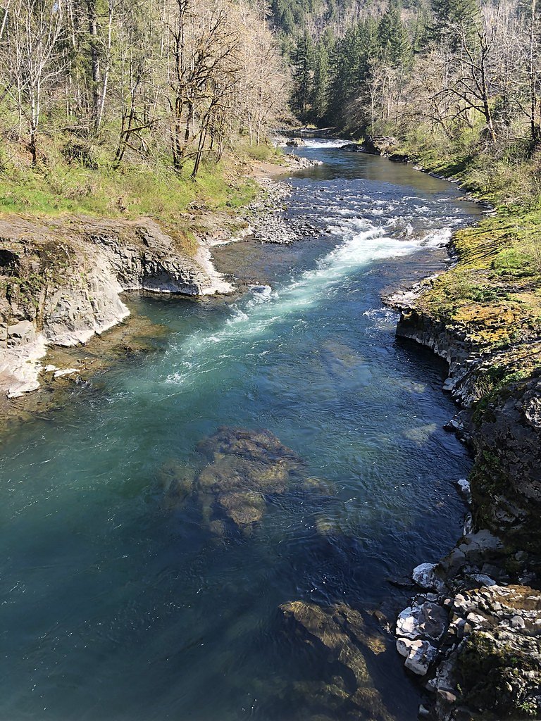
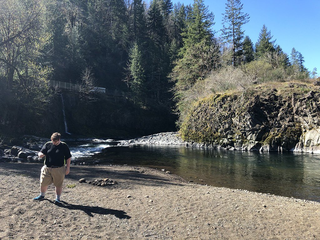
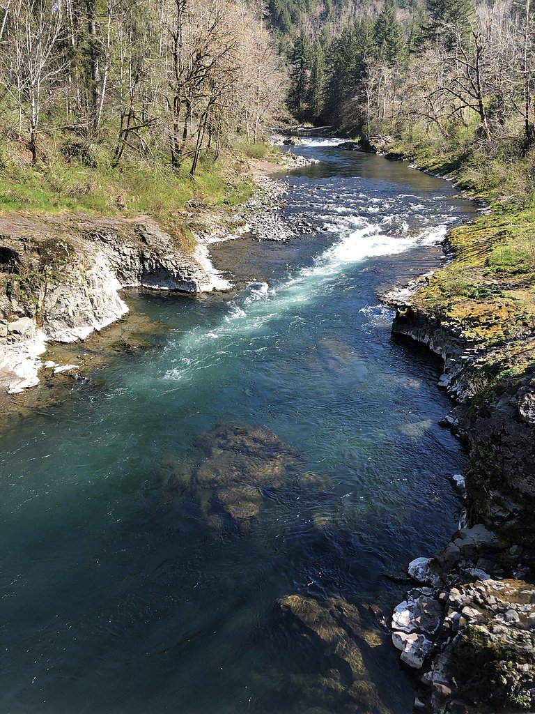
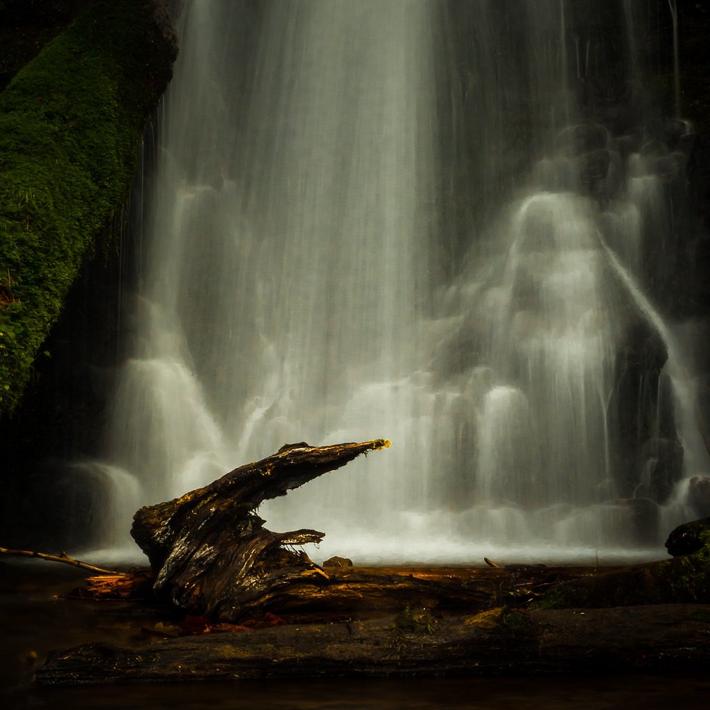
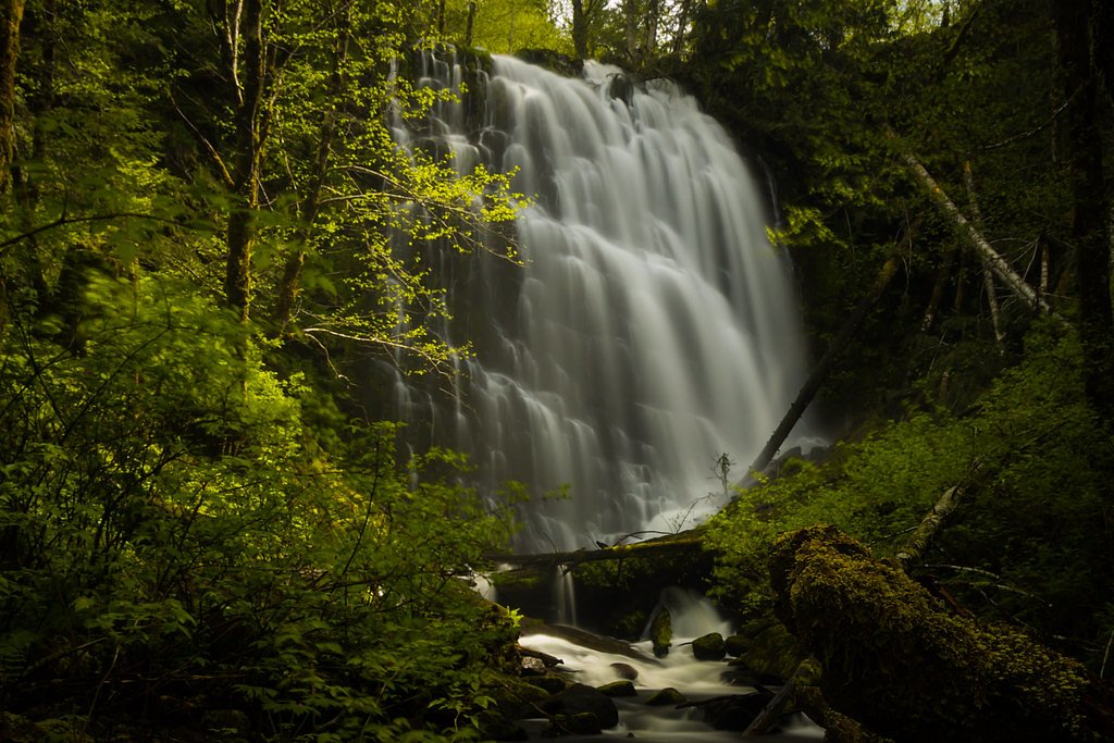
About Wilson Falls
Wilson Falls is a tucked-away cascade set amid lush forest in Oregon, offering a peaceful spot for a short day hike or a quiet picnic beside the water. The setting retains a feeling of solitude—popular with locals who appreciate its mossy rocks and shaded amphitheater-like streambed—while remaining a lower-profile destination for visitors seeking a calm nature escape. The falls and access corridor sit on land owned by SDNR within the Forest Development Fund (Board Of Forestry) and are designated as an SRMA managed by SLB. The most common approach to the falls is a 2.0-mile out-and-back hike with about 300 feet of elevation gain, so plan for a moderate trek; the nearest developed campground is Dovre Recreation Site, roughly 29.2 km away if you’re looking to camp before or after your visit.
The Setting
Wilson Falls sits at 469 feet within Forest Development Fund (Board Of Forestry), fed by the Wilson River, in the coastal lowlands of Oregon.
Trail & Hike Details
The Approach
The moderate 2.0-mile out-and-back trail gains 300 feet of elevation on the way to the falls.
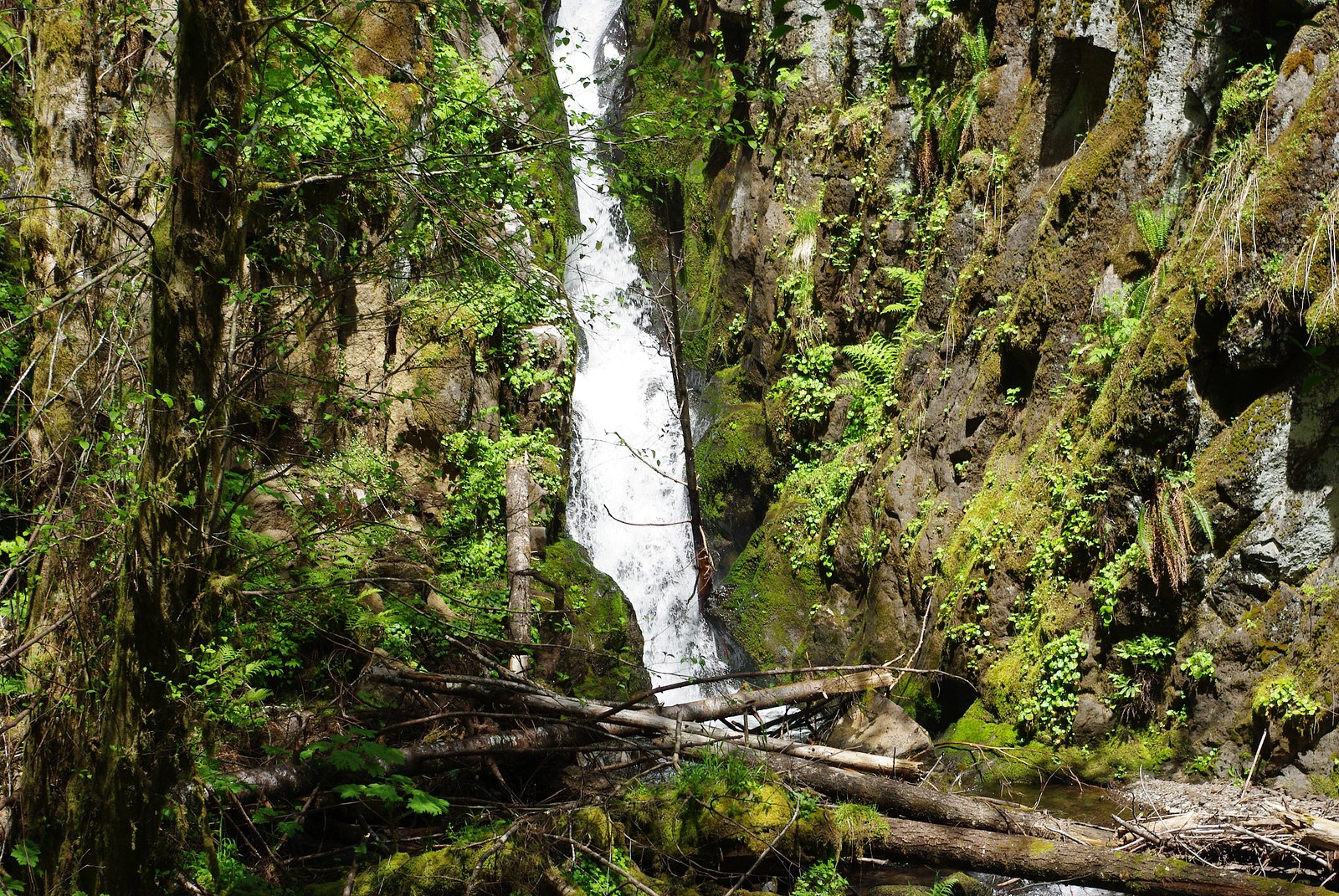
Trail Description
Trail length: 2.0 miles round-trip (out-and-back). Elevation gain: approximately 300 feet. Difficulty: moderate. The route follows a forested footpath through mostly natural tread with moderate grades and several short, steeper sections; hikers should expect some uneven terrain and roots/rocks underfoot. The trail is suitable for hikers with moderate experience and is typically a day-hike; no USFS trail number was provided in the available data.
What to Expect
Visitors can expect a tranquil hike through lush greenery, leading to a picturesque waterfall surrounded by natural beauty. The area may be less crowded compared to more popular waterfalls in Oregon.
Accessibility
The trail is not wheelchair accessible. Uneven terrain and elevation changes require steady footing.
Frequently Asked Questions
🐶 Are Dogs Allowed at Wilson Falls?
❌ Dogs are not allowed
Are There Any Fees or Permits Required?
🆖 No fees required
🏊 Is There Swimming at Wilson Falls?
❌ Swimming is not allowed
When to Visit
Spring and early summer are ideal times to visit, as the waterfall flow is typically strongest during these seasons.
Seasonal Access
The best time to visit is Spring, Summer, and Fall. Winter access may be limited.
Safety Information
Visitors should be cautious of slippery rocks near the waterfall and prepare for changing weather conditions. Always stay on marked trails.
Current Water Conditions
191 ft³/s
Current discharge — how much water is flowing
About average for this time of year
Based on 94 years of record
3.93 ft
Water depth at gauge
7-Day Discharge Trend
What does this mean for your visit?
Flow is about average for this time of year.
About This Gauge
This gauge is on a nearby waterway and may not reflect exact conditions at the falls.
7-Day Flow Outlook
Based on the USGS gauge WILSON RIVER NEAR TILLAMOOK, OR (16 km away).
Today
Low
215 cfs
4/10Tomorrow
Moderate
232 cfs
5/10Sun
Moderate
220 cfs
5/10Mon
Moderate
216 cfs
5/10Tue
Moderate
206 cfs
5/10Wed
Low
188 cfs
5/10Thu
Low
193 cfs
4/10Best window: Tomorrow — moderate flow, rain showers (trip score 5/10).
Best time of year: this gauge typically runs highest from mid November to late January, peaking in January.
How we calculate this
This is a transparent outlook, not a precise forecast. We take the waterfall's current flow strength (how it ranks against its historical normal for today, from the nearest USGS stream gauge), carry that ranking forward along the gauge's seasonal curve, and nudge it for forecast rain. Confidence is highest for the next day or two and falls further out. Always check official conditions and your own judgment before visiting — high flows can be dangerous.
Know when to go.
Get a free email alert when waterfalls near Fairview hit peak flow. We only send when conditions are worth the trip — no weekly newsletters, no spam.
Weather Forecast
Location & Access
Getting There
Wilson Falls is located in Oregon, but specific directions to the trailhead or parking area are not widely documented. Visitors are encouraged to consult local maps or resources for accurate navigation.
Get Directions on Google MapsParking
Parking availability is unclear, but visitors should prepare for limited parking options near the trailhead.
Elevation
469 feet above sea level
Coordinates
45.570665° N, -123.570675° W
Land Management
Managed by SLB
Visitor Tips & Gear
Wear sturdy hiking shoes and bring plenty of water. Check trail conditions before visiting, especially during the rainy season, as trails may become muddy or slippery.
As an Amazon Associate, we earn from qualifying purchases.
With 2.0 miles and 300 ft of elevation gain, sturdy boots and trekking poles will help on this moderate trail. Sun exposure on the trail makes good sun protection a must in summer.

Polarized Sunglasses (Knockaround)
Cuts glare off the water so you actually see the falls — and your photos turn out better too.

Columbia Watertight II Rain Jacket
Packs into its own pocket, seam-sealed, and keeps you dry from spray and surprise rain.

Earth Pak Waterproof Dry Bag
Keeps your phone and gear dry when waterfall mist soaks everything else.

Waterproof Phone Pouch (AiRunTech)
Cheap insurance — take photos right next to the falls without killing your phone.

Timberland Euro Sprint Mid Waterproof
Trusted waterproof boot with premium leather and grippy rubber sole — reliable on rocky, wet trails.

TrailBuddy Trekking Poles
Lightweight aluminum, cork grips, and flip-locks that actually hold — a best-seller for good reason.
Where to Stay

Inn at Cannon Beach

The Tillamook Inn

Rockaway oceanview condo,Steps to the beach & Downtown,W&D, WiFi

2 Bed 2 Bath Vacation home in Rockaway Beach
Browse vacation cabins and private rentals nearby
Unique outdoor stays — tents, yurts, and treehouses
Rent a campervan or RV for your waterfall road trip
Some links are affiliate links. We may earn a commission at no extra cost to you.
Nearby Campground
Dovre Recreation Site
18.1 miles away · 11 sites
Overview Want to camp? Camping season is generally May-September, with Alder Glen and Elk Bend remaining open through the weekend following General Western Oregon Coast 2nd Season for elk. During months with reduced sunlight, potable water may be turned off. Be prepared to bring your own wash and drinking water. Reserve a site at one of our four campgrounds on recreation.gov or pay when you arrive for non-reserved campsites using the Recreation.gov Mobile App. You must download before you reach t
Book on Recreation.govAdditional Information
Nearby Attractions
Other waterfalls and hiking trails in the area may be worth exploring, but specific nearby attractions are not documented.
Wildlife
The area may feature common Oregon wildlife such as birds, deer, and small mammals. Visitors should be aware of potential encounters with wildlife.
Cities near Wilson Falls
Nearby Waterfalls
Other waterfalls named Wilson Falls
2 other waterfalls share this name across the U.S.
Writing about Wilson Falls? Embed this waterfall on your site for free.