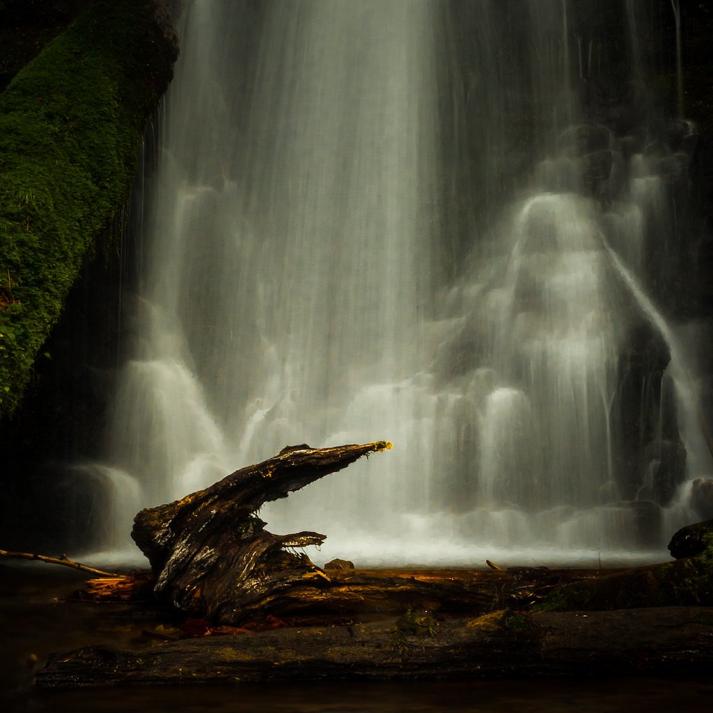
University Falls
Oregon • 55 ft
By Armen Suny · Last verified May 2026
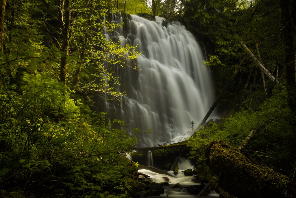

Photo Credits (3)
Difficulty
Easy
Trail Length
1.6 miles
Trail Type
Out And Back
Elevation Gain
200 ft
About University Falls
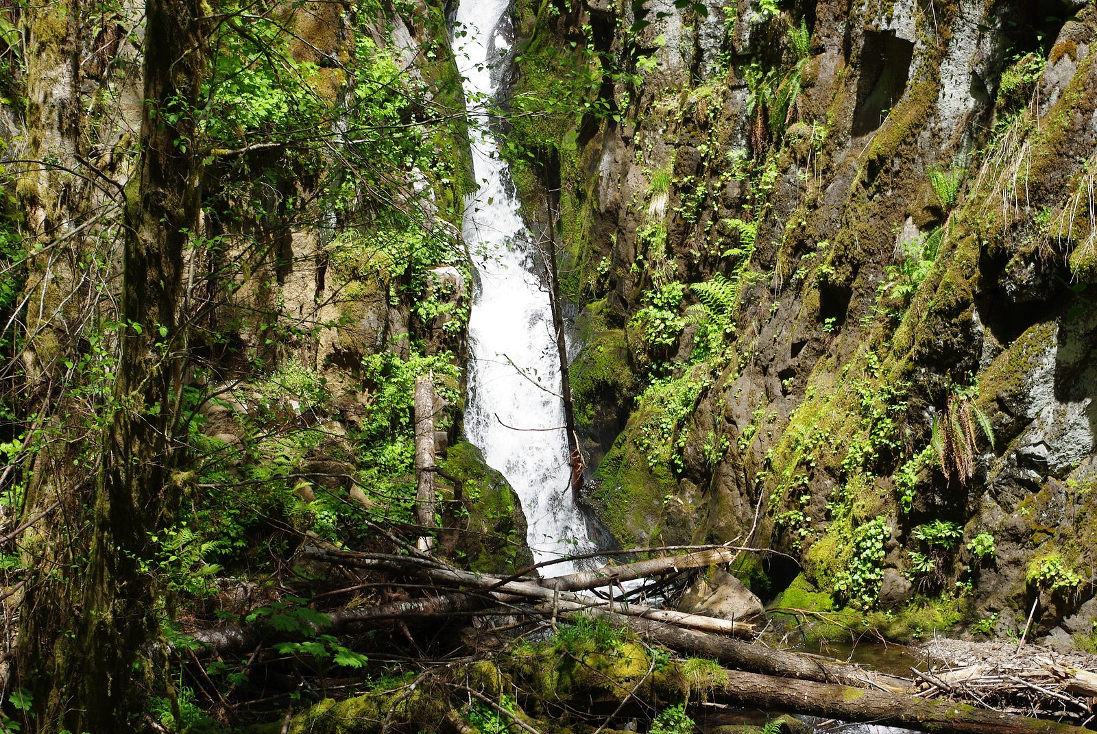
University Falls is a charming 55-foot cascade tucked into a forested parcel in Oregon, offering a classic Pacific Northwest waterfall experience without requiring a long trek. The falls drop in a single, photogenic chute into a pool at the base, framed by mossy rocks and timber that make it a popular stop for day hikers and photographers looking for a serene, leafy setting. The site lies on land owned by SDNR within the Forest Development Fund (Board Of Forestry) and is managed as an SRMA by SLB, so visitors should be respectful of site rules and leave no trace. Camping is not immediately adjacent—the nearest developed campsite is Dovre Recreation Site, roughly 32.26 km away—making University Falls best suited to half-day trips or a focused day hike from nearby towns.
The Setting
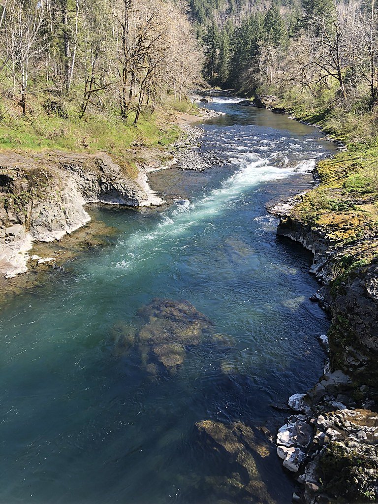
University Falls sits at 1,601 feet within Forest Development Fund (Board Of Forestry), fed by the Nehalem River, in the hills of Oregon. The falls drop 55 feet.
Height: 55 feet
Trail & Hike Details
The Approach
The easy 1.6-mile out-and-back trail gains 200 feet of elevation on the way to the falls.
Trail Description
The trail to University Falls is a short out-and-back route of approximately 1.6 miles round trip with about 200 feet of elevation gain, rated easy and suitable for most hikers. The path follows a forested tread to the waterfall and ends at the base, providing close-up views and excellent photo opportunities; expect a mostly natural surface and some uneven footing near the water. Because the hike is short and the setting is relatively sheltered, plan for wet or slippery sections around the falls and bring appropriate footwear.
What to Expect
The falls drop 55 feet. Dogs are welcome.
Accessibility
The trail is not wheelchair accessible. Uneven terrain and elevation changes require steady footing.
Frequently Asked Questions
🐶 Are Dogs Allowed at University Falls?
✅ Dogs are allowed
Are There Any Fees or Permits Required?
🆖 No fees required
🏊 Is There Swimming at University Falls?
❌ Swimming is not allowed
When to Visit
Spring and early summer are the best times to visit, as the waterfall flow is strongest due to seasonal rainfall.
Seasonal Access
The best time to visit is Spring, Summer, and Fall. Winter access may be limited.
Safety Information
The trail can be slippery and muddy, especially after rain. Exercise caution near the waterfall as rocks may be wet and slippery. Check for any forest closures or fire restrictions before visiting.
Current Water Conditions
Based on a USGS gauge 15.3 miles away
19 ft³/s
Current discharge — how much water is flowing
Lower than usual for this time of year
Based on 23 years of record
4.05 ft
Water depth at gauge
7-Day Discharge Trend
What does this mean for your visit?
Flow is lower than usual for this time of year.
About This Gauge
This gauge is on a regional waterway. Conditions at the falls may differ, especially after local rain.
7-Day Flow Outlook
Based on the USGS gauge NEHALEM RIVER NEAR VERNONIA, OR (25 km away).
Today
Barely Flowing
20 cfs
3/10Tomorrow
Low
21 cfs
4/10Sat
Low
21 cfs
3/10Sun
Low
19 cfs
4/10Mon
Low
19 cfs
4/10Tue
Low
18 cfs
4/10Wed
Low
17 cfs
4/10Best window: Tomorrow — low flow, light rain then rain showers (trip score 4/10).
Best time of year: this gauge typically runs highest from mid December to late January, peaking in January.
How we calculate this
This is a transparent outlook, not a precise forecast. We take the waterfall's current flow strength (how it ranks against its historical normal for today, from the nearest USGS stream gauge), carry that ranking forward along the gauge's seasonal curve, and nudge it for forecast rain. Confidence is highest for the next day or two and falls further out. Always check official conditions and your own judgment before visiting — high flows can be dangerous.
Know when to go.
Get a free email alert when waterfalls near Banks hit peak flow. We only send when conditions are worth the trip — no weekly newsletters, no spam.
Weather Forecast
Location & Access
Getting There
University Falls is located off the Wilson River Highway (Highway 6) in the Tillamook State Forest. The trailhead can be accessed via the Rogers Camp Trailhead or the University Falls Trailhead, depending on your starting point.
Get Directions on Google MapsParking
Parking is available at the Rogers Camp Trailhead, which is the most common starting point for accessing University Falls. Parking may be limited during peak seasons.
Elevation
1,601 feet above sea level
Coordinates
45.599833° N, -123.394004° W
Land Management
Managed by SLB
Visitor Tips & Gear
Visit early in the day to avoid crowds, especially during weekends and summer months. Wear sturdy shoes as the trail can be muddy, particularly after rain. Bring a camera to capture the beauty of the falls.
As an Amazon Associate, we earn from qualifying purchases.
This easy 1.6 miles hike is straightforward — comfortable trail shoes and plenty of water should do. Sun exposure on the trail makes good sun protection a must in summer.

Polarized Sunglasses (Knockaround)
Cuts glare off the water so you actually see the falls — and your photos turn out better too.

Columbia Watertight II Rain Jacket
Packs into its own pocket, seam-sealed, and keeps you dry from spray and surprise rain.

Earth Pak Waterproof Dry Bag
Keeps your phone and gear dry when waterfall mist soaks everything else.

Waterproof Phone Pouch (AiRunTech)
Cheap insurance — take photos right next to the falls without killing your phone.

JOBY GorillaPod Starter Kit
Wraps around railings and rocks for long-exposure waterfall shots — no flat surface needed.

Osprey Daylite Daypack
Light, organized, and just the right size for a day hike — fits water, snacks, and layers.
Where to Stay

Inn at Cannon Beach

Rockaway oceanview condo,Steps to the beach & Downtown,W&D, WiFi

Rockaway beach vibes,Waterfront Oceanfront Rockaway Beach House near Downtown,WIFI, Washer Dryer

Cannon beach vibes, steps to the beach,WIFI,3 full bedroom en suites with 3 fireplaces,Near Downtown
Browse vacation cabins and private rentals nearby
Unique outdoor stays — tents, yurts, and treehouses
Rent a campervan or RV for your waterfall road trip
Some links are affiliate links. We may earn a commission at no extra cost to you.
Nearby Campground
Dovre Recreation Site
20 miles away · 11 sites
Overview Want to camp? Camping season is generally May-September, with Alder Glen and Elk Bend remaining open through the weekend following General Western Oregon Coast 2nd Season for elk. During months with reduced sunlight, potable water may be turned off. Be prepared to bring your own wash and drinking water. Reserve a site at one of our four campgrounds on recreation.gov or pay when you arrive for non-reserved campsites using the Recreation.gov Mobile App. You must download before you reach t
Book on Recreation.govAdditional Information
Nearby Attractions
Nearby attractions include the Tillamook Forest Center, Gales Creek Trail, and the Wilson River Trail.
Wildlife
The area is home to a variety of wildlife, including deer, birds, and small mammals. Be cautious of ticks and other insects during warmer months.
Cities near University Falls
Nearby Waterfalls
Writing about University Falls? Embed this waterfall on your site for free.