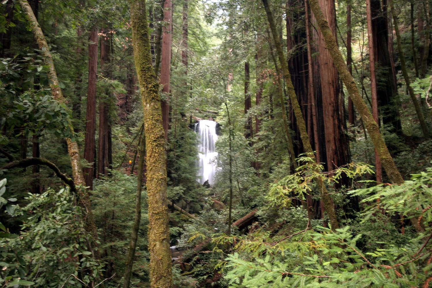
Berry Creek Falls
By Armen Suny · Last verified May 2026
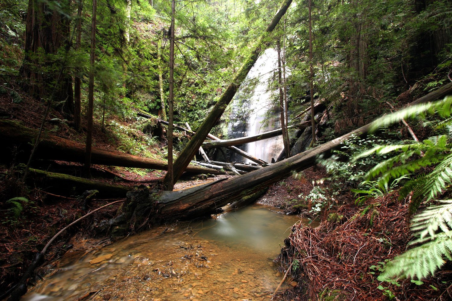
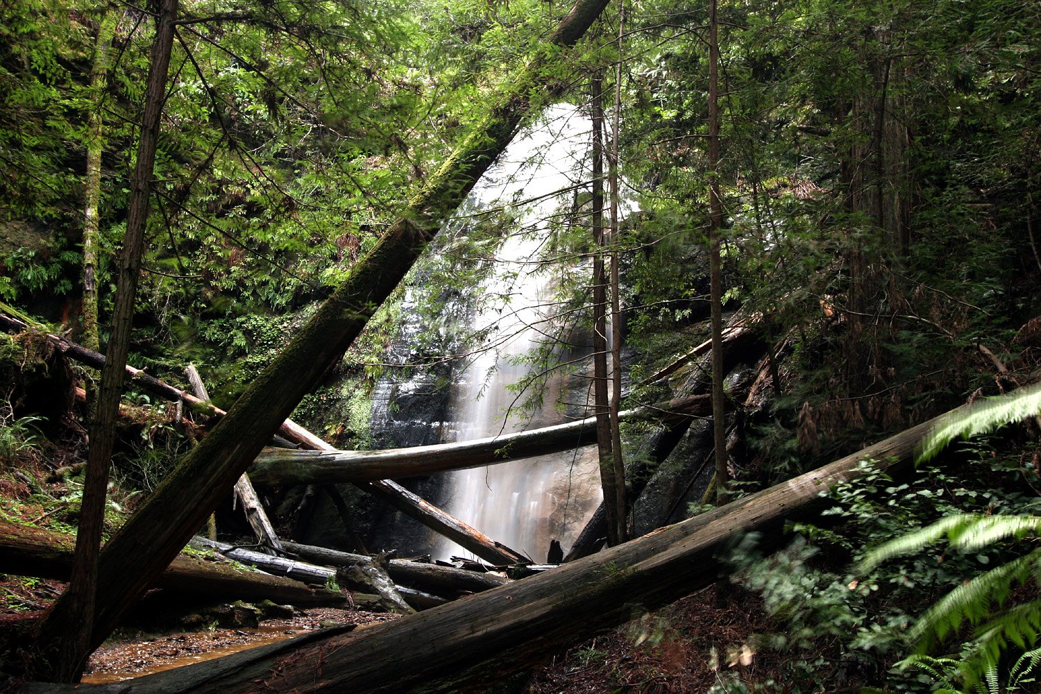
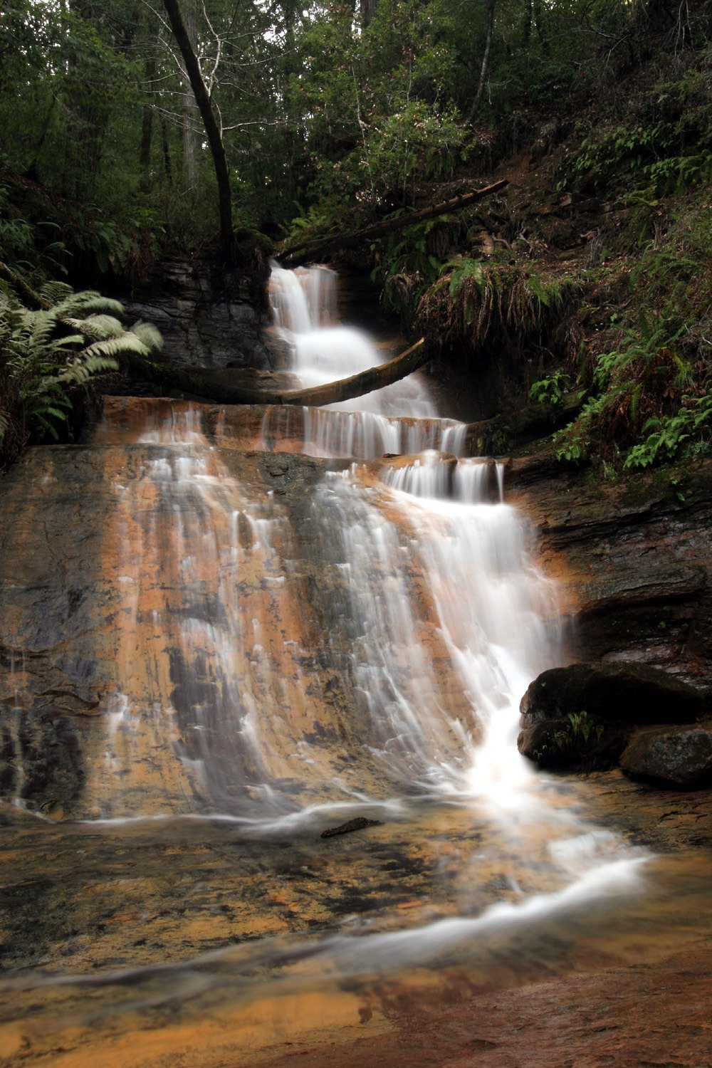
Photo Credits (4)
Difficulty
Moderate
Trail Length
2.4 miles
Trail Type
Out And Back
Elevation Gain
350 ft
About Berry Creek Falls
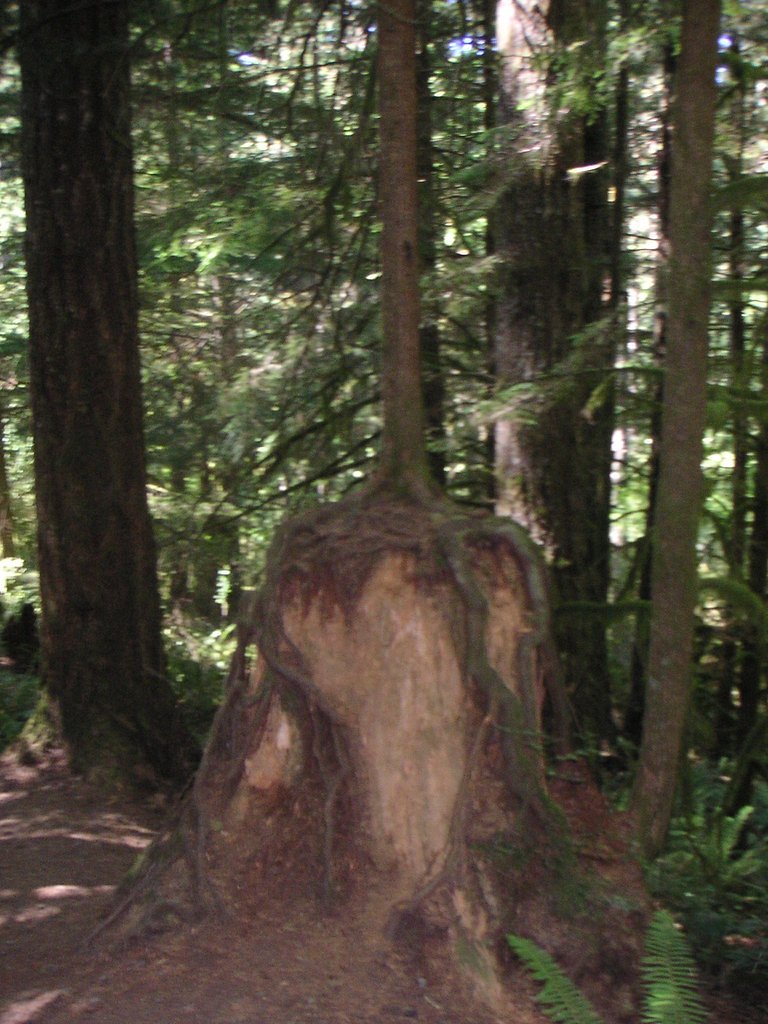
Berry Creek Falls sits tucked into Oregon’s coastal forest like a quiet secret, where a narrow cascade threads through moss-draped logs, sword ferns, and a dense conifer understory. The short approach and intimate, wooded setting make this a restorative escape from the busier coastal corridors — hikers often note the soft hush of the forest, rich fall color, and the meditative sound of running water as highlights of the visit. The route to the falls is a popular choice for a day hike, offering scenic payoff on a relatively modest outing. At 2.4 miles round trip with roughly 350 feet of elevation gain, the trail is rated moderate and is well suited to families and moderately fit hikers who want a short forest walk that finishes at a peaceful cascade. Check local trailhead postings or park notices before you go for current conditions and seasonal access information.
The Setting
Berry Creek Falls sits at 1,112 feet along the Luckiamute River, in the foothills of Oregon.
Trail & Hike Details
The Approach
The moderate 2.4-mile out-and-back trail gains 350 feet of elevation on the way to the falls.
Trail Description
Trail type: out-and-back; length: 2.4 miles round trip; elevation gain: approximately 350 feet; difficulty: moderate. The path climbs steadily but gently through dense coastal forest to reach the falls, making it a manageable hike for most moderately fit visitors and families. USFS-specific trail data such as official surface type, grade classification, and trail class are not provided in the available information; consult local land managers or the trailhead bulletin for the latest surface and condition reports before you go.
What to Expect
Visitors can expect a tranquil forest setting with a waterfall surrounded by lush vegetation. However, specific details about the trail and waterfall are not well-documented.
Accessibility
The trail is not wheelchair accessible. Uneven terrain and elevation changes require steady footing.
Frequently Asked Questions
🐶 Are Dogs Allowed at Berry Creek Falls?
❌ Dogs are not allowed
Are There Any Fees or Permits Required?
🆖 No fees required
🏊 Is There Swimming at Berry Creek Falls?
❌ Swimming is not allowed
When to Visit
Spring and summer are typically the best times to visit waterfalls in Oregon due to higher water flow and pleasant weather.
Seasonal Access
The best time to visit is Spring, Summer, and Fall. Winter access may be limited.
Safety Information
Trail conditions and hazards are not well-documented. Visitors should be cautious of slippery rocks, uneven terrain, and potential wildlife encounters.
Current Water Conditions
86 ft³/s
Current discharge — how much water is flowing
Lower than usual for this time of year
Based on 91 years of record
2.63 ft
Water depth at gauge
75°F
ComfortablePleasant for swimming
7-Day Discharge Trend
What does this mean for your visit?
Flow is lower than usual for this time of year. The water is a comfortable 75 degrees F, pleasant for swimming.
About This Gauge
This gauge is on a nearby waterway and may not reflect exact conditions at the falls.
7-Day Flow Outlook
Based on the USGS gauge LUCKIAMUTE RIVER NEAR SUVER, OR (20 km away).
Today
Barely Flowing
86 cfs
5/10Tomorrow
Barely Flowing
89 cfs
3/10Fri
Low
93 cfs
4/10Sat
Low
99 cfs
3/10Sun
Low
91 cfs
4/10Mon
Barely Flowing
83 cfs
5/10Tue
Barely Flowing
76 cfs
5/10Best window: Today — barely flowing flow, sunny (trip score 5/10).
Best time of year: this gauge typically runs highest from mid December to mid February, peaking in January.
How we calculate this
This is a transparent outlook, not a precise forecast. We take the waterfall's current flow strength (how it ranks against its historical normal for today, from the nearest USGS stream gauge), carry that ranking forward along the gauge's seasonal curve, and nudge it for forecast rain. Confidence is highest for the next day or two and falls further out. Always check official conditions and your own judgment before visiting — high flows can be dangerous.
Know when to go.
Get a free email alert when waterfalls near Falls City hit peak flow. We only send when conditions are worth the trip — no weekly newsletters, no spam.
Weather Forecast
Location & Access
Getting There
The exact location of Berry Creek Falls in Oregon is not well-documented, and it may be confused with the more well-known Berry Creek Falls in California. Visitors should verify the location and directions before planning their trip.
Get Directions on Google MapsParking
Parking availability is unclear. Visitors should research nearby parking options or contact local park services for guidance.
Elevation
1,112 feet above sea level
Coordinates
44.856506° N, -123.470106° W
Visitor Tips & Gear
Verify the location and trail details before visiting. Bring appropriate hiking gear and be prepared for potentially unclear trail conditions.
As an Amazon Associate, we earn from qualifying purchases.
With 2.4 miles and 350 ft of elevation gain, sturdy boots and trekking poles will help on this moderate trail. Sun exposure on the trail makes good sun protection a must in summer.

Polarized Sunglasses (Knockaround)
Cuts glare off the water so you actually see the falls — and your photos turn out better too.

Columbia Watertight II Rain Jacket
Packs into its own pocket, seam-sealed, and keeps you dry from spray and surprise rain.

Earth Pak Waterproof Dry Bag
Keeps your phone and gear dry when waterfall mist soaks everything else.

Waterproof Phone Pouch (AiRunTech)
Cheap insurance — take photos right next to the falls without killing your phone.

Timberland Euro Sprint Mid Waterproof
Trusted waterproof boot with premium leather and grippy rubber sole — reliable on rocky, wet trails.

TrailBuddy Trekking Poles
Lightweight aluminum, cork grips, and flip-locks that actually hold — a best-seller for good reason.
Where to Stay

Steps to Otter Crest Beach Studio with Resort Perks

Sailor Jack Oceanfront Motel

The Coho Oceanfront Lodge

Stunning Oceanview Townhouse Walk to Seawall, Shops & Depoe Bay Dining
Browse vacation cabins and private rentals nearby
Unique outdoor stays — tents, yurts, and treehouses
Rent a campervan or RV for your waterfall road trip
Some links are affiliate links. We may earn a commission at no extra cost to you.
Nearby Campground
Big Elk Campground
24.9 miles away · 0 sites
Big Elk Campground is popular for fishing and hiking. It is operated by a local community under special use permit.
Book on Recreation.govAdditional Information
Nearby Attractions
Nearby attractions are not well-documented. Visitors may explore other natural areas or parks in the region.
Wildlife
The area may host typical Oregon forest wildlife such as birds, deer, and small mammals.
Cities near Berry Creek Falls
Nearby Waterfalls
Other waterfalls named Berry Creek Falls
1 other waterfall shares this name across the U.S.
Writing about Berry Creek Falls? Embed this waterfall on your site for free.