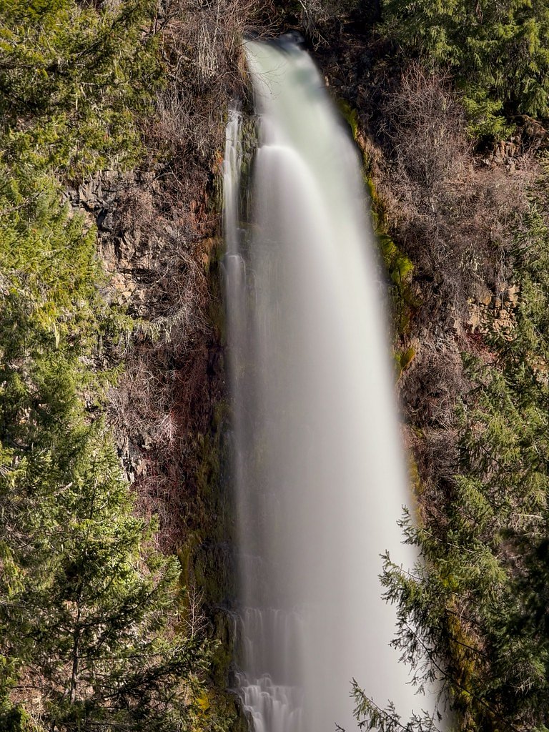
Mill Creek Falls
By Armen Suny · Last verified Mar 2026
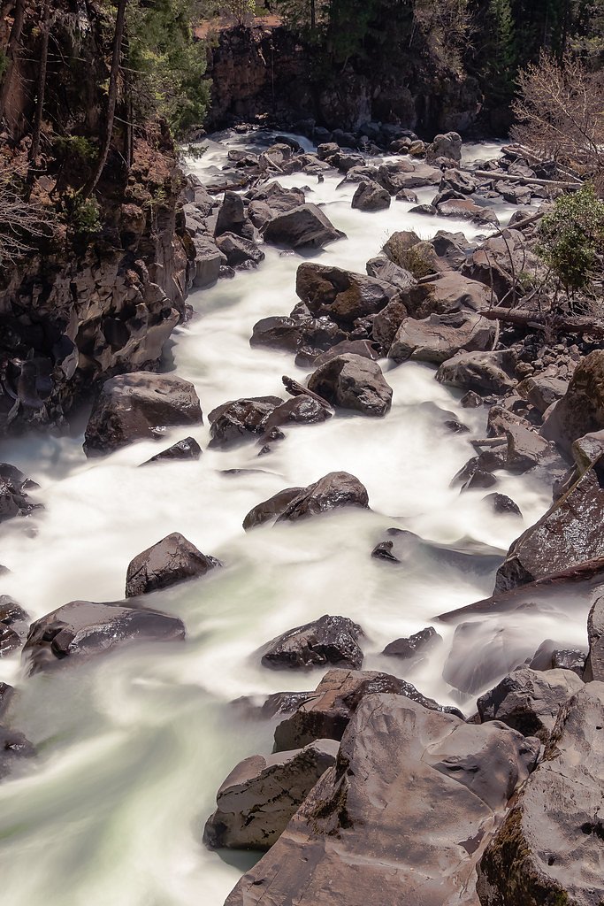
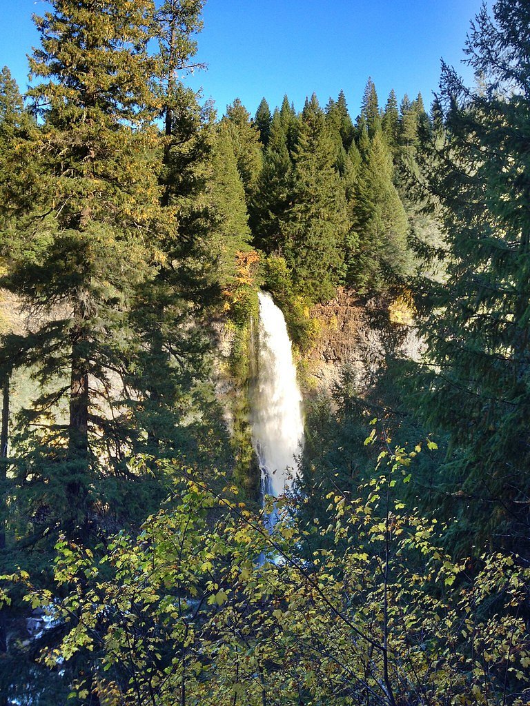
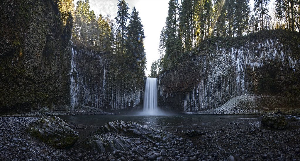
Photo Credits (5)
Difficulty
Moderate
Trail Length
2.4 miles
Trail Type
Out And Back
Elevation Gain
350 ft
About Mill Creek Falls
Mill Creek Falls sits amid the forested hills of Oregon, near the small communities of Chenoweth, Rowena and the Mount Hood area. The falls are fed by Mill Creek and offer a peaceful cascade framed by mature timber, making it a great stop for photographers and hikers looking for a classic Pacific Northwest streamside scene. The setting feels remote but is accessible enough for a half-day outing. Access to the falls is typically via a 2.4-mile out-and-back route that gains about 350 feet, so it’s a moderately paced hike that rewards you with water, shade and quiet. The nearest designated campground in the available data is Fivemile Butte Lookout, about 15.8 km (roughly 9.8 miles) away, so most visitors treat Mill Creek Falls as a day trip rather than an on-site overnight destination.
The Setting
Mill Creek Falls sits at 1,398 feet along the Mosier Creek, in the foothills of Oregon.
Trail & Hike Details
The Approach
The moderate 2.4-mile out-and-back trail gains 350 feet of elevation on the way to the falls.
Trail Description
Trail length: 2.4 miles round trip (out-and-back). Elevation gain: approximately 350 feet. Difficulty: moderate. The route is a moderately graded hike with steady climbing portions totaling the listed elevation gain; expect typical natural-trail conditions (dirt tread, roots and occasional rocks). Note: specific USFS trail name/number, and formal surface/grade/class data were not included in the provided information. Hikers should come prepared with sturdy footwear, water and a map or GPS, and check local sources for any seasonal trail advisories before heading out.
What to Expect
Visitors can expect a serene and scenic waterfall surrounded by lush greenery. The area may feature a mix of forested trails and rocky terrain. Seasonal changes can affect water flow, with spring and early summer typically offering the most dramatic views.
Accessibility
The trail is not wheelchair accessible. Uneven terrain and elevation changes require steady footing.
Frequently Asked Questions
🐶 Are Dogs Allowed at Mill Creek Falls?
❌ Dogs are not allowed
Are There Any Fees or Permits Required?
🆖 No fees required
🏊 Is There Swimming at Mill Creek Falls?
❌ Swimming is not allowed
When to Visit
Spring and early summer are ideal for visiting Mill Creek Falls, as the water flow is typically at its peak during these seasons. Fall offers beautiful foliage, while summer provides warmer weather for hiking.
Seasonal Access
The best time to visit is Spring, Summer, and Fall. Winter access may be limited.
Safety Information
Trails may be uneven, slippery, or rocky. Visitors should exercise caution, especially near the waterfall. Check weather conditions before visiting, and be aware of potential hazards such as falling rocks or swift water currents.
Current Water Conditions
1 ft³/s
Current discharge — how much water is flowing
Lower than usual for this time of year
Based on 38 years of record
2.24 ft
Water depth at gauge
7-Day Discharge Trend
What does this mean for your visit?
Flow is lower than usual for this time of year.
About This Gauge
This gauge is on a nearby waterway and may not reflect exact conditions at the falls.
7-Day Flow Outlook
Based on the USGS gauge MOSIER CREEK NEAR MOSIER, OR (15 km away).
Today
Roaring
2 cfs
6/10Tomorrow
Roaring
2 cfs
6/10Sun
Roaring
2 cfs
9/10Mon
Strong
1 cfs
10/10Tue
Strong
1 cfs
10/10Wed
Strong
1 cfs
10/10Thu
Strong
1 cfs
10/10Best window: Mon — strong flow, mostly sunny (trip score 10/10).
Best time of year: this gauge typically runs highest from mid January to mid April, peaking in March.
How we calculate this
This is a transparent outlook, not a precise forecast. We take the waterfall's current flow strength (how it ranks against its historical normal for today, from the nearest USGS stream gauge), carry that ranking forward along the gauge's seasonal curve, and nudge it for forecast rain. Confidence is highest for the next day or two and falls further out. Always check official conditions and your own judgment before visiting — high flows can be dangerous.
Know when to go.
Get a free email alert when waterfalls near Chenoweth hit peak flow. We only send when conditions are worth the trip — no weekly newsletters, no spam.
Weather Forecast
Location & Access
Getting There
Mill Creek Falls is located approximately 9.3 miles from Chenoweth, 10.0 miles from Rowena, and 10.4 miles from Mount Hood. The coordinates for the falls are 45.5189, -121.3377. Access to the falls may require navigating local roads and potentially a short hike, depending on the specific trailhead used.
Get Directions on Google MapsParking
Parking availability is not well-documented, but visitors should expect limited parking near the trailhead or along nearby roads. It is recommended to arrive early during peak seasons.
Elevation
1,398 feet above sea level
Coordinates
45.518850° N, -121.337726° W
Visitor Tips & Gear
Wear sturdy footwear, as trails may be uneven or slippery. Bring water and snacks, and check weather conditions before your visit. Cell service may be limited in the area, so plan accordingly.
As an Amazon Associate, we earn from qualifying purchases.
With 2.4 miles and 350 ft of elevation gain, sturdy boots and trekking poles will help on this moderate trail. Sun exposure on the trail makes good sun protection a must in summer.

Polarized Sunglasses (Knockaround)
Cuts glare off the water so you actually see the falls — and your photos turn out better too.

Columbia Watertight II Rain Jacket
Packs into its own pocket, seam-sealed, and keeps you dry from spray and surprise rain.

Earth Pak Waterproof Dry Bag
Keeps your phone and gear dry when waterfall mist soaks everything else.

Waterproof Phone Pouch (AiRunTech)
Cheap insurance — take photos right next to the falls without killing your phone.

Timberland Euro Sprint Mid Waterproof
Trusted waterproof boot with premium leather and grippy rubber sole — reliable on rocky, wet trails.

TrailBuddy Trekking Poles
Lightweight aluminum, cork grips, and flip-locks that actually hold — a best-seller for good reason.
Where to Stay

Cousin's Country Inn

Holiday Inn Express & Suites - The Dalles by IHG

Balch Hotel

The Dalles Inn
Browse vacation cabins and private rentals nearby
Unique outdoor stays — tents, yurts, and treehouses
Rent a campervan or RV for your waterfall road trip
Some links are affiliate links. We may earn a commission at no extra cost to you.
Nearby Campground
FIVEMILE BUTTE LOOKOUT
9.8 miles away · 1 sites
Overview Fivemile Butte Lookout is available for reservation year-round. It provides stellar mountain views and access to a variety of outdoor recreation opportunities, including hiking, mountain biking and wildlife viewing. During the winter months, the lookout is popular among hunters and winter sports enthusiasts. During winter driving conditions, from early fall to late spring, the lookout can only be accessed by skiing, snowmobiling or snowshoeing up to 3 miles one way from a parking area at
Book on Recreation.govNearby Hot Springs
Hot springs near Chenoweth, Oregon

Mount Hood Fumaroles
Mount Hood Fumaroles vent at 194°F from the flanks of Oregon's highest peak, among the state's most extreme geothermal features...
Klickitat Mineral Springs
Klickitat Mineral Springs produces 81-degree water at just 481 feet elevation on state conservation lands, flowing 27.9 degrees...

Collins Hot Springs
Collins Hot Springs emerges at 122 degrees just 127 feet above sea level in the Columbia River Gorge, producing water 68.4 degr...

Swim Warm Springs
Swim Warm Springs emerges at 79°F within Mount Hood National Forest at 4,063 feet elevation, flowing just 6.9 meters from White...
St Martins Hot Springs
St. Martins Hot Springs flows at 120 degrees Fahrenheit at just 432 feet elevation in the Columbia River Gorge near Carson in S...
Fish Hatchery Warm Spring
Fish Hatchery Warm Spring produces 75-degree water on Yakama Nation Reservation lands, flowing 23.7 degrees above ambient tempe...
Looking for a soak after your hike? Explore more hot springs near Chenoweth, Oregon on SoakingSprings.
Explore Oregon springsAdditional Information
Nearby Attractions
Nearby attractions include the towns of Chenoweth, Rowena, and Mount Hood, as well as other natural landmarks in the region.
Wildlife
The area around Mill Creek Falls may feature local wildlife such as birds, deer, and small mammals. Visitors should be mindful of their surroundings and avoid disturbing wildlife.
Cities near Mill Creek Falls
Nearby Waterfalls
Other waterfalls named Mill Creek Falls
6 other waterfalls share this name across the U.S.
Writing about Mill Creek Falls? Embed this waterfall on your site for free.