Photo Credits (5)
Difficulty
Moderate
Trail Length
1.6 km
Trail Type
Out And Back
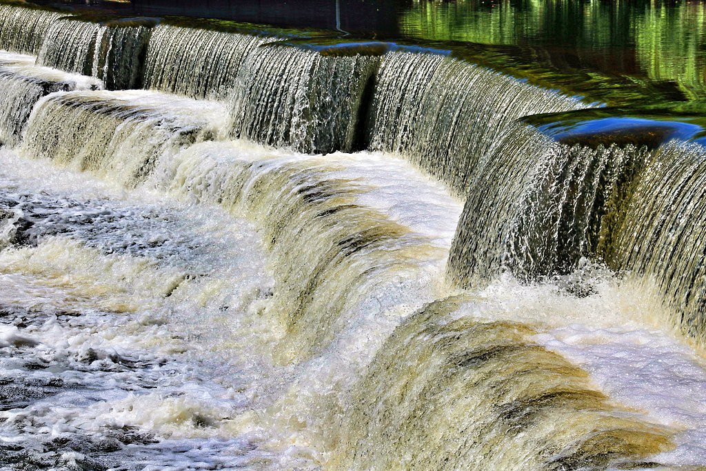
About Mill Creek Falls
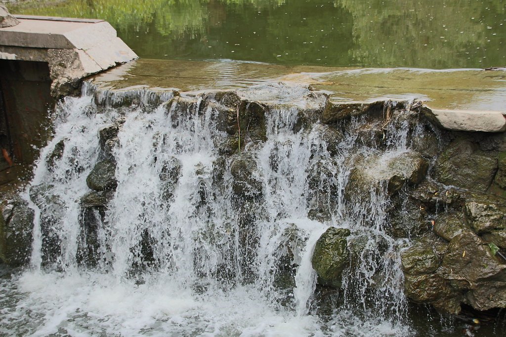
Mill Creek Falls is a small, local waterfall on Mill Creek near the towns of Cobalt (approx. 5.0 miles) and New Liskeard/Temiskaming Shores (approx. 5.3 miles) in northeastern Ontario. The falls sit in a forested, rocky setting and are best located by GPS coordinates (47.4314, -79.6195). Visitor and trail information from regional sources is limited; the site appears to be a natural cascade/plunge on a tributary creek rather than a large developed park attraction. Water flow is typically highest in spring during snowmelt and after heavy rains, and lower in late summer and early fall. Exact measurements and developed facilities are not well documented.
Why This Waterfall Exists
Mill Creek Falls flows over Cobalt Group, a soft fine-grained rock layer deposited over 2.3-2.5 billion years ago. These soft rocks erode readily, allowing the stream to carve a vertical drop into the landscape.
Trail & Hike Details
Trail Description
Trail information is sparse and the route to the falls may be an informal social trail rather than a maintained trail. Expect single-track, uneven footing, roots, rocks and potentially steep, slippery sections near the water. There may be short bushwhacks or route-finding required. Follow any cairns or faint footpaths, but be prepared for unmarked terrain and limited signage.
What to Expect
A small, natural waterfall and cascade in a mixed boreal/deciduous forest setting. Rock ledges, moss, and wet, slippery surfaces near the creek are common. The stream flow varies seasonally, strongest in spring and after rains, lower in late summer. Limited visitor facilities (likely none): no washrooms, handrails, or formal viewing platforms. Cell service may be spotty. Wildlife in the area can include deer, beaver, small mammals, and birds; larger mammals (moose, black bear) are possible in the region.
Accessibility
The trail is not wheelchair accessible. Uneven terrain and elevation changes require steady footing.
Frequently Asked Questions
🐶 Are Dogs Allowed at Mill Creek Falls?
❌ Dogs are not allowed
Are There Any Fees or Permits Required?
🆖 No fees required
🏊 Is There Swimming at Mill Creek Falls?
❌ Swimming is not allowed
When to Visit
Late spring (after snowmelt) for highest flows and dramatic water volume; early fall for fall foliage and generally stable weather. Summer offers easier access but lower flow. Winter can offer icy/frozen scenery but access and footing are hazardous and should only be attempted with proper winter gear and experience.
Seasonal Access
The best time to visit is Spring, Summer, Fall, and Winter. Check with the managing park or local authority for current conditions.
Safety Information
Hazards include slippery wet rock, unstable ledges, fast or cold water (especially during spring melt), unstable or unmarked trails, ticks, black flies, and limited cell service. Ice can form on rocks and trails in cold weather, making conditions treacherous. Do not approach cliff edges, and avoid crossing fast-moving water. If visiting in winter, use appropriate traction devices and winter safety gear. When uncertain about conditions, defer the visit.
7-Day Flow Outlook
Based on the WSC gauge MONTREAL RIVER AT MOUNTAIN CHUTES (49 km away).
Best time of year: this gauge typically runs highest from mid April to early July, peaking in May.
How we calculate this
This is a transparent outlook, not a precise forecast. We take the waterfall's current flow strength (how it ranks against its historical normal for today, from the nearest WSC stream gauge), carry that ranking forward along the gauge's seasonal curve, and nudge it for forecast rain. Confidence is highest for the next day or two and falls further out. Always check official conditions and your own judgment before visiting — high flows can be dangerous.
Know when to go.
Get a free email alert when waterfalls near Cobalt hit peak flow. We only send when conditions are worth the trip — no weekly newsletters, no spam.
Weather Forecast
Location & Access
Getting There
Use the provided coordinates (47.4314, -79.6195) with a GPS device. The falls are in a rural/forest area near Cobalt and New Liskeard (Temiskaming Shores). Access is likely via local paved or gravel roads and then an unmarked or lightly used footpath; there may be short stretches of forest road or 2-track. Consult local maps, landowner signs, or municipal offices if unsure about road access.
Get Directions on Google MapsParking
There is likely no formal parking lot. Expect informal/roadside parking or a small pullout on a nearby road. Park well off the roadway, avoid blocking gates or driveways, and obey posted signs. If in doubt, use parking in the nearest town and approach on foot.
Elevation
210 metres above sea level
Coordinates
47.431412° N, -79.619518° W
Visitor Tips & Gear
• Use the GPS coordinates and local maps; do not rely solely on informal directions. • Wear sturdy, waterproof footwear with good traction; rocks near the falls can be very slippery. • Practice Leave No Trace: pack out all trash and avoid disturbing vegetation. • Expect limited or no cell coverage; tell someone your plans and expected return time. • Bring insect repellent for black flies and mosquitoes in spring/summer. • Avoid approaching the edge of the falls or standing on wet, unstable ledges. • If conditions are icy or water is high, consider postponing the visit, winter and spring runoff can be hazardous.
Where to Stay
Browse vacation cabins and private rentals nearby
Unique outdoor stays — tents, yurts, and treehouses
Rent a campervan or RV for your waterfall road trip
Some links are affiliate links. We may earn a commission at no extra cost to you.
Nearby Campground
Fountain Falls
18 km away
Additional Information
Nearby Attractions
Cobalt: historic silver mining sites and the Cobalt Mining Museum; Temiskaming Shores/New Liskeard/Latchford area recreation on Lake Temiskaming and rivers. Local trails and provincial crown land offer additional outdoor opportunities.
Wildlife
Common regional wildlife may include white-tailed deer, beaver, varied bird species, small mammals, and occasional moose or black bear. Take standard precautions for wildlife: store food securely, give animals space, and be bear-aware where applicable.
Cities near Mill Creek Falls
Nearby Waterfalls
Other waterfalls named Mill Creek Falls
6 other waterfalls share this name across Canada.
Writing about Mill Creek Falls? Embed this waterfall on your site for free.