Mill Creek Falls
Oregon • Crater Lake National Park • 173 ft
By Armen Suny · Last verified Mar 2026
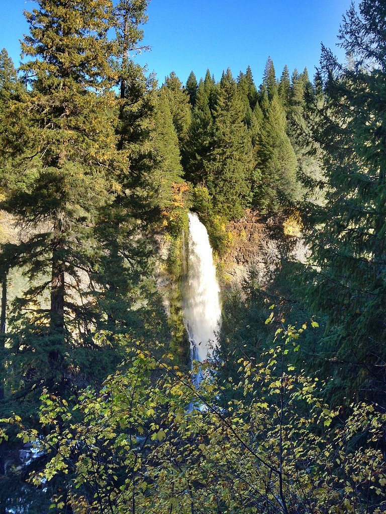
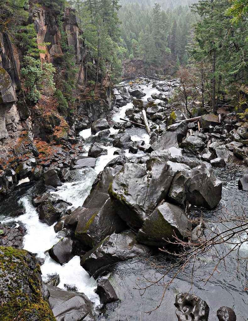
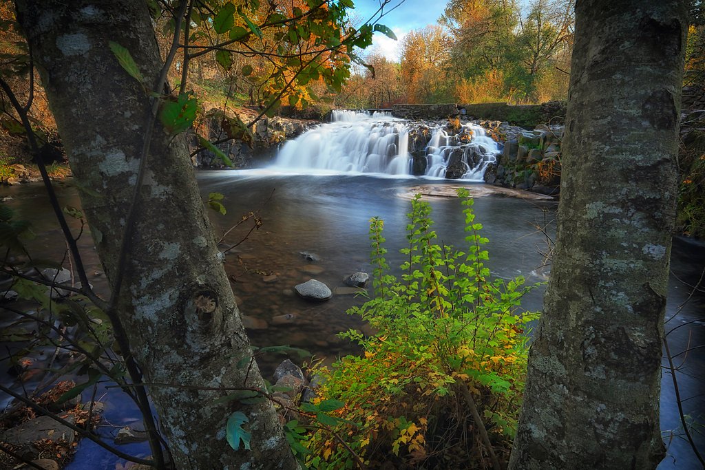
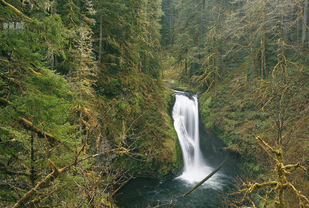

Photo Credits (5)
Difficulty
Easy
Trail Length
1.8 miles
Trail Type
Out And Back
Elevation Gain
200 ft
About Mill Creek Falls
Mill Creek Falls is a dramatic 173-foot plunge tucked near Prospect, Oregon, nestled within the Rogue River–Siskiyou National Forest. The falls pour into a basalt-walled canyon and form part of a scenic corridor that also includes Barr Creek Falls and the Avenue of the Giant Boulders, making the area a compact showcase of southern Oregon’s volcanic geology and forested beauty. Access is short and very approachable, so Mill Creek Falls is a popular choice for day hikers and photographers. The route through mixed evergreen forest delivers close viewpoints of the cascade and nearby features; because the trail is short and well-maintained, it’s a rewarding outing for families and casual explorers looking to experience a dramatic waterfall without a long backcountry trek.
The Setting
Mill Creek Falls sits at 2,365 feet within Crater Lake National Park, fed by the Rogue River, in the hills of Oregon. At 173 feet, it is among the taller waterfalls in Oregon.
Height: 173 feet
Trail & Hike Details
The Approach
The easy 1.8-mile out-and-back trail gains 200 feet of elevation on the way to the falls.
Trail Description
Trail type: 1.8-mile out-and-back; Elevation gain: ~200 ft; Difficulty: Easy. The trail is a short, well-maintained forest path composed primarily of dirt with some rocky sections and brief stair or viewpoint areas. The modest elevation gain over the short distance keeps the grade easy for most hikers; expect clear signage and compacted tread with a few uneven spots near viewpoints into the basalt canyon.
What to Expect
The falls plunge 173 feet. Dogs are welcome.
Accessibility
The trail is not wheelchair accessible. Uneven terrain and elevation changes require steady footing.
Frequently Asked Questions
🐶 Are Dogs Allowed at Mill Creek Falls?
✅ Dogs are allowed
Are There Any Fees or Permits Required?
🆖 No fees required
🏊 Is There Swimming at Mill Creek Falls?
❌ Swimming is not allowed
When to Visit
Spring and early summer are ideal times to visit, as the waterfall is typically at its fullest due to snowmelt. Fall offers beautiful foliage, while winter may bring icy conditions but fewer crowds.
Seasonal Access
The best time to visit is Spring, Summer, and Fall. Winter access may be limited. Check with Crater Lake National Park for current conditions.
Safety Information
Stay on the designated trail and avoid getting too close to the edge of the canyon. The rocks near the waterfall can be slippery, especially after rain. Be cautious of poison oak along the trail.
Current Water Conditions
683 ft³/s
Current discharge — how much water is flowing
Much lower than usual for this time of year
Based on 74 years of record
1.52 ft
Water depth at gauge
53°F
ColdBracing — limit time in water
7-Day Discharge Trend
What does this mean for your visit?
Flow is well below normal for this time of year, so the waterfall may be a trickle. Water temperature is a bracing 53 degrees F, limit your time in the water.
About This Gauge
7-Day Flow Outlook
Based on the USGS gauge ROGUE RIVER BELOW PROSPECT, OR (2 km away).
Today
Moderate
779 cfs
6/10Tomorrow
Moderate
779 cfs
6/10Sun
Moderate
739 cfs
6/10Mon
Moderate
680 cfs
8/10Tue
Moderate
648 cfs
8/10Wed
Moderate
636 cfs
8/10Thu
Moderate
636 cfs
8/10Best window: Mon — moderate flow, mostly sunny (trip score 8/10).
Best time of year: this gauge typically runs highest from early March to early June, peaking in May.
How we calculate this
This is a transparent outlook, not a precise forecast. We take the waterfall's current flow strength (how it ranks against its historical normal for today, from the nearest USGS stream gauge), carry that ranking forward along the gauge's seasonal curve, and nudge it for forecast rain. Confidence is highest for the next day or two and falls further out. Always check official conditions and your own judgment before visiting — high flows can be dangerous.
Know when to go.
Get a free email alert when waterfalls near Prospect hit peak flow. We only send when conditions are worth the trip — no weekly newsletters, no spam.
Weather Forecast
Location & Access
Getting There
Mill Creek Falls is located near the town of Prospect, Oregon. From Highway 62, take Mill Creek Drive and follow signs to the Mill Creek Falls Trailhead. The trailhead is well-marked and easy to find.
Get Directions on Google MapsParking
There is a small parking area available at the trailhead, which can accommodate several vehicles. Parking is free, but it may fill up during peak seasons.
Elevation
2,365 feet above sea level
Coordinates
42.740130° N, -122.495217° W
Visitor Tips & Gear
Arrive early during weekends or holidays to secure parking. Wear sturdy shoes as some sections of the trail may be uneven. Bring a camera to capture the scenic views.
As an Amazon Associate, we earn from qualifying purchases.
This easy 1.8 miles hike is straightforward — comfortable trail shoes and plenty of water should do. Sun exposure on the trail makes good sun protection a must in summer.

Polarized Sunglasses (Knockaround)
Cuts glare off the water so you actually see the falls — and your photos turn out better too.

Columbia Watertight II Rain Jacket
Packs into its own pocket, seam-sealed, and keeps you dry from spray and surprise rain.

Earth Pak Waterproof Dry Bag
Keeps your phone and gear dry when waterfall mist soaks everything else.

Waterproof Phone Pouch (AiRunTech)
Cheap insurance — take photos right next to the falls without killing your phone.

JOBY GorillaPod Starter Kit
Wraps around railings and rocks for long-exposure waterfall shots — no flat surface needed.

Osprey Daylite Daypack
Light, organized, and just the right size for a day hike — fits water, snacks, and layers.
Where to Stay

Crater Lake Gateway - Hwy 140

Holiday Inn Express Hotel & Suites Medford-Central Point by IHG

Resort at Eagle Point Golf Club Lodging

Crater Lake Gateway-Rocky Point Resort
Browse vacation cabins and private rentals nearby
Unique outdoor stays — tents, yurts, and treehouses
Rent a campervan or RV for your waterfall road trip
Some links are affiliate links. We may earn a commission at no extra cost to you.
Nearby Campground
LODGEPOLE GUARD STATION
8.4 miles away · 1 sites
Overview The guard station at Lodgepole Meadow was built in 1935 by the Civilian Conservation Corps to replace the original station built in 1911. Lodgepole Meadow was used as a remote guard station for the early Forest Service crews working in the area. During WWII, Herb and Zella Wright, a husband and wife lookout team, lived throughout the winter high up on the Blue Rock Lookout several miles away watching for enemy aircraft. Lodgepole Guard Station served as their base camp.Today, Lodgepole G
Book on Recreation.govNearby Hot Springs
Hot springs near Prospect, Oregon

Annie Spring
Annie Spring flows at 77°F within Crater Lake National Park at 5,983 feet elevation, discharging 1.71 cubic feet per second at ...

Umpqua Hot Springs
Umpqua Hot Springs flows at 117°F from multiple geothermal sources along the North Umpqua River in Lane County, forming cascadi...
Jackson Hot Springs
Jackson Hot Springs registers 95°F with highly alkaline chemistry, posting pH 9.3 in sodium-dominated waters containing 95 mg/L...
Eagle Point Spring
Eagle Point Spring flows at 95°F in Klamath County, emerging 45.6°F above the 49.4°F ambient temperature in a climate receiving...
Howard Holiday
Howard Holiday flows at 77°F in Klamath County near Klamath Falls, emerging at 4,107 feet elevation approximately 157 meters fr...
Hardboard Spring
Hardboard Spring flows at 70°F from roadside terrain 36 meters from the nearest road in Klamath County near Klamath Falls, emer...
Looking for a soak after your hike? Explore more hot springs near Prospect, Oregon on SoakingSprings.
Explore Oregon springsAdditional Information
Nearby Attractions
Nearby attractions include Barr Creek Falls, the Avenue of the Giant Boulders, and Crater Lake National Park, which is about an hour's drive away.
Wildlife
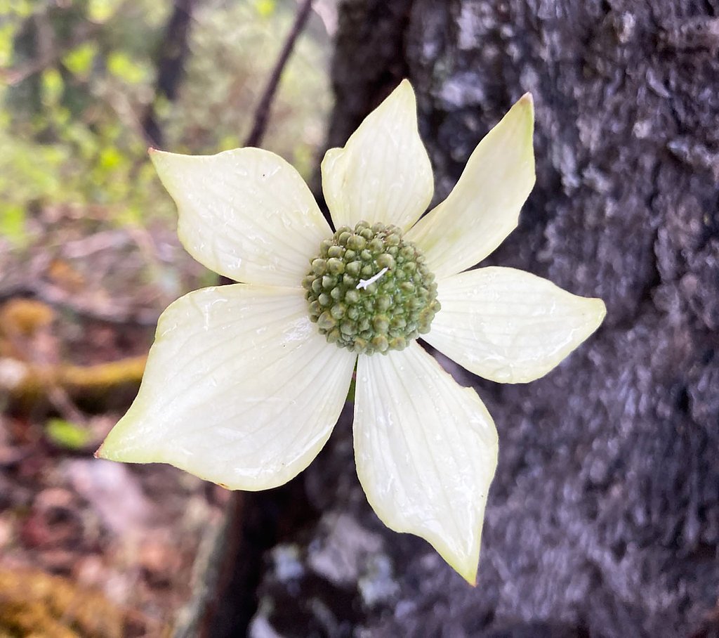
The area is home to a variety of wildlife, including deer, birds, and small mammals. Visitors may also spot wildflowers during the spring and summer months.
Cities near Mill Creek Falls
Nearby Waterfalls
 CC
CC
Other waterfalls named Mill Creek Falls
6 other waterfalls share this name across the U.S.
Writing about Mill Creek Falls? Embed this waterfall on your site for free.