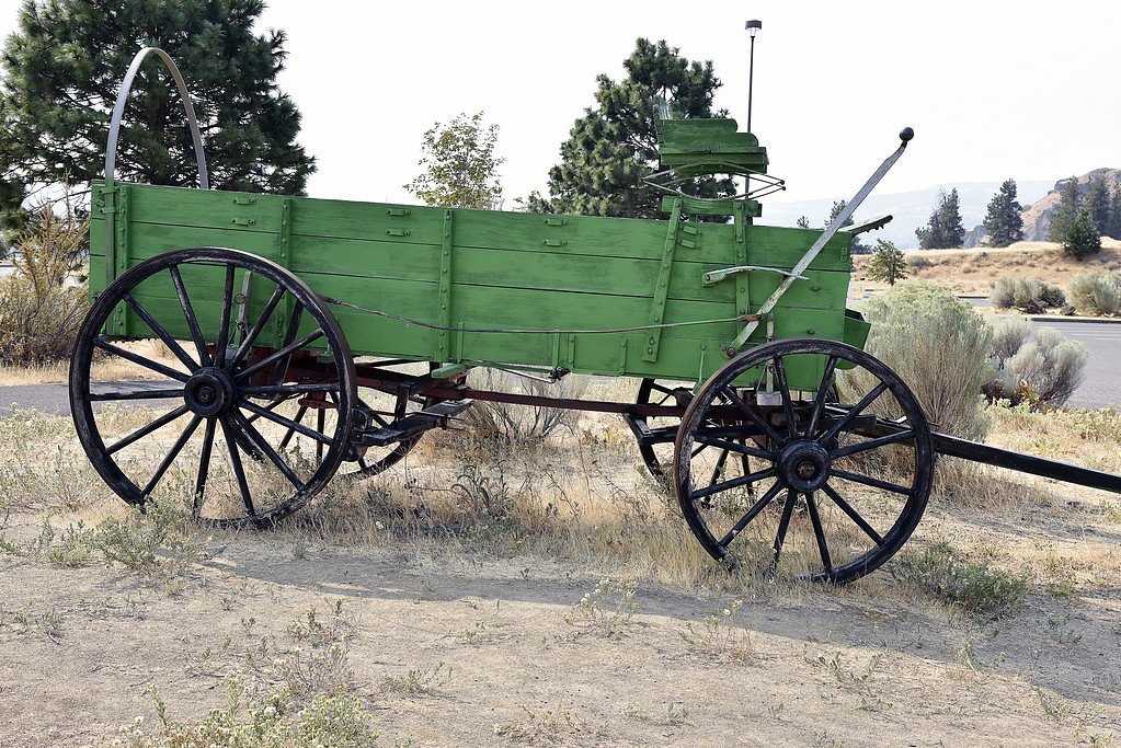
The Dalles (historical)
By Armen Suny · Last verified Mar 2026
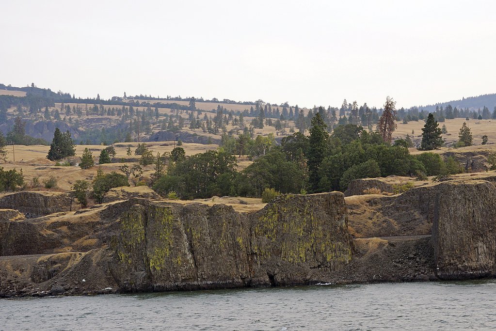
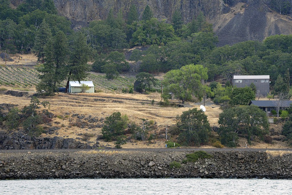
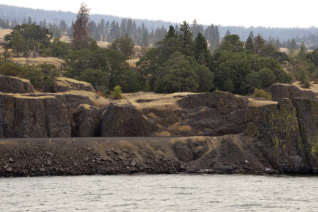

Photo Credits (5)
Difficulty
Moderate
Trail Length
2.4 miles
Trail Type
Out And Back
Elevation Gain
350 ft
About The Dalles (historical)
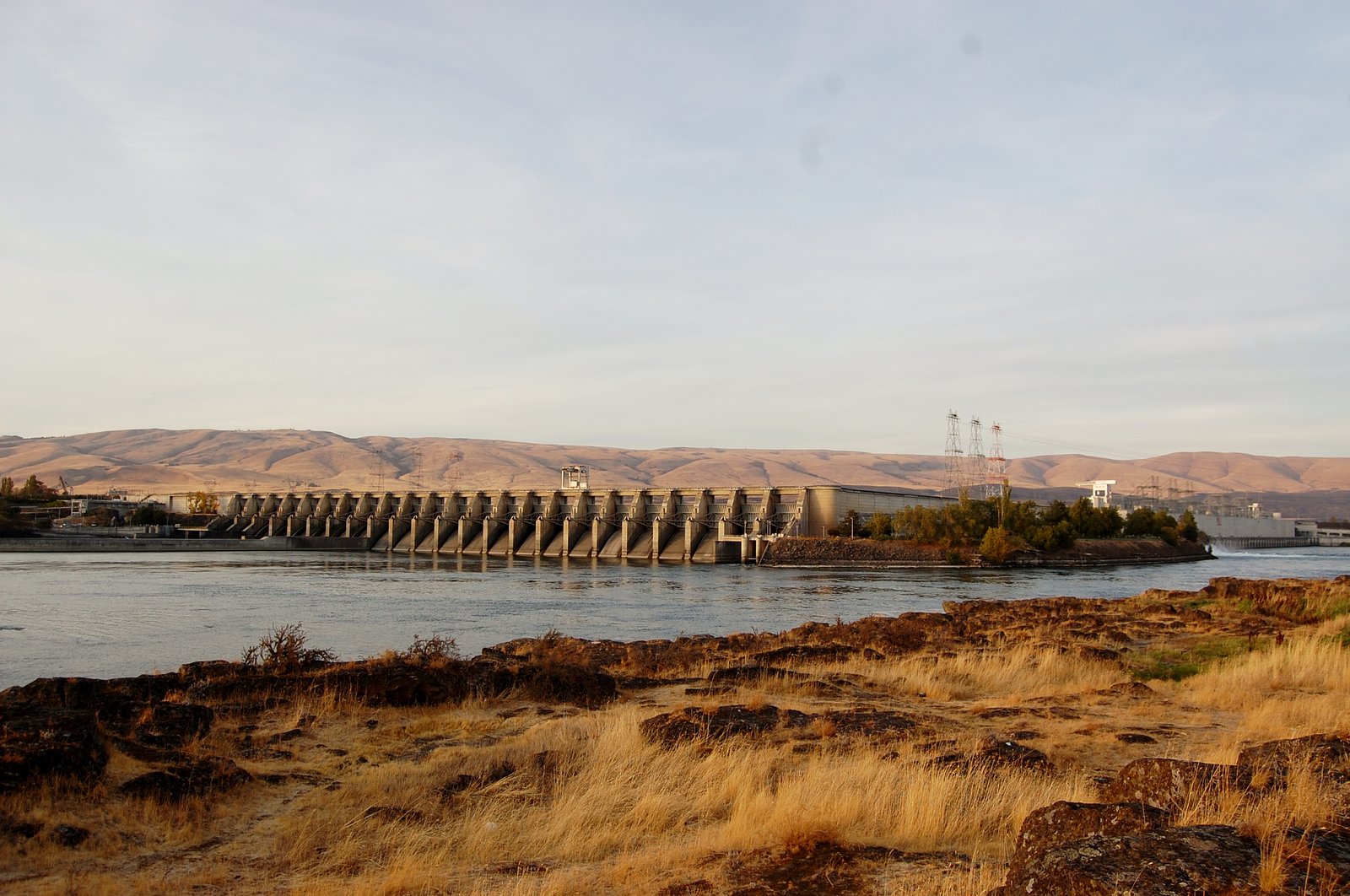
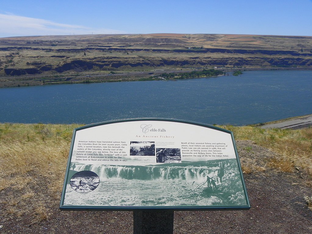
The Dalles (historical) marks the former series of rapids and waterfalls on the Columbia River that were an important fishing and trading site for Native American tribes before being submerged by the reservoir created when The Dalles Dam was completed in 1957. Where the thundering narrows once funneled salmon and sustained local communities, the river today spreads quietly behind the dam; the exact location of the original falls lies underwater but its history is still visible in maps and interpretation at nearby viewpoints. The site now sits within the Lake Bonneville recreation unit (Designation: REC), with land ownership recorded as DESG and management by the U.S. Army Corps of Engineers (USACE). While you can’t hike down to the vanished rapids, shoreline overlooks, interpretive pullouts and nearby trails give satisfying views of the reservoir and river corridor. For overnight stays, Columbia Hills State Park campground is approximately 6.24 km away, making the area a convenient base for exploring the river’s modern landscape and its historic significance.
The Setting
The Dalles (historical) sits at 82 feet within Lake Bonneville, fed by the Klickitat River, in the coastal lowlands of Washington.
Trail & Hike Details
The Approach
The moderate 2.4-mile out-and-back trail gains 350 feet of elevation on the way to the falls.
Trail Description
There is no direct trail to the original Dalles rapids—their location is submerged beneath the reservoir behind The Dalles Dam. However, nearby recreational routes and viewpoints provide access to the riverside landscape. A commonly used out-and-back route in the area is approximately 2.4 miles (about 3.9 km) round-trip with roughly 350 feet (≈107 m) of elevation gain and is generally rated moderate in difficulty. This trail type is out-and-back; surface and grade details vary by section and conditions can change seasonally, so check current information with USACE (Lake Bonneville recreation unit) or local park resources before heading out. Columbia Hills State Park campground lies about 6.24 km away for campers wanting to stay close to the river.
What to Expect
Visitors can expect to learn about the historical significance of The Dalles as a cultural and trading hub for Native American tribes. Interpretive signs and exhibits near The Dalles Dam provide historical context.
Accessibility
The trail is not wheelchair accessible. Uneven terrain and elevation changes require steady footing.
Frequently Asked Questions
🐶 Are Dogs Allowed at The Dalles (historical)?
❌ Dogs are not allowed
Are There Any Fees or Permits Required?
🆖 No fees required
🏊 Is There Swimming at The Dalles (historical)?
❌ Swimming is not allowed
When to Visit
Spring and summer are ideal for visiting nearby recreational areas and enjoying outdoor activities.
Seasonal Access
The best time to visit is Spring, Summer, and Fall. Winter access may be limited.
Safety Information
Be cautious of strong winds near the Columbia River. Follow all posted safety guidelines at recreational areas.
Current Water Conditions
881 ft³/s
Current discharge — how much water is flowing
Lower than usual for this time of year
Based on 99 years of record
4.29 ft
Water depth at gauge
65°F
CoolRefreshing for swimming
7-Day Discharge Trend
What does this mean for your visit?
Flow is lower than usual for this time of year. Water temperature is a refreshing 65 degrees F, good for a quick swim. Expect very murky conditions with low visibility.
Water Quality
Water Clarity
Slightly cloudyMinor sediment present
About This Gauge
This gauge is on a nearby waterway and may not reflect exact conditions at the falls.
7-Day Flow Outlook
Based on the USGS gauge KLICKITAT RIVER NEAR PITT, WA (17 km away).
Today
Barely Flowing
881 cfs
5/10Tomorrow
Barely Flowing
945 cfs
3/10Sat
Low
987 cfs
4/10Sun
Low
980 cfs
4/10Mon
Barely Flowing
897 cfs
5/10Tue
Barely Flowing
856 cfs
5/10Wed
Barely Flowing
831 cfs
5/10Best window: Today — barely flowing flow, sunny (trip score 5/10).
Best time of year: this gauge typically runs highest from mid March to mid June, peaking in May.
How we calculate this
This is a transparent outlook, not a precise forecast. We take the waterfall's current flow strength (how it ranks against its historical normal for today, from the nearest USGS stream gauge), carry that ranking forward along the gauge's seasonal curve, and nudge it for forecast rain. Confidence is highest for the next day or two and falls further out. Always check official conditions and your own judgment before visiting — high flows can be dangerous.
Know when to go.
Get a free email alert when waterfalls near The Dalles hit peak flow. We only send when conditions are worth the trip — no weekly newsletters, no spam.
Weather Forecast
Location & Access
Getting There
The Dalles (historical) is located along the Columbia River near the city of The Dalles, Washington. The area is now part of the reservoir created by The Dalles Dam, and the original rapids and falls are no longer visible.
Get Directions on Google MapsParking
Parking is available at various viewpoints and recreational areas near The Dalles Dam.
Elevation
82 feet above sea level
Coordinates
45.605954° N, -121.165071° W
Land Management
Managed by USACE
Visitor Tips & Gear
Bring binoculars to enjoy views of the Columbia River and surrounding landscapes. Check weather conditions before visiting, as the area can be windy.
As an Amazon Associate, we earn from qualifying purchases.
With 2.4 miles and 350 ft of elevation gain, sturdy boots and trekking poles will help on this moderate trail. Sun exposure on the trail makes good sun protection a must in summer.

Polarized Sunglasses (Knockaround)
Cuts glare off the water so you actually see the falls — and your photos turn out better too.

Columbia Watertight II Rain Jacket
Packs into its own pocket, seam-sealed, and keeps you dry from spray and surprise rain.

Earth Pak Waterproof Dry Bag
Keeps your phone and gear dry when waterfall mist soaks everything else.

Waterproof Phone Pouch (AiRunTech)
Cheap insurance — take photos right next to the falls without killing your phone.

Timberland Euro Sprint Mid Waterproof
Trusted waterproof boot with premium leather and grippy rubber sole — reliable on rocky, wet trails.

TrailBuddy Trekking Poles
Lightweight aluminum, cork grips, and flip-locks that actually hold — a best-seller for good reason.
Where to Stay

Cousin's Country Inn

Holiday Inn Express & Suites - The Dalles by IHG

The Dalles Inn

Columbia River Hotel and Conference Center, an Ascend Collection Hotel
Browse vacation cabins and private rentals nearby
Unique outdoor stays — tents, yurts, and treehouses
Rent a campervan or RV for your waterfall road trip
Some links are affiliate links. We may earn a commission at no extra cost to you.
Nearby Campground
Columbia Hills State Park
3.9 miles away · 0 sites
This recreation area is part of The Dalles Lock and Dam, Lake Celilo
Book on Recreation.govNearby Hot Springs
Hot springs near The Dalles, Washington
Klickitat Mineral Springs
Klickitat Mineral Springs produces 81-degree water at just 481 feet elevation on state conservation lands, flowing 27.9 degrees...
Fish Hatchery Warm Spring
Fish Hatchery Warm Spring produces 75-degree water on Yakama Nation Reservation lands, flowing 23.7 degrees above ambient tempe...

Collins Hot Springs
Collins Hot Springs emerges at 122 degrees just 127 feet above sea level in the Columbia River Gorge, producing water 68.4 degr...
St Martins Hot Springs
St. Martins Hot Springs flows at 120 degrees Fahrenheit at just 432 feet elevation in the Columbia River Gorge near Carson in S...

Mount Hood Fumaroles
Mount Hood Fumaroles vent at 194°F from the flanks of Oregon's highest peak, among the state's most extreme geothermal features...
Moffetts (Bonneville) Hot Springs
Moffetts Hot Springs, also called Bonneville Hot Springs, flows at 97 degrees in the Gifford Pinchot National Forest at just 75...
Looking for a soak after your hike? Explore more hot springs near The Dalles, Washington on SoakingSprings.
Explore Washington springsAdditional Information
Nearby Attractions
The Dalles Dam, Columbia Gorge Discovery Center, and nearby hiking trails in the Columbia River Gorge.
Wildlife
The area is home to various bird species, including eagles and ospreys, as well as fish species in the Columbia River.
Cities near The Dalles (historical)
Nearby Waterfalls
Writing about The Dalles (historical)? Embed this waterfall on your site for free.