Mill Creek Falls
California • 75 ft
By Armen Suny · Last verified Mar 2026
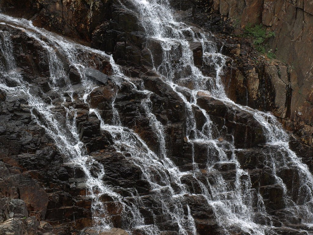
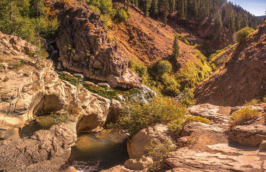
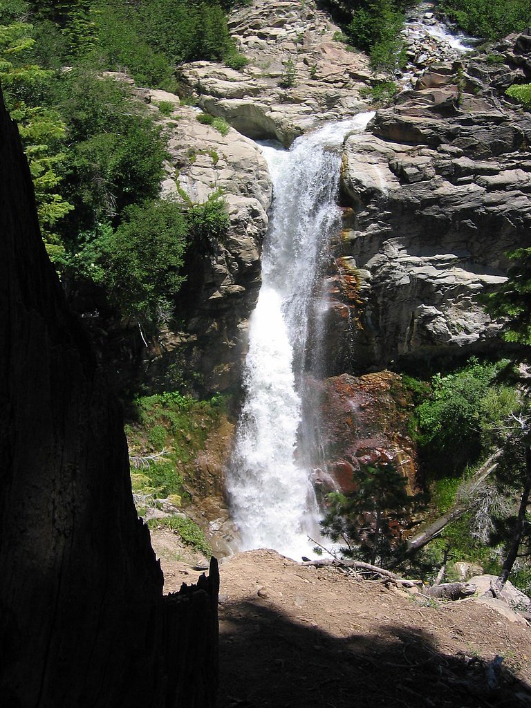
Photo Credits (5)
Difficulty
Moderate
Trail Length
3.8 miles
Trail Type
Out And Back
Elevation Gain
600 ft
About Mill Creek Falls
Mill Creek Falls is an impressive 75-foot cascade tucked into Modoc National Forest in California and managed by the U.S. Forest Service. The falls make a rewarding destination for hikers looking for a relatively short outing with a dramatic payoff: the drop is the highlight of the route and a popular spot for photos and quiet nature time. Access is via the USFS-designated MILL CREEK FALLS TRAIL (Trail #15E34-09). The approach is rated moderate overall: the round-trip outing is listed as an out-and-back of about 3.8 miles with roughly 600 feet of elevation gain. That combination makes the hike a good choice for fit day-hikers and those who want a shorter route with a bit of climb and a scenic endpoint. The U.S. Forest Service maintains the trail, so expect a clearly identified route and signage consistent with Forest Service management.
The Setting
Mill Creek Falls sits at 5,768 feet within Modoc National Forest, in the high mountains of California. The falls drop 75 feet.
Height: 75 feet
Trail & Hike Details
The Approach
The moderate hike follows Mill Creek Falls Trail (#15E34-09), a 3.8-mile out-and-back trail over natural surface. Expect 600 feet of elevation gain with grades of 8-10%. The trail is moderately developed (Class 2).
USFS Trail
MILL CREEK FALLS TRAIL #15E34-09
Trail Class
Moderately Developed
Surface
Avg Grade
USFS Segment
0.11 miTrail Description
Trail name/number: MILL CREEK FALLS TRAIL (Trail #15E34-09). Trail type: out-and-back; total route length reported as about 3.8 miles with approximately 600 feet of elevation gain and a moderate difficulty rating. The Falls themselves are listed at 75 feet in height. USFS trail data: the Mill Creek Falls Trail is mapped as a Class 2 route on a native-material surface (NAT). The GIS-recorded segment length for the USFS trail is 0.11 miles; typical grade on the maintained segment is 8–10%. Expect a short, clearly defined native-surface trail segment at the falls, with moderate grades on the approach given the overall elevation gain for the outing.
What to Expect
The falls drop 75 feet.
Accessibility
The trail is not wheelchair accessible. Uneven terrain and elevation changes require steady footing.
Frequently Asked Questions
🐶 Are Dogs Allowed at Mill Creek Falls?
❌ Dogs are not allowed
Are There Any Fees or Permits Required?
🤑 Fee: $30.00
🏊 Is There Swimming at Mill Creek Falls?
❌ Swimming is not allowed
When to Visit
Spring and early summer are the best times to visit, as the waterfall is most impressive with higher water flow from snowmelt.
Seasonal Access
The best time to visit is Spring, Summer, and Fall. Access roads and trails may close during winter due to snow. Check with Modoc National Forest for seasonal road closures.
Safety Information
Be cautious of slippery rocks near the waterfall. Stay on the designated trail to avoid damaging the environment or putting yourself at risk. Carry bear spray and be aware of wildlife.
Current Water Conditions
87 ft³/s
Current discharge — how much water is flowing
About average for this time of year
Based on 97 years of record
2.57 ft
Water depth at gauge
7-Day Discharge Trend
What does this mean for your visit?
Flow is about average for this time of year.
About This Gauge
This gauge is on a nearby waterway and may not reflect exact conditions at the falls.
7-Day Flow Outlook
Based on the USGS gauge SF PIT R NR LIKELY CA (14 km away).
Today
Moderate
99 cfs
4/10Tomorrow
Moderate
105 cfs
4/10Sun
Moderate
89 cfs
8/10Mon
Low
81 cfs
6/10Tue
Low
84 cfs
6/10Wed
Low
81 cfs
6/10Thu
Low
79 cfs
6/10Best window: Sun — moderate flow, areas of frost then mostly sunny (trip score 8/10).
Best time of year: this gauge typically runs highest from late April to late June, peaking in May.
How we calculate this
This is a transparent outlook, not a precise forecast. We take the waterfall's current flow strength (how it ranks against its historical normal for today, from the nearest USGS stream gauge), carry that ranking forward along the gauge's seasonal curve, and nudge it for forecast rain. Confidence is highest for the next day or two and falls further out. Always check official conditions and your own judgment before visiting — high flows can be dangerous.
Know when to go.
Get a free email alert when waterfalls near Eagleville hit peak flow. We only send when conditions are worth the trip — no weekly newsletters, no spam.
Weather Forecast
Location & Access
Getting There
Mill Creek Falls is accessible via Lassen Volcanic National Park. The trailhead begins near the Kohm Yah-mah-nee Visitor Center, which is located off Highway 89.
Get Directions on Google MapsParking
Parking is available at the Kohm Yah-mah-nee Visitor Center. Spaces may be limited during peak seasons, so arriving early is recommended.
Elevation
5,768 feet above sea level
Coordinates
41.278784° N, -120.285779° W
Land Management
Managed by USFS
Visitor Tips & Gear
Wear sturdy hiking shoes as the trail can be uneven in places. Bring water and snacks, especially during warmer months. Check weather conditions before your visit, as snow can make the trail inaccessible in winter.
This trail sits at 5,768 ft above sea level
Elevated TrailUV radiation is roughly 23% stronger at this elevation than at sea level, and the dry air accelerates dehydration. Extra sun protection and fluids go a long way.
As an Amazon Associate, we earn from qualifying purchases.

Coppertone Sport SPF 50 Sunscreen
UV intensity jumps ~4% per 1,000 ft — at this elevation you can burn in half the time.

Sun Bum SPF 30 Lip Balm (3-Pack)
Lips have almost no natural UV protection and burn fast in thin, dry mountain air.

Liquid I.V. Electrolyte Packets
You lose moisture ~2x faster at elevation — electrolytes help you absorb water efficiently.

ROCKNIGHT Polarized UV400 Sunglasses
High-altitude glare off rock and water is intense — UV400 lenses block 99%+ of UVA/UVB.
As an Amazon Associate, we earn from qualifying purchases.
With 3.8 miles and 600 ft of elevation gain, sturdy boots and trekking poles will help on this moderate trail. Sun exposure on the trail makes good sun protection a must in summer.

Polarized Sunglasses (Knockaround)
Cuts glare off the water so you actually see the falls — and your photos turn out better too.

Columbia Watertight II Rain Jacket
Packs into its own pocket, seam-sealed, and keeps you dry from spray and surprise rain.

Earth Pak Waterproof Dry Bag
Keeps your phone and gear dry when waterfall mist soaks everything else.

Waterproof Phone Pouch (AiRunTech)
Cheap insurance — take photos right next to the falls without killing your phone.

Timberland Euro Sprint Mid Waterproof
Trusted waterproof boot with premium leather and grippy rubber sole — reliable on rocky, wet trails.

TrailBuddy Trekking Poles
Lightweight aluminum, cork grips, and flip-locks that actually hold — a best-seller for good reason.
Where to Stay


Browse vacation cabins and private rentals nearby
Unique outdoor stays — tents, yurts, and treehouses
Rent a campervan or RV for your waterfall road trip
Some links are affiliate links. We may earn a commission at no extra cost to you.
Nearby Campground
Patterson Guard Station
7.5 miles away · 1 sites
Overview *Altitude is 7,080 feet above sea level* Set on the edge of a meadow surrounded by Aspen, Fir and Pine trees, Patterson Guard Station has stood since 1921. It served the Modoc National Forest as a fully staffed fire office and guard station until 1981. Just a few footsteps from the Summit Trail and one-quarter mile from the wilderness boundary, Patterson Guard Station can be your basecamp for trips into the South Warner Wilderness or the perfect place to disconnect and relax. The cabi
Book on Recreation.govNearby Hot Springs
Hot springs near Eagleville, California
West Valley Reservoir Hot Spring
West Valley Reservoir Hot Spring flows at 171°F in the volcanic highlands near Alturas, discharging water 121.5 degrees above a...
Hot Springs (Menlo Baths)
Hot Springs historically known as Menlo Baths emerge at 135°F from the floor of Surprise Valley in Modoc County at 4,510 feet e...
Warm Spring
Warm Spring emerges at 70°F in the volcanic heartland of northeastern California, where the Basin and Range meets the Cascades....
Warm Spring
Warm Spring emerges at 75°F on the high plateau of northeastern California, rising 24.1 degrees above the 50.9°F annual average...
Springs
These warm springs sit at 4,798 feet elevation in Modoc County's remote plateau country near Alturas, emerging just 193 feet fr...
Squaw Baths
Squaw Baths emerges at a vigorous 106 degrees just 47 meters from Surprise Valley Road at 4,494 feet elevation in Modoc County'...
Looking for a soak after your hike? Explore more hot springs near Eagleville, California on SoakingSprings.
Explore California springsAdditional Information
Nearby Attractions
Nearby attractions include Bumpass Hell, Lassen Peak, and the Sulphur Works geothermal area.
Wildlife
Wildlife in the area may include deer, squirrels, and various bird species. Bears are also present in the park, so proper food storage is essential.
Cities near Mill Creek Falls
Other waterfalls named Mill Creek Falls
6 other waterfalls share this name across the U.S.
Writing about Mill Creek Falls? Embed this waterfall on your site for free.