Photo Credits (5)
Difficulty
Moderate
Trail Length
2.4 miles
Trail Type
Out And Back
Elevation Gain
350 ft
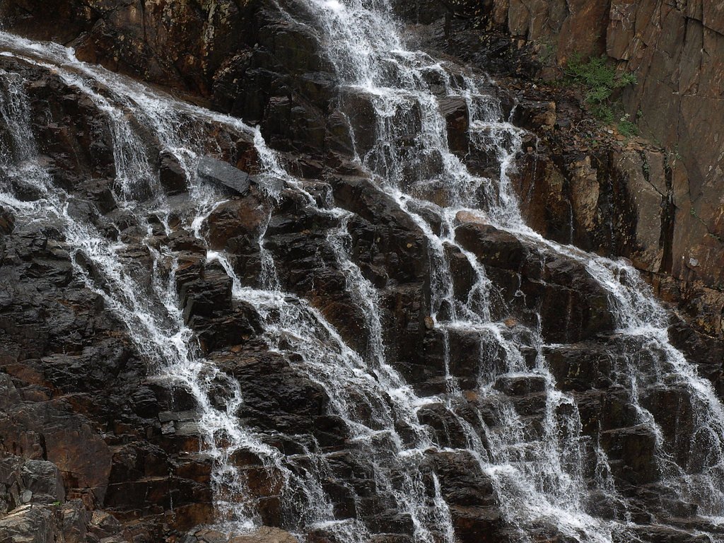
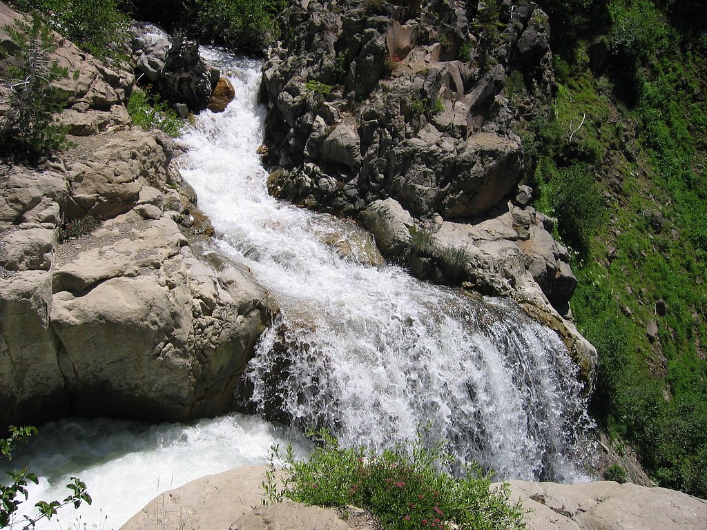
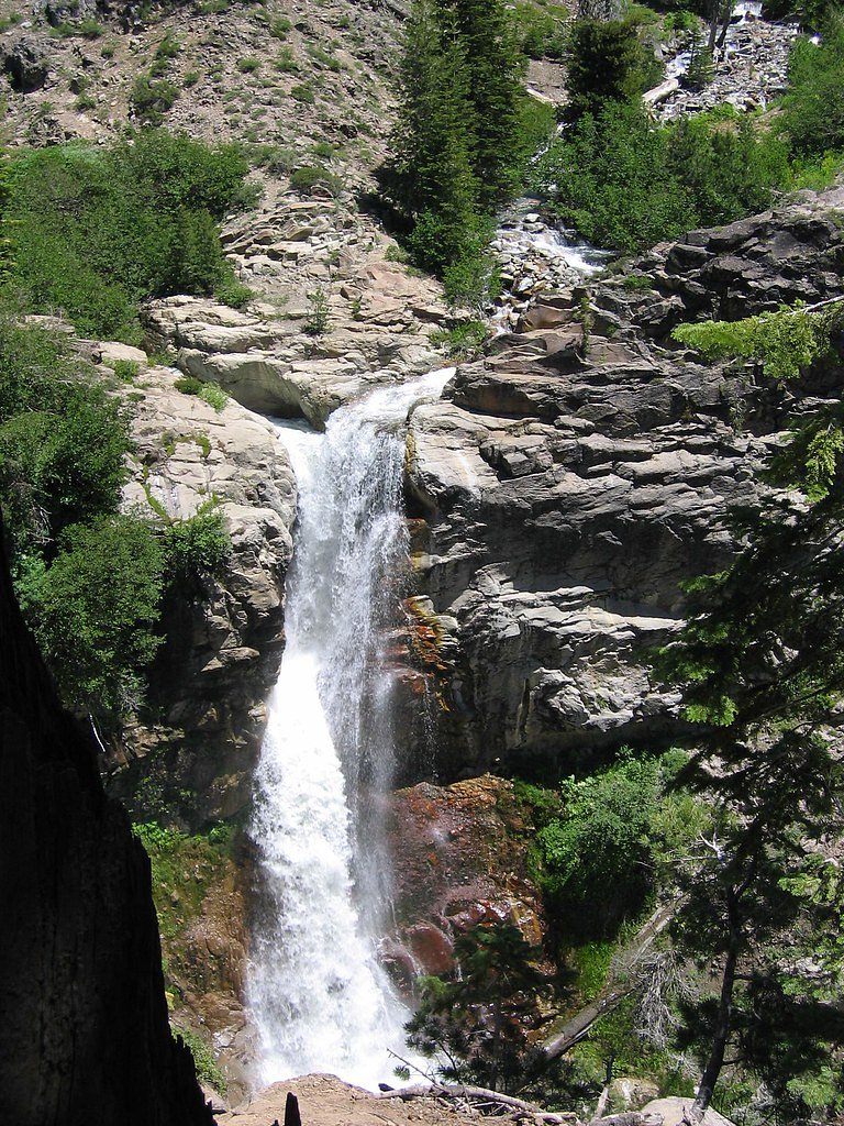
About Mill Creek Falls
Mill Creek Falls is a scenic waterfall on Mill Creek near Leggett, California, set among the redwood and mixed-conifer forests of the coastal range. The falls sit within the Standish-Hickey State Recreation Area, managed by California State Parks (SPR), and offer a peaceful, wooded setting that draws hikers and nature lovers looking for a short, restorative outing in the trees. Access to the falls is best enjoyed as a moderately paced hike that follows the Mill Creek drainage. The route’s manageable length and elevation change make it a pleasant half-day excursion for visitors seeking waterfall views and quiet forest scenery within the state recreation area.
The Setting
Mill Creek Falls sits at 850 feet within Standish-Hickey State Recreation Area, in the foothills of California.
Trail & Hike Details
The Approach
The moderate 2.4-mile out-and-back trail gains 350 feet of elevation on the way to the falls.
Trail Description
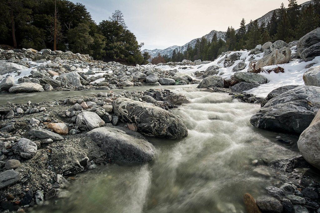
Trail to Mill Creek Falls is a 2.4-mile out-and-back route with about 350 feet of elevation gain and is rated moderate in difficulty. The path traverses forested terrain and includes uneven footing and some elevation changes; hikers should be prepared for natural trail conditions rather than paved surfaces. The route is managed within Standish-Hickey State Recreation Area (SPR) and is suitable for those comfortable with a moderate, unpaved woodland hike.
What to Expect
Visitors can expect a tranquil waterfall surrounded by dense forest. The area is likely to be peaceful and offers opportunities for photography and nature observation.
Accessibility
The trail is not wheelchair accessible. Uneven terrain and elevation changes require steady footing.
Frequently Asked Questions
🐶 Are Dogs Allowed at Mill Creek Falls?
❌ Dogs are not allowed
Are There Any Fees or Permits Required?
🆖 No fees required
🏊 Is There Swimming at Mill Creek Falls?
❌ Swimming is not allowed
When to Visit
Spring and early summer are typically the best times to visit, as water flow is likely to be at its peak. However, the falls may be accessible year-round.
Seasonal Access
The best time to visit is Spring, Summer, Fall, and Winter.
Safety Information
Trail conditions may vary, and the area can be slippery, especially after rain. Visitors should exercise caution near the water and avoid climbing on wet rocks.
Current Water Conditions
51 ft³/s
Current discharge — how much water is flowing
About average for this time of year
Based on 53 years of record
5.58 ft
Water depth at gauge
7-Day Discharge Trend
What does this mean for your visit?
Flow is about average for this time of year.
About This Gauge
7-Day Flow Outlook
Based on the USGS gauge SF EEL R A LEGGETT CA (2 km away).
Today
Moderate
51 cfs
8/10Tomorrow
Moderate
49 cfs
8/10Mon
Moderate
47 cfs
8/10Tue
Moderate
47 cfs
8/10Wed
Moderate
45 cfs
8/10Thu
Moderate
44 cfs
8/10Fri
Moderate
42 cfs
8/10Best window: Today — moderate flow, sunny (trip score 8/10).
Best time of year: this gauge typically runs highest from early January to early April, peaking in February.
How we calculate this
This is a transparent outlook, not a precise forecast. We take the waterfall's current flow strength (how it ranks against its historical normal for today, from the nearest USGS stream gauge), carry that ranking forward along the gauge's seasonal curve, and nudge it for forecast rain. Confidence is highest for the next day or two and falls further out. Always check official conditions and your own judgment before visiting — high flows can be dangerous.
Know when to go.
Get a free email alert when waterfalls near Leggett hit peak flow. We only send when conditions are worth the trip — no weekly newsletters, no spam.
Weather Forecast
Location & Access
Getting There
Mill Creek Falls is located approximately 1.7 miles from Leggett, California. Visitors can access the area via Highway 101, with the falls situated near the Avenue of the Giants. Specific directions to the trailhead or parking area may vary, so it is recommended to consult local maps or guides.
Get Directions on Google MapsParking
Parking availability is unclear, but there may be roadside or designated parking areas nearby. Visitors should check for signage or local guidance.
Elevation
850 feet above sea level
Coordinates
39.881278° N, -123.745256° W
Land Management
Managed by SPR
Visitor Tips & Gear
Wear sturdy footwear and bring water, as trail conditions are not well-documented. Check weather conditions before visiting, as rain may make trails slippery.
As an Amazon Associate, we earn from qualifying purchases.
With 2.4 miles and 350 ft of elevation gain, sturdy boots and trekking poles will help on this moderate trail. Icy conditions are common in winter — traction cleats are a smart addition.

Columbia Watertight II Rain Jacket
Packs into its own pocket, seam-sealed, and keeps you dry from spray and surprise rain.

Polarized Sunglasses (Knockaround)
Cuts glare off the water so you actually see the falls — and your photos turn out better too.

Earth Pak Waterproof Dry Bag
Keeps your phone and gear dry when waterfall mist soaks everything else.

Waterproof Phone Pouch (AiRunTech)
Cheap insurance — take photos right next to the falls without killing your phone.

Timberland Euro Sprint Mid Waterproof
Trusted waterproof boot with premium leather and grippy rubber sole — reliable on rocky, wet trails.

TrailBuddy Trekking Poles
Lightweight aluminum, cork grips, and flip-locks that actually hold — a best-seller for good reason.
Where to Stay

Redwoods River Resort & Campground

Inn of the Lost Coast

The Oceanfront Inn

Benbow Historic Inn
Browse vacation cabins and private rentals nearby
Unique outdoor stays — tents, yurts, and treehouses
Rent a campervan or RV for your waterfall road trip
Some links are affiliate links. We may earn a commission at no extra cost to you.
Nearby Campground
Wailaki Campground
16.7 miles away · 0 sites
CLOSED FOR THE SEASON. WILL REOPEN MARCH 1, 2025 CAMPGROUND DETAILS • 13 campsites • Wheelchair accessible • Group site available on first come first serve basis • Fire rings, picnic tables, bear-proof trash cans, vault toilets •Trailhead for the Bear Creek Nature Trail which connects to Wailaki Campground • Trailhead alternative for the Chemise Mountain Trail No OHV access. NO HOOK-UPS. NO POTABLE WATER Wailaki Campground is located just off of Shelter Cove Road, a short drive from the town of
Book on Recreation.govNearby Hot Springs
Hot springs near Leggett, California
Jackson Valley Mud Springs
Jackson Valley Mud Springs produces 80-degree water from the Mendocino County coast range near Laytonville. The spring's muddy ...
Pinches Spring
Pinches Spring flows at 70 degrees Fahrenheit in Mendocino County's heavily forested mountains, creating moderately warm waters...
Muir Springs
Muir Springs flows at a modest 68°F (20°C) in Mendocino County's coastal mountains, sitting 11 degrees above the ambient temper...

Orrs Springs
Orrs Springs flows at 104 degrees Fahrenheit in Mendocino County, creating a 48-degree thermal anomaly in this cooler mountain ...
Vichy Springs
Vichy Springs flows at 85 degrees in Mendocino County wine country, producing water 26 degrees warmer than ambient temperature ...

Crabtree Hot Springs
Crabtree Hot Springs emerges at 106°F from private property approximately 25 miles north of Upper Lake, remains closed to publi...
Looking for a soak after your hike? Explore more hot springs near Leggett, California on SoakingSprings.
Explore California springsAdditional Information
Nearby Attractions
Nearby attractions include the Avenue of the Giants and other scenic spots in Humboldt Redwoods State Park.
Wildlife
The area may feature local wildlife such as birds, deer, and small mammals. Be cautious of ticks and other insects.
Cities near Mill Creek Falls
Other waterfalls named Mill Creek Falls
6 other waterfalls share this name across the U.S.
Writing about Mill Creek Falls? Embed this waterfall on your site for free.