Difficulty
Moderate
Trail Length
2.0 miles
Trail Type
Out And Back
Elevation Gain
300 ft
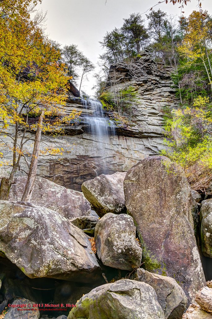
About Hilliard Falls
Hilliard Falls is a picturesque waterfall located in Tennessee, known for its serene surroundings and natural beauty. It is a lesser-known destination, making it a peaceful spot for nature enthusiasts.
The Setting
Hilliard Falls sits at 1,939 feet along the Basses Creek, in the hills of Tennessee.
Nearby Falls Worth Visiting
Laurel Falls (80 ft) lies 7.4 miles to the south. Also nearby: Stinging Fork Falls (30 ft, 9.0 mi).
Trail & Hike Details
The Approach
The moderate 2.0-mile out-and-back trail gains 300 feet of elevation on the way to the falls.
Trail Description
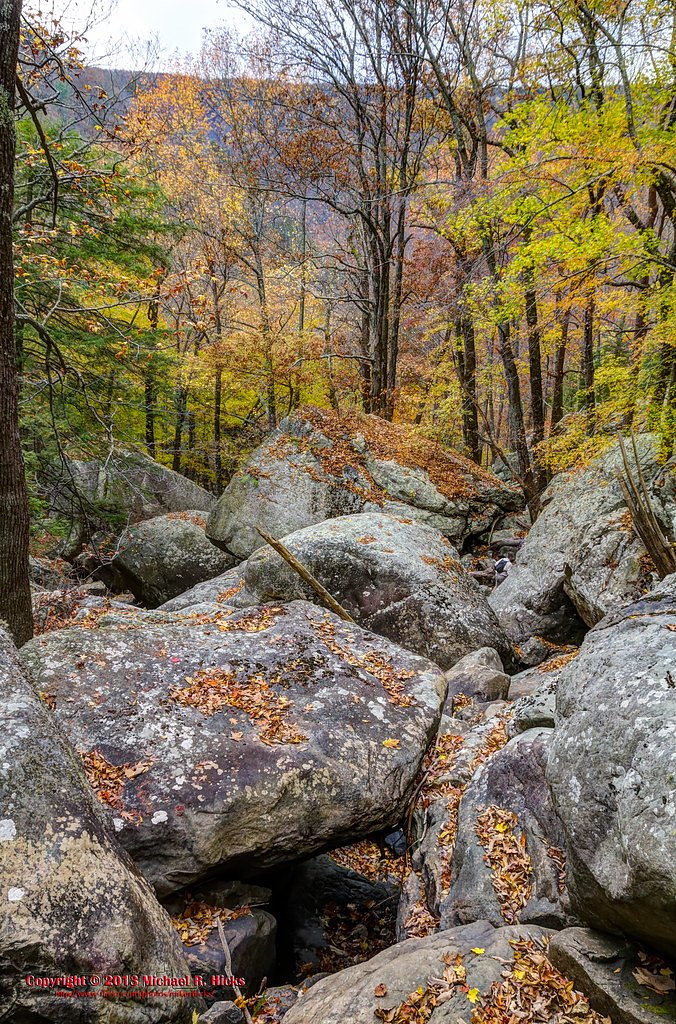
The trail to Hilliard Falls is a moderately challenging hike through forested terrain. It features some uneven paths and potential stream crossings, making sturdy footwear essential. The trail is not heavily trafficked, offering a quiet and immersive experience in nature.
What to Expect
Visitors can expect a peaceful hike through wooded areas leading to a scenic waterfall. The falls may vary in flow depending on recent rainfall, with spring and early summer typically offering the most impressive views.
Accessibility
The trail is not wheelchair accessible. Uneven terrain and elevation changes require steady footing.
Frequently Asked Questions
🐶 Are Dogs Allowed at Hilliard Falls?
❌ Dogs are not allowed
Are There Any Fees or Permits Required?
🆖 No fees required
🏊 Is There Swimming at Hilliard Falls?
❌ Swimming is not allowed
When to Visit
Spring and early summer are the best times to visit, as the waterfall is likely to have a stronger flow due to seasonal rainfall.
Seasonal Access
The best time to visit is Spring, Summer, and Fall. Winter access may be limited.
Safety Information
Be cautious of slippery rocks near the waterfall and stream crossings. Check weather conditions before your visit, as rain can make the trail more challenging. Cell service may be limited in the area.
Current Water Conditions
1 ft³/s
Current discharge — how much water is flowing
About average for this time of year
Based on 14 years of record
2.36 ft
Water depth at gauge
7-Day Discharge Trend
What does this mean for your visit?
Flow is about average for this time of year.
About This Gauge
This gauge is on a nearby waterway and may not reflect exact conditions at the falls.
7-Day Flow Outlook
Based on the USGS gauge BASSES CREEK AT LAKE TANSI NR CROSSVILLE,TN (22 km away).
Today
Low
1 cfs
6/10Tomorrow
Low
1 cfs
6/10Tue
Low
1 cfs
6/10Wed
Moderate
3 cfs
4/10Thu
Moderate
1 cfs
4/10Fri
Moderate
2 cfs
4/10Sat
Moderate
2 cfs
4/10Best window: Today — low flow, sunny (trip score 6/10).
Best time of year: this gauge typically runs highest from mid February to late March, peaking in December.
How we calculate this
This is a transparent outlook, not a precise forecast. We take the waterfall's current flow strength (how it ranks against its historical normal for today, from the nearest USGS stream gauge), carry that ranking forward along the gauge's seasonal curve, and nudge it for forecast rain. Confidence is highest for the next day or two and falls further out. Always check official conditions and your own judgment before visiting — high flows can be dangerous.
Know when to go.
Get a free email alert when waterfalls near Pikeville hit peak flow. We only send when conditions are worth the trip — no weekly newsletters, no spam.
Weather Forecast
Location & Access
Getting There
Hilliard Falls is located in Tennessee, but specific directions to the trailhead or parking area are not widely documented. Visitors are advised to consult local maps or hiking resources for accurate directions.
Get Directions on Google MapsParking
Parking availability is unclear. Visitors should prepare for limited or informal parking options near the trailhead.
Elevation
1,939 feet above sea level
Coordinates
35.650624° N, -85.061067° W
Visitor Tips & Gear
Start your hike early to avoid potential crowds and ensure ample daylight for your return. Bring plenty of water and wear sturdy hiking shoes. Be prepared for muddy or slippery sections, especially after rain.
As an Amazon Associate, we earn from qualifying purchases.
With 2.0 miles and 300 ft of elevation gain, sturdy boots and trekking poles will help on this moderate trail. Sun exposure on the trail makes good sun protection a must in summer.

Columbia Watertight II Rain Jacket
Packs into its own pocket, seam-sealed, and keeps you dry from spray and surprise rain.

Earth Pak Waterproof Dry Bag
Keeps your phone and gear dry when waterfall mist soaks everything else.

Waterproof Phone Pouch (AiRunTech)
Cheap insurance — take photos right next to the falls without killing your phone.

Timberland Euro Sprint Mid Waterproof
Trusted waterproof boot with premium leather and grippy rubber sole — reliable on rocky, wet trails.

TrailBuddy Trekking Poles
Lightweight aluminum, cork grips, and flip-locks that actually hold — a best-seller for good reason.

Polarized Sunglasses (Knockaround)
Cuts glare off the water so you actually see the falls — and your photos turn out better too.
Where to Stay

Holiday Inn Express & Suites Crossville by IHG

Comfort Suites Crossville

Hampton Inn Mcminnville, Tn

Quality Inn Crossville Near Cumberland Mountain State Park
Browse vacation cabins and private rentals nearby
Unique outdoor stays — tents, yurts, and treehouses
Rent a campervan or RV for your waterfall road trip
Some links are affiliate links. We may earn a commission at no extra cost to you.
Additional Information
Nearby Attractions
Other hiking trails and natural attractions in the area may be worth exploring. Research local parks or forests for additional options.
Wildlife
The area may feature common Tennessee wildlife such as deer, birds, and small mammals. Be cautious of snakes and other potentially hazardous animals.
Cities near Hilliard Falls
Nearby Waterfalls
Writing about Hilliard Falls? Embed this waterfall on your site for free.