
Difficulty
Easy
Trail Length
0.5 miles
Trail Type
Out And Back
About Granite Falls
Granite Falls is a scenic cascade on the South Fork Stillaguamish River just outside the town of Granite Falls, Washington. The river plunges over rugged bedrock here, creating punchy drops and a photogenic setting that draws visitors year-round. Note that, per Wikipedia, “Granite Falls” can refer to multiple places — this entry refers to the waterfall on the South Fork Stillaguamish River near the town of Granite Falls, WA. The falls are accessed via a short woodland approach that rewards hikers with close-up river views and exposed rock formations. The setting feels wild and accessible at the same time, making it a great outing for photographers and day-hikers looking for a brisk, scenic walk rather than a long backcountry trek.
The Setting
Granite Falls sits at 299 feet along the Sf Stillaguamish River, in the coastal lowlands of Washington.
Trail & Hike Details
Trail Description
The trail to Granite Falls is an out-and-back route measuring 2.4 miles with approximately 350 feet of elevation gain, and it is typically rated moderate in difficulty. The path follows a forested corridor down toward the South Fork Stillaguamish River; while surface and official USFS trail class/grade data aren’t provided here, the route is a maintained hiking path with some uneven and rocky sections that contribute to the moderate rating.
What to Expect
Dogs are welcome.
Accessibility
The trail is short and relatively flat, but the surface may be uneven. Contact the managing agency for accessibility details.
Frequently Asked Questions
🐶 Are Dogs Allowed at Granite Falls?
✅ Dogs are allowed
Are There Any Fees or Permits Required?
🆖 No fees required
🏊 Is There Swimming at Granite Falls?
❌ Swimming is not allowed
When to Visit
Spring and early summer are the best times to visit Granite Falls, as the water flow is typically strongest during these seasons. However, the waterfall is accessible and enjoyable year-round.
Seasonal Access
The best time to visit is Spring, Summer, Fall, and Winter.
Safety Information
Exercise caution near the water as rocks can be slippery, and the currents are strong. Stay on designated trails and avoid climbing on rocks near the waterfall.
Current Water Conditions
3.31 ft
Water depth at gauge
About This Gauge
7-Day Flow Outlook
Based on the USGS gauge SF STILLAGUAMISH RIVER NEAR GRANITE FALLS, WA (1 km away).
Best time of year: this gauge typically runs highest from late April to mid June, peaking in May.
How we calculate this
This is a transparent outlook, not a precise forecast. We take the waterfall's current flow strength (how it ranks against its historical normal for today, from the nearest USGS stream gauge), carry that ranking forward along the gauge's seasonal curve, and nudge it for forecast rain. Confidence is highest for the next day or two and falls further out. Always check official conditions and your own judgment before visiting — high flows can be dangerous.
Know when to go.
Get a free email alert when waterfalls near Granite Falls hit peak flow. We only send when conditions are worth the trip — no weekly newsletters, no spam.
Weather Forecast
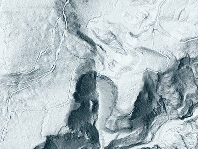
The Terrain, Seen by LiDAR
Aircraft-mounted lasers measured this ground to within inches. Trees and buildings are digitally stripped away, leaving the bare shape of the land the water has carved.
Through the falls the surface drops roughly 197 feet over a short, steep run of tiers. Elevation at the pin is about 299 feet.
Steep ground runs through the entire stretch: about 204 feet of descent in the 500 feet above the pin and 89 feet in the 500 feet below it. Facing southwest, the falls sit in full sun for most of the day, best photographed early or late.
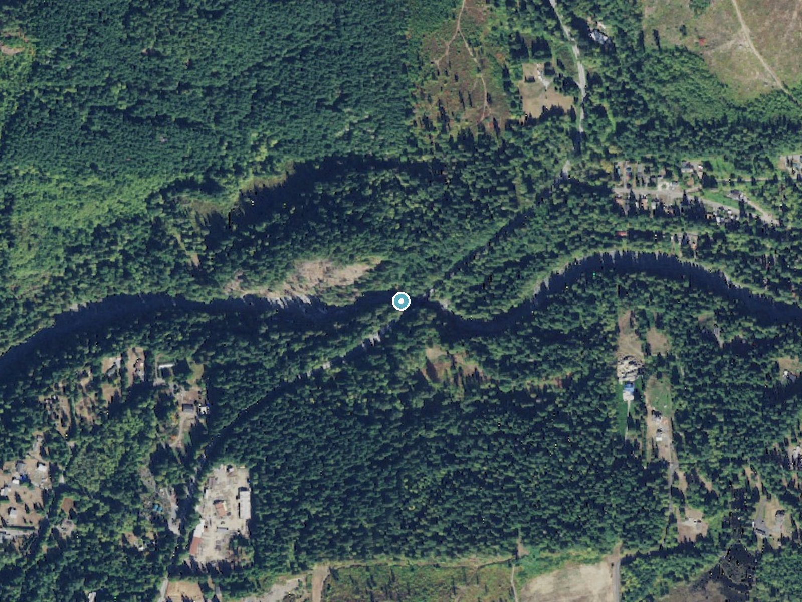
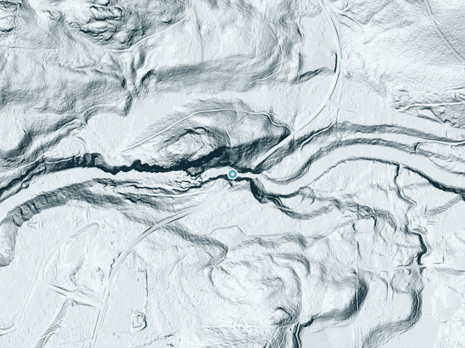
Drag to compare. The dot marks the waterfall. The frame is about a mile across.
- Ground elevation
- 299 feet
- Measured by 1-meter lidar
- Drop at the falls
- About 197 feet
- Change in ground height within ~250 feet of the falls
- Faces
- Southwest
- Sunlit most of the day. Go early or late for softer light.
A slice through the lidar ground surface, from above the falls to downstream (heading southwest).
Elevation data: USGS 3D Elevation Program. Aerial imagery: USGS The National Map. Public domain.
Location & Access
Getting There
Granite Falls is located approximately 1.5 miles from the town of Granite Falls, Washington. From the town, take the Mountain Loop Highway and follow signs to the Granite Falls Fish Ladder, which provides access to the waterfall.
Get Directions on Google MapsParking
There is a small parking area near the Granite Falls Fish Ladder, which serves as the primary access point to the waterfall. Parking availability may be limited during peak times.
Elevation
299 feet above sea level
Coordinates
48.102879° N, -121.953465° W
Visitor Tips & Gear
Arrive early during weekends or holidays to secure parking. Wear sturdy shoes as the trail may be slippery, especially after rain. Bring a camera to capture the scenic views.
Where to Stay
La Quinta Inn & Suites by Wyndham Marysville
Inn at Port Gardner-Everett Waterfront, Ascend Hotel Collection
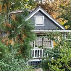
Marrowstone Cottage
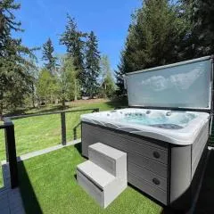
Encanto House A Forest Haven
Browse vacation cabins and private rentals nearby
Unique outdoor stays — tents, yurts, and treehouses
Rent a campervan or RV for your waterfall road trip
Some links are affiliate links. We may earn a commission at no extra cost to you.
Nearby Campground
Turlo Campground
7.5 miles away · 18 sites
Overview Turlo Campground is located just off the Mountain Loop Highway in the Mt.Baker-Snoqualmie National Forest. The campground is nestled in tall firs, cedars and hemlocks, adjacent to the south fork of the Stillaguamish River. The location offers individuals and families a tranquil camping experience with plenty of opportunities to fish, enjoy the river or relax at their campsite.Recreation The Mt. Baker-Snoqualmie National Forest has 1,500 miles of trails, ranging from smooth paths through
Book on Recreation.govNearby Hot Springs
Hot springs near Marysville, Washington
Kennedy Hot Spring
Kennedy Hot Spring flows at 100 degrees at 3,520 feet elevation in the Mt. Baker National Forest, emerging 58.7 degrees above a...
Garland Mineral Springs
Garland Mineral Springs flows at 84 degrees in the Snoqualmie National Forest, producing water 39.6 degrees above ambient tempe...

Sherman Crater Fumaroles
Sherman Crater Fumaroles register 266 degrees Fahrenheit at 9,463 feet elevation within the active volcanic crater atop Mount B...
Dorr Fumarole Field
Dorr Fumarole Field reaches 194 degrees at 8,168 feet elevation on Mount Baker's active volcanic slopes, producing superheated ...
Gamma Hot Springs
Gamma Hot Springs produces 140-degree water at 5,397 feet elevation in the Mt. Baker National Forest, emerging 104.6 degrees ab...
Sulphur Creek Hot Springs
Sulphur Creek Hot Springs flows at 99 degrees Fahrenheit at 2,973 feet elevation in Mount Baker National Forest's remote backco...
Looking for a soak after your hike? Explore more hot springs near Marysville, Washington on SoakingSprings.
Explore Washington springsAdditional Information
Nearby Attractions
Nearby attractions include the Granite Falls Fish Ladder, the Mountain Loop Highway, and Lake Bosworth.
Wildlife
Visitors may encounter birds, squirrels, and other small wildlife in the area. Be cautious of slippery rocks near the water.
Cities near Granite Falls
Nearby Waterfalls
 LiDAR
LiDAR
Other waterfalls named Granite Falls
6 other waterfalls share this name across the U.S.
Writing about Granite Falls? Embed this waterfall on your site for free.