


Photo Credits (5)
Difficulty
Moderate
Trail Length
2.4 miles
Trail Type
Out And Back
Elevation Gain
350 ft
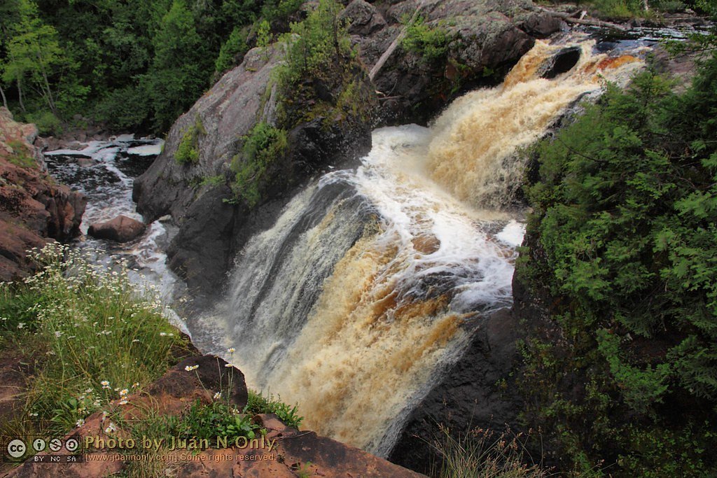
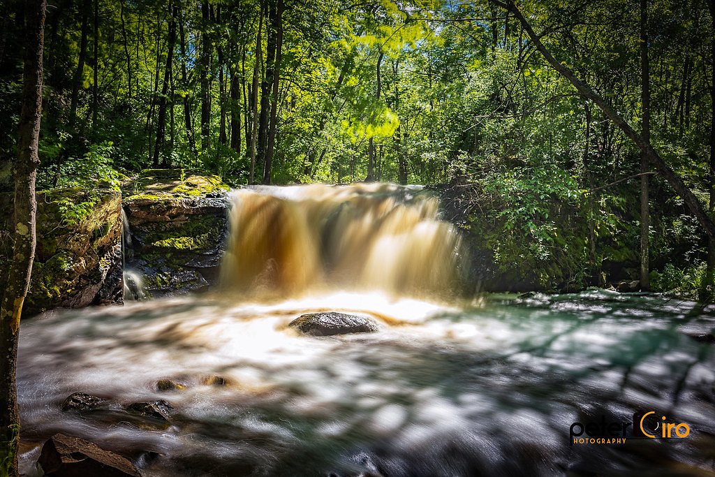
About Granite Falls
Granite Falls in Michigan is a small, scenic waterfall tucked into a quiet stretch of woodland. It’s a lesser-known spot that rewards visitors seeking a peaceful retreat with natural cascades and a restorative atmosphere. Note that, per Wikipedia, “Granite Falls” is a name used for multiple waterfalls — confirm you’re looking at the Michigan location when planning your trip. The most common approach to the falls is a moderate out-and-back hike of about 2.4 miles with roughly 350 feet of elevation gain. The nearest developed camping lies at the Bessemer Ranger District campground, approximately 24.06 km from the falls, so day-trip planning or arranging nearby lodging is a good idea if you want to spend more time exploring.
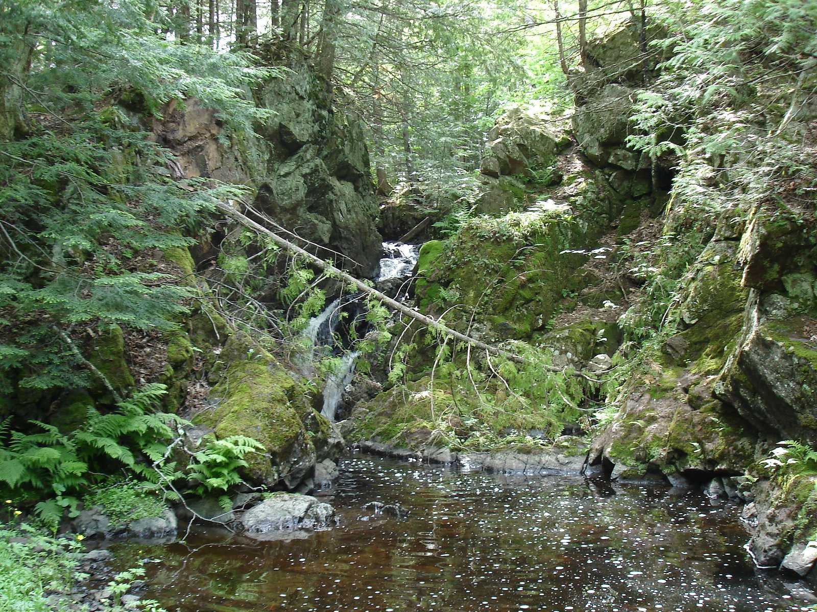
The Setting
Granite Falls sits at 1,450 feet along the Black River, in the foothills of Michigan.
Trail & Hike Details
The Approach
The moderate 2.4-mile out-and-back trail gains 350 feet of elevation on the way to the falls.
Trail Description
Trail data: 2.4 miles round-trip (out-and-back), ~350 feet elevation gain, rated moderate. Available sources do not list a USFS trail name/number or provide specific surface, grade, or class information for the route. Because official surface/maintenance details aren’t provided, plan for a moderate hike and bring sturdy footwear, a map or GPS, and basic day-hike supplies. This route is best suited to hikers comfortable with a few uphill sections and a relatively short but active out-and-back outing.
What to Expect
Expect a serene and natural setting with a small waterfall surrounded by Michigan's lush greenery. The area may be less developed, offering a more rustic experience.
Accessibility
The trail is not wheelchair accessible. Uneven terrain and elevation changes require steady footing.
Frequently Asked Questions
🐶 Are Dogs Allowed at Granite Falls?
❌ Dogs are not allowed
Are There Any Fees or Permits Required?
🆖 No fees required
🏊 Is There Swimming at Granite Falls?
❌ Swimming is not allowed
When to Visit
Spring and early summer are ideal for visiting Granite Falls, as water flow is typically higher during these seasons.
Seasonal Access
The best time to visit is Spring, Summer, and Fall. Winter access may be limited.
Safety Information
Visitors should be cautious of slippery rocks near the waterfall and uneven terrain. Always stay on marked paths if available.
Current Water Conditions
34 ft³/s
Current discharge — how much water is flowing
Lower than usual for this time of year
Based on 53 years of record
2.07 ft
Water depth at gauge
7-Day Discharge Trend
What does this mean for your visit?
Flow is lower than usual for this time of year.
About This Gauge
This gauge is on a nearby waterway and may not reflect exact conditions at the falls.
7-Day Flow Outlook
Based on the USGS gauge BLACK RIVER NEAR BESSEMER, MI (9 km away).
Today
Low
34 cfs
6/10Tomorrow
Low
37 cfs
4/10Mon
Moderate
44 cfs
4/10Tue
Moderate
44 cfs
4/10Wed
Moderate
45 cfs
4/10Thu
Moderate
35 cfs
4/10Fri
Moderate
36 cfs
4/10Best window: Today — low flow, mostly sunny (trip score 6/10).
Best time of year: this gauge typically runs highest from late March to late May, peaking in April.
How we calculate this
This is a transparent outlook, not a precise forecast. We take the waterfall's current flow strength (how it ranks against its historical normal for today, from the nearest USGS stream gauge), carry that ranking forward along the gauge's seasonal curve, and nudge it for forecast rain. Confidence is highest for the next day or two and falls further out. Always check official conditions and your own judgment before visiting — high flows can be dangerous.
Know when to go.
Get a free email alert when waterfalls near Ramsay hit peak flow. We only send when conditions are worth the trip — no weekly newsletters, no spam.
Weather Forecast
Location & Access
Getting There
Granite Falls is located in Michigan, but specific directions to the site are not widely documented. Visitors are advised to consult local maps or guides for the most accurate route.
Get Directions on Google MapsParking
Parking availability is unclear. Visitors should prepare for limited or informal parking options near the site.
Elevation
1,450 feet above sea level
Coordinates
46.440000° N, -90.028056° W
Visitor Tips & Gear
Bring sturdy footwear and a map or GPS device, as the trail and access details are not well-marked. Check local weather conditions before visiting.
As an Amazon Associate, we earn from qualifying purchases.
With 2.4 miles and 350 ft of elevation gain, sturdy boots and trekking poles will help on this moderate trail. Sun exposure on the trail makes good sun protection a must in summer.

Polarized Sunglasses (Knockaround)
Cuts glare off the water so you actually see the falls — and your photos turn out better too.

Columbia Watertight II Rain Jacket
Packs into its own pocket, seam-sealed, and keeps you dry from spray and surprise rain.

Earth Pak Waterproof Dry Bag
Keeps your phone and gear dry when waterfall mist soaks everything else.

Waterproof Phone Pouch (AiRunTech)
Cheap insurance — take photos right next to the falls without killing your phone.

Timberland Euro Sprint Mid Waterproof
Trusted waterproof boot with premium leather and grippy rubber sole — reliable on rocky, wet trails.

TrailBuddy Trekking Poles
Lightweight aluminum, cork grips, and flip-locks that actually hold — a best-seller for good reason.
Where to Stay

Snow Otter Haus - 2

Quality Inn Ironwood

Snow Otter Haus - 1

North Ironwood Acres - Black River Lodge
Browse vacation cabins and private rentals nearby
Unique outdoor stays — tents, yurts, and treehouses
Rent a campervan or RV for your waterfall road trip
Some links are affiliate links. We may earn a commission at no extra cost to you.
Nearby Campground
Bessemer Ranger District
15 miles away · 0 sites
Bessemer Ranger District has a variety of traditional lands, fisheries, and timber programs with new challenges in wildlife partnerships, in recreation (Region 9's only Harbor) and with management of our Wild and Scenic Rivers, and Scenic Byway. The district has an excellent reputation for being team participants at both the district and Forest levels.There is something for everyone with 32 waterfalls; 1200 miles of rivers and streams; over 1,100 lakes; and 30 miles of Lake Superior shoreline jus
Book on Recreation.govAdditional Information
Nearby Attractions
Nearby attractions may include other natural sites or small towns in Michigan. Research local guides for more information.
Wildlife
The area may host typical Michigan wildlife, such as birds, deer, and small mammals. Be cautious of ticks and other insects.
Cities near Granite Falls
Nearby Waterfalls
Other waterfalls named Granite Falls
6 other waterfalls share this name across the U.S.
Writing about Granite Falls? Embed this waterfall on your site for free.