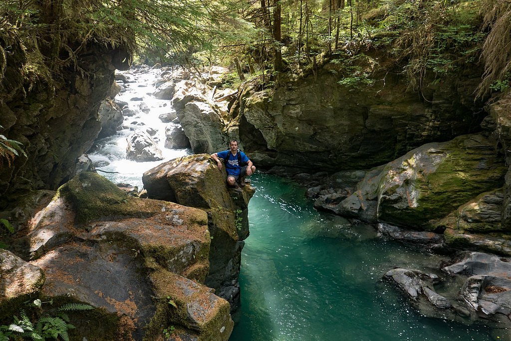
Boulder Falls
By Armen Suny · Last verified Mar 2026
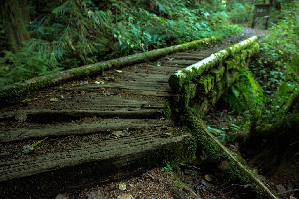
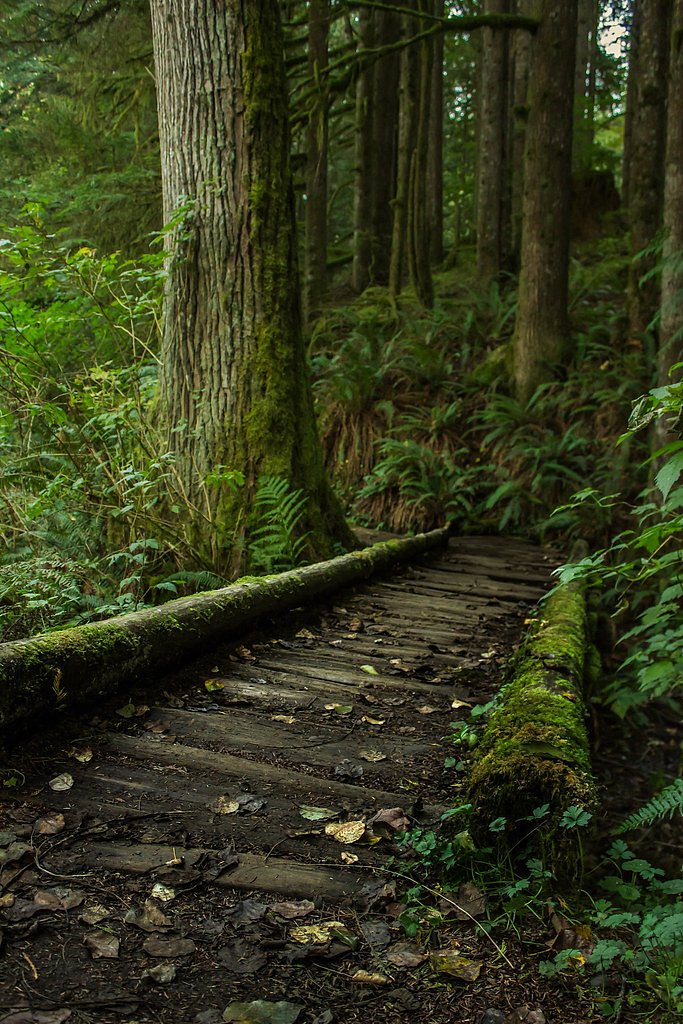
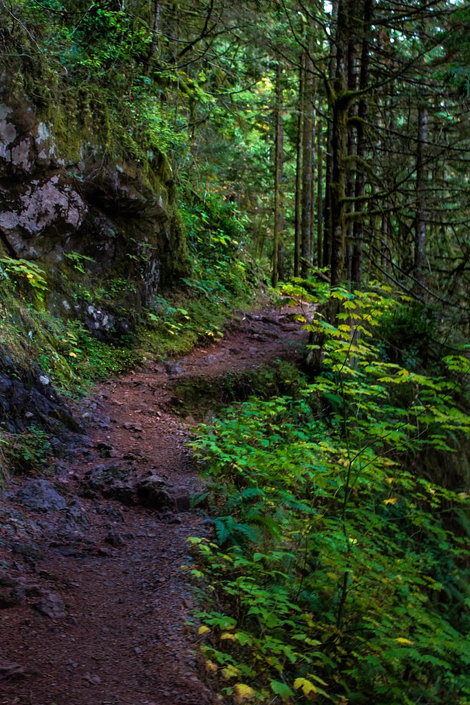
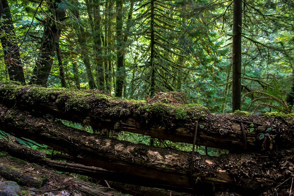

Photo Credits (5)
Difficulty
Moderate
Trail Length
2.4 miles
Trail Type
Out And Back
Elevation Gain
350 ft
About Boulder Falls
Boulder Falls sits tucked into Washington’s Mount Baker National Forest and is managed by the U.S. Forest Service. The falls cascade over a rocky cliff into a small pool framed by old-growth forest, creating a compact but photogenic scene that draws hikers and photographers alike. Access is via the Boulder River Trail (USFS Trail #734), which brings you right to the falls’ viewpoint. The hike to the falls is an enjoyable moderate outing: the route measures about 2.4 miles one-way (USFS GIS records list 2.99 miles) with roughly 350 feet of elevation gain. The USFS classifies the trail as Trail #734 (Class 3) on a native-material surface with typical grades of 12–20%, so you’ll encounter natural tread and some steeper sections along the river corridor. The setting is inviting for a half-day trip and is stewarded as part of the National Forest system, so plan for typical backcountry conditions and pack accordingly.
The Setting
Boulder Falls sits at 1,027 feet within Mt. Baker National Forest, fed by the Nf Stillaguamish River, in the foothills of Washington.
Trail & Hike Details
The Approach
The moderate hike follows Boulder River (#734), a 2.4-mile out-and-back trail over natural surface. Expect 350 feet of elevation gain with grades of 12-20%. The trail is developed (Class 3).
USFS Trail
BOULDER RIVER #734
Trail Class
Developed
Surface
Avg Grade
USFS Segment
2.99 miTrail Description
Trail: Boulder River Trail (USFS Trail #734), out-and-back. Length: ~2.4 miles (USFS GIS: 2.99 miles). Elevation gain: ~350 feet. Difficulty: Moderate. Surface: NAT - native material. USFS class: 3. Typical grade: 12–20%. The trail follows the Boulder River through forested terrain on natural tread; expect roots, rocks, and short steeper pitches as you approach the waterfall viewpoint.
What to Expect
Dogs are welcome.
Accessibility
The trail is not wheelchair accessible. Uneven terrain and elevation changes require steady footing.
Frequently Asked Questions
🐶 Are Dogs Allowed at Boulder Falls?
✅ Dogs are allowed
Are There Any Fees or Permits Required?
🆖 No fees required
🏊 Is There Swimming at Boulder Falls?
❌ Swimming is not allowed
When to Visit
Spring and early summer are ideal times to visit, as the waterfall flow is typically strongest due to snowmelt. Fall offers beautiful foliage, while summer provides warmer weather.
Seasonal Access
The best time to visit is Spring, Summer, and Fall. Winter access may be limited. Check with Mt. Baker National Forest for seasonal road closures.
Safety Information
The rocks near the waterfall can be slippery, so visitors should exercise caution. Always stay on the designated trail and avoid climbing on wet rocks. Check weather conditions before visiting, as heavy rain can make the trail more hazardous.
Current Water Conditions
427 ft³/s
Current discharge — how much water is flowing
Much lower than usual for this time of year
Based on 97 years of record
2.06 ft
Water depth at gauge
7-Day Discharge Trend
What does this mean for your visit?
Flow is well below normal for this time of year, so the waterfall may be a trickle.
About This Gauge
This gauge is on a nearby waterway and may not reflect exact conditions at the falls.
7-Day Flow Outlook
Based on the USGS gauge NF STILLAGUAMISH RIVER NEAR ARLINGTON, WA (16 km away).
Today
Low
487 cfs
3/10Tomorrow
Low
486 cfs
4/10Sun
Low
487 cfs
4/10Mon
Low
456 cfs
4/10Tue
Low
445 cfs
4/10Wed
Low
430 cfs
4/10Thu
Low
426 cfs
4/10Best window: Tomorrow — low flow, chance light rain (trip score 4/10).
Best time of year: this gauge typically runs highest from late November to late December, peaking in December.
How we calculate this
This is a transparent outlook, not a precise forecast. We take the waterfall's current flow strength (how it ranks against its historical normal for today, from the nearest USGS stream gauge), carry that ranking forward along the gauge's seasonal curve, and nudge it for forecast rain. Confidence is highest for the next day or two and falls further out. Always check official conditions and your own judgment before visiting — high flows can be dangerous.
Know when to go.
Get a free email alert when waterfalls near Oso hit peak flow. We only send when conditions are worth the trip — no weekly newsletters, no spam.
Weather Forecast
Location & Access
Getting There
Boulder Falls is located near Index, Washington, in the Mount Baker-Snoqualmie National Forest. Access is typically via a short drive from Highway 2, followed by a brief hike.
Get Directions on Google MapsParking
Parking is available near the trailhead, but spaces may be limited during peak seasons. Visitors should arrive early to secure a spot.
Elevation
1,027 feet above sea level
Coordinates
48.245661° N, -121.826800° W
Land Management
Managed by USFS
Visitor Tips & Gear
Wear sturdy shoes with good grip, as the trail and rocks near the waterfall can be slippery. Arrive early to avoid crowds, especially on weekends. Bring a camera to capture the scenic beauty.
As an Amazon Associate, we earn from qualifying purchases.
With 2.4 miles and 350 ft of elevation gain, sturdy boots and trekking poles will help on this moderate trail. Sun exposure on the trail makes good sun protection a must in summer.

Polarized Sunglasses (Knockaround)
Cuts glare off the water so you actually see the falls — and your photos turn out better too.

Columbia Watertight II Rain Jacket
Packs into its own pocket, seam-sealed, and keeps you dry from spray and surprise rain.

Earth Pak Waterproof Dry Bag
Keeps your phone and gear dry when waterfall mist soaks everything else.

Waterproof Phone Pouch (AiRunTech)
Cheap insurance — take photos right next to the falls without killing your phone.

Timberland Euro Sprint Mid Waterproof
Trusted waterproof boot with premium leather and grippy rubber sole — reliable on rocky, wet trails.

TrailBuddy Trekking Poles
Lightweight aluminum, cork grips, and flip-locks that actually hold — a best-seller for good reason.
Where to Stay

Inn at Port Gardner-Everett Waterfront, Ascend Hotel Collection

The Kulshan Hotel

Encanto House A Forest Haven

PNW River Cabin
Browse vacation cabins and private rentals nearby
Unique outdoor stays — tents, yurts, and treehouses
Rent a campervan or RV for your waterfall road trip
Some links are affiliate links. We may earn a commission at no extra cost to you.
Nearby Campground
Turlo Campground
10.5 miles away · 18 sites
Overview Turlo Campground is located just off the Mountain Loop Highway in the Mt.Baker-Snoqualmie National Forest. The campground is nestled in tall firs, cedars and hemlocks, adjacent to the south fork of the Stillaguamish River. The location offers individuals and families a tranquil camping experience with plenty of opportunities to fish, enjoy the river or relax at their campsite.Recreation The Mt. Baker-Snoqualmie National Forest has 1,500 miles of trails, ranging from smooth paths through
Book on Recreation.govNearby Hot Springs
Hot springs near Oso, Washington

Sherman Crater Fumaroles
Sherman Crater Fumaroles register 266 degrees Fahrenheit at 9,463 feet elevation within the active volcanic crater atop Mount B...
Dorr Fumarole Field
Dorr Fumarole Field reaches 194 degrees at 8,168 feet elevation on Mount Baker's active volcanic slopes, producing superheated ...
Sulphur Creek Hot Springs
Sulphur Creek Hot Springs flows at 99 degrees Fahrenheit at 2,973 feet elevation in Mount Baker National Forest's remote backco...
Baker Hot Spring
Baker Hot Spring emerges at 108 degrees Fahrenheit on US Forest Service land in Mt. Baker National Forest, flowing 59.5 degrees...
Kennedy Hot Spring
Kennedy Hot Spring flows at 100 degrees at 3,520 feet elevation in the Mt. Baker National Forest, emerging 58.7 degrees above a...
Gamma Hot Springs
Gamma Hot Springs produces 140-degree water at 5,397 feet elevation in the Mt. Baker National Forest, emerging 104.6 degrees ab...
Looking for a soak after your hike? Explore more hot springs near Oso, Washington on SoakingSprings.
Explore Washington springsAdditional Information
Nearby Attractions
Nearby attractions include Wallace Falls State Park and the town of Index, which offers rock climbing opportunities and scenic views.
Wildlife
The area is home to various wildlife, including birds, deer, and small mammals. Visitors should be cautious of bears and other larger animals in the region.
Cities near Boulder Falls
Nearby Waterfalls

Other waterfalls named Boulder Falls
3 other waterfalls share this name across the U.S.
Writing about Boulder Falls? Embed this waterfall on your site for free.