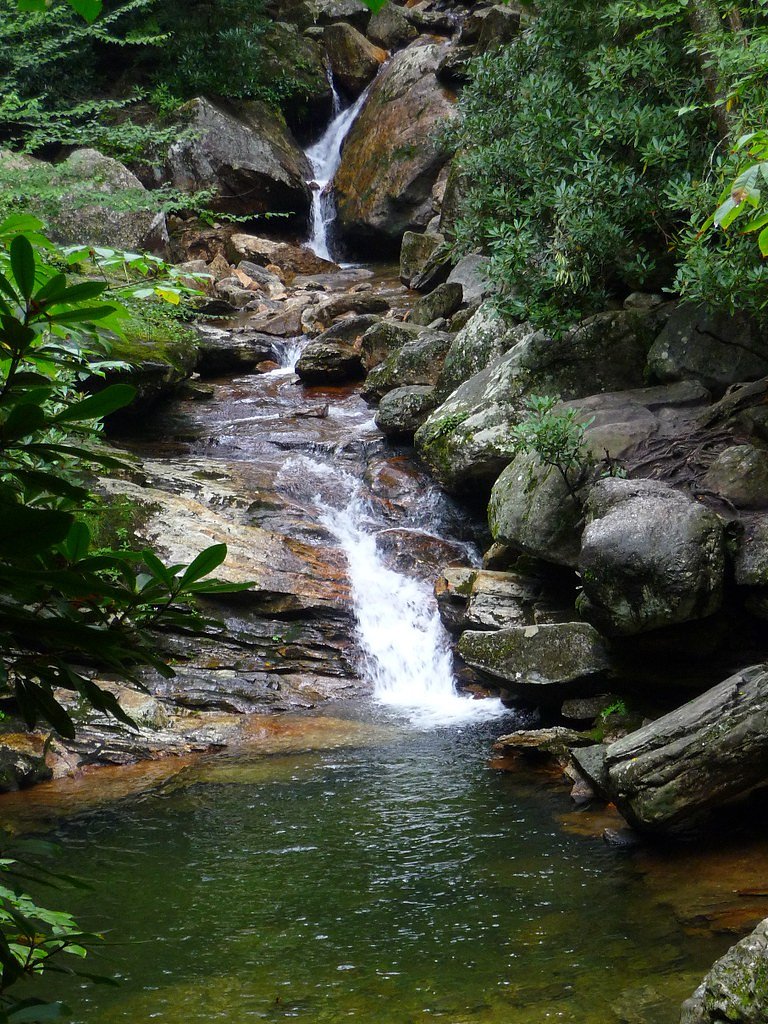
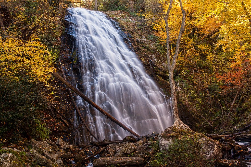
Crystal Falls
By Armen Suny · Last verified May 2026
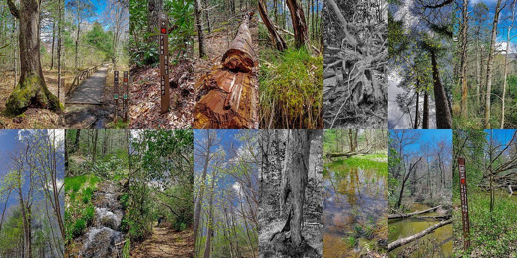
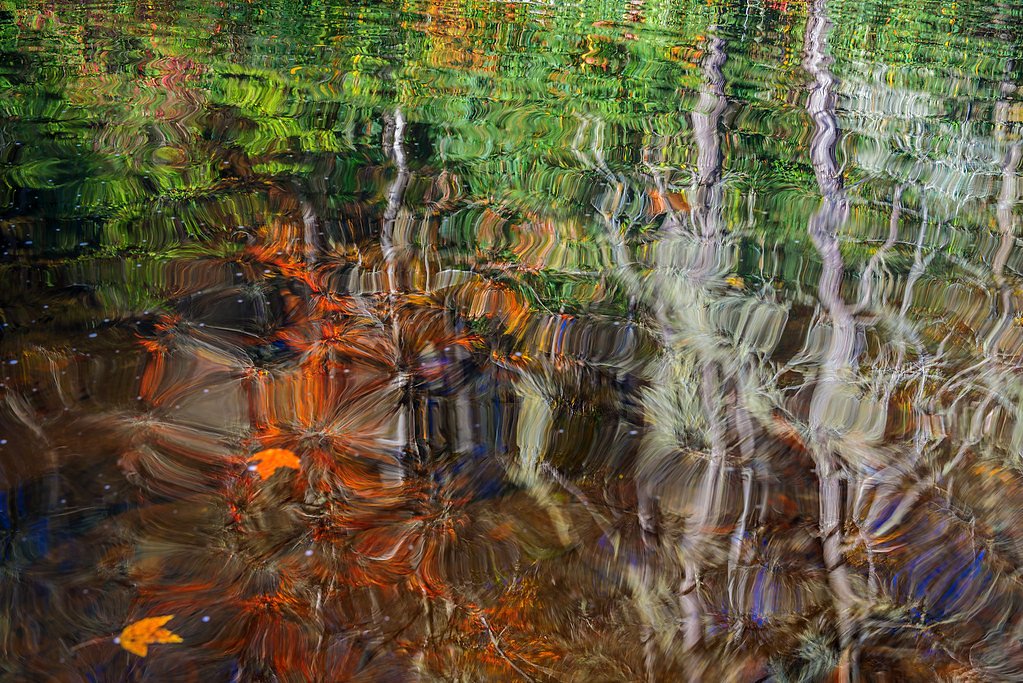
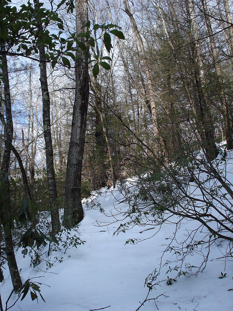
Photo Credits (5)
Difficulty
Moderate
Trail Length
2.4 miles
Trail Type
Out And Back
Elevation Gain
350 ft
About Crystal Falls
Crystal Falls is a peaceful, lesser-known waterfall in North Carolina that rewards visitors seeking a quiet nature escape. Framed by forested surroundings, the falls are a great spot for photographers and hikers who prefer a low-traffic outing. The setting feels secluded compared with more popular local attractions, making it ideal for a reflective stroll or a short picnic near the water. Access to the falls is via a moderate out-and-back hike of about 2.4 miles round trip, with roughly 350 feet of elevation gain. The trail is rated moderate—short enough for a half-day trip but with enough ups and downs to keep things interesting—so bring sturdy footwear and water. Because this is a less-developed route, check local trail conditions before you go and plan accordingly.
The Setting
Crystal Falls sits at 2,743 feet along the South Toe River, in the hills of North Carolina.
Trail & Hike Details
The Approach
The moderate 2.4-mile out-and-back trail gains 350 feet of elevation on the way to the falls.
Trail Description
Trail type: out-and-back. Distance: 2.4 miles (round trip). Elevation gain: ~350 feet. Difficulty: moderate. The route follows natural tread and is not highly developed; hikers should prepare for uneven footing and occasional short uphill sections. No USFS trail name or number is provided in the available data—consult local land managers or trail resources for up-to-date conditions and any seasonal advisories.
What to Expect
Visitors can expect a tranquil natural setting with a cascading waterfall surrounded by lush greenery. The area may be less crowded compared to more popular waterfalls in North Carolina.
Accessibility
The trail is not wheelchair accessible. Uneven terrain and elevation changes require steady footing.
Frequently Asked Questions
🐶 Are Dogs Allowed at Crystal Falls?
❌ Dogs are not allowed
Are There Any Fees or Permits Required?
🆖 No fees required
🏊 Is There Swimming at Crystal Falls?
❌ Swimming is not allowed
When to Visit
Spring and fall are typically the best times to visit, as the weather is mild and the surrounding foliage is vibrant.
Seasonal Access
The best time to visit is Spring, Summer, and Fall. Winter access may be limited.
Safety Information
Visitors should be cautious of slippery rocks and uneven terrain. Always stay on marked trails and avoid getting too close to the edge of the waterfall.
Current Water Conditions
36 ft³/s
Current discharge — how much water is flowing
Much lower than usual for this time of year
Based on 68 years of record
0.66 ft
Water depth at gauge
7-Day Discharge Trend
What does this mean for your visit?
Flow is well below normal for this time of year, so the waterfall may be a trickle.
About This Gauge
This gauge is on a nearby waterway and may not reflect exact conditions at the falls.
7-Day Flow Outlook
Based on the USGS gauge SOUTH TOE RIVER NEAR CELO, NC (11 km away).
Today
Low
41 cfs
3/10Tomorrow
Low
42 cfs
3/10Mon
Low
42 cfs
3/10Tue
Low
40 cfs
3/10Wed
Low
38 cfs
3/10Thu
Low
39 cfs
3/10Fri
Low
38 cfs
3/10Best window: Today — low flow, slight chance showers and thunderstorms (trip score 3/10).
Best time of year: this gauge typically runs highest from late February to early May, peaking in April.
How we calculate this
This is a transparent outlook, not a precise forecast. We take the waterfall's current flow strength (how it ranks against its historical normal for today, from the nearest USGS stream gauge), carry that ranking forward along the gauge's seasonal curve, and nudge it for forecast rain. Confidence is highest for the next day or two and falls further out. Always check official conditions and your own judgment before visiting — high flows can be dangerous.
Know when to go.
Get a free email alert when waterfalls near Spruce Pine hit peak flow. We only send when conditions are worth the trip — no weekly newsletters, no spam.
Weather Forecast
Location & Access
Getting There
The exact location of Crystal Falls is not widely documented, but it is believed to be accessible via a trail in a forested area. Visitors should research local maps or consult with nearby park services for precise directions.
Get Directions on Google MapsParking
Parking availability is unclear, but visitors may need to park at a nearby trailhead or designated area.
Elevation
2,743 feet above sea level
Coordinates
35.891560° N, -82.084240° W
Visitor Tips & Gear
Bring sturdy footwear and plenty of water. Check weather conditions before visiting, as trails may become slippery after rain.
As an Amazon Associate, we earn from qualifying purchases.
With 2.4 miles and 350 ft of elevation gain, sturdy boots and trekking poles will help on this moderate trail. Sun exposure on the trail makes good sun protection a must in summer.

Polarized Sunglasses (Knockaround)
Cuts glare off the water so you actually see the falls — and your photos turn out better too.

Columbia Watertight II Rain Jacket
Packs into its own pocket, seam-sealed, and keeps you dry from spray and surprise rain.

Earth Pak Waterproof Dry Bag
Keeps your phone and gear dry when waterfall mist soaks everything else.

Waterproof Phone Pouch (AiRunTech)
Cheap insurance — take photos right next to the falls without killing your phone.

Timberland Euro Sprint Mid Waterproof
Trusted waterproof boot with premium leather and grippy rubber sole — reliable on rocky, wet trails.

TrailBuddy Trekking Poles
Lightweight aluminum, cork grips, and flip-locks that actually hold — a best-seller for good reason.
Where to Stay

PINE VALLEY MOTEL

Alpine Inn

Ruth's Place Tiny Home Retreat 1 mile to town

The Embers Hotel
Browse vacation cabins and private rentals nearby
Unique outdoor stays — tents, yurts, and treehouses
Rent a campervan or RV for your waterfall road trip
Some links are affiliate links. We may earn a commission at no extra cost to you.
Nearby Campground
CAROLINA HEMLOCKS REC AREA
9 miles away · 39 sites
Overview Carolina Hemlocks Recreation Area sits in the scenic mountains of Pisgah National Forest. This is a great place for small to medium-sized groups to swim, fish, tube, hike, camp, picnic and simply relax in the cool shade of the forest.Recreation The river provides endless hours of fun for families and water enthusiasts, including swimming and tubing. Anglers can also try their luck for trout and smallmouth bass from the shore. Picnickers will enjoy relaxing in the shaded picnic shelter se
Book on Recreation.govNearby Hot Springs
Hot springs near Spruce Pine, North Carolina

Looking for a soak after your hike? Explore more hot springs near Spruce Pine, North Carolina on SoakingSprings.
Explore North Carolina springsAdditional Information
Nearby Attractions
Nearby attractions may include other waterfalls and hiking trails in the region, but specific recommendations are not documented.
Wildlife
The area may host typical North Carolina wildlife such as birds, deer, and small mammals. Visitors should be cautious of snakes and other potentially hazardous animals.
Cities near Crystal Falls
Nearby Waterfalls
Other waterfalls named Crystal Falls
8 other waterfalls share this name across the U.S.
Writing about Crystal Falls? Embed this waterfall on your site for free.