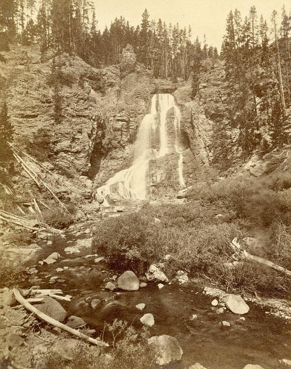
Falls of Gouges Creek
By Armen Suny · Last verified May 2026
Difficulty
Moderate
Trail Length
2.0 miles
Trail Type
Out And Back
Elevation Gain
300 ft
About Falls of Gouges Creek
Falls of Gouges Creek is a quiet, lesser-known waterfall tucked into the wooded slopes of the Yellow Mountain / Raven Cliffs Registered Heritage Area in North Carolina. The cascade sits on private land (land owner: PVT) within a PCON-designated heritage area, so the setting feels tucked-away and peaceful; visitors should be mindful of posted signs and respect private-property access. The forested surroundings make the falls a rewarding spot for hikers seeking a low-traffic, scenic stop in a relatively undeveloped landscape. The approach to the falls is a roughly 2.0-mile out-and-back route with about 300 feet of elevation gain, rated moderate in difficulty. Because the site is on private land and the managing entity is unknown, plan ahead, follow any on-site guidance, and practice Leave No Trace to help preserve the area for others. The route’s calm, wooded character and moderate climb make it a pleasant half-day outing for hikers comfortable on uneven natural trails.
The Setting
Falls of Gouges Creek sits at 3,100 feet within Yellow Mountain/Raven Cliffs Registered Heritage Area, fed by the South Toe River, in the mountains of North Carolina.
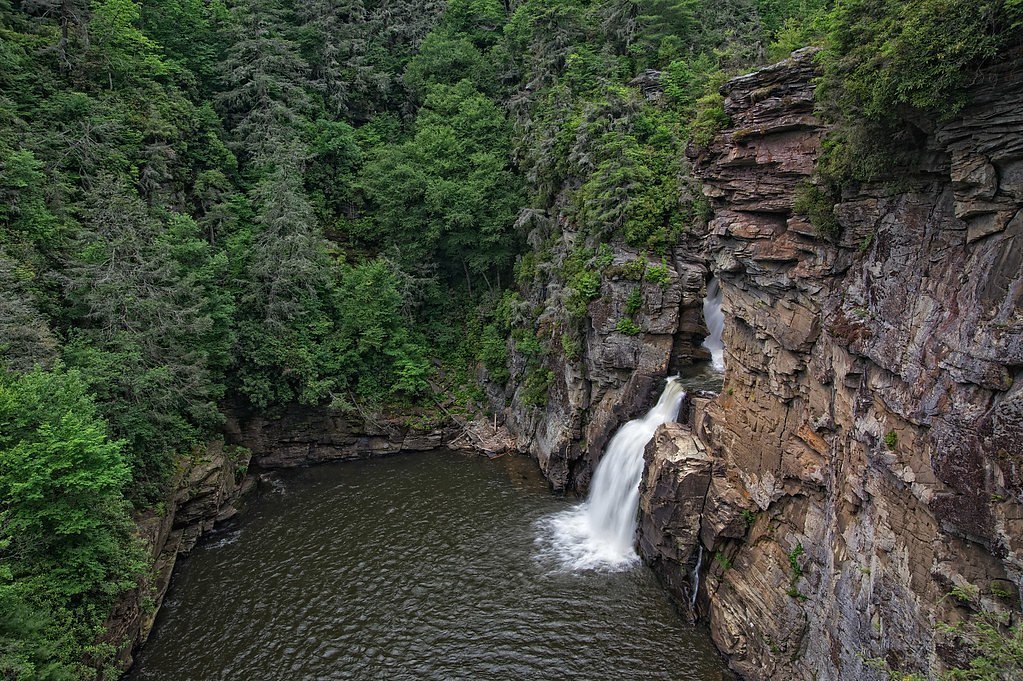
Nearby Falls Worth Visiting
Linville Falls (90 ft) lies 7.0 miles to the east. Also nearby: Crabtree Falls (70 ft, 8.6 mi).
Trail & Hike Details
The Approach
The moderate 2.0-mile out-and-back trail gains 300 feet of elevation on the way to the falls.
Trail Description
This is an out-and-back hike of roughly 2.0 miles total with approximately 300 feet of elevation gain and a moderate difficulty rating. The trail threads through dense forest and is not heavily trafficked, offering a peaceful walk to the falls. Expect natural tread with rocky and uneven sections; the route may include stream crossings and muddy stretches after rain. No USFS trail number or official surface/grade/class data are available for this private-land access route, so hikers should be prepared for minimal signage and natural, sometimes rough footing.
What to Expect
Dogs are welcome.
Accessibility
The trail is not wheelchair accessible. Uneven terrain and elevation changes require steady footing.
Frequently Asked Questions
🐶 Are Dogs Allowed at Falls of Gouges Creek?
✅ Dogs are allowed
Are There Any Fees or Permits Required?
🆖 No fees required
🏊 Is There Swimming at Falls of Gouges Creek?
❌ Swimming is not allowed
When to Visit
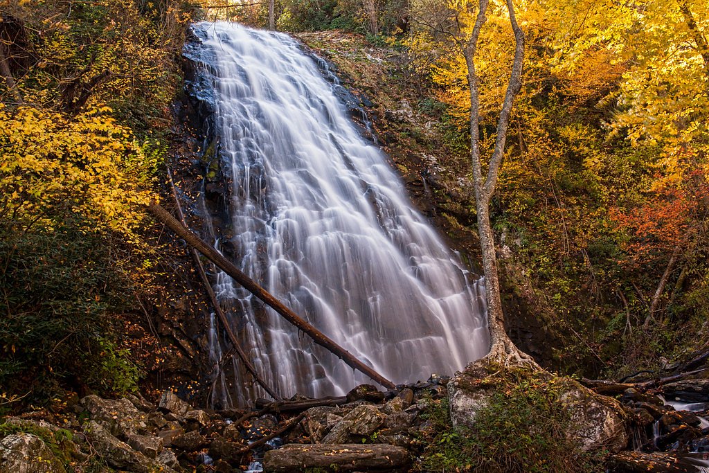
Spring and early summer are ideal for visiting, as the waterfall is likely to have higher flow due to seasonal rainfall. Fall offers beautiful foliage, while winter may provide a quieter experience.
Seasonal Access
The best time to visit is Spring, Summer, and Fall. Winter access may be limited.
Safety Information
Be cautious of slippery rocks near the waterfall. Stream crossings may be required, so waterproof footwear is recommended. Cell service may be limited in the area.
Current Water Conditions
36 ft³/s
Current discharge — how much water is flowing
Much lower than usual for this time of year
Based on 68 years of record
0.66 ft
Water depth at gauge
7-Day Discharge Trend
What does this mean for your visit?
Flow is well below normal for this time of year, so the waterfall may be a trickle.
About This Gauge
This gauge is on a nearby waterway and may not reflect exact conditions at the falls.
7-Day Flow Outlook
Based on the USGS gauge SOUTH TOE RIVER NEAR CELO, NC (19 km away).
Today
Low
41 cfs
3/10Tomorrow
Low
42 cfs
3/10Mon
Low
42 cfs
3/10Tue
Low
40 cfs
3/10Wed
Low
38 cfs
3/10Thu
Low
39 cfs
3/10Fri
Low
38 cfs
3/10Best window: Today — low flow, slight chance showers and thunderstorms (trip score 3/10).
Best time of year: this gauge typically runs highest from late February to early May, peaking in April.
How we calculate this
This is a transparent outlook, not a precise forecast. We take the waterfall's current flow strength (how it ranks against its historical normal for today, from the nearest USGS stream gauge), carry that ranking forward along the gauge's seasonal curve, and nudge it for forecast rain. Confidence is highest for the next day or two and falls further out. Always check official conditions and your own judgment before visiting — high flows can be dangerous.
Know when to go.
Get a free email alert when waterfalls near Spruce Pine hit peak flow. We only send when conditions are worth the trip — no weekly newsletters, no spam.
Weather Forecast
Location & Access
Getting There
Falls of Gouges Creek is located within Pisgah National Forest. Access may require navigating forest service roads, which can be rough or unpaved. Visitors are advised to use a reliable map or GPS as signage may be limited.
Get Directions on Google MapsParking
Parking is typically available at a small pull-off or designated area near the trailhead, but spaces may be limited.
Elevation
3,100 feet above sea level
Coordinates
35.959793° N, -82.051234° W
Land Management
Managed by UNK
Visitor Tips & Gear
Wear sturdy hiking shoes due to uneven terrain. Bring a map or GPS device as the trail may not be well-marked. Check weather conditions before visiting, as rain can make the trail slippery and increase water levels.
As an Amazon Associate, we earn from qualifying purchases.
With 2.0 miles and 300 ft of elevation gain, sturdy boots and trekking poles will help on this moderate trail. Sun exposure on the trail makes good sun protection a must in summer.

Columbia Watertight II Rain Jacket
Packs into its own pocket, seam-sealed, and keeps you dry from spray and surprise rain.

Earth Pak Waterproof Dry Bag
Keeps your phone and gear dry when waterfall mist soaks everything else.

Waterproof Phone Pouch (AiRunTech)
Cheap insurance — take photos right next to the falls without killing your phone.

Timberland Euro Sprint Mid Waterproof
Trusted waterproof boot with premium leather and grippy rubber sole — reliable on rocky, wet trails.

TrailBuddy Trekking Poles
Lightweight aluminum, cork grips, and flip-locks that actually hold — a best-seller for good reason.

Polarized Sunglasses (Knockaround)
Cuts glare off the water so you actually see the falls — and your photos turn out better too.
Where to Stay

The Embers Hotel

Boxwood Lodge Blowing Rock near Boone-University

Blowing Rock Inn

Serene mountain getaway, Hot Tub, Sauna, Lake View, Swim, Fish, Hiking, EV plugin
Browse vacation cabins and private rentals nearby
Unique outdoor stays — tents, yurts, and treehouses
Rent a campervan or RV for your waterfall road trip
Some links are affiliate links. We may earn a commission at no extra cost to you.
Nearby Campground
Linville Falls Campground
6.7 miles away · 66 sites
Overview Located in a dense pine canopy, within hiking distance of Linville Gorge, and along the famous Blue Ridge Parkway, Linville Falls Campground is an ideal location for your next family camping excursion. Linville River, which winds beside the campground, is stocked for fishing, and the location is central to many area attractions including the Linville Falls waterfall, which has three waterfall overlooks in a one-mile hike. Recreation The Linville Falls area is a hiker's paradise, and the
Book on Recreation.govNearby Hot Springs
Hot springs near Spruce Pine, North Carolina

Looking for a soak after your hike? Explore more hot springs near Spruce Pine, North Carolina on SoakingSprings.
Explore North Carolina springsAdditional Information
Nearby Attractions
Pisgah National Forest offers numerous other waterfalls, hiking trails, and scenic spots to explore.
Wildlife
The area is home to a variety of wildlife, including birds, deer, and small mammals. Be cautious of snakes and other potentially hazardous animals.
Cities near Falls of Gouges Creek
Nearby Waterfalls
Writing about Falls of Gouges Creek? Embed this waterfall on your site for free.