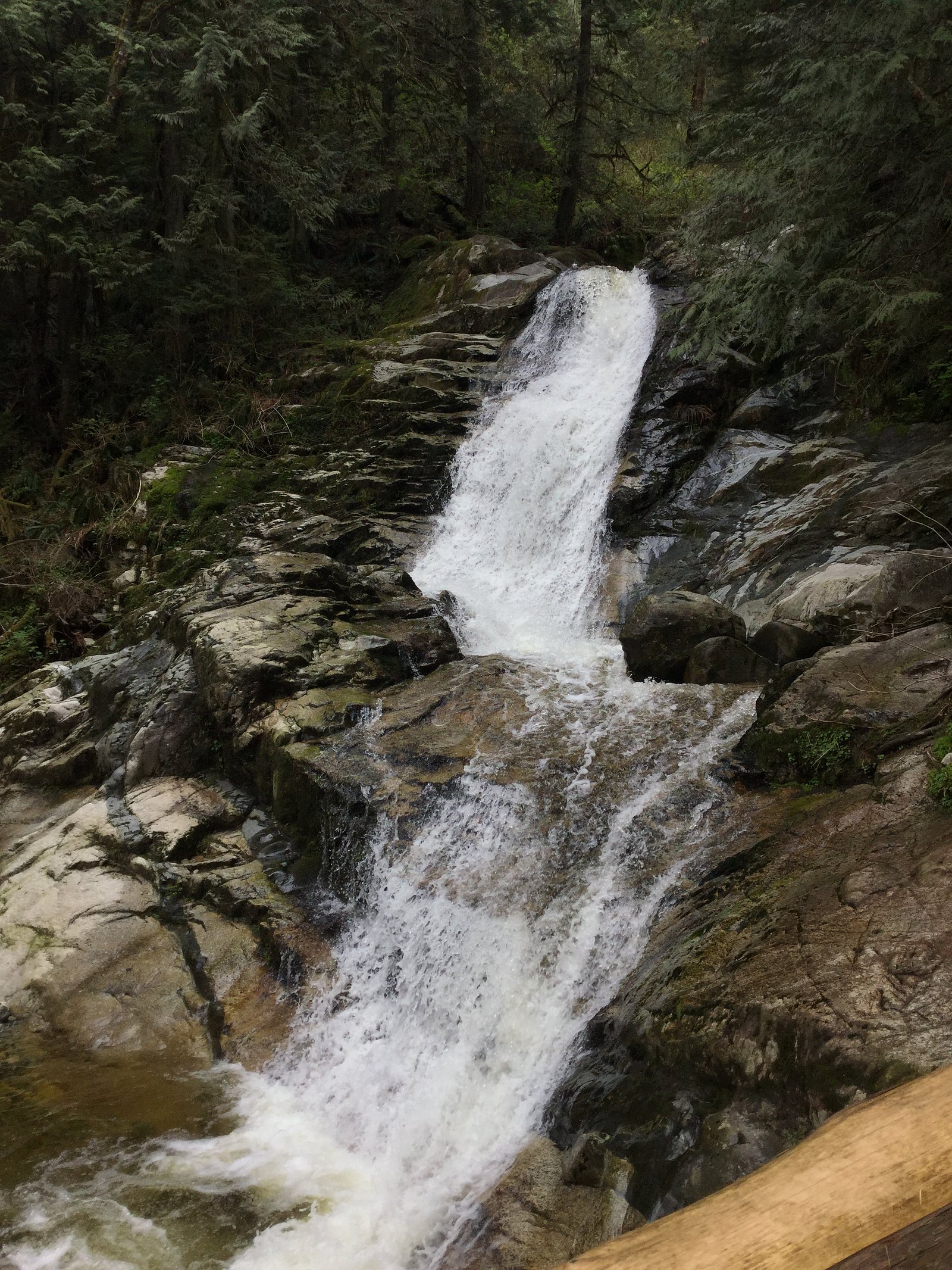
Crystal Falls
British Columbia • Pinecone Burke Park • 12 m
By Armen Suny · Last verified Jun 2026
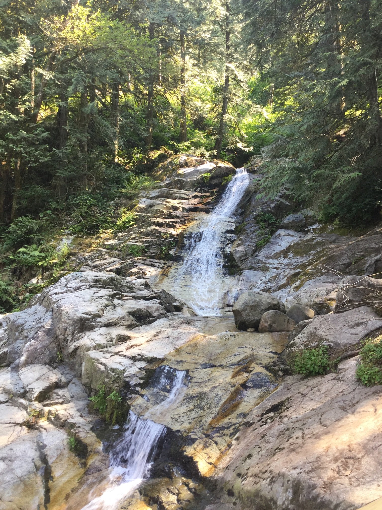
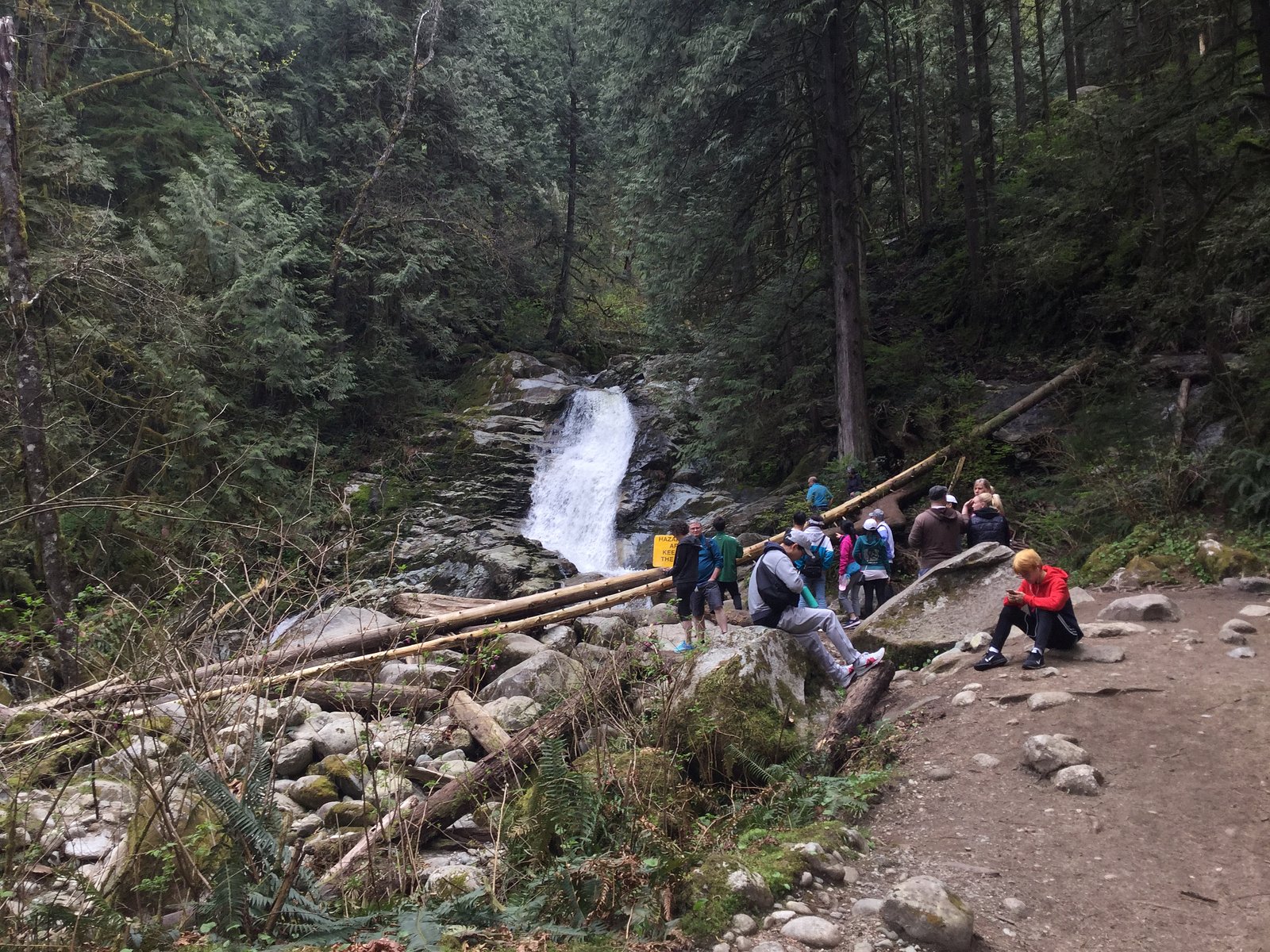

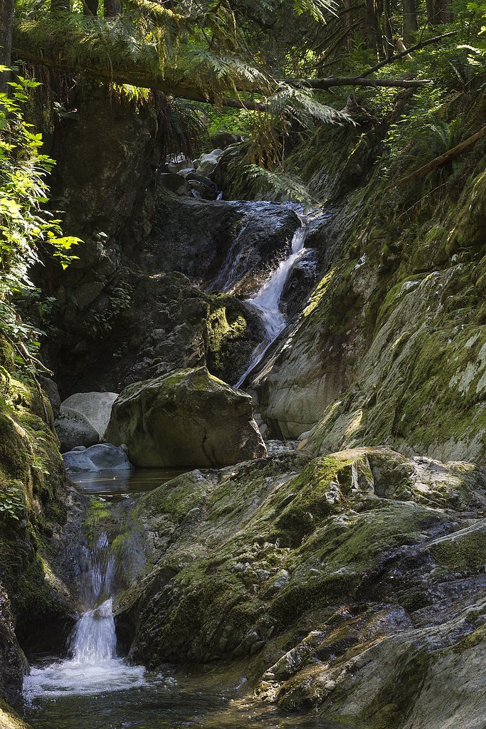
Photo Credits (5)
Difficulty
Easy
Trail Length
6.1 km
Trail Type
Out And Back
Elevation Gain
108 m
About Crystal Falls
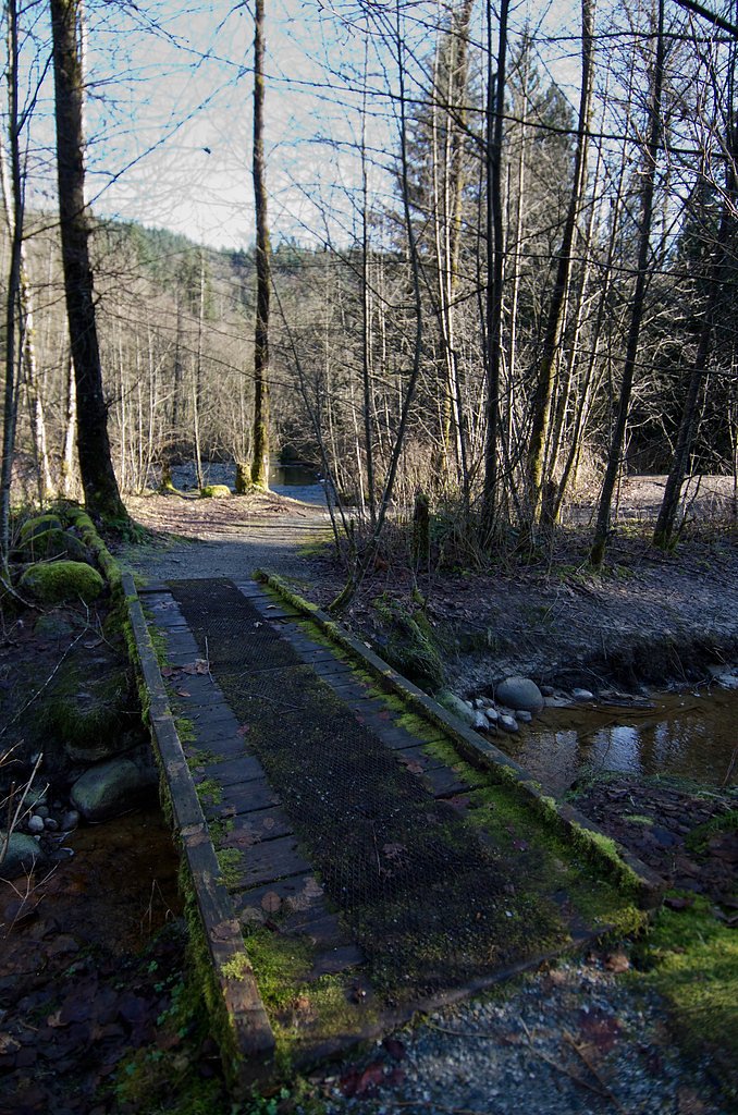
Crystal Falls is a forested cascade located near the Canada–U.S. border in southwestern British Columbia (coordinates 49.3186, -122.7659). The waterfall sits in a largely natural setting that appears to be reached via secondary roads and a short forested trail. Specifics about the waterfall's official name, exact measured height, and formal management (park vs. private land) are not confirmed here, so descriptions below use conservative language where appropriate.
The Setting
Crystal Falls sits at 114 metres within Pinecone Burke Park, in the coastal lowlands of British Columbia. The falls drop 12 metres.
Why This Waterfall Exists
Crystal Falls flows over hard intrusive rock laid down about 66-101 million years ago. These resistant rocks form a durable ledge that water cannot easily wear away, creating a 39-foot drop where softer material downstream has already eroded.
Nearby Falls Worth Visiting
Noons Creek Falls (4 m) lies 4.0 kilometres to the west.
Trail & Hike Details
The Approach
The easy 6.1-km out-and-back trail gains 108 metres of elevation on the way to the falls.
Trail Description
Reported approaches to Crystal Falls appear to follow an unpaved or lightly maintained forest trail through mixed coastal forest. Expect uneven footing, tree roots and possibly muddy sections after rain. There may be short creek or stream crossings and some steeper sections near the falls themselves. Trailhead signage and clear maps are not confirmed; consider bringing a map or using a GPS point (49.3186, -122.7659) to navigate.
What to Expect
The falls drop 12 metres over hard intrusive rock.
Accessibility
The trail is not wheelchair accessible. Uneven terrain and elevation changes require steady footing.
Frequently Asked Questions
🐶 Are Dogs Allowed at Crystal Falls?
❌ Dogs are not allowed
Are There Any Fees or Permits Required?
🆖 No fees required
🏊 Is There Swimming at Crystal Falls?
❌ Swimming is not allowed
When to Visit
Late spring (snowmelt and seasonal rains) through early summer for the strongest flows and lush vegetation. Early morning or weekdays typically offer fewer people. Avoid heavy rainstorms when the stream may become dangerously fast and banks unstable.
Seasonal Access
The best time to visit is Spring, Summer, and Fall. Winter access may be limited. Check with Pinecone Burke Park for current conditions.
Safety Information
Hazards may include slippery rocks and steep banks near the falls, fast-flowing water after rain, unstable ground, and limited or no cell service. There may be seasonal logging activity or gated roads; do not enter private property without permission. Wear appropriate footwear, avoid cliff edges, and supervise children closely. Check weather and local advisories before you go.
Current Water Conditions
0.1 m³/s
Current discharge — how much water is flowing
Much lower than usual for this time of year
Based on 16 years of record
3.12 m
Water depth at gauge
7-Day Discharge Trend
What does this mean for your visit?
Flow is well below normal for this time of year, so the waterfall may be a trickle.
About This Gauge
7-Day Flow Outlook
Based on the WSC gauge OR CREEK NEAR COQUITLAM (6 km away).
Today
Barely Flowing
0.1 m³/s
4/10Tomorrow
Barely Flowing
0.1 m³/s
4/10Tue
Barely Flowing
0.1 m³/s
4/10Wed
Barely Flowing
0.1 m³/s
4/10Thu
Barely Flowing
0.1 m³/s
4/10Fri
Barely Flowing
0.1 m³/s
4/10Sat
Barely Flowing
0.1 m³/s
3/10Best window: Today — barely flowing flow, cloudy (trip score 4/10).
Best time of year: this gauge typically runs highest from mid April to late May, peaking in November.
How we calculate this
This is a transparent outlook, not a precise forecast. We take the waterfall's current flow strength (how it ranks against its historical normal for today, from the nearest WSC stream gauge), carry that ranking forward along the gauge's seasonal curve, and nudge it for forecast rain. Confidence is highest for the next day or two and falls further out. Always check official conditions and your own judgment before visiting — high flows can be dangerous.
Know when to go.
Get a free email alert when waterfalls near Vancouver hit peak flow. We only send when conditions are worth the trip — no weekly newsletters, no spam.
Weather Forecast
Location & Access
Getting There
The waterfall is located at 49.3186, -122.7659, roughly 19 miles south of central Vancouver and close to the Delta/Boundary Bay area. Access usually requires driving on local or secondary roads from Highway 99 / Highway 17 (Delta/Tsawwassen area). Exact turnoffs and the condition of any access roads are not confirmed, a high-clearance vehicle may be useful if driving on unpaved roads. Confirm the route with local maps or trail resources before you go.
Get Directions on Google MapsParking
Parking may be limited to a small pullout or roadside turnout near the trail access. There may be no formal paved lot or signage. Park legally and avoid blocking gates, private driveways, or logging roads. If the site is on or adjacent to private property, parking could be restricted, check local notices.
Elevation
114 metres above sea level
Coordinates
49.318649° N, -122.765927° W
Land Management
Managed by Government of British Columbia
Visitor Tips & Gear
1) Confirm access and ownership before visiting, some popular local falls are on private or leasehold land. 2) Wear sturdy, waterproof footwear; trails may be muddy and slippery. 3) Bring a map/GPS and download offline maps; coordinates are a useful reference. 4) Leave no trace: pack out all trash and avoid damaging vegetation near the falls. 5) Be cautious on wet rocks and near edges, riverbanks can be unstable.
As an Amazon Associate, we earn from qualifying purchases.
This easy 6.1 km hike is straightforward — comfortable trail shoes and plenty of water should do. Sun exposure on the trail makes good sun protection a must in summer.

Polarized Sunglasses (Knockaround)
Cuts glare off the water so you actually see the falls — and your photos turn out better too.

Columbia Watertight II Rain Jacket
Packs into its own pocket, seam-sealed, and keeps you dry from spray and surprise rain.

Earth Pak Waterproof Dry Bag
Keeps your phone and gear dry when waterfall mist soaks everything else.

Waterproof Phone Pouch (AiRunTech)
Cheap insurance — take photos right next to the falls without killing your phone.

Sawyer Squeeze Water Filter
The backcountry standard — filters 99.9% of bacteria and weighs just 3 oz.

JOBY GorillaPod Starter Kit
Wraps around railings and rocks for long-exposure waterfall shots — no flat surface needed.
Where to Stay
Browse vacation cabins and private rentals nearby
Unique outdoor stays — tents, yurts, and treehouses
Rent a campervan or RV for your waterfall road trip
Some links are affiliate links. We may earn a commission at no extra cost to you.
Nearby Campground
North Twin Campground
9.7 km away
Nearby Hot Springs
Hot springs near Vancouver, British Columbia
Dorr Fumarole Field
Dorr Fumarole Field reaches 194 degrees at 8,168 feet elevation on Mount Baker's active volcanic slopes, producing superheated ...

Sherman Crater Fumaroles
Sherman Crater Fumaroles register 266 degrees Fahrenheit at 9,463 feet elevation within the active volcanic crater atop Mount B...
Baker Hot Spring
Baker Hot Spring emerges at 108 degrees Fahrenheit on US Forest Service land in Mt. Baker National Forest, flowing 59.5 degrees...
Looking for a soak after your hike? Explore more hot springs near Vancouver, British Columbia on SoakingSprings.
Explore British Columbia springsAdditional Information
Nearby Attractions
Nearby communities and points of interest include Delta/Tsawwassen, Boundary Bay Regional Park, and the Canada–U.S. border area (Peace Arch/Blaine). City of Vancouver is approximately 19 miles away. Check local park and tourism sites for additional nearby trails and beaches.
Wildlife
Expect common Coastal BC wildlife: songbirds, waterfowl in lowland areas, deer, small mammals and potentially black bears in more remote patches of forest. Keep food secure and be bear-aware in spring–fall. Cougar sightings are rare but possible; take standard precautions.
Cities near Crystal Falls
Nearby Waterfalls
Other waterfalls named Crystal Falls
8 other waterfalls share this name across Canada.
Writing about Crystal Falls? Embed this waterfall on your site for free.