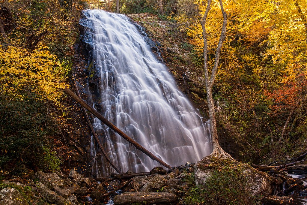
Murphy Falls
By Armen Suny · Last verified May 2026
Difficulty
Moderate
Trail Length
4.0 miles
Trail Type
Out And Back
Elevation Gain
300 ft
About Murphy Falls
Murphy Falls is a quiet, scenic cascade tucked into the heart of Panthertown Valley, an area often called the “Yosemite of the East” for its rugged granite bowl and concentration of waterfalls. The falls drop into a leafy, moss-lined pool framed by hardwood forest, making it a peaceful destination for photographers and anyone wanting a short nature escape. The approach to Murphy Falls is an inviting forest hike: an approximately 4.0-mile out-and-back route with about 300 feet of elevation gain and a moderate difficulty rating. After your hike you’ll find nearby camping at the Carolina Hemlocks Recreation Area roughly 7.73 km away, a convenient option if you want to turn the visit into an overnight trip.
The Setting
Murphy Falls sits at 2,743 feet along the South Toe River, in the hills of North Carolina.
Trail & Hike Details
The Approach
The moderate 4.0-mile out-and-back trail gains 300 feet of elevation on the way to the falls.
Trail Description
The trail to Murphy Falls is an out-and-back footpath totaling about 4.0 miles round-trip with roughly 300 feet of cumulative elevation gain. Surface conditions are natural dirt tread with exposed roots, rocks and occasional muddy sections, and the grade ranges from gentle to moderate—suitable for hikers comfortable with uneven terrain. Expect a handful of stream crossings and some short uphill pulls; sturdy footwear and care on wet rock are recommended. The route is non-technical and family-friendly for those used to moderate hikes, and the nearby Carolina Hemlocks Recreation Area (≈7.73 km) provides camping options if you plan to stay overnight.
What to Expect
Dogs are welcome.
Accessibility
The trail is not wheelchair accessible. Uneven terrain and elevation changes require steady footing.
Frequently Asked Questions
🐶 Are Dogs Allowed at Murphy Falls?
✅ Dogs are allowed
Are There Any Fees or Permits Required?
🆖 No fees required
🏊 Is There Swimming at Murphy Falls?
❌ Swimming is not allowed
When to Visit
Spring and early summer are ideal for visiting Murphy Falls, as the water flow is typically stronger and the surrounding vegetation is lush and vibrant.
Seasonal Access
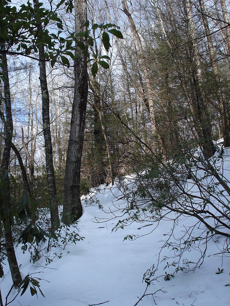
The best time to visit is Spring, Summer, and Fall. Winter access may be limited.
Safety Information
Be cautious of slippery rocks near the waterfall and stream crossings. Check weather conditions before your visit, as heavy rain can make trails hazardous. Cell service may be limited in the area.
Current Water Conditions
36 ft³/s
Current discharge — how much water is flowing
Much lower than usual for this time of year
Based on 68 years of record
0.66 ft
Water depth at gauge
7-Day Discharge Trend
What does this mean for your visit?
Flow is well below normal for this time of year, so the waterfall may be a trickle.
About This Gauge
7-Day Flow Outlook
Based on the USGS gauge SOUTH TOE RIVER NEAR CELO, NC (4 km away).
Today
Low
41 cfs
3/10Tomorrow
Barely Flowing
39 cfs
5/10Fri
Barely Flowing
36 cfs
5/10Sat
Low
38 cfs
3/10Sun
Low
39 cfs
3/10Mon
Low
39 cfs
3/10Tue
Low
37 cfs
3/10Best window: Tomorrow — barely flowing flow, mostly sunny (trip score 5/10).
Best time of year: this gauge typically runs highest from late February to early May, peaking in April.
How we calculate this
This is a transparent outlook, not a precise forecast. We take the waterfall's current flow strength (how it ranks against its historical normal for today, from the nearest USGS stream gauge), carry that ranking forward along the gauge's seasonal curve, and nudge it for forecast rain. Confidence is highest for the next day or two and falls further out. Always check official conditions and your own judgment before visiting — high flows can be dangerous.
Know when to go.
Get a free email alert when waterfalls near Spruce Pine hit peak flow. We only send when conditions are worth the trip — no weekly newsletters, no spam.
Weather Forecast
Location & Access
Getting There
Murphy Falls is located within Panthertown Valley, a popular hiking destination in the Nantahala National Forest. Access is typically via the Salt Rock Gap trailhead or other nearby trailheads leading into the valley.
Get Directions on Google MapsParking
Parking is available at the Salt Rock Gap trailhead, but spaces may be limited during peak seasons. Arrive early to secure a spot.
Elevation
2,743 feet above sea level
Coordinates
35.852109° N, -82.142028° W
Visitor Tips & Gear
Bring a map or GPS device, as trails in Panthertown Valley can be confusing due to intersecting paths. Start early to avoid getting caught in the dark, and be prepared for muddy or slippery conditions, especially after rain.
As an Amazon Associate, we earn from qualifying purchases.
With 4.0 miles and 300 ft of elevation gain, sturdy boots and trekking poles will help on this moderate trail. Sun exposure on the trail makes good sun protection a must in summer.

Columbia Watertight II Rain Jacket
Packs into its own pocket, seam-sealed, and keeps you dry from spray and surprise rain.

Earth Pak Waterproof Dry Bag
Keeps your phone and gear dry when waterfall mist soaks everything else.

Waterproof Phone Pouch (AiRunTech)
Cheap insurance — take photos right next to the falls without killing your phone.

Timberland Euro Sprint Mid Waterproof
Trusted waterproof boot with premium leather and grippy rubber sole — reliable on rocky, wet trails.

TrailBuddy Trekking Poles
Lightweight aluminum, cork grips, and flip-locks that actually hold — a best-seller for good reason.

Sawyer Squeeze Water Filter
The backcountry standard — filters 99.9% of bacteria and weighs just 3 oz.
Where to Stay

PINE VALLEY MOTEL

Alpine Inn

Ruth's Place Tiny Home Retreat 1 mile to town

The Embers Hotel
Browse vacation cabins and private rentals nearby
Unique outdoor stays — tents, yurts, and treehouses
Rent a campervan or RV for your waterfall road trip
Some links are affiliate links. We may earn a commission at no extra cost to you.
Nearby Campground
CAROLINA HEMLOCKS REC AREA
4.8 miles away · 39 sites
Overview Carolina Hemlocks Recreation Area sits in the scenic mountains of Pisgah National Forest. This is a great place for small to medium-sized groups to swim, fish, tube, hike, camp, picnic and simply relax in the cool shade of the forest.Recreation The river provides endless hours of fun for families and water enthusiasts, including swimming and tubing. Anglers can also try their luck for trout and smallmouth bass from the shore. Picnickers will enjoy relaxing in the shaded picnic shelter se
Book on Recreation.govNearby Hot Springs
Hot springs near Spruce Pine, North Carolina

Looking for a soak after your hike? Explore more hot springs near Spruce Pine, North Carolina on SoakingSprings.
Explore North Carolina springsAdditional Information
Nearby Attractions
Other waterfalls in Panthertown Valley, such as Schoolhouse Falls and Greenland Creek Falls, are worth exploring.
Wildlife
The area is home to diverse wildlife, including deer, black bears, and various bird species. Be cautious and follow Leave No Trace principles.
Cities near Murphy Falls
Nearby Waterfalls
Writing about Murphy Falls? Embed this waterfall on your site for free.