Photo Credits (5)
Difficulty
Easy
Trail Length
3.1 km
Trail Type
Out And Back
Elevation Gain
75 m
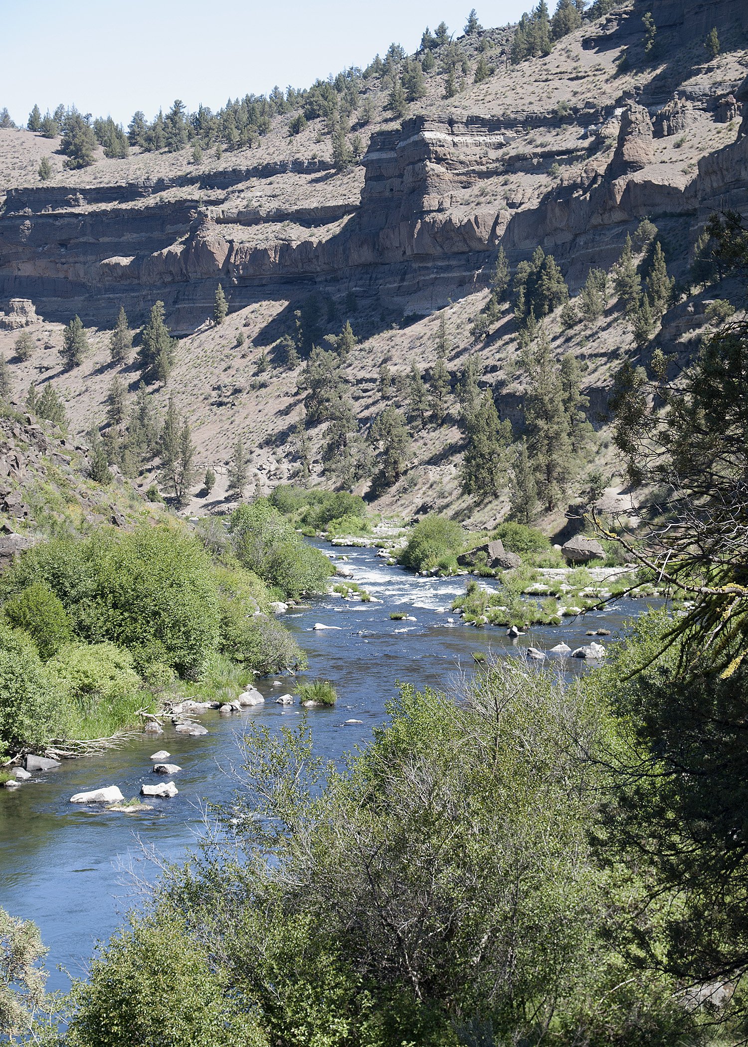
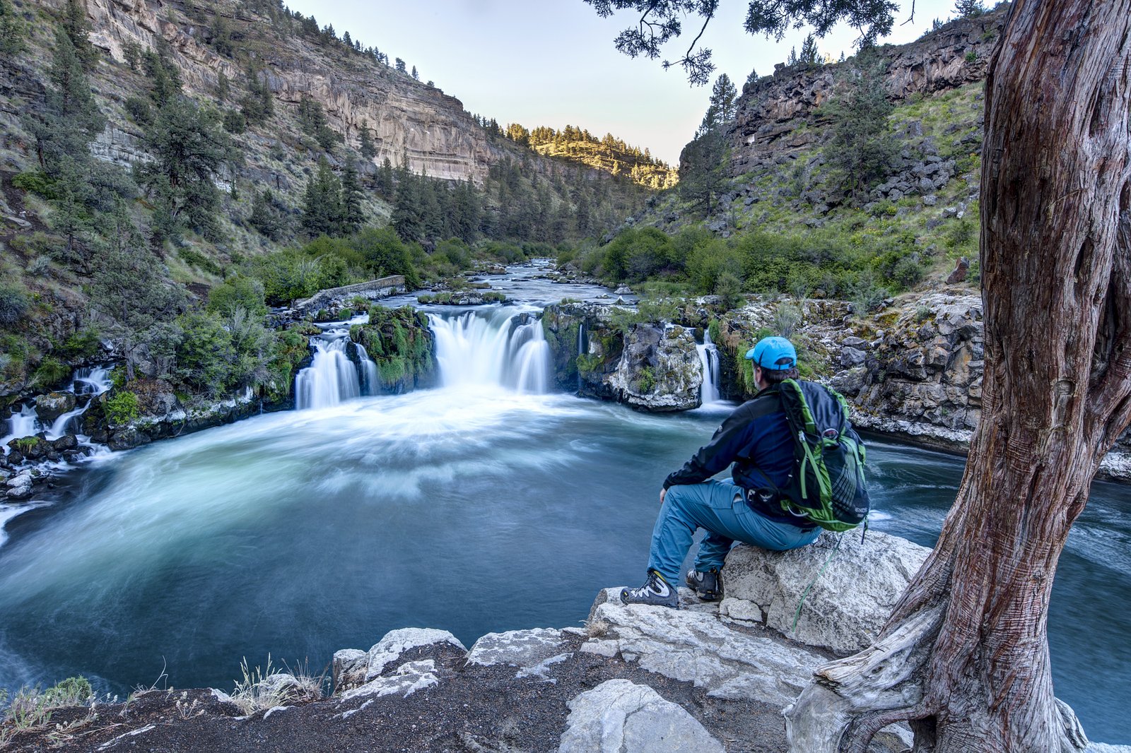
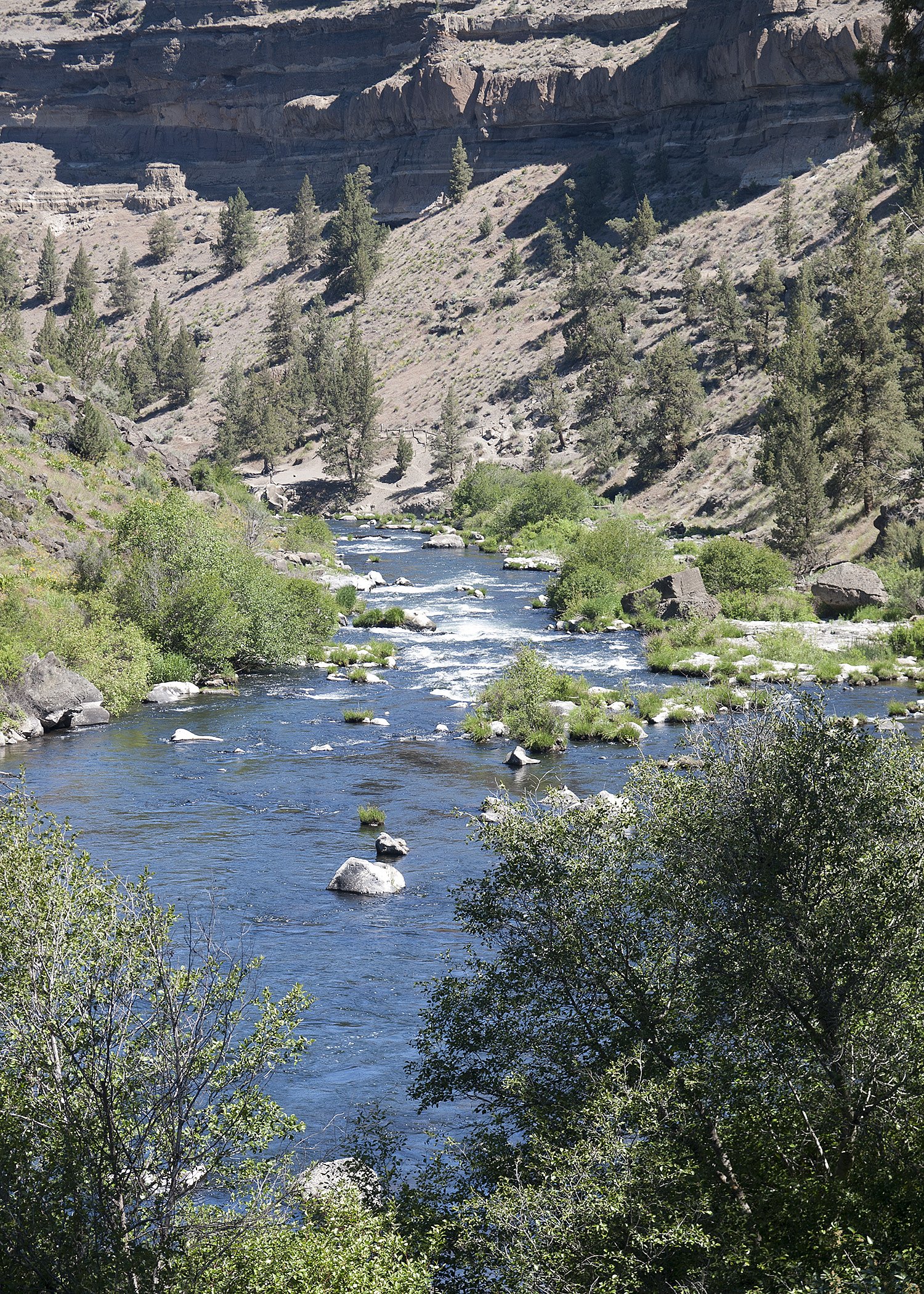
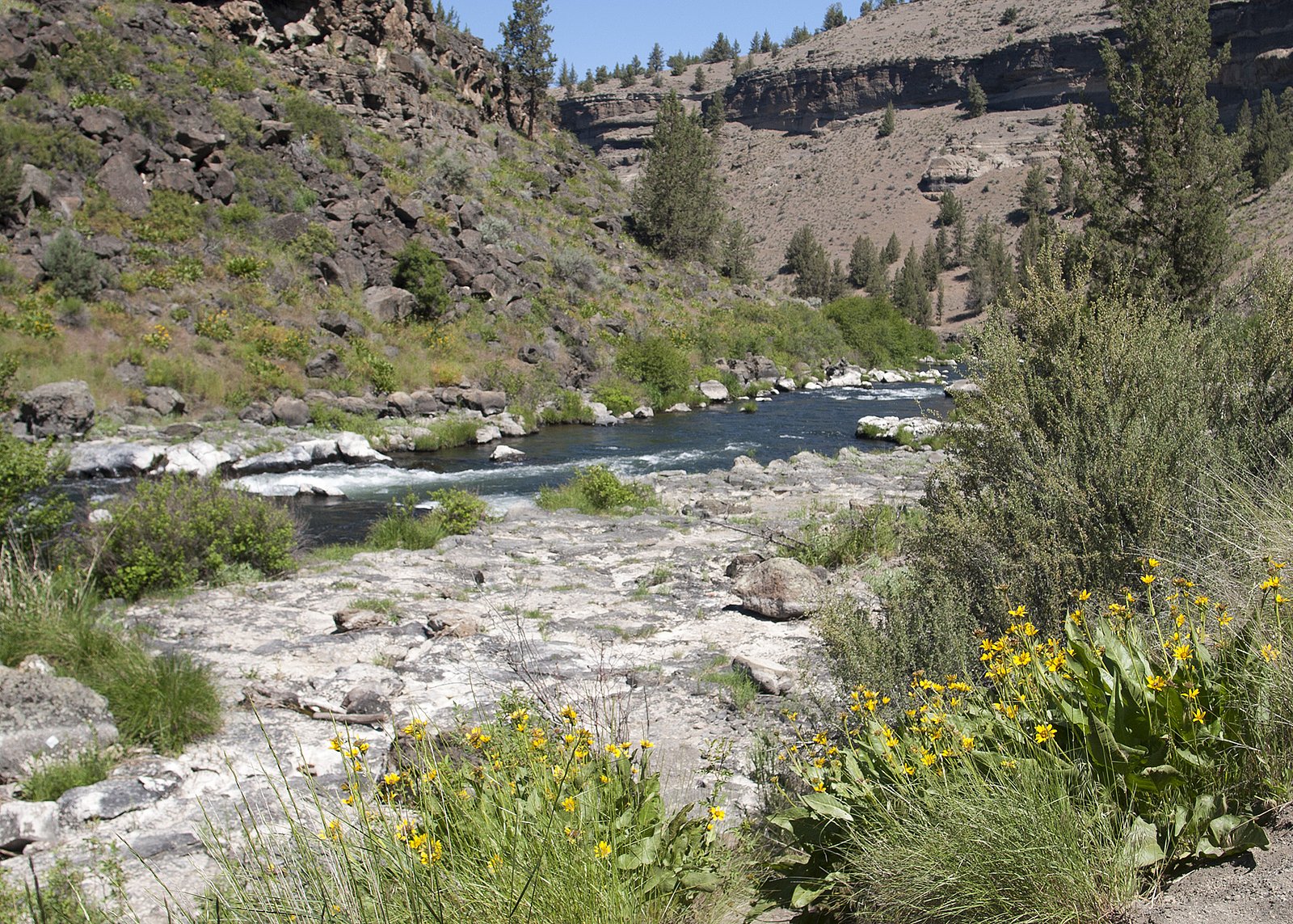
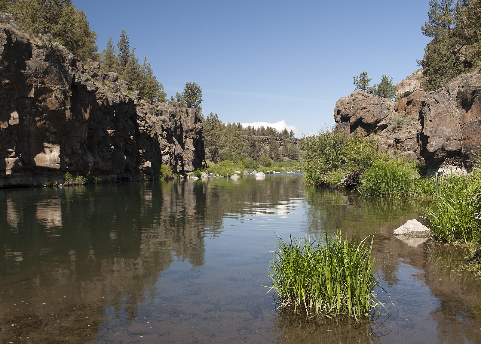
About Steelhead Falls
Steelhead Falls is a small, possibly lesser-known waterfall located in the Fraser Valley region of British Columbia near Abbotsford (approximately 10.7 miles away). Coordinates for the waterfall are 49.2253, -122.3504. The waterfall is in a rural/forested area where water flow can vary seasonally, typically highest in spring snowmelt and after heavy rains, and lower in late summer. Precise published measurements and detailed official descriptions are limited; some visitor reports indicate the site is accessed by informal trails and may be on or adjacent to private land in places, so access and conditions can change.
Why This Waterfall Exists
Steelhead Falls flows over hard intrusive rock laid down about 145-162 million years ago. These resistant rocks form a durable ledge that water cannot easily wear away, creating the falls where softer material downstream has already eroded.
Nearby Falls Worth Visiting
Upper Kanaka Falls (25 m) lies 7.6 kilometres to the west. Also nearby: Rolley Falls (22 m, 3.2 km) and Rockwell Falls (12 m, 4.3 km).
Trail & Hike Details
The Approach
The easy 3.1-km out-and-back trail gains 75 metres of elevation on the way to the falls.
Trail Description
Approach routes are likely unmaintained or semi-maintained footpaths that may include uneven ground, mud, and short steep sections. Some visitor accounts for similar local falls mention short bushwhacks from a nearby road or informal trailheads. Trail surfaces can be root- and rock-strewn and may be slippery when wet. Because published trail maps and official wayfinding are limited for this specific feature, navigation may require a GPS waypoint or local knowledge.
What to Expect
Expect a small- to medium-sized cascade whose flow changes with season. Surroundings are generally rural and forested with mixed second-growth and riparian vegetation. There may be limited or no facilities (no restrooms, no maintained viewpoints, no trash service). Water levels and access can be affected by weather, and sections near the water often have slippery rocks and steep banks. Some approaches may cross farmland or pass close to private property, respect signage and closures.
Accessibility
The trail is not wheelchair accessible. Uneven terrain and elevation changes require steady footing.
Frequently Asked Questions
🐶 Are Dogs Allowed at Steelhead Falls?
❌ Dogs are not allowed
Are There Any Fees or Permits Required?
🆖 No fees required
🏊 Is There Swimming at Steelhead Falls?
❌ Swimming is not allowed
When to Visit
Late spring for highest flows and lush vegetation; early summer and fall are good for drier conditions and hiking access. Avoid times of heavy rain or rapid snowmelt due to high flows and slippery banks.
Seasonal Access
The best time to visit is Spring, Summer, and Fall. Winter access may be limited. Check with the managing park or local authority for current conditions.
Safety Information
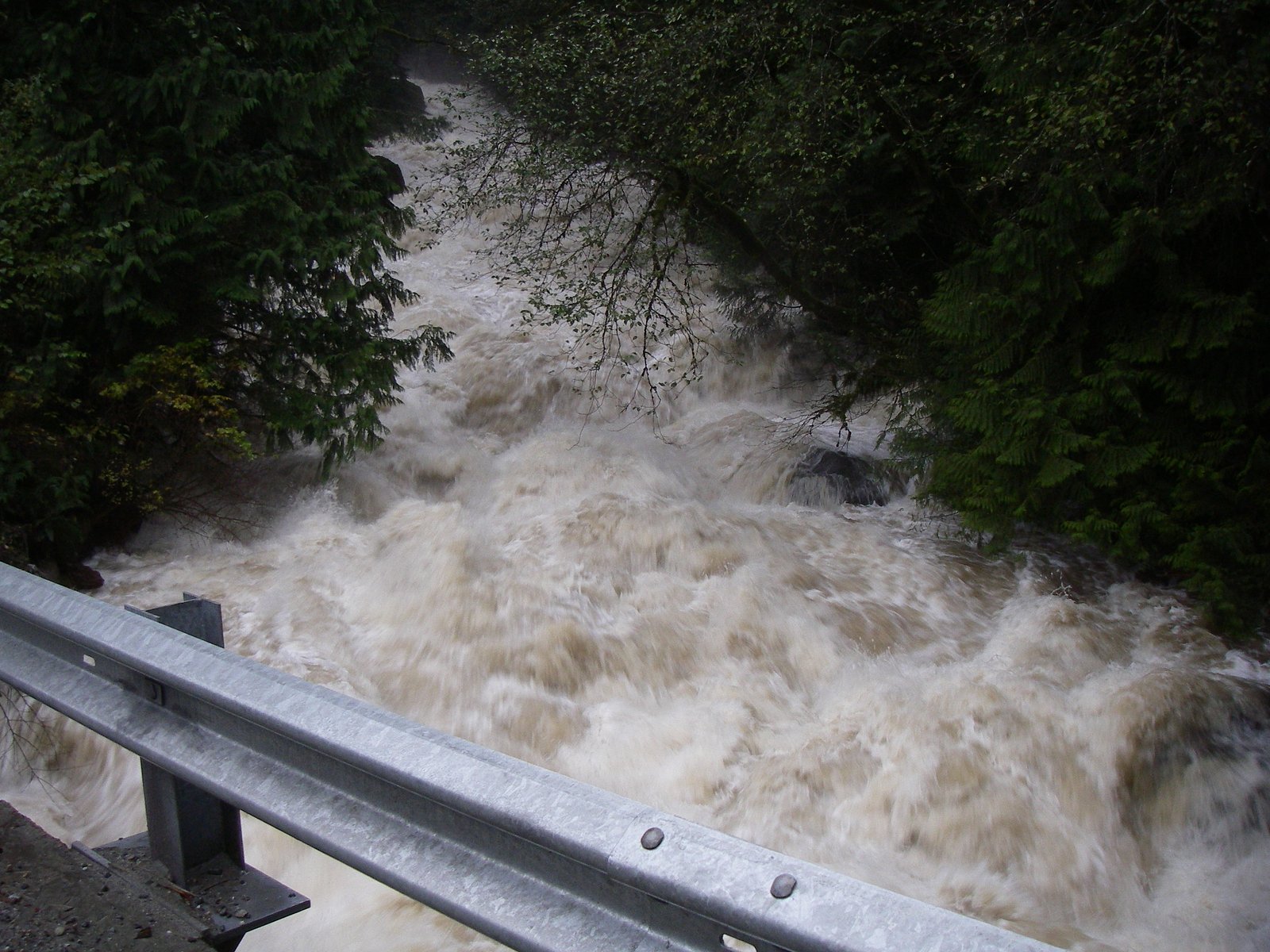
Hazards can include slippery rocks, steep and unstable banks, fast-moving water especially in spring or after heavy rains, changing access due to private property boundaries, and seasonal road or trail closures. Cell service may be limited. Bring a map/GPS, tell someone your plans, and avoid visiting alone in remote conditions. If you encounter posted private property or closures, do not proceed.
7-Day Flow Outlook
Based on the WSC gauge FRASER RIVER AT MISSION (11 km away).
Best time of year: this gauge typically runs highest from early May to early August, peaking in June.
How we calculate this
This is a transparent outlook, not a precise forecast. We take the waterfall's current flow strength (how it ranks against its historical normal for today, from the nearest WSC stream gauge), carry that ranking forward along the gauge's seasonal curve, and nudge it for forecast rain. Confidence is highest for the next day or two and falls further out. Always check official conditions and your own judgment before visiting — high flows can be dangerous.
Know when to go.
Get a free email alert when waterfalls near Abbotsford hit peak flow. We only send when conditions are worth the trip — no weekly newsletters, no spam.
Weather Forecast
Location & Access
Getting There
Steelhead Falls is at coordinates 49.2253, -122.3504, in the Fraser Valley near Abbotsford, with Sumas and Everson also nearby. Approaches reported by visitors vary; common access involves local forest or rural roads and short footpaths. Some routes may use logging roads or informal trails and could cross or come close to private property, confirm access locally before visiting. Expect limited signage.
Get Directions on Google MapsParking
No formal developed parking lot is confirmed. Visitors typically park on the shoulder of a nearby low-traffic road or at informal pullouts. Park legally and avoid blocking gates, driveways, or farm access. If unsure about legal parking, consider parking further away and walking.
Elevation
97 metres above sea level
Coordinates
49.225303° N, -122.350392° W
Visitor Tips & Gear
• Check local maps and recent trip reports before you go; access routes can change. • Respect private property and posted signs, if access looks like it crosses private land, seek permission or use a public approach. • Wear sturdy, waterproof footwear with good traction. • Expect muddy or slippery conditions after rain. • Bring insect repellent in warm months and be aware of ticks. • Pack out all trash. • If parking on rural roads, pull fully off the pavement and avoid blocking gates or driveways.
As an Amazon Associate, we earn from qualifying purchases.
This easy 3.1 km hike is straightforward — comfortable trail shoes and plenty of water should do. Sun exposure on the trail makes good sun protection a must in summer.

Polarized Sunglasses (Knockaround)
Cuts glare off the water so you actually see the falls — and your photos turn out better too.

Columbia Watertight II Rain Jacket
Packs into its own pocket, seam-sealed, and keeps you dry from spray and surprise rain.

Earth Pak Waterproof Dry Bag
Keeps your phone and gear dry when waterfall mist soaks everything else.

Waterproof Phone Pouch (AiRunTech)
Cheap insurance — take photos right next to the falls without killing your phone.

JOBY GorillaPod Starter Kit
Wraps around railings and rocks for long-exposure waterfall shots — no flat surface needed.

Osprey Daylite Daypack
Light, organized, and just the right size for a day hike — fits water, snacks, and layers.
Where to Stay
Browse vacation cabins and private rentals nearby
Unique outdoor stays — tents, yurts, and treehouses
Rent a campervan or RV for your waterfall road trip
Some links are affiliate links. We may earn a commission at no extra cost to you.
Nearby Campground
Rolley Lake Campground
3.2 km away
Nearby Hot Springs
Hot springs near Abbotsford, British Columbia
Dorr Fumarole Field
Dorr Fumarole Field reaches 194 degrees at 8,168 feet elevation on Mount Baker's active volcanic slopes, producing superheated ...

Sherman Crater Fumaroles
Sherman Crater Fumaroles register 266 degrees Fahrenheit at 9,463 feet elevation within the active volcanic crater atop Mount B...
Baker Hot Spring
Baker Hot Spring emerges at 108 degrees Fahrenheit on US Forest Service land in Mt. Baker National Forest, flowing 59.5 degrees...
Looking for a soak after your hike? Explore more hot springs near Abbotsford, British Columbia on SoakingSprings.
Explore British Columbia springsAdditional Information
Nearby Attractions
Abbotsford (town services, restaurants), Sumas Mountain (recreation and viewpoints), local Fraser Valley parks and agricultural areas. Check regional visitor resources for up-to-date nearby trail and park options.
Wildlife
Typical Fraser Valley wildlife may be present: songbirds, waterfowl, small mammals, and potentially larger mammals such as black bear or cougar in forested areas. Also watch for ticks in warmer months. Maintain distance from wildlife and secure food.
Cities near Steelhead Falls
Nearby Waterfalls
Other waterfalls named Steelhead Falls
1 other waterfall shares this name across Canada.
Writing about Steelhead Falls? Embed this waterfall on your site for free.