Lower Kanaka Falls
British Columbia • Kanaka Creek Regional Park
By Armen Suny · Last verified Jun 2026
Difficulty
Moderate
Trail Length
5.0 km
Trail Type
Out And Back
Elevation Gain
235 m
About Lower Kanaka Falls
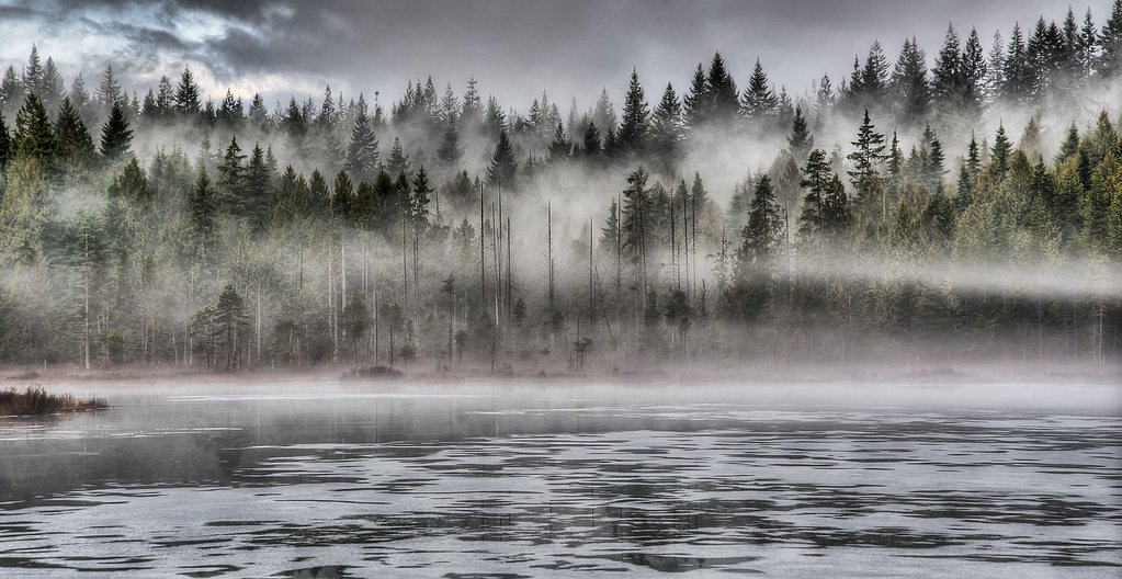
Lower Kanaka Falls is a small forested cascade located in the Fraser Valley region of British Columbia near the communities of Lynden, Abbotsford and Sumas (coordinates: 49.2306, -122.4517). Documentation for this specific feature is limited; it appears to be a modest waterfall on a creek in a wooded, semi-rural area. Access details and official amenities are not well-documented and may involve unmaintained trails, informal access points, or crossing private land. Visitors should plan conservatively and verify access with local authorities or landowners where possible.
The Setting
Lower Kanaka Falls sits at 254 metres within Kanaka Creek Regional Park, in the foothills of British Columbia.
Why This Waterfall Exists
Lower Kanaka Falls flows over hard intrusive rock laid down about 145-162 million years ago. These resistant rocks form a durable ledge that water cannot easily wear away, creating the falls where softer material downstream has already eroded.
Nearby Falls Worth Visiting
Upper Kanaka Falls (25 m) lies 2.1 kilometres to the north. Also nearby: Rolley Falls (22 m, 6.0 km) and Whispering Falls (10 m, 2.9 km).
Trail & Hike Details
The Approach
The moderate 5.0-km out-and-back trail gains 235 metres of elevation on the way to the falls.
Trail Description
Reports for this specific waterfall are sparse. Expect an informal, possibly steep and uneven path down toward the creek with roots, loose rock and muddy sections. There may be short bushwhack sections and one or more creek crossings. Expect limited or no wayfinding signs; GPS coordinates and a physical map are recommended. The approach may cross or run adjacent to private land in places, confirm legality of access before entering.
What to Expect
A small cascade or series of cascades in a forested creek channel. Mossy rocks, fallen logs and dense vegetation are typical. Water volume will vary seasonally, higher in spring snowmelt and after heavy rain, lower in late summer. Views may be limited to a single vantage point or require careful scrambling to multiple viewpoints. Conditions can be slippery and unstable near the water.
Accessibility
The trail is not wheelchair accessible. Uneven terrain and elevation changes require steady footing.
Frequently Asked Questions
🐶 Are Dogs Allowed at Lower Kanaka Falls?
❌ Dogs are not allowed
Are There Any Fees or Permits Required?
🆖 No fees required
🏊 Is There Swimming at Lower Kanaka Falls?
❌ Swimming is not allowed
When to Visit
Spring for highest flows and fuller cascades; late spring and early summer for green forest conditions. Summer offers easier weather but potentially lower flows. Fall can provide good color and lower visitor numbers. Winter access may be more difficult due to water, ice and weather.
Seasonal Access
The best time to visit is Spring, Summer, and Fall. Winter access may be limited. Check with Kanaka Creek Regional Park for current conditions.
Safety Information
Hazards may include slippery rocks, steep or unstable banks, fast-moving water during high flows, creek crossings, ticks, and possible encounters with wildlife. There may be limited or no cell service and no lifeguards or formal rescue infrastructure in the immediate area. Avoid venturing onto cliffs or wet rock ledges, travel with a companion when possible, tell someone your plans, and carry basic emergency supplies.
Current Water Conditions
0.2 m³/s
Current discharge — how much water is flowing
Lower than usual for this time of year
Based on 64 years of record
0.84 m
Water depth at gauge
7-Day Discharge Trend
What does this mean for your visit?
Flow is lower than usual for this time of year.
About This Gauge
7-Day Flow Outlook
Based on the WSC gauge KANAKA CREEK NEAR WEBSTER CORNERS (7 km away).
Today
Low
0.2 m³/s
5/10Tomorrow
Low
0.2 m³/s
5/10Tue
Low
0.2 m³/s
5/10Wed
Low
0.1 m³/s
5/10Thu
Moderate
0.2 m³/s
5/10Fri
Moderate
0.1 m³/s
6/10Sat
Moderate
0.1 m³/s
5/10Best window: Fri — moderate flow, cloudy (trip score 6/10).
Best time of year: this gauge typically runs highest from early November to late December, peaking in December.
How we calculate this
This is a transparent outlook, not a precise forecast. We take the waterfall's current flow strength (how it ranks against its historical normal for today, from the nearest WSC stream gauge), carry that ranking forward along the gauge's seasonal curve, and nudge it for forecast rain. Confidence is highest for the next day or two and falls further out. Always check official conditions and your own judgment before visiting — high flows can be dangerous.
Know when to go.
Get a free email alert when waterfalls near Abbotsford hit peak flow. We only send when conditions are worth the trip — no weekly newsletters, no spam.
Weather Forecast
Location & Access
Getting There
The falls are located in the border-area portion of the Fraser Valley (coordinates above). The nearest larger centers are Lynden (approx. 13.8 miles), Abbotsford (approx. 15.2 miles) and Sumas (approx. 19.2 miles). There is no widely advertised formal trailhead; access may require driving to a nearby road or logging spur and hiking on an informal/unmaintained path. Use a detailed map or GPS to reach the coordinates and confirm private property boundaries before proceeding.
Get Directions on Google MapsParking
Parking is likely limited to roadside pullouts or informal spaces. Some nearby roads may be narrow and residential; avoid blocking driveways or creating a hazard. Parking on private property may be prohibited. If no formal parking area exists, consider parking in a legal, marked area and walking in.
Elevation
254 metres above sea level
Coordinates
49.230644° N, -122.451723° W
Land Management
Managed by Metro Vancouver Regional District
Visitor Tips & Gear
1) Verify access and property boundaries before visiting; avoid trespassing. 2) Wear sturdy, waterproof footwear with good traction, rocks and roots will be slippery. 3) Use a map/GPS and carry a charged phone; cell service may be intermittent. 4) Bring insect repellent in spring/summer. 5) Do not climb on wet rocks near the falls; slips can be serious. 6) Park legally and avoid blocking narrow roads. 7) Leave no trace, pack out all trash.
As an Amazon Associate, we earn from qualifying purchases.
With 5.0 km and 235 m of elevation gain, sturdy boots and trekking poles will help on this moderate trail. Sun exposure on the trail makes good sun protection a must in summer.

Columbia Watertight II Rain Jacket
Packs into its own pocket, seam-sealed, and keeps you dry from spray and surprise rain.

Earth Pak Waterproof Dry Bag
Keeps your phone and gear dry when waterfall mist soaks everything else.

Waterproof Phone Pouch (AiRunTech)
Cheap insurance — take photos right next to the falls without killing your phone.

Timberland Euro Sprint Mid Waterproof
Trusted waterproof boot with premium leather and grippy rubber sole — reliable on rocky, wet trails.

TrailBuddy Trekking Poles
Lightweight aluminum, cork grips, and flip-locks that actually hold — a best-seller for good reason.

Sawyer Squeeze Water Filter
The backcountry standard — filters 99.9% of bacteria and weighs just 3 oz.
Where to Stay
Browse vacation cabins and private rentals nearby
Unique outdoor stays — tents, yurts, and treehouses
Rent a campervan or RV for your waterfall road trip
Some links are affiliate links. We may earn a commission at no extra cost to you.
Nearby Campground
Rolley Lake Campground
5.4 km away
Nearby Hot Springs
Hot springs near Abbotsford, British Columbia
Dorr Fumarole Field
Dorr Fumarole Field reaches 194 degrees at 8,168 feet elevation on Mount Baker's active volcanic slopes, producing superheated ...

Sherman Crater Fumaroles
Sherman Crater Fumaroles register 266 degrees Fahrenheit at 9,463 feet elevation within the active volcanic crater atop Mount B...
Baker Hot Spring
Baker Hot Spring emerges at 108 degrees Fahrenheit on US Forest Service land in Mt. Baker National Forest, flowing 59.5 degrees...
Looking for a soak after your hike? Explore more hot springs near Abbotsford, British Columbia on SoakingSprings.
Explore British Columbia springsAdditional Information
Nearby Attractions
Fraser Valley parks, rural scenic drives and local trails in the Abbotsford/Lynden/Sumas border region. Specific nearby official parks or maintained trail systems should be confirmed via local municipal or provincial park resources.
Wildlife
Typical Fraser Valley wildlife may be present: black-tailed deer, small mammals, coyotes, various birds and potentially black bears. Be aware of ticks in warmer months. Fish presence in the creek is possible but not confirmed for this specific location.
Cities near Lower Kanaka Falls
Nearby Waterfalls
Writing about Lower Kanaka Falls? Embed this waterfall on your site for free.