Rolley Falls
British Columbia • 22 m
By Armen Suny · Last verified Jun 2026
Difficulty
Easy
Trail Length
1.0 km
Trail Type
Out And Back
About Rolley Falls
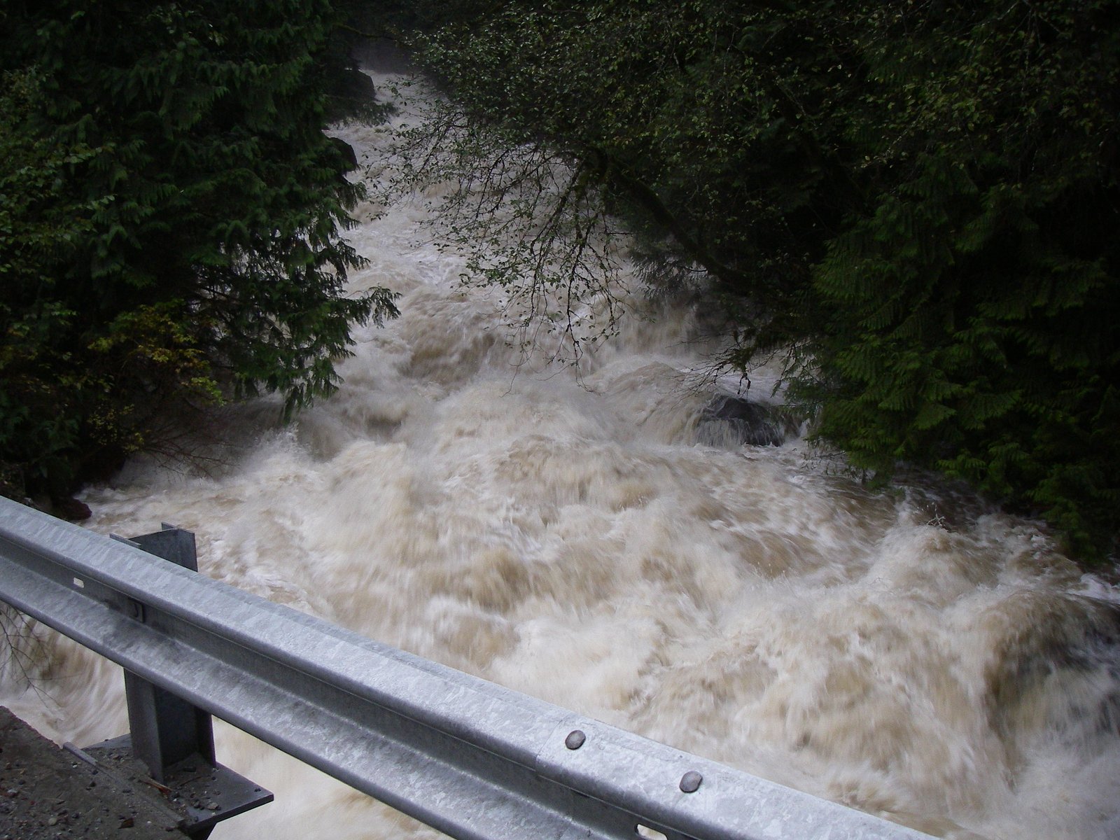
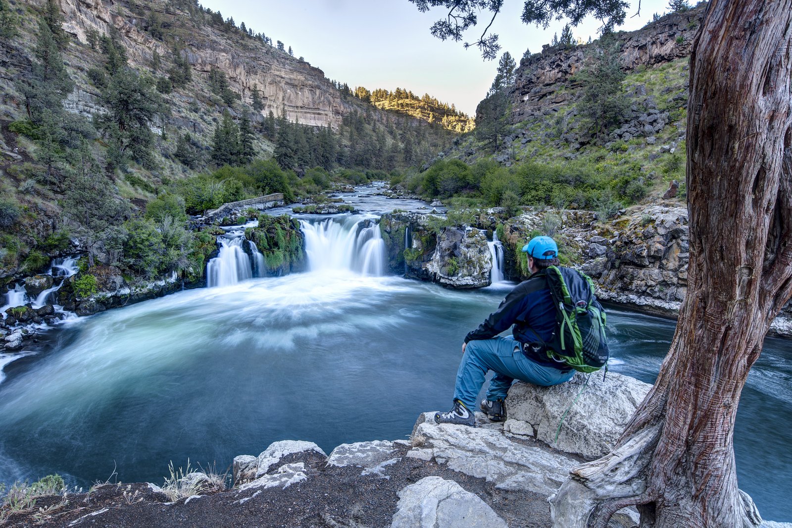
Rolley Falls is a small, scenic cascade at the outflow of Rolley Lake in Rolley Lake Provincial Park near Mission, British Columbia. The falls are accessed by a short, well-used trail through second-growth forest and alder, and there is a viewing area/boardwalk near the falls. The site is popular with day visitors and families and is often visited together with Rolley Lake. Flow and appearance vary seasonally (higher in spring and after rain).
The Setting
Rolley Falls sits at 214 metres within Old Growth Management Areas (Mapped Legal), in the foothills of British Columbia. The falls drop 22 metres.
Why This Waterfall Exists
Rolley Falls flows over hard intrusive rock laid down about 145-175 million years ago. These resistant rocks form a durable ledge that water cannot easily wear away, creating a 72-foot drop where softer material downstream has already eroded.
Nearby Falls Worth Visiting
Upper Kanaka Falls (25 m) lies 5.3 kilometres to the west. Also nearby: Rockwell Falls (12 m, 1.1 km).
Trail & Hike Details
Trail Description
A short, well-marked path leaves the Rolley Lake parking area and descends through mixed forest and alder to viewing platforms near the falls. The trail is short and typically maintained; sections can be muddy or have exposed roots. There are wooden boardwalks/steps in places and one primary viewpoint from which you can safely view the cascade. The immediate area around the falls is often wet and slippery.
What to Expect
The falls drop 22 metres over hard intrusive rock.
Accessibility
The trail is short and relatively flat, but the surface may be uneven. Contact the managing agency for accessibility details.
Frequently Asked Questions
🐶 Are Dogs Allowed at Rolley Falls?
❌ Dogs are not allowed
Are There Any Fees or Permits Required?
🆖 No fees required
🏊 Is There Swimming at Rolley Falls?
❌ Swimming is not allowed
When to Visit
Spring for strongest water flows and green forest growth; summer for warmer weather and combining with lake activities; fall for autumn color. Winter visits are possible but expect muddy/icy conditions and shorter daylight.
Seasonal Access
The best time to visit is Spring, Summer, and Fall. Winter access may be limited. Check with the managing park or local authority for current conditions.
Safety Information
Hazards include slippery rocks and boardwalks, steep or eroding edges near the falls, cold water and strong currents after heavy rain, and variable trail conditions (mud, roots). Watch children closely near edges and water. Weather can change rapidly, dress in layers. Check for park advisories or temporary closures before visiting. Cell phone reception may be limited.
Current Water Conditions
0.2 m³/s
Current discharge — how much water is flowing
Lower than usual for this time of year
Based on 64 years of record
0.84 m
Water depth at gauge
7-Day Discharge Trend
What does this mean for your visit?
Flow is lower than usual for this time of year.
About This Gauge
This gauge is on a nearby waterway and may not reflect exact conditions at the falls.
7-Day Flow Outlook
Based on the WSC gauge KANAKA CREEK NEAR WEBSTER CORNERS (13 km away).
Today
Low
0.2 m³/s
5/10Tomorrow
Low
0.2 m³/s
5/10Tue
Low
0.2 m³/s
5/10Wed
Low
0.1 m³/s
5/10Thu
Moderate
0.2 m³/s
5/10Fri
Moderate
0.1 m³/s
6/10Sat
Moderate
0.1 m³/s
5/10Best window: Fri — moderate flow, cloudy (trip score 6/10).
Best time of year: this gauge typically runs highest from early November to late December, peaking in December.
How we calculate this
This is a transparent outlook, not a precise forecast. We take the waterfall's current flow strength (how it ranks against its historical normal for today, from the nearest WSC stream gauge), carry that ranking forward along the gauge's seasonal curve, and nudge it for forecast rain. Confidence is highest for the next day or two and falls further out. Always check official conditions and your own judgment before visiting — high flows can be dangerous.
Know when to go.
Get a free email alert when waterfalls near Abbotsford hit peak flow. We only send when conditions are worth the trip — no weekly newsletters, no spam.
Weather Forecast
Location & Access
Getting There
Rolley Falls is reached from Rolley Lake Provincial Park off Lougheed Highway (Highway 7) near Mission, BC. From Mission drive toward Rolley Lake Road; follow signs to the provincial park and park in the main lot. A short signed path from the parking area leads to the falls. Coordinates (approx): 49.2504, -122.3745.
Get Directions on Google MapsParking
Small day-use parking lot at Rolley Lake Provincial Park. Parking can fill on warm weekends, arrive early. Overflow parking along nearby roads may be restricted. Facilities at the lot are limited.
Elevation
214 metres above sea level
Coordinates
49.250407° N, -122.374454° W
Land Management
Managed by Government of British Columbia
Visitor Tips & Gear
Arrive early on weekends to secure parking. Wear sturdy, traction-capable footwear, rocks and boardwalks can be slippery. Keep dogs on leash and under control (check park regulations). Bring a water bottle, insect repellent during warm months, and dress for changeable weather. Pack out all trash. Cell service may be limited in some spots. Check BC Parks or local trail resources for current conditions or closures before visiting.
Where to Stay
Browse vacation cabins and private rentals nearby
Unique outdoor stays — tents, yurts, and treehouses
Rent a campervan or RV for your waterfall road trip
Some links are affiliate links. We may earn a commission at no extra cost to you.
Nearby Campground
Rolley Lake Campground
0.7 km away
Nearby Hot Springs
Hot springs near Abbotsford, British Columbia
Dorr Fumarole Field
Dorr Fumarole Field reaches 194 degrees at 8,168 feet elevation on Mount Baker's active volcanic slopes, producing superheated ...

Sherman Crater Fumaroles
Sherman Crater Fumaroles register 266 degrees Fahrenheit at 9,463 feet elevation within the active volcanic crater atop Mount B...
Baker Hot Spring
Baker Hot Spring emerges at 108 degrees Fahrenheit on US Forest Service land in Mt. Baker National Forest, flowing 59.5 degrees...
Looking for a soak after your hike? Explore more hot springs near Abbotsford, British Columbia on SoakingSprings.
Explore British Columbia springsAdditional Information
Nearby Attractions
Rolley Lake (beach, picnicking), Rolley Lake Provincial Park trails and day-use areas, nearby Mission attractions such as Stave Falls Regional Park and local hiking routes.
Wildlife
Wildlife in the area includes songbirds, waterfowl, small mammals (squirrels, raccoons), and occasionally deer. Black bears and cougars occur regionally, practice standard wildlife precautions. Ticks can be present in warmer months.
Cities near Rolley Falls
Nearby Waterfalls
Writing about Rolley Falls? Embed this waterfall on your site for free.