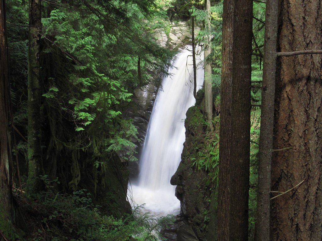
Woodland Falls
British Columbia • Pinecone Burke Park
By Armen Suny · Last verified Jun 2026
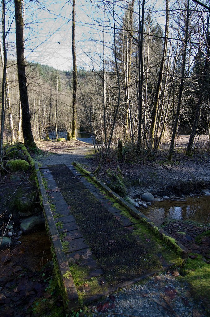
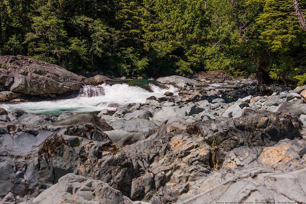
Photo Credits (5)
Difficulty
Easy
Trail Length
6.0 km
Trail Type
Out And Back
Elevation Gain
180 m
About Woodland Falls
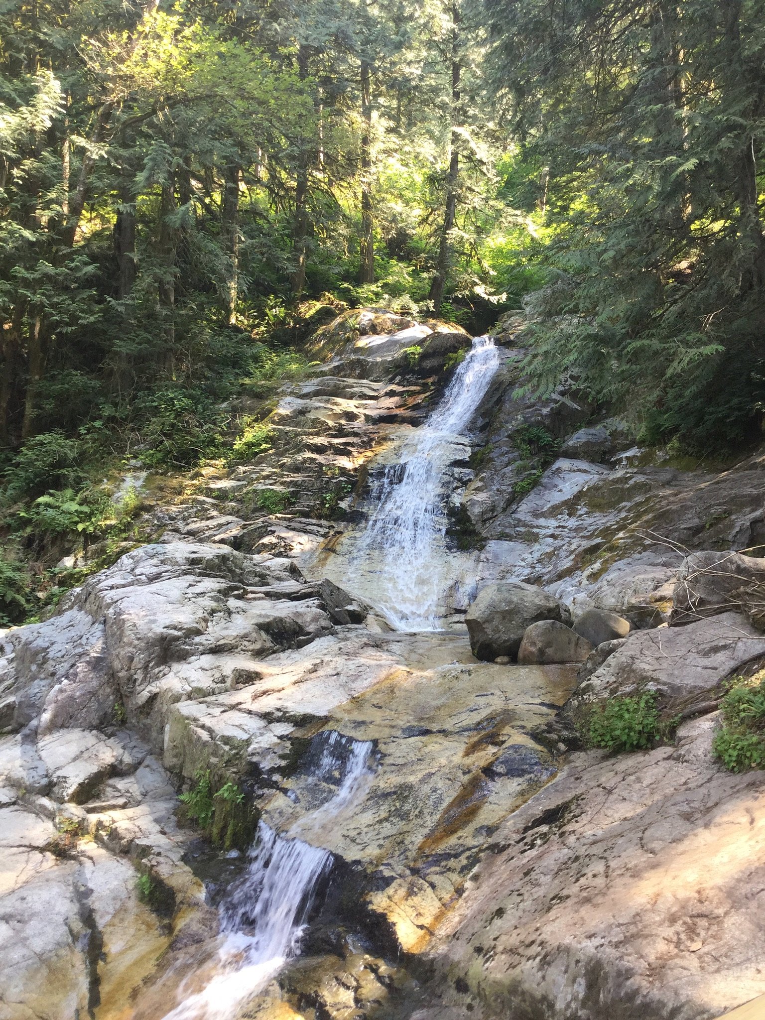
Woodland Falls is a small forested cascade located on the Canadian side of the Fraser Valley near the Canada–US border (coordinates 49.3408, -122.7502). It appears to be a modest waterfall on a tributary stream surrounded by mixed second-growth forest and private/rural parcels. Flow is likely highest in spring and after heavy rain; viewpoints and formal facilities may be minimal or nonexistent. Precise published information about the falls is limited, and access may require short off-trail travel on unmaintained paths or roadside approaches.
The Setting
Woodland Falls sits at 499 metres within Pinecone Burke Park, in the hills of British Columbia.
Why This Waterfall Exists
Woodland Falls flows over hard intrusive rock laid down about 145-162 million years ago. These resistant rocks form a durable ledge that water cannot easily wear away, creating the falls where softer material downstream has already eroded.
Nearby Falls Worth Visiting
Crystal Falls (12 m) lies 2.7 kilometres to the southwest.
Trail & Hike Details
The Approach
The easy 6.0-km out-and-back trail gains 180 metres of elevation on the way to the falls.
Trail Description
There is no widely published maintained trail to Woodland Falls. Visitors should expect unmarked routes that may involve short sections of bushwhacking, steep or muddy ground, and uneven footing. Trails (if any) are likely user-created and not regularly maintained. Because mapped trail data is limited, navigation with GPS or a detailed local map is recommended. Access may cross private land, obtain permission where required.
What to Expect
A modest wooded cascade with limited infrastructure. Expect minimal viewpoints, no formal viewing platforms, and possible steep banks or slippery rocks at the stream edge. Peak water flow typically occurs in spring or after heavy rain. Surrounding land is a mix of rural properties and forest; cell coverage may be variable. Facilities such as toilets, trash cans, and signage are likely absent.
Accessibility
The trail is not wheelchair accessible. Uneven terrain and elevation changes require steady footing.
Frequently Asked Questions
🐶 Are Dogs Allowed at Woodland Falls?
❌ Dogs are not allowed
Are There Any Fees or Permits Required?
🆖 No fees required
🏊 Is There Swimming at Woodland Falls?
❌ Swimming is not allowed
When to Visit
Late winter to spring for highest flow; summer for easier, drier access. Avoid visits right after heavy storms if concerned about slippery conditions or high water.
Seasonal Access
The best time to visit is Spring, Summer, and Fall. Winter access may be limited. Check with Pinecone Burke Park for current conditions.
Safety Information
Hazards may include slippery rocks, steep or unstable stream banks, fast-moving water during high flow, poison ivy/nettles, ticks, and potentially limited cell service. There may be private property near the falls, do not trespass. If traveling from the United States or vice versa, be prepared to present ID at the border; do not attempt to cross the international boundary except at official crossings. Always tell someone your plan and expected return time.
Current Water Conditions
0.1 m³/s
Current discharge — how much water is flowing
Much lower than usual for this time of year
Based on 16 years of record
3.12 m
Water depth at gauge
7-Day Discharge Trend
What does this mean for your visit?
Flow is well below normal for this time of year, so the waterfall may be a trickle.
About This Gauge
7-Day Flow Outlook
Based on the WSC gauge OR CREEK NEAR COQUITLAM (3 km away).
Today
Barely Flowing
0.1 m³/s
4/10Tomorrow
Barely Flowing
0.1 m³/s
4/10Tue
Barely Flowing
0.1 m³/s
4/10Wed
Barely Flowing
0.1 m³/s
4/10Thu
Barely Flowing
0.1 m³/s
4/10Fri
Barely Flowing
0.1 m³/s
4/10Sat
Barely Flowing
0.1 m³/s
3/10Best window: Today — barely flowing flow, fog (trip score 4/10).
Best time of year: this gauge typically runs highest from mid April to late May, peaking in November.
How we calculate this
This is a transparent outlook, not a precise forecast. We take the waterfall's current flow strength (how it ranks against its historical normal for today, from the nearest WSC stream gauge), carry that ranking forward along the gauge's seasonal curve, and nudge it for forecast rain. Confidence is highest for the next day or two and falls further out. Always check official conditions and your own judgment before visiting — high flows can be dangerous.
Know when to go.
Get a free email alert when waterfalls near Vancouver hit peak flow. We only send when conditions are worth the trip — no weekly newsletters, no spam.
Weather Forecast
Location & Access
Getting There
Woodland Falls is roughly 20 miles south of downtown Vancouver, BC, and near the communities of Blaine and Birch Bay (across the border in Washington State). Coordinates: 49.3408, -122.7502. Access details are not well documented; the waterfall may be reached from a nearby rural road and could require a short walk or bushwhack from a parking spot. Verify access on up-to-date local maps and respect private property boundaries.
Get Directions on Google MapsParking
No confirmed official parking lot. Expect limited or informal roadside pullouts; parking may be on gravel shoulders. Do not block driveways or gates. If unsure, park in a legal location and walk in.
Elevation
499 metres above sea level
Coordinates
49.340827° N, -122.750186° W
Land Management
Managed by Government of British Columbia
Visitor Tips & Gear
• Wear sturdy, waterproof footwear; watch for slippery rocks and roots. • Check land ownership and access rules before entering, some nearby parcels may be private. • Bring a map or GPS and note the provided coordinates (49.3408, -122.7502). • Do not attempt to park in gated driveways or block road shoulders. • Be aware of seasonal high flows and avoid getting too close to the stream during floods. • Carry out all trash and leave no trace. • If the visit involves crossing the international border for staging or parking, carry proper ID and follow border crossing rules.
As an Amazon Associate, we earn from qualifying purchases.
This easy 6.0 km hike is straightforward — comfortable trail shoes and plenty of water should do. Sun exposure on the trail makes good sun protection a must in summer.

Polarized Sunglasses (Knockaround)
Cuts glare off the water so you actually see the falls — and your photos turn out better too.

Columbia Watertight II Rain Jacket
Packs into its own pocket, seam-sealed, and keeps you dry from spray and surprise rain.

Earth Pak Waterproof Dry Bag
Keeps your phone and gear dry when waterfall mist soaks everything else.

Waterproof Phone Pouch (AiRunTech)
Cheap insurance — take photos right next to the falls without killing your phone.

Sawyer Squeeze Water Filter
The backcountry standard — filters 99.9% of bacteria and weighs just 3 oz.

JOBY GorillaPod Starter Kit
Wraps around railings and rocks for long-exposure waterfall shots — no flat surface needed.
Where to Stay
Browse vacation cabins and private rentals nearby
Unique outdoor stays — tents, yurts, and treehouses
Rent a campervan or RV for your waterfall road trip
Some links are affiliate links. We may earn a commission at no extra cost to you.
Nearby Campground
Widgeon Creek Campsite
8.7 km away
Nearby Hot Springs
Hot springs near Vancouver, British Columbia
Dorr Fumarole Field
Dorr Fumarole Field reaches 194 degrees at 8,168 feet elevation on Mount Baker's active volcanic slopes, producing superheated ...

Sherman Crater Fumaroles
Sherman Crater Fumaroles register 266 degrees Fahrenheit at 9,463 feet elevation within the active volcanic crater atop Mount B...
Baker Hot Spring
Baker Hot Spring emerges at 108 degrees Fahrenheit on US Forest Service land in Mt. Baker National Forest, flowing 59.5 degrees...
Looking for a soak after your hike? Explore more hot springs near Vancouver, British Columbia on SoakingSprings.
Explore British Columbia springsAdditional Information
Nearby Attractions
Nearby communities and attractions include the coastal areas around Blaine and Birch Bay (in Washington State) and the Metro Vancouver region. Regional parks along the coast and border such as Boundary Bay/Peace Arch areas may be within broader driving distance. Confirm locations and access before planning combined visits.
Wildlife
Typical Fraser Valley wildlife may be present: black-tailed deer, black bears (seasonal), coyotes, small mammals, and a variety of birds and waterfowl. Use standard wildlife safety practices and store food securely.
Cities near Woodland Falls
Nearby Waterfalls
Writing about Woodland Falls? Embed this waterfall on your site for free.