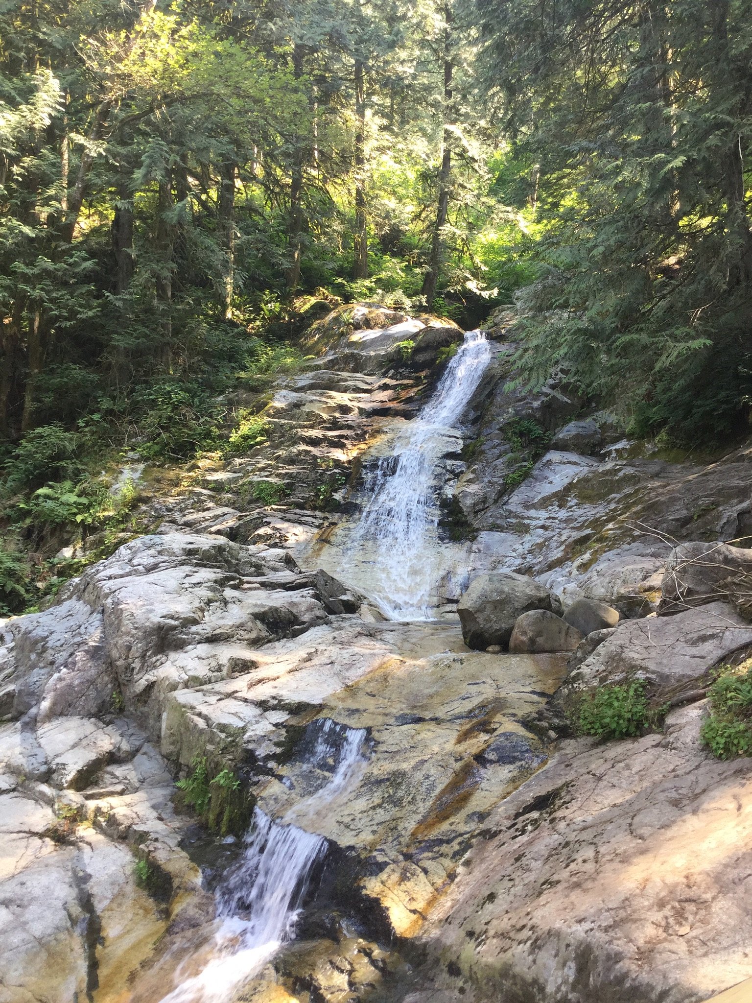
Noons Creek Falls
British Columbia • 4 m
By Armen Suny · Last verified Jun 2026
Difficulty
Moderate
Trail Length
5.6 km
Trail Type
Out And Back
Elevation Gain
273 m
About Noons Creek Falls
Noons Creek Falls is a small, forested waterfall on Noons (Noon’s) Creek in the Lower Mainland of British Columbia. It is accessible from local roads near the Canada–U.S. border and is commonly visited as a short natural attraction for residents and visitors based in the Vancouver/Blaine/Birch Bay region. Flow is typically highest in spring and after heavy rain; summer flows may be reduced. Precise height and official measurement data are not widely published.
The Setting
Noons Creek Falls sits at 553 metres in the hills of British Columbia. The falls drop 4 metres.
Why This Waterfall Exists
Noons Creek Falls flows over hard intrusive rock laid down about 66-101 million years ago. These resistant rocks form a durable ledge that water cannot easily wear away, creating a 13-foot drop where softer material downstream has already eroded.
Trail & Hike Details
The Approach
The moderate 5.6-km out-and-back trail gains 273 metres of elevation on the way to the falls.
Trail Description
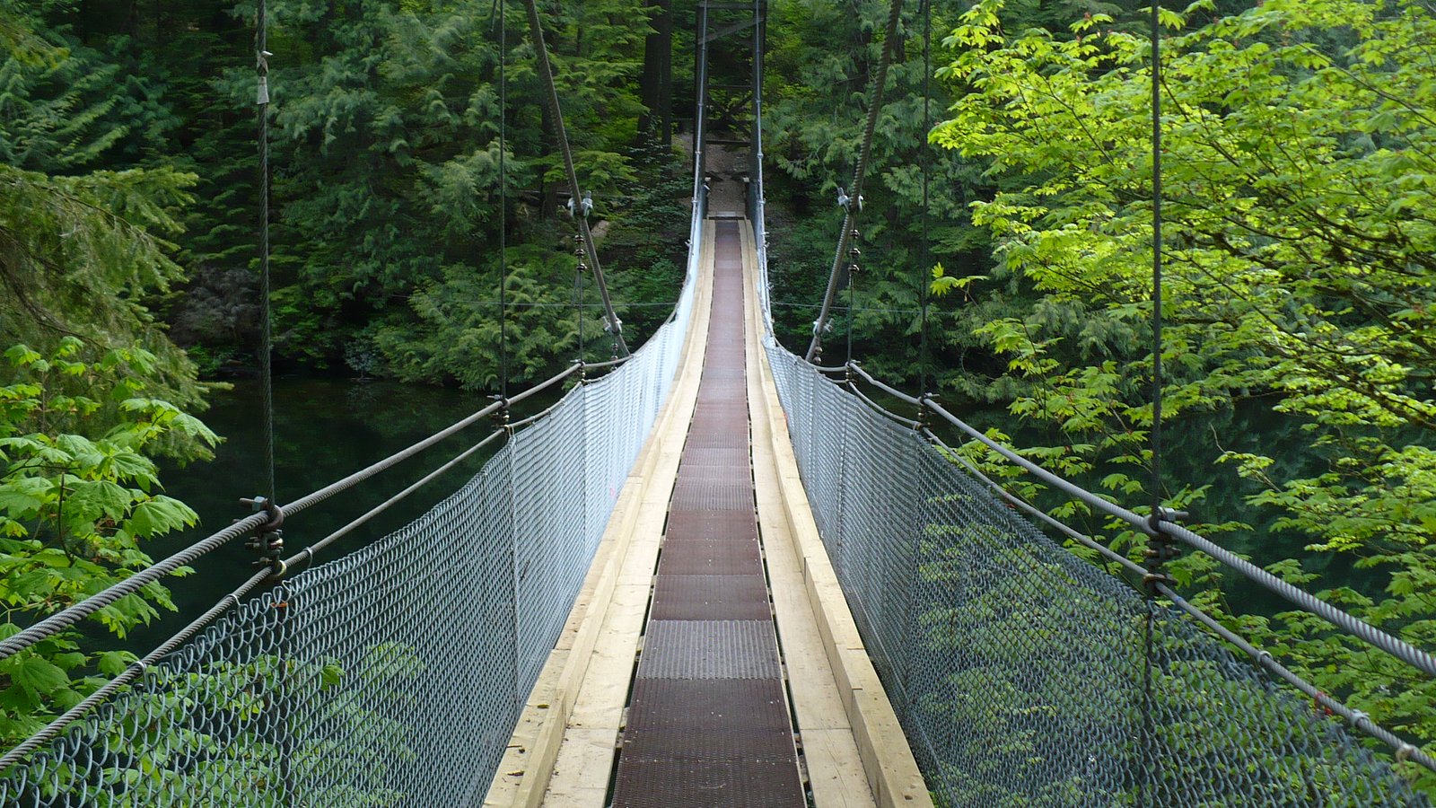
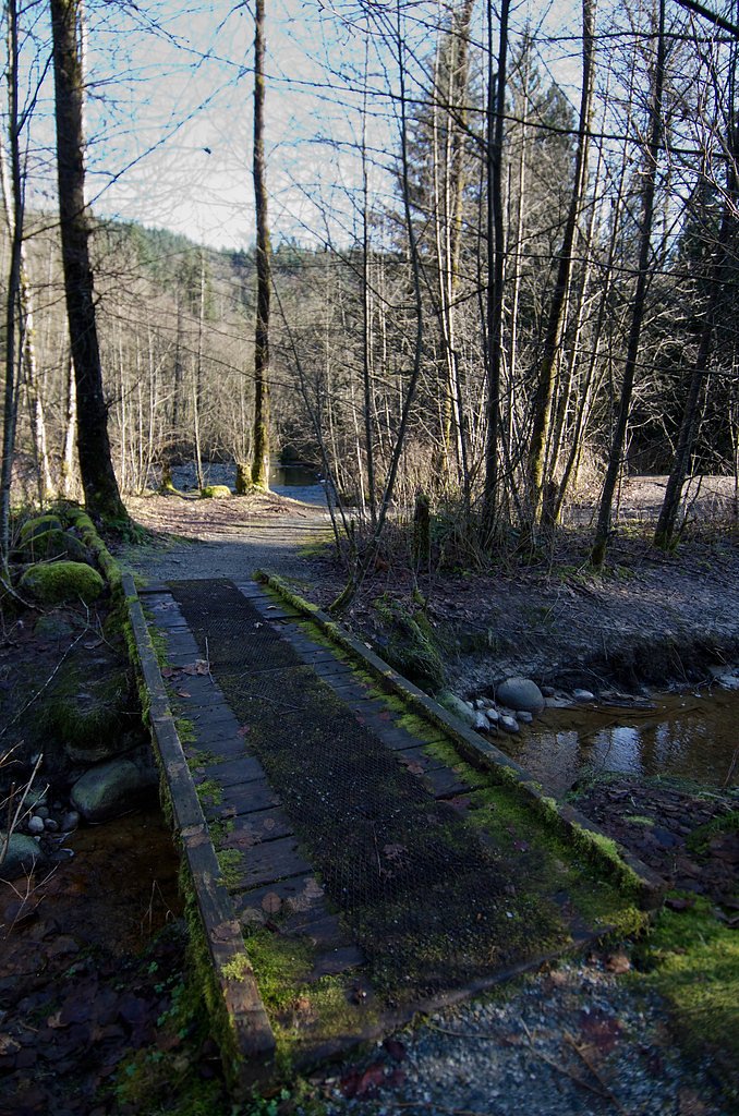
The approach to Noons Creek Falls is typically a short forested walk from a roadside access point. Trails in the immediate area are often unpaved, narrow, and may include roots, rocks, and short steep sections. There may not be a formal maintained boardwalk or viewing platform; views are commonly taken from the trail or from the creek bank. Routes and conditions can change with storms, seasonal washouts, or land-use changes, so recent trip reports or local sources are advisable before visiting.
What to Expect
The falls drop a gentle 4 metres over hard intrusive rock.
Accessibility
The trail is not wheelchair accessible. Uneven terrain and elevation changes require steady footing.
Frequently Asked Questions
🐶 Are Dogs Allowed at Noons Creek Falls?
❌ Dogs are not allowed
Are There Any Fees or Permits Required?
🆖 No fees required
🏊 Is There Swimming at Noons Creek Falls?
❌ Swimming is not allowed
When to Visit
Late spring to early summer (after snowmelt and seasonal rains) often yields the strongest flows and most dramatic appearance. Fall can also offer strong flows after rain. Summer may have lower flow but generally better trail conditions. Winter visits can be icy and muddy, use caution.
Seasonal Access
The best time to visit is Spring, Summer, Fall, and Winter. Check with the managing park or local authority for current conditions.
Safety Information
• Slippery, wet rock and steep creek banks present fall hazards. Stay on stable ground and avoid climbing on wet rocks. • Stream flow can rise rapidly after rain, avoid visiting during or immediately after heavy storms. • Hypothermia risk in cold water; do not assume creek pools are safe for swimming. • Limited or no cell service in spots, tell someone your plan and estimated return time. • Respect private property and posted warnings; illegal or unsafe access routes can lead to injury or trespass issues.
Current Water Conditions
1.1 m³/s
Current discharge — how much water is flowing
Lower than usual for this time of year
Based on 59 years of record
7.64 m
Water depth at gauge
7-Day Discharge Trend
What does this mean for your visit?
Flow is lower than usual for this time of year.
About This Gauge
7-Day Flow Outlook
Based on the WSC gauge COQUITLAM RIVER AT PORT COQUITLAM (6 km away).
Today
Low
1.1 m³/s
5/10Tomorrow
Low
1.1 m³/s
5/10Tue
Low
1.1 m³/s
5/10Wed
Low
1.0 m³/s
5/10Thu
Low
1.0 m³/s
5/10Fri
Low
1.0 m³/s
5/10Sat
Moderate
1.1 m³/s
5/10Best window: Today — low flow, fog (trip score 5/10).
Best time of year: this gauge typically runs highest from mid November to late December, peaking in October.
How we calculate this
This is a transparent outlook, not a precise forecast. We take the waterfall's current flow strength (how it ranks against its historical normal for today, from the nearest WSC stream gauge), carry that ranking forward along the gauge's seasonal curve, and nudge it for forecast rain. Confidence is highest for the next day or two and falls further out. Always check official conditions and your own judgment before visiting — high flows can be dangerous.
Know when to go.
Get a free email alert when waterfalls near Vancouver hit peak flow. We only send when conditions are worth the trip — no weekly newsletters, no spam.
Weather Forecast
Location & Access
Getting There
The falls lie in the south-western Lower Mainland (coordinates 49.3152, -122.8212). Approaches are by local paved roads; exact access points and parking areas vary by landowner and municipality. From Vancouver it is roughly a 20–30 minute drive depending on route and traffic. Visitors should use a reliable map or GPS and confirm the current access route before driving.
Get Directions on Google MapsParking
Parking may be limited or informal near the trail access; there may be a small pullout or roadside parking. Expect no formal lot, signage, or facilities in many cases. Park legally and do not block driveways or gates.
Elevation
553 metres above sea level
Coordinates
49.315232° N, -122.821215° W
Visitor Tips & Gear
• Check recent trip reports or local parks/municipal websites for access updates before you go. • Wear sturdy, waterproof footwear, trails and creek banks may be slippery. • Bring a small trash bag and pack out what you bring in. There may be no garbage service. • Respect private property and posted signs, some approaches may cross or be adjacent to private land. • Avoid getting too close to the falls or climbing on wet rocks; currents and undercut banks can be hazardous. • If visiting with dogs, always follow local leash rules and posted restrictions, policies may vary by landowner or municipality.
As an Amazon Associate, we earn from qualifying purchases.
With 5.6 km and 273 m of elevation gain, sturdy boots and trekking poles will help on this moderate trail. Icy conditions are common in winter — traction cleats are a smart addition.

Columbia Watertight II Rain Jacket
Packs into its own pocket, seam-sealed, and keeps you dry from spray and surprise rain.

Earth Pak Waterproof Dry Bag
Keeps your phone and gear dry when waterfall mist soaks everything else.

Waterproof Phone Pouch (AiRunTech)
Cheap insurance — take photos right next to the falls without killing your phone.

Timberland Euro Sprint Mid Waterproof
Trusted waterproof boot with premium leather and grippy rubber sole — reliable on rocky, wet trails.

TrailBuddy Trekking Poles
Lightweight aluminum, cork grips, and flip-locks that actually hold — a best-seller for good reason.

Kahtoola MICROspikes
Cult-favorite traction cleats that grip ice and wet rock — essential for winter waterfall hikes.
Where to Stay
Browse vacation cabins and private rentals nearby
Unique outdoor stays — tents, yurts, and treehouses
Rent a campervan or RV for your waterfall road trip
Some links are affiliate links. We may earn a commission at no extra cost to you.
Nearby Campground
North Twin Campground
6.3 km away
Nearby Hot Springs
Hot springs near Vancouver, British Columbia
Dorr Fumarole Field
Dorr Fumarole Field reaches 194 degrees at 8,168 feet elevation on Mount Baker's active volcanic slopes, producing superheated ...

Sherman Crater Fumaroles
Sherman Crater Fumaroles register 266 degrees Fahrenheit at 9,463 feet elevation within the active volcanic crater atop Mount B...
Looking for a soak after your hike? Explore more hot springs near Vancouver, British Columbia on SoakingSprings.
Explore British Columbia springsAdditional Information
Nearby Attractions
Nearby coastal and Lower Mainland attractions may include Boundary Bay/Boundary Bay Regional Park, Crescent Beach/White Rock area, and other coastal viewpoints and trails. Vancouver and the U.S. border towns (Blaine, Birch Bay) are within a short drive. Confirm distances and routes from your starting point.
Wildlife
Typical Lower Mainland wildlife may be present: deer, small mammals (raccoon, squirrel), various songbirds and waterfowl. Black bears and cougars exist in the region but are less common near developed coastal areas, always give wildlife space and secure food. Ticks can be present in brushy areas during warmer months.
Cities near Noons Creek Falls
Nearby Waterfalls
Writing about Noons Creek Falls? Embed this waterfall on your site for free.